
Col du Galibier & Col du Télégraphe
Über diese Route
Zwei HC-Anstiege am Stück: der Télégraphe durch den Wald, dann der Galibier bis auf über 2600 m. 88,9 km und 2.859 Höhenmeter auf einer der ikonischsten Schleifen der französischen Alpen — hart, egal wie oft du sie schon gefahren bist.
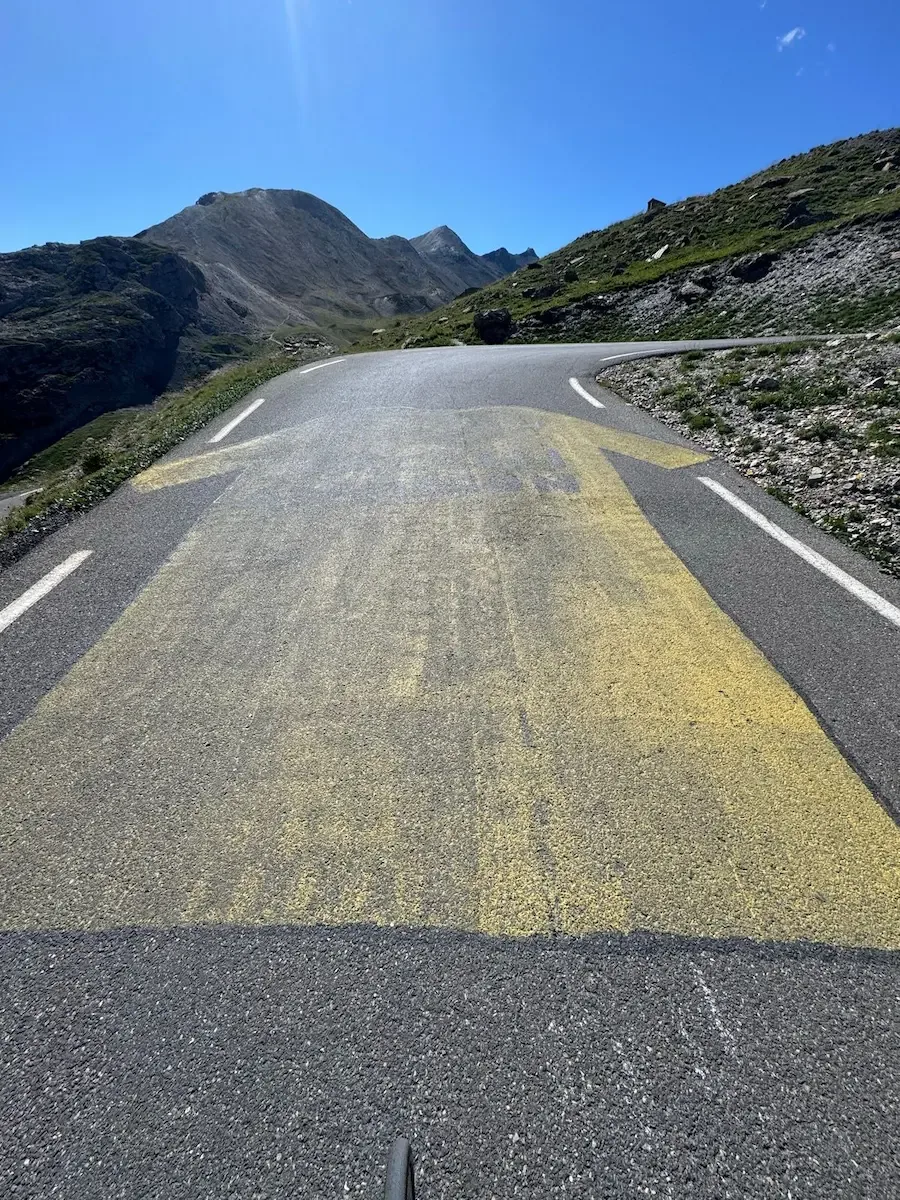
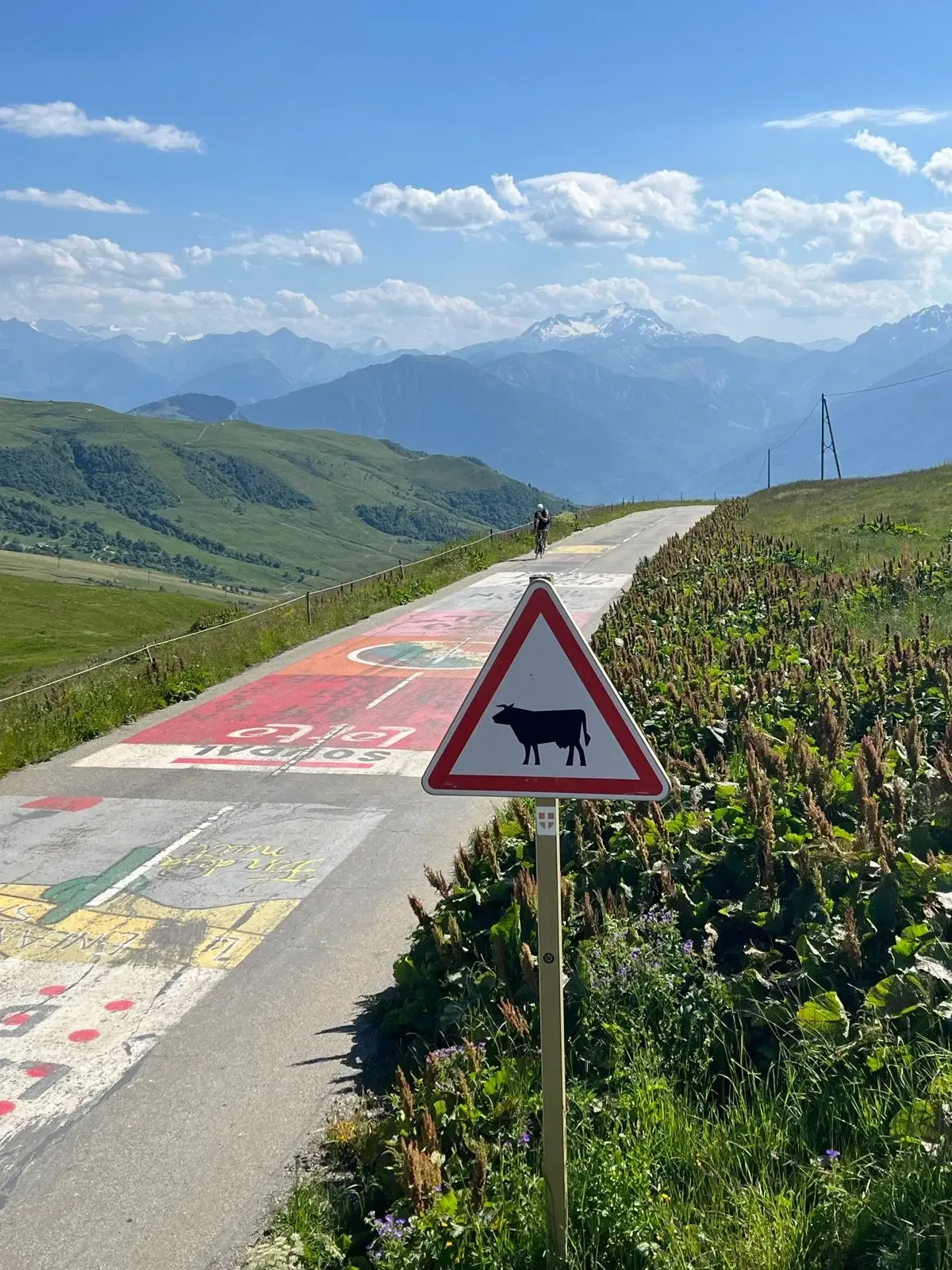
Der Galibier ist eine meiner Lieblingsauffahrten — gleich hart bei jedem Mal, aber das Panorama entschädigt für jede Sekunde Schmerz. Gefahren im Juli 2025, bei Bilderbuchwetter. Dieses Jahr ist er nicht auf der Tour-Route, aber die verblassten gelben Pfeile und die Namen früherer Etappensieger auf dem Asphalt erinnern dich ständig daran, wo du fährst.
Der Start liegt in Saint-Michel-de-Maurienne, und die D902 kippt quasi sofort aus dem Arc-Tal nach oben in die ersten Serpentinen des Col du Télégraphe. Schatten, kühle Luft vom Fluss, Kiefernharz in der Nase — ein angenehm regelmäßiger Rhythmus, um die Beine aufzuwecken. Der Télégraphe ist keine Erholung, aber er ist ehrlich: konstante Prozente durch dichten Nadelwald, gelegentliche Fenster hinunter ins Maurienne-Tal, und dann das alte Fort du Télégraphe auf dem Pass. Kurz abwärts rollen, und du bist in Valloire.
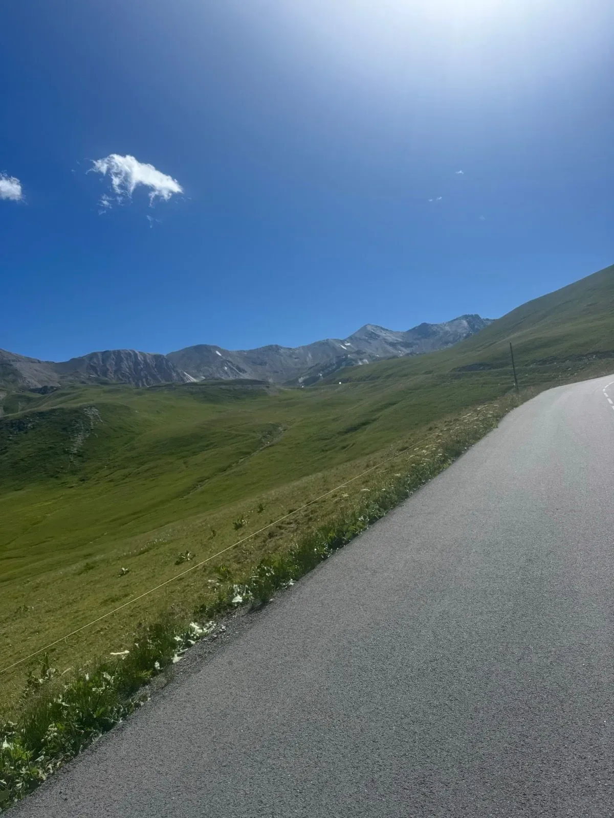
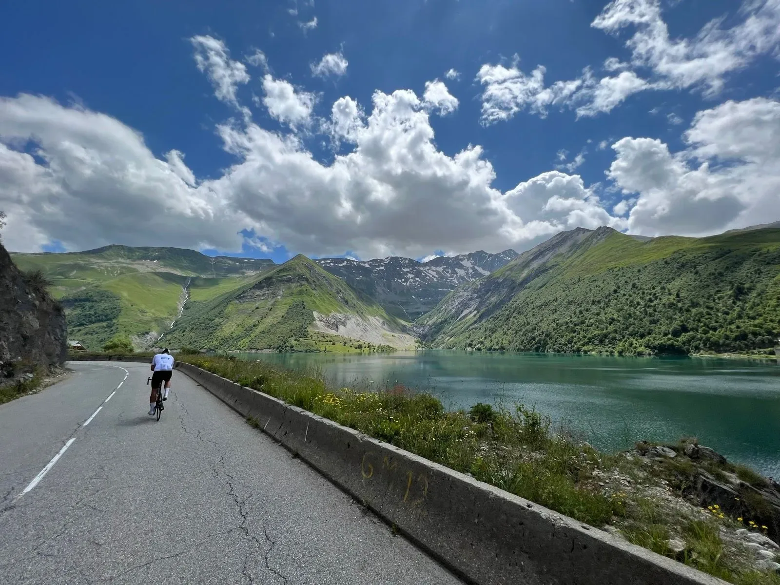
Valloire ist der Moment, an dem du dich nochmal sortierst. Bäckerei auf dem Platz, Brunnen zum Auffüllen, ein Stück Tarte aux myrtilles in die Trikottasche — die letzten echten Geschäfte vor dem Hochgebirge. Ab hier rollt die Straße sanft durchs Valloirette-Tal, breite Almwiesen, Kuhglocken, der Fluss mäandert neben dir. Es ist die trügerische Ruhe vor dem eigentlichen Galibier.
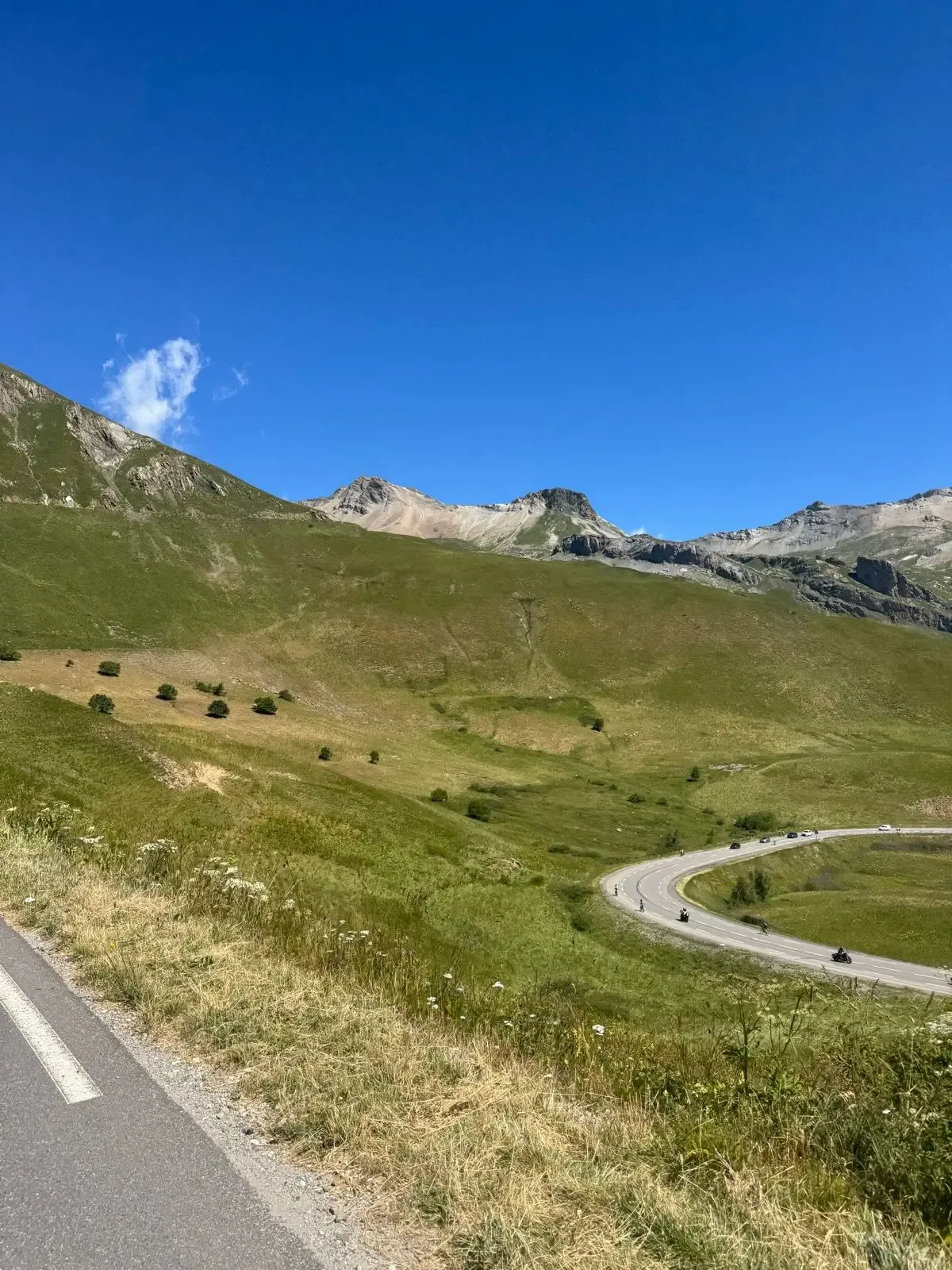
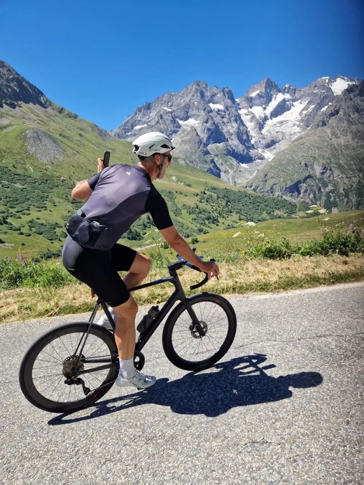
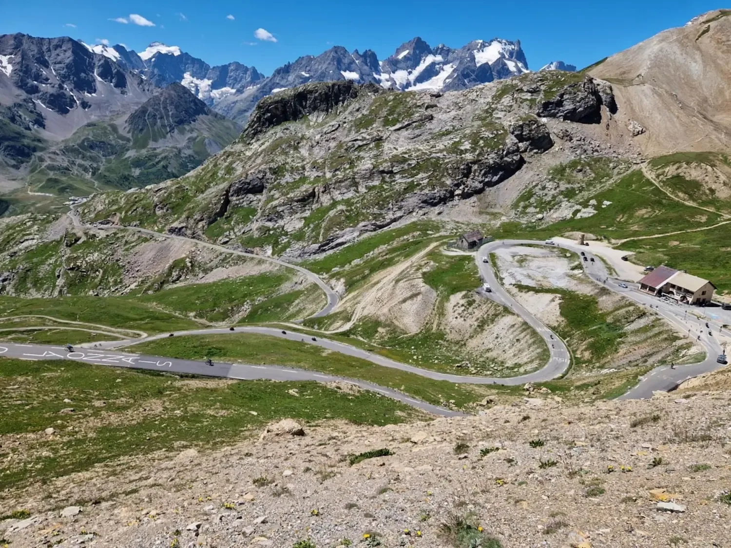
Bei Plan Lachat ändert sich alles. Die Straße knickt scharf links über den Bach und legt sich an die kahle Südflanke. Gras wird zu Geröll, die Luft dünner, das Prozent-Profil geht nach oben. Hier oben beginnt der Galibier, den man aus dem Fernsehen kennt: offene Hänge, Serpentinen übereinander gestapelt, und über dem Tunnel am Col du Lautaret die letzten brutalen Rampen bis zum Henri-Desgrange-Denkmal auf dem Gipfel. Dort oben liegt La Meije direkt gegenüber, die Gletscher der Écrins im Süden, die Grandes Rousses im Westen — eines der größten Panoramen, das du im Rennradsattel bekommst.
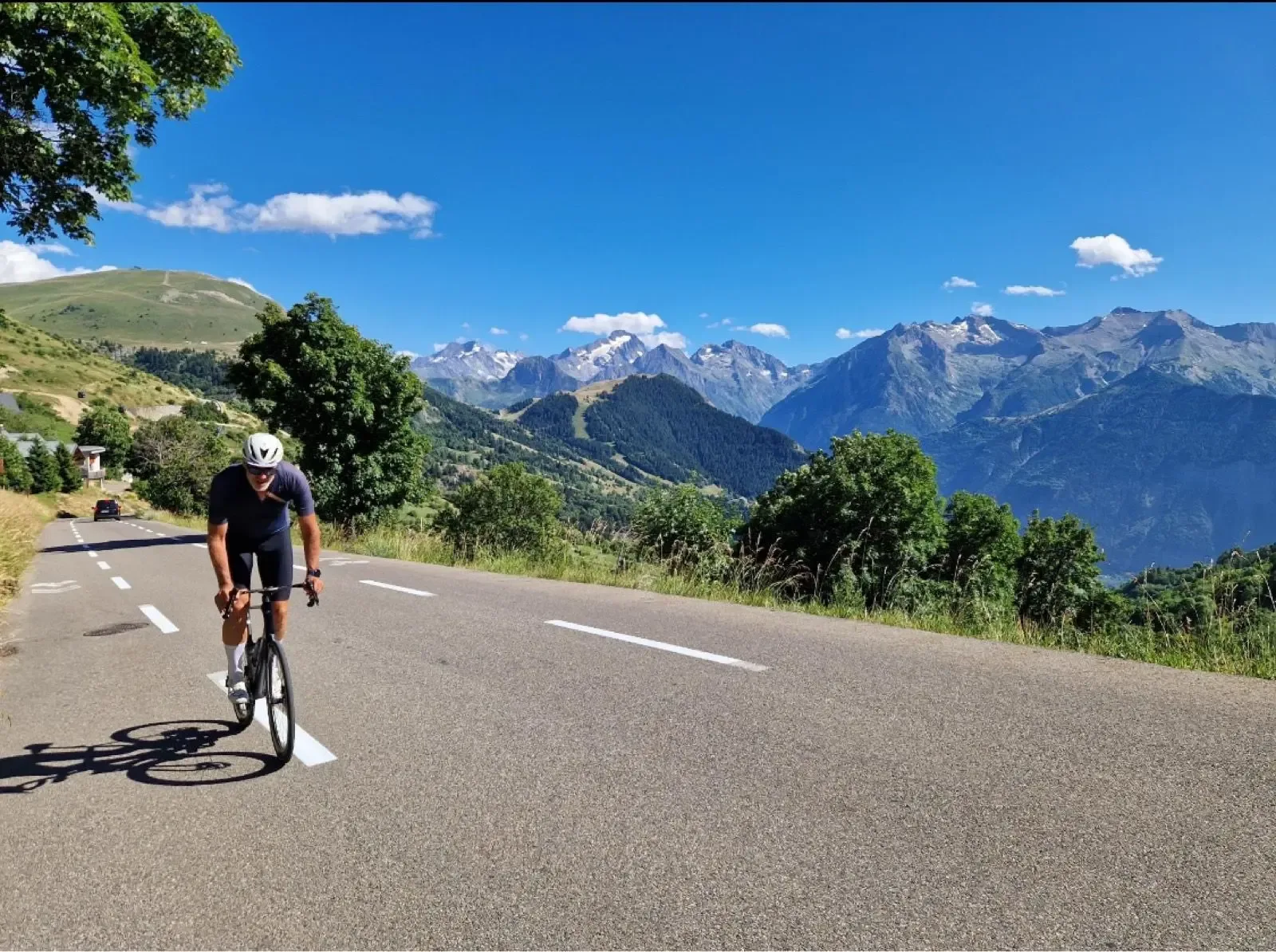
Die Abfahrt ist lang und lohnt jede Mühe. Erst zügig hinunter zum Refuge du Lautaret — große Terrasse, heiße Schokolade, Omelette, und La Meije hängt dir gegenüber in der Luft. Danach die D1091 durch die Romanche-Schlucht zurück Richtung Oisans, schnelle, weite Kurven, und das Massiv der Écrins immer im Rückspiegel. Pack eine Windweste ein — von 2600 m herunter ist auch im Juli kalt. Und starte früh: Die Gewitter im Hochsommer kommen zuverlässig am Nachmittag, und Wohnmobile wie Motorräder werden mit den Stunden nicht weniger.

Kilometer für Kilometer
Ab Saint-Michel-de-Maurienne schwenkt die D902 sofort aus dem Arc-Tal in die ersten Serpentinen. Schattiger Nadelwald, kühle Flussluft, konstante Prozente. Der Anstieg ist regelmäßig genug, um einen Rhythmus zu finden.
Oben am Fort du Télégraphe kurz durchatmen, dann eine kurze, schwungvolle Abfahrt hinunter nach Valloire. Fenster hinunter ins Maurienne-Tal, bevor der Ort dich einsammelt.
Bäckerei, Brunnen, letzte Geschäfte. Danach rollst du sanft durchs breite Valloirette-Tal — Almwiesen, Kuhglocken, der Fluss daneben. Die trügerische Ruhe vor dem eigentlichen Galibier.
Bei Plan Lachat kippt die Straße über den Bach und an die kahle Flanke. Gras weicht Geröll, die Luft wird dünn, die Prozente beißen. In den letzten Rampen über dem Lautaret-Tunnel bist du voll exponiert — belohnt wird das mit La Meije und den Écrins am Horizont.
Schnelle, weite Kurven hinunter zum Refuge du Lautaret. Die große Terrasse ist der klassische Boxenstopp — heiße Schokolade, etwas Warmes essen, La Meije direkt gegenüber.
Die D1091 gleitet durch die Romanche-Schlucht zurück Richtung Tal. Lange, schnelle Kurven, Écrins-Massiv im Rückspiegel. Achte auf Camper- und Motorradverkehr — im Sommer ist hier viel los.
Galerie
Karte und Höhenprofil
Tipps & lokales Wissen
- Starte früh aus Saint-Michel-de-Maurienne — Nachmittagsgewitter im Juli und August sind zuverlässig, und der obere Galibier ist völlig exponiert.
- Pack eine Windweste oder leichte Jacke ein. Die Abfahrt vom Galibier zum Lautaret ist auch im Hochsommer empfindlich kalt.
- Deck dich in Valloire ein: Bäckerei am Hauptplatz für Tarte aux myrtilles und Espresso, danach kommt nichts mehr bis zum Refuge.
- Prüfe vor der Anreise die Öffnung der Galibier-Straße — sie ist oft bis Ende Mai oder Anfang Juni gesperrt.
- Nimm die Passstraße über den Gipfel, nicht den Tunnel beim Lautaret — der ist für Radfahrer weder erlaubt noch sinnvoll.
- Kalkuliere Camper- und Motorradverkehr im Hochsommer ein, besonders auf der Abfahrt durch die Romanche-Schlucht.
- Plane eine Pause am Refuge du Lautaret: heiße Schokolade und Omelette mit Blick zurück auf La Meije.
Kennst du eine bessere Linie?
Reiche deine lokale Route ein und werde mit deinem eigenen Autorenprofil, Strava, Instagram und Buy Me a Coffee Link vorgestellt.
Eine Route teilen → →Ähnliche Strecken
Col de la Croix de Fer og Col du Glandon
Gleiches Maurienne-Tal — andere HC-Pass-Kombination
Col de la Madeleine
Der ikonische HC-Anstieg des Nachbartals aus der Tour-de-France-Geschichte
Alpe d’Huez & Col de Sarenne
Gleiche Oisans-Region — ikonischer Alpe d'Huez statt Galibier
Route Details
- Land
- France
- Region
- Oisans & Maurienne
Für erfahrene Radfahrer. Erhebliche Höhenmeter und anspruchsvolle Distanzen.