Côte d’Héry-sur-Ugine & Col des Saisies
Acerca de esta ruta
Bucle alpino de 70,2 km y 1.705 m de desnivel por Saboya que encadena dos ascensiones de la etapa 19 del Tour de France 2025: la Côte d'Héry-sur-Ugine y el Col des Saisies. Pedaleas sobre el mismo asfalto que los pros, con las marcas aún frescas.
Lo rodé en julio de 2025, pocos días antes de que el Tour de France pasara por aquí en la etapa 19. Salí de Ugine con las piernas frías, siguiendo el Arly por el fondo del Val d'Arly entre acantilados calizos y pueblos saboyanos que todavía dormían. El asfalto llano del valle es un buen calentamiento, porque sabes lo que viene: dos puertos encadenados y 1.705 metros de desnivel por delante.
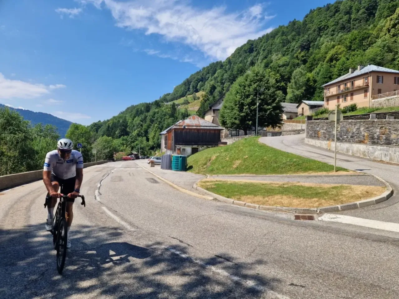
La Côte d'Héry-sur-Ugine empieza casi sin avisar. Es una carretera departamental estrecha, sombreada, que se mete en el bosque de frondosas por rampas irregulares. Me gustó precisamente por eso: no tiene ritmo, te obliga a ajustar el desarrollo cada par de curvas. Entre los árboles se abrían huecos hacia la Combe de Savoie, allá abajo, y el asfalto ya estaba pintado con nombres de corredores y las marcas del Tour. Pasar por Héry-sur-Ugine con esas pintadas frescas bajo las ruedas es algo especial, aunque vayas solo.
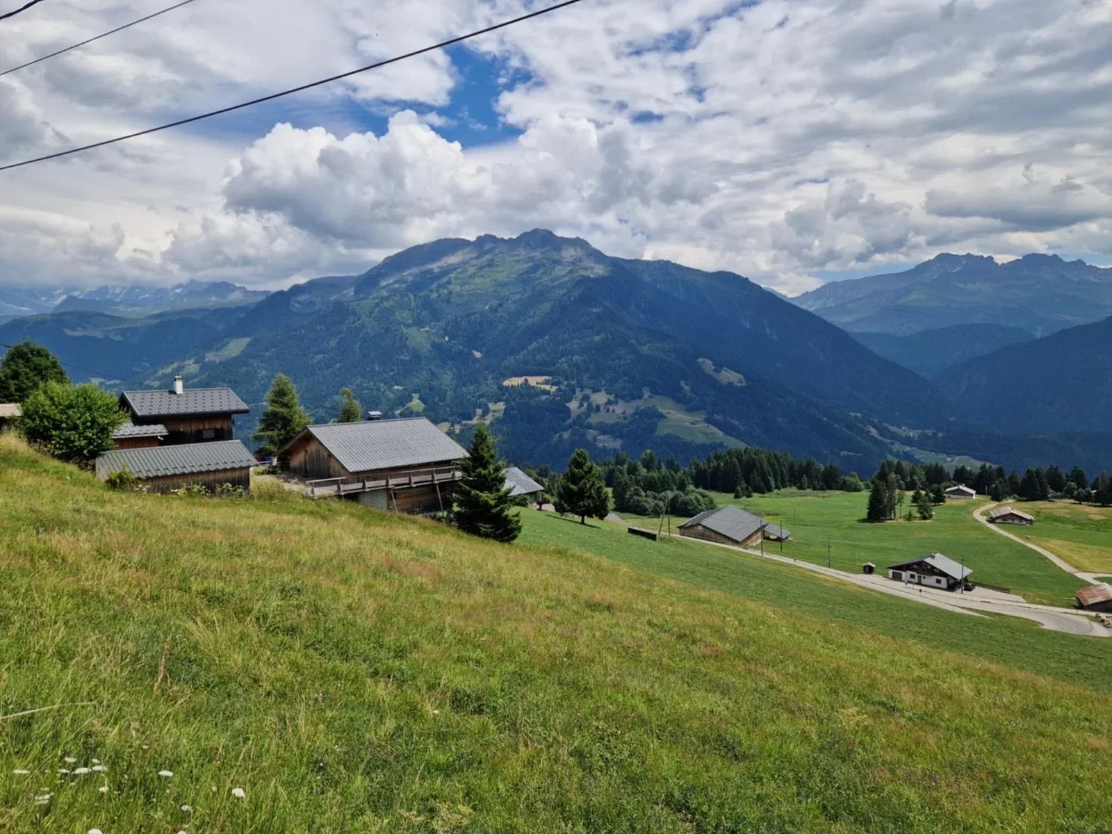
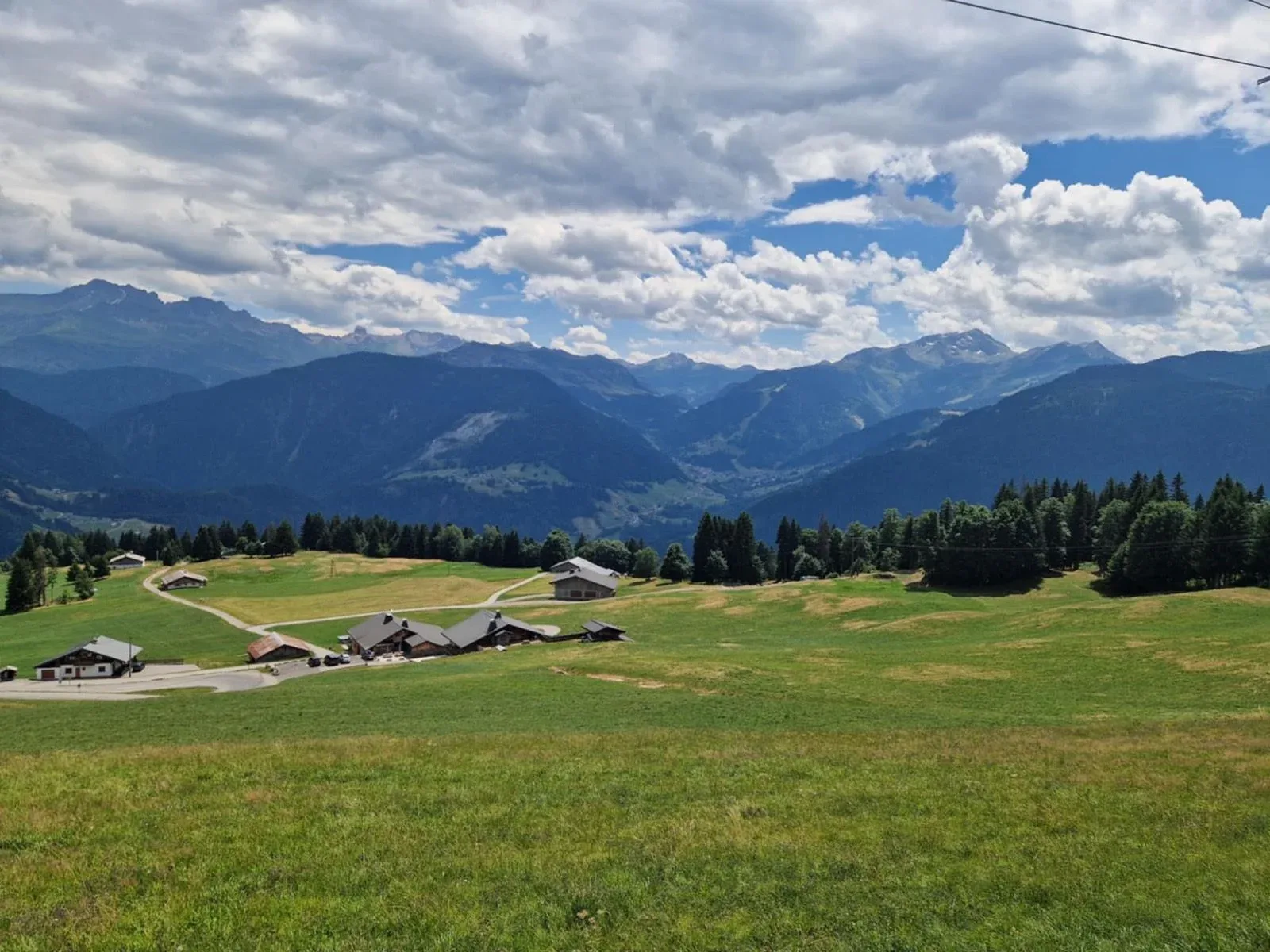
Arriba el paisaje cambia por completo. La parte de balcón hasta Flumet y Crest-Voland es de lo mejor del día: prados altos, chalets de madera, vacas beaufortaines pastando y enfrente toda la cadena de los Aravis con el macizo del Mont Blanc asomando al fondo. Aquí se pedalea cómodo, casi llano, y se recupera para lo que viene. Aproveché para beber y comer algo antes de la bajada hacia el valle que da paso al segundo puerto.
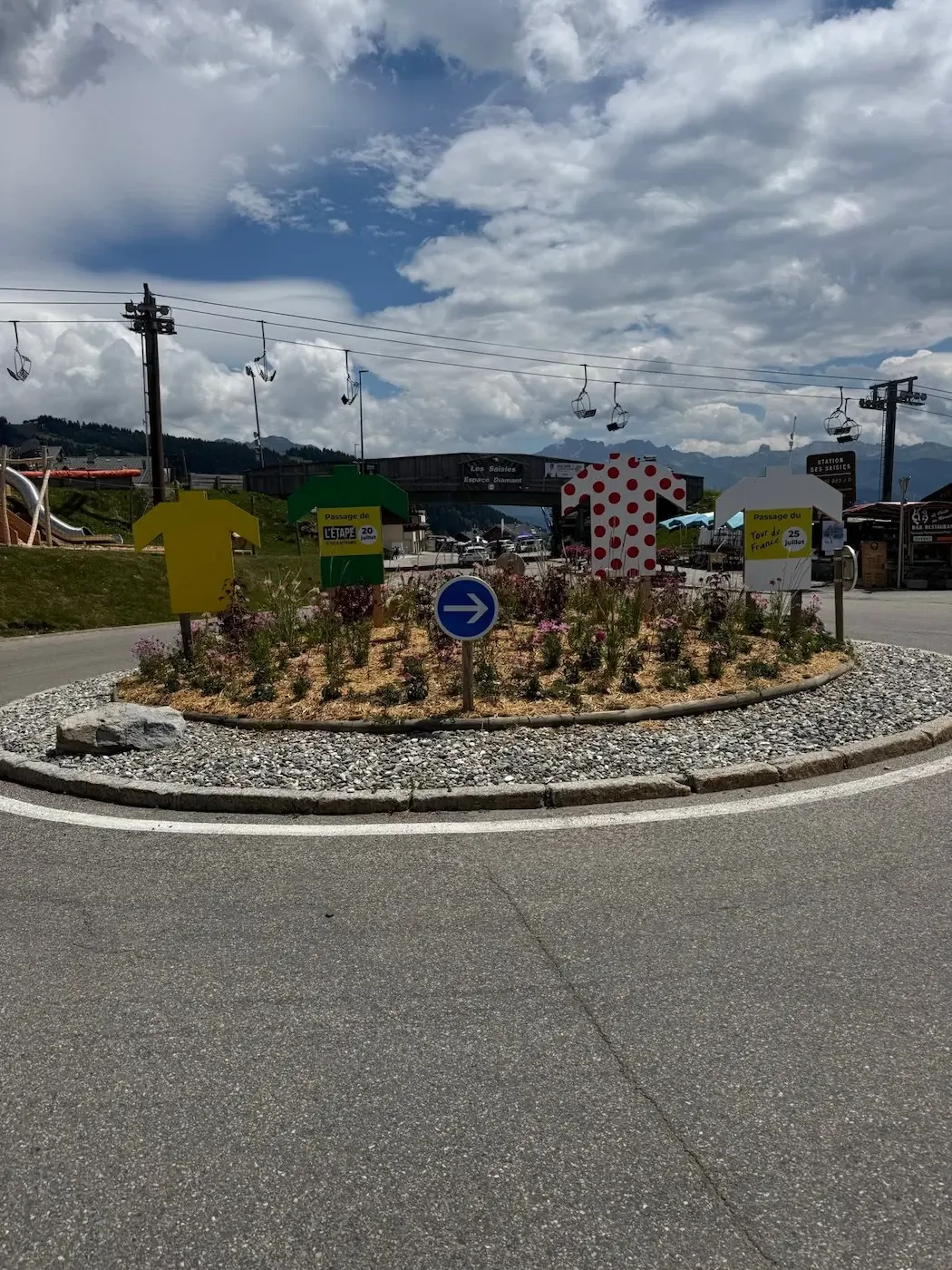
El Col des Saisies por la D218B es otro mundo. Ascensión regular, rítmica, de esas en las que encuentras un engranaje y lo mantienes. Atraviesas bosque de abetos, luego praderas alpinas con granjas beaufortaines desperdigadas, y cuando empiezan a aparecer los cables de los remontes sabes que el puerto está cerca. Coroné en la estación de Les Saisies, donde la rotonda estaba decorada con recortes gigantes del maillot amarillo, el de lunares y el verde, plantados entre las flores, con los carteles de la Étape y el paso del Tour. Parada obligatoria en la plaza del Espace Diamant: café y una tarte aux myrtilles en uno de los bar-restaurantes. La sensación de estar en el mismo sitio que verías por la tele unos días después es difícil de describir sin caer en tópicos, así que me la quedo para mí.
La bajada hacia Hauteluce y Villard-sur-Doron es rápida, con curvas amplias y visibilidad buena, pasando junto a granjas de piedra y madera típicas del Beaufortain. Después, el regreso por el valle del Arly hasta Ugine se hace con las piernas ya fundidas pero con esa satisfacción tranquila de haber rodado sobre el mismo asfalto que los profesionales. Si te gustan los puertos alpinos y tienes debilidad por el Tour, este bucle es de los que se quedan grabados.

Kilómetro a kilómetro
Arrancas desde Ugine siguiendo el río Arly por el fondo del valle. Terreno llano o levemente ascendente, ideal para calentar. Acantilados calizos a ambos lados y pueblos saboyanos despertando.
La carretera se estrecha y se mete en el bosque. Rampas irregulares por una departamental sombreada, con curvas cerradas encadenadas entre aldeas. Desde los huecos entre árboles se ve la Combe de Savoie. Asfalto con marcas del Tour.
Tramo de balcón en alta pradera, casi llano, con chalets de madera y vistas abiertas hacia los Aravis y el macizo del Mont Blanc. Buen momento para hidratarte antes del segundo puerto. Descenso suave hacia Flumet.
Ascensión regular por bosque de abetos que da paso a praderas alpinas con granjas beaufortaines. Gradiente constante que permite encontrar ritmo. Los remontes anuncian la cima y la estación de Les Saisies.
Coronas en la rotonda decorada con los maillots del Tour de France. Parada natural en los bar-restaurantes de la plaza para café y algo dulce antes del descenso.
Bajada rápida y amplia por el Beaufortain, pasando por Hauteluce y Villard-sur-Doron entre granjas de piedra y madera. Regreso por el valle del Arly hasta Ugine con las piernas fundidas.
Galería

Mapa y perfil de desnivel
Ascensiones clave
Consejos y conocimientos locales
- Sal temprano en julio y agosto para evitar el tráfico turístico hacia Les Saisies y las tormentas de tarde sobre el Beaufortain.
- Reserva piernas en la Côte d'Héry: las rampas son irregulares y castigan si entras demasiado fuerte.
- Para en la plaza del Espace Diamant en la cima: café, tarte aux myrtilles o un bocadillo de Beaufort antes de bajar.
- Lleva cortavientos para el descenso hacia Hauteluce; a 1650 m baja rápido la temperatura aunque haga calor en el valle.
- Si ruedas cerca de fechas del Tour, fíjate en las pintadas del asfalto y los carteles temporales, pero cuidado con las caravanas.
- Ojo en la departamental de Héry: carretera estrecha, sin arcén y con visibilidad limitada en algunas curvas cerradas.
¿Conoces un trazado mejor?
Envía tu ruta local y aparece con tu propio perfil de autor, Strava, Instagram y el enlace Buy Me a Coffee.
Compartir ruta → →Rutas similares
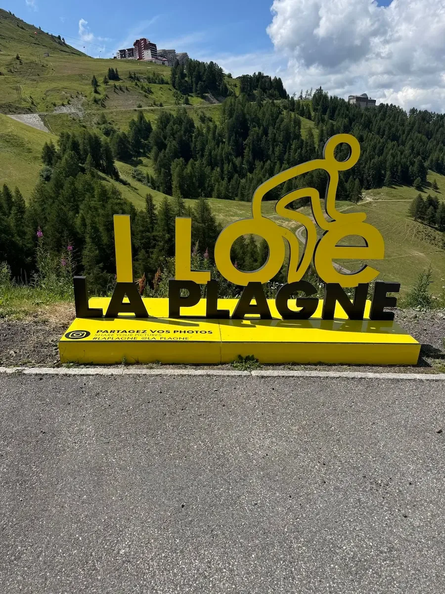
Aime - La Plagne
Misma región Tarentaise-Beaufortain — otra subida a estación de esquí (Plagne)
Col de la Madeleine
Maurienne adyacente — icónica vertiente sur HC de Madeleine
Col du Galibier & Col du Télégraphe
Sube a la etapa reina de los Alpes franceses — Galibier y Télégraphe
Detalles de la ruta
- País
- France
- Región
- Tarentaise & Beaufortain
Para ciclistas experimentados. Desnivel importante y distancias exigentes.