Gamle Strynefjellsveg — carretera histórica de montaña
Acerca de esta ruta
← Western Fjords Cycling Guide41,9 km de ida y vuelta desde Hjelle en el Oppstrynsvatnet hasta una de las carreteras de montaña históricas más bellas de Noruega. La Gamle Strynefjellsveg, construida entre 1889 y 1894, asciende 1.062 metros de desnivel en 18 km sobre asfalto rugoso — sin cafeterías, sin respiro, solo un 7–8 % sostenido y cimas nevadas sobre agua glaciar turquesa.
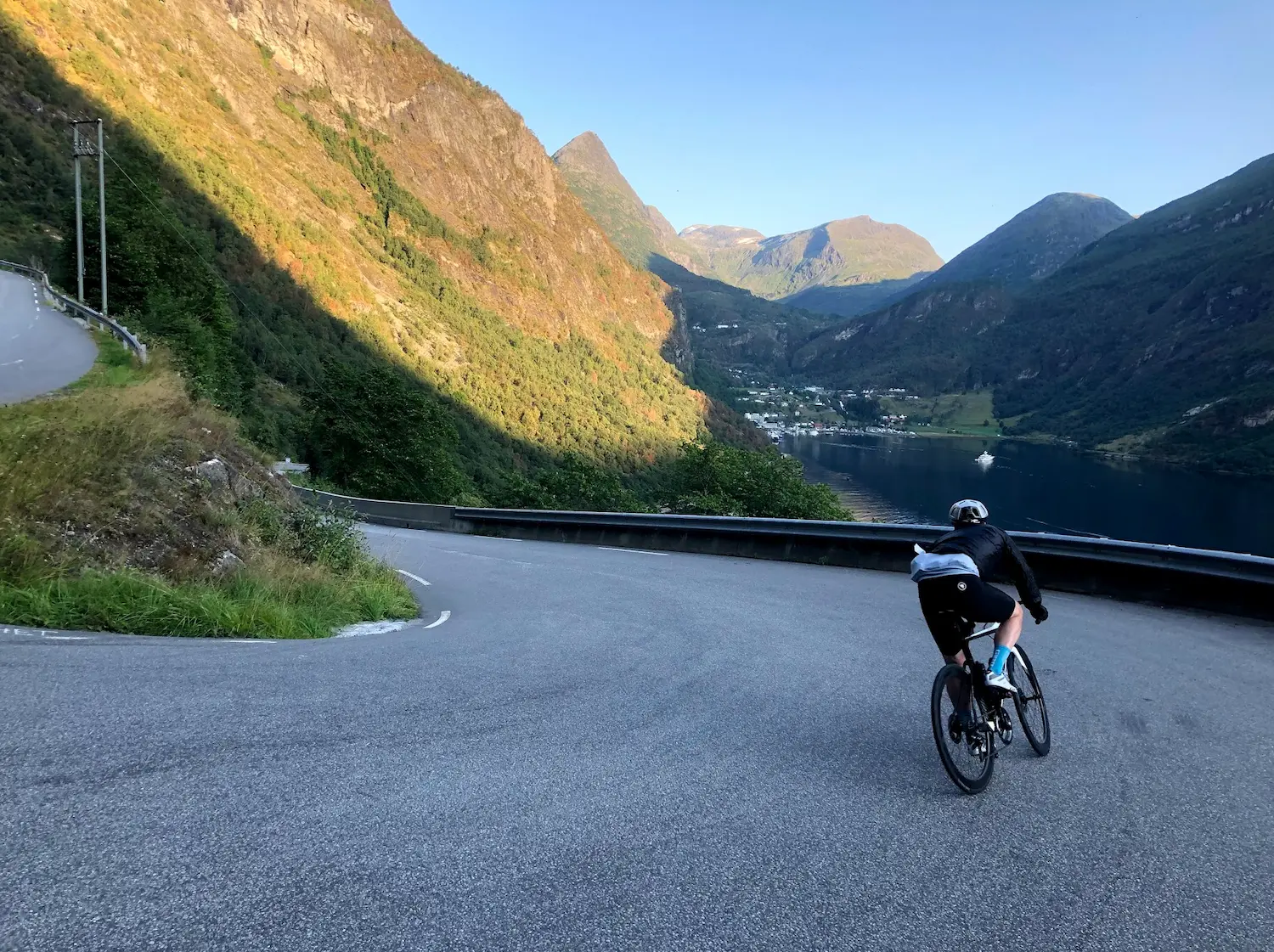
Cuando recorrí esta ruta en agosto de 2021, empezamos y terminamos en Hjelle, a orillas del Oppstrynsvatnet — un pequeño pueblo en el extremo occidental del lago donde el aire es fresco, el agua brilla turquesa por el deshielo glaciar, y la antigua carretera de montaña empieza a subir en el momento en que giras hacia ella. El día anterior habíamos subido Dalsnibba y tomado el ferry de Hellesylt a Geiranger, y este era el día después. Terreno distinto, misma escala.
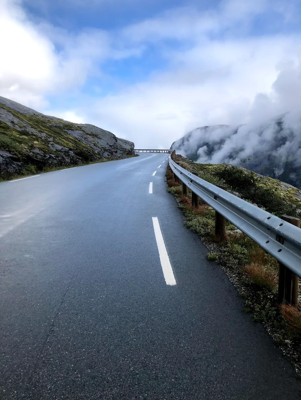
La Gamle Strynefjellsveg fue excavada en estas montañas a mano entre 1889 y 1894. Se nota. El asfalto es rugoso, la carretera es estrecha, y la superficie irregular de la forma en que solo puede serlo una carretera de montaña de 130 años. No hay tramo de calentamiento en el sentido convencional — los primeros siete kilómetros son suaves a moderados con un 0,4 a 4 %, pero el ascenso ya ha comenzado y notas cómo la carretera se inclina bajo ti al salir de Hjelle pedaleando.
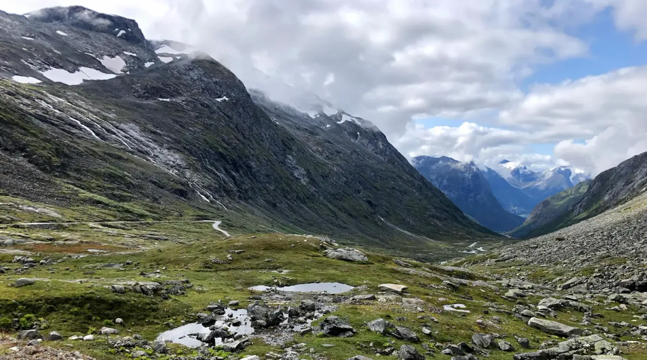
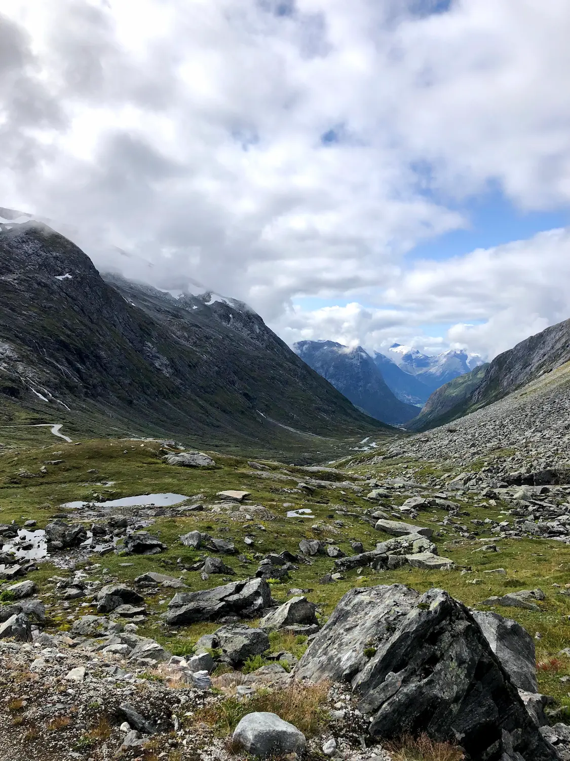
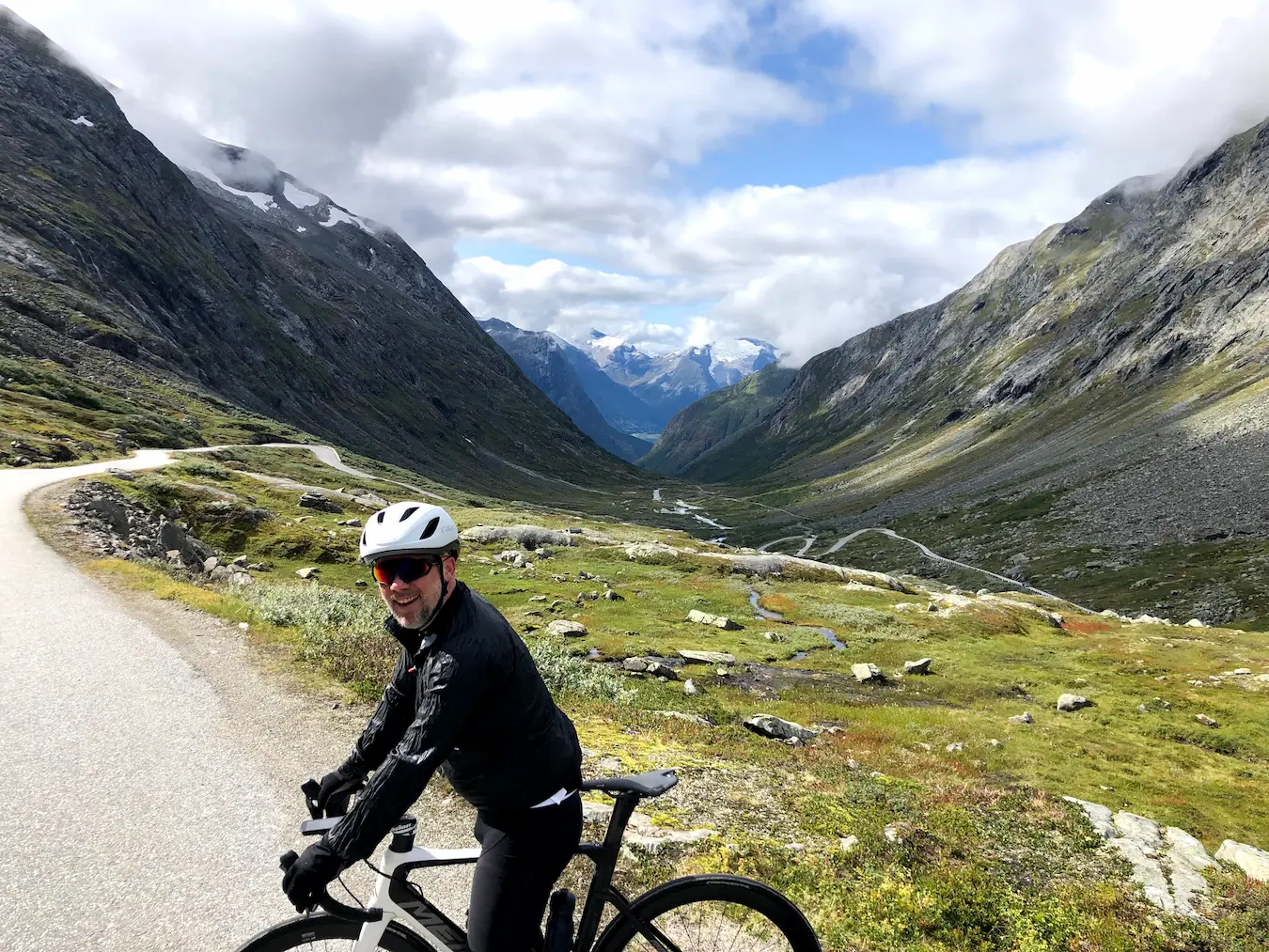
A partir del kilómetro 8, la pendiente se asienta. 6,5 % al principio, luego 7, luego 8 — y se queda ahí. Once kilómetros de ascenso sostenido sin ni un solo tramo de recuperación. Encuentras el ritmo o sufres. Mientras subíamos, las nubes rodaban a nuestro alrededor con esa luz mística que solo encuentras en las montañas noruegas en verano — la visibilidad cambiaba de un panorama completo a niebla blanco-grisácea y de vuelta, a veces en el espacio de un kilómetro.
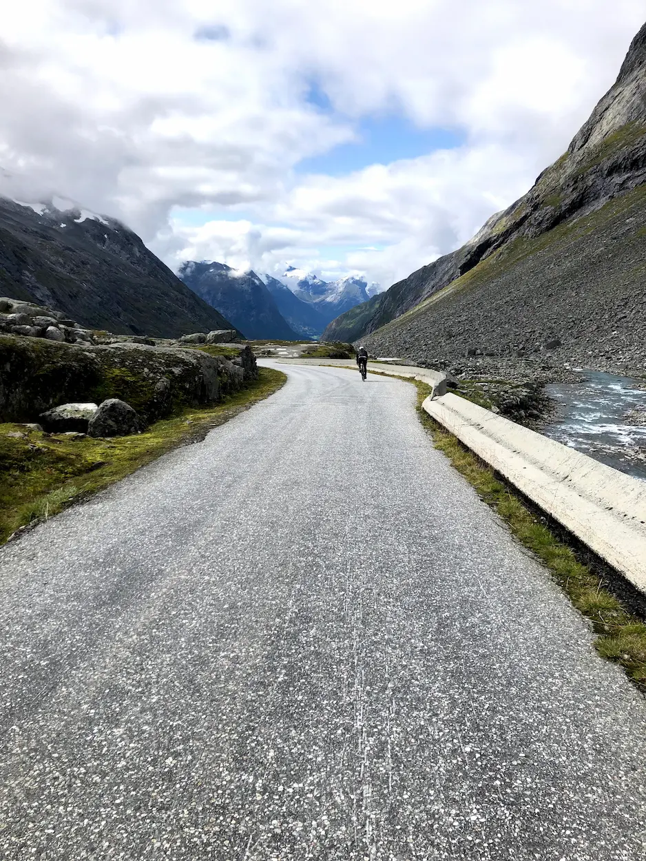
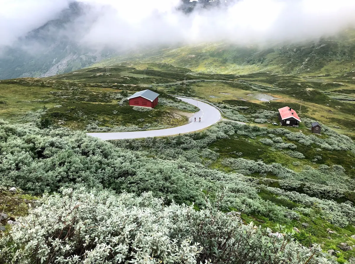
Cerca de la cima, la carretera está rodeada de picos con manchas de nieve incluso en agosto. El asfalto se mantiene rugoso todo el camino — granuloso y antiguo, exactamente lo que se espera de una carretera que lleva aquí desde 1894. La pendiente se agudiza hasta casi el 8 % en la rampa final hacia la cima de 1.098 m. Solo en lo más alto, en la pequeña meseta antes de que la carretera se incline para el descenso, la superficie da paso a un tramo corto de grava compacta — compacta e inofensiva con neumáticos de 25 mm. Paramos allí, hicimos fotos y dimos media vuelta.
El descenso son los mismos 18 kilómetros al revés, con el lago reapareciendo a través de la capa de nubes bajo ti a medida que desciendes. De vuelta en Hjelle, Gamlebutikken — la antigua tienda del pueblo junto al lago — es el lugar adecuado para reponer fuerzas. Almuerzo al aire libre, sol sobre el agua, nieve aún visible en las cimas que acabábamos de escalar. Eso es lo que es esta ruta.
No es una ruta para hacer un buen tiempo. Es una ruta para el ciclista que quiere pedalear por una carretera que no ha cambiado desde 1894 y que probablemente no cambiará. Lleva todo lo que necesitas antes de salir de Hjelle.

Kilómetro a kilómetro
Sal de Hjelle siguiendo la orilla del Oppstrynsvatnet. Los primeros kilómetros son suaves — 0,4 a 4 % — mientras la antigua carretera asciende hacia el valle. El asfalto es rugoso desde el principio. Agua glaciar a la derecha, los altos picos cerrándose frente a ti.
A partir del kilómetro 8, la pendiente sube al 6–7 % y se mantiene en el 7–8 % durante el resto del ascenso. Once kilómetros sin ni un solo tramo de recuperación. El asfalto se mantiene rugoso todo el camino — granuloso y antiguo, el carácter de una carretera de 1894. La rampa final hacia la cima de 1.098 m se agudiza hasta casi el 8 %. Manchas de nieve en los picos incluso en agosto. Sin avituallamiento — encuentra el ritmo y llega hasta arriba.
Los mismos 18 kilómetros al revés. Ten cuidado en la pequeña meseta de grava en lo más alto. El lago reaparece en el horizonte mientras desciendes — verde glaciar bajo el sol. Termina con un almuerzo en Gamlebutikken en Hjelle junto al agua — Hjelle Hotell a pocos metros si quieres quedarte a dormir.
Galería
Mapa y perfil de desnivel
Ascensiones clave
Imprescindibles
- •Gamle Strynefjellsveg — una de las carreteras de montaña históricas de Noruega, inaugurada en 1894
- •Ascenso sostenido e implacable — 11 km al 7–8 % sin recuperación real
- •Agua glaciar turquesa en el Oppstrynsvatnet en la salida y llegada
- •Manchas de nieve en los picos incluso en agosto en la cima de 1.098 m
- •Asfalto rugoso todo el camino — solo una pequeña meseta de grava en la cima. Los neumáticos de 25 mm son más que suficientes.
- •Hjelle Hotell (est. 1894) junto al lago: campamento base histórico con sauna y baño glaciar
Debes saber
- ⚠Los neumáticos de 25 o 28 mm de carretera funcionan bien en la pequeña meseta de grava de la cima — está bien compactada.
- ⚠Sin tramos de recuperación desde el km 8 hasta la cima — encontrar el ritmo pronto.
- ⚠El Hjelle Hotell (est. 1894) en el Oppstrynsvatnet es la base natural — sauna y baño en el lago glaciar. Un destino en sí mismo.
- ⚠Sin cafeterías, fuentes ni tiendas en la ruta — prepara el almuerzo y un bidón lleno en Gamlebutikken antes de salir de Hjelle.
- ⚠Lleva una chaqueta cortavientos para el descenso — la cima a 1.098 m es fría incluso en agosto.
- ⚠Carretera normalmente abierta de julio a principios de octubre. Consulta vegvesen.no antes de pedalear.
Café y agua
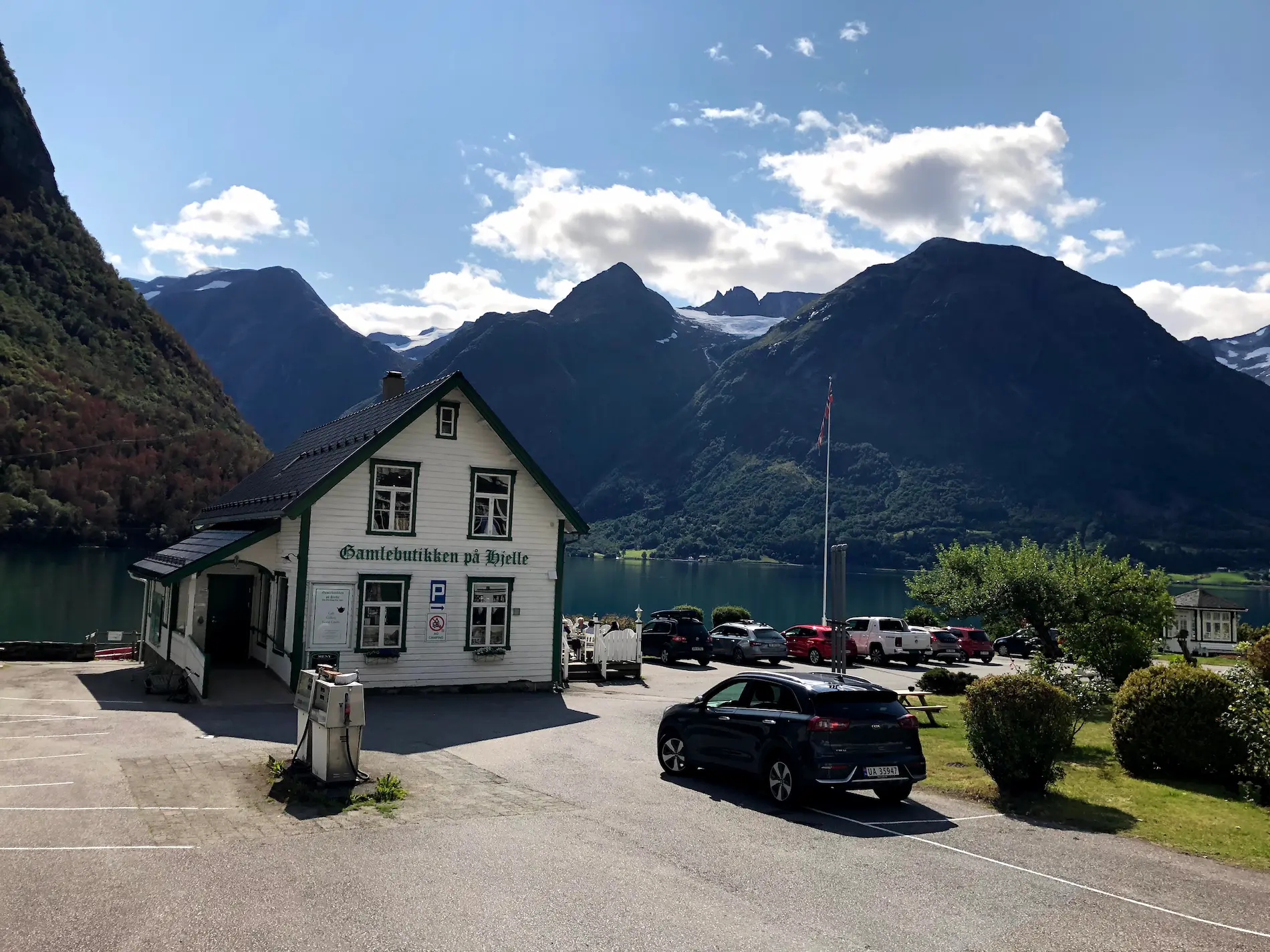
- km 0Gamlebutikken på Hjelle
La antigua tienda del pueblo en Hjelle, a orillas del Oppstrynsvatnet. Parada idílica — agua glaciar turquesa con cimas nevadas de fondo. Almuerzo y bebidas. La única parada de avituallamiento en la ruta.
Preguntas frecuentes
- ¿Qué neumáticos necesito para la Gamle Strynefjellsveg?
- Los neumáticos de carretera de 25 o 28 mm son más que suficientes. La superficie es asfalto rugoso todo el camino — solo una pequeña meseta de grava compacta en lo más alto, justo antes del descenso. Sin dramatismos.
- ¿Hay algún sitio para parar a comer o beber?
- No hay cafeterías, tiendas ni fuentes en la ruta. Abastécete en Gamlebutikken en Hjelle antes de empezar, o lleva todo lo que necesitas. La comida más cercana tras el descenso es la misma tienda.
- ¿Necesito una bicicleta de gravel para la Gamle Strynefjellsveg?
- No. La ruta es asfalto durante todo el recorrido — solo una pequeña meseta de grava compacta en lo más alto. Una bicicleta de carretera normal con neumáticos de 25 o 28 mm es todo lo que necesitas.
- ¿Cuál es la diferencia entre la Gamle Strynefjellsveg y el túnel de Strynefjellet?
- El túnel de Strynefjellet es el moderno túnel de carretera (Rv. 15) que conduce el tráfico de vehículos a través de la montaña hoy en día. La Gamle Strynefjellsveg es la carretera histórica de montaña de 1889–1894 que cruzaba por encima — y que sigue abierta en verano. Tú pedaleas por la antigua carretera, no por el túnel.
- ¿Cuándo abre la carretera?
- Aproximadamente de julio a principios de octubre — las fechas exactas dependen de la nieve. La cima está a 1.098 m y la nieve puede persistir hasta junio. Consulta vegvesen.no antes de pedalear.
- ¿Dónde debo alojarme?
- El Hjelle Hotell (est. 1894) está justo al inicio del ascenso — histórico, apto para ciclistas, con sauna y baño en el lago glaciar. Reserva con antelación en verano, el pueblo es pequeño.
Dónde alojarte
Hjelle
Hjelle Hotell (est. 1894) is the natural basecamp — at the western end of Oppstrynsvatnet, with sauna and swimming in the glacial lake. A destination in its own right. Gamlebutikken next door is the only food and supply stop on the route.
¿Conoces un trazado mejor?
Envía tu ruta local y aparece con tu propio perfil de autor, Strava, Instagram y el enlace Buy Me a Coffee.
Compartir ruta → →Rutas similares
Geirangerfjord Cycling — Dalsnibba HC Climb & Stryn
Día 1 del bucle de 3 días de Geiranger — subida a Dalsnibba con el ferry UNESCO Hellesylt-Geiranger
Trollstigen — 11 Hairpins
Día 2 — doblete Ørnevegen + Trollstigen desde Geiranger
Sognefjellet & Tindevegen — Norway's Highest Mountain Roads
Misma liga de etapa reina de los fiordos occidentales — la carretera de paso más alta del norte de Europa desde Skjolden
Detalles de la ruta
- País
- Norway
- Región
- Western Fjords
Para ciclistas experimentados. Desnivel importante y distancias exigentes.