About this Route
← Western Fjords Cycling GuideA 41.9 km out-and-back from Hjelle on Oppstrynsvatnet up Norway's most beautiful historic mountain road. The Gamle Strynefjellsveg, built between 1889 and 1894, climbs 1,062 metres in 18 kilometres on rough asphalt all the way to the 1,098-metre summit. No cafés, no respite — just sustained 7-8% gradient and snow-flecked peaks above turquoise glacial water.
When I rode this in August 2021, we started and finished at Hjelle on the shore of Oppstrynsvatnet — a small village at the western end of the lake where the air is cool, the water is turquoise from glacial melt, and the old mountain road begins climbing the moment you turn onto it. We had ridden Dalsnibba and the Hellesylt-Geiranger ferry the day before, and this was the day after. Different terrain, same scale.
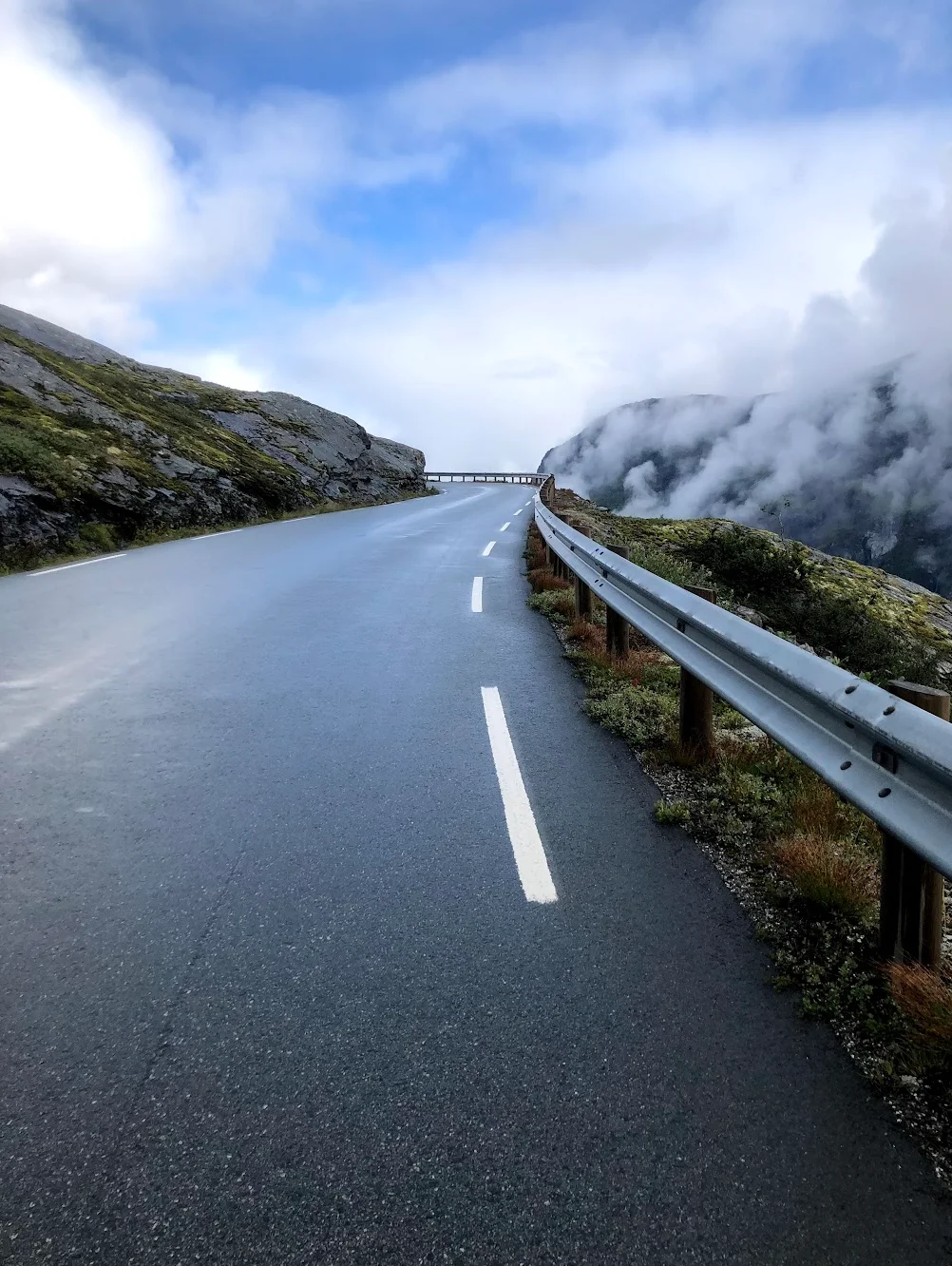
The Gamle Strynefjellsveg was carved out of these mountains by hand between 1889 and 1894. It shows. The asphalt is rough, the road is narrow, the surface uneven in the way only a 130-year-old mountain road can be. There is no warm-up section in the conventional sense — the first seven kilometres are gentle to moderate at 0.4 to 4%, but the climb is already underway and you can feel the road tilting as you spin out of Hjelle.
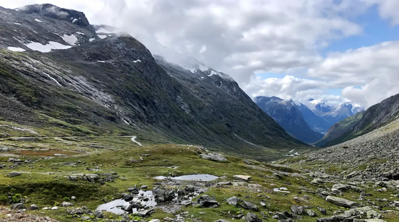
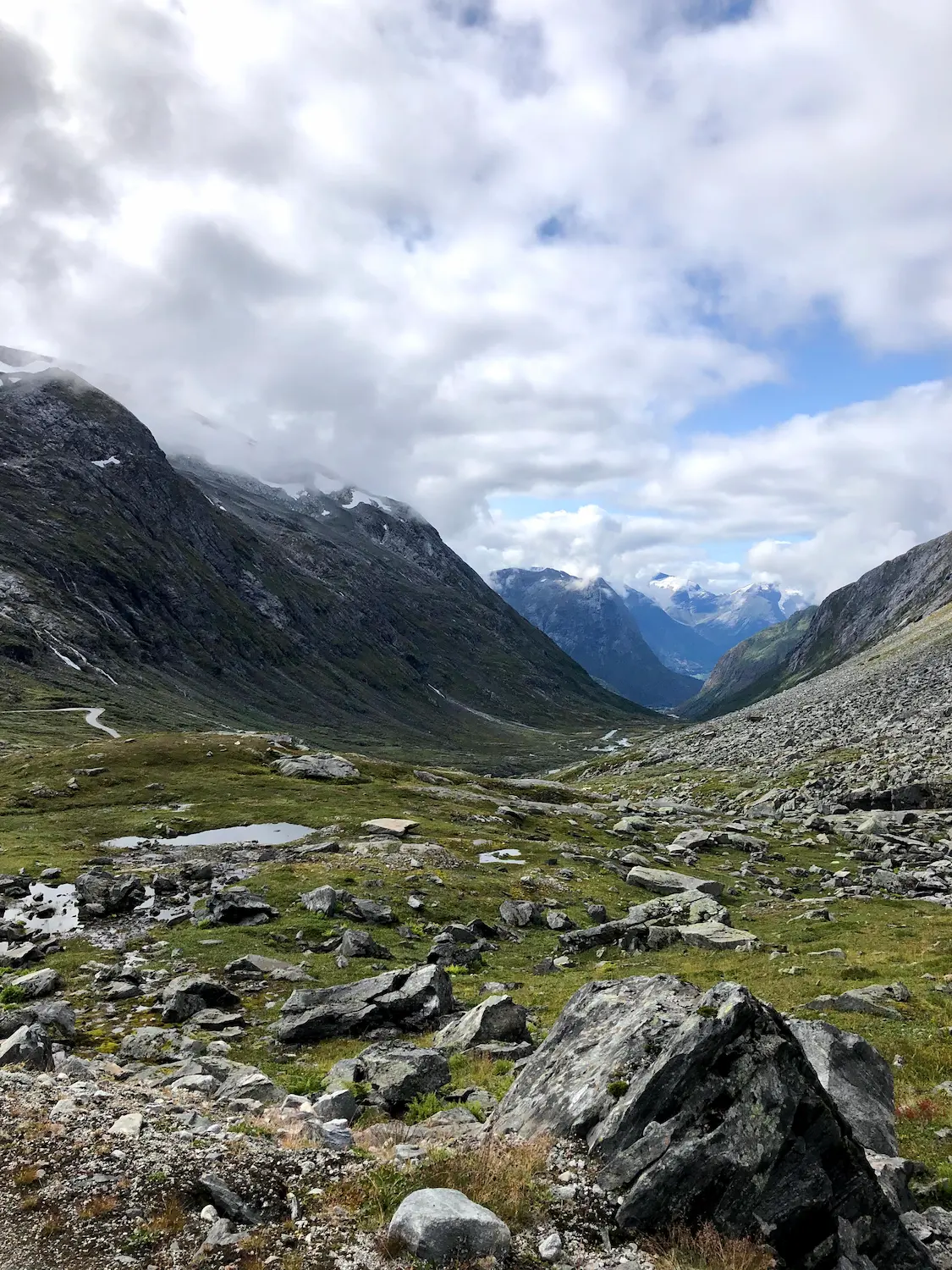
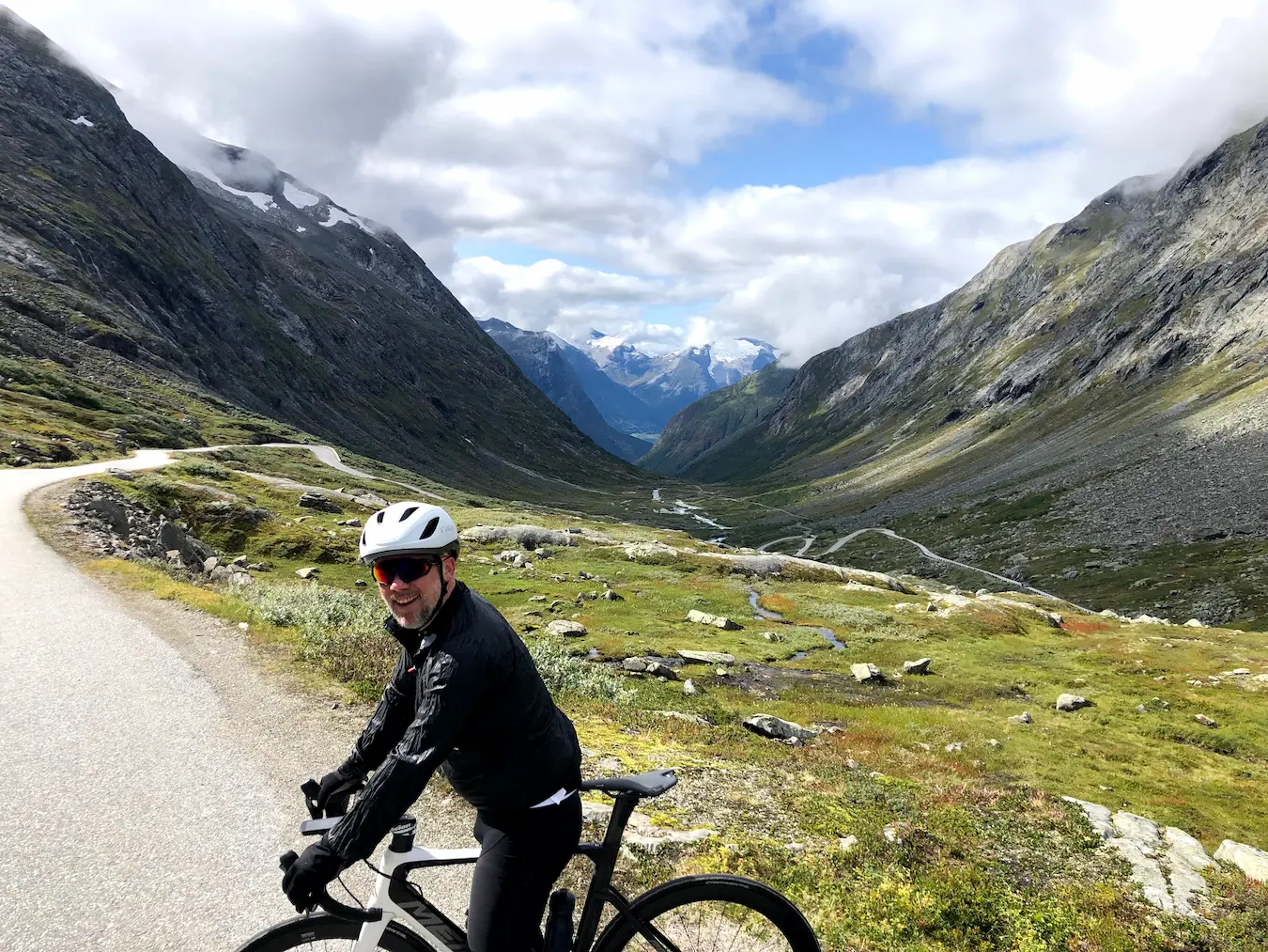
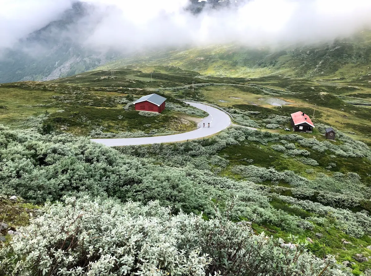
From kilometre 8 the gradient settles in. 6.5% at first, then 7, then 8 — and it stays there. Eleven kilometres of sustained climbing without a single recovery section. You find a rhythm or you suffer. We had clouds rolling around us as we climbed, with the kind of mystical light you only get in high Norwegian mountains in summer — visibility shifting from full panorama to grey-white cloud and back again, sometimes in the space of a kilometre.
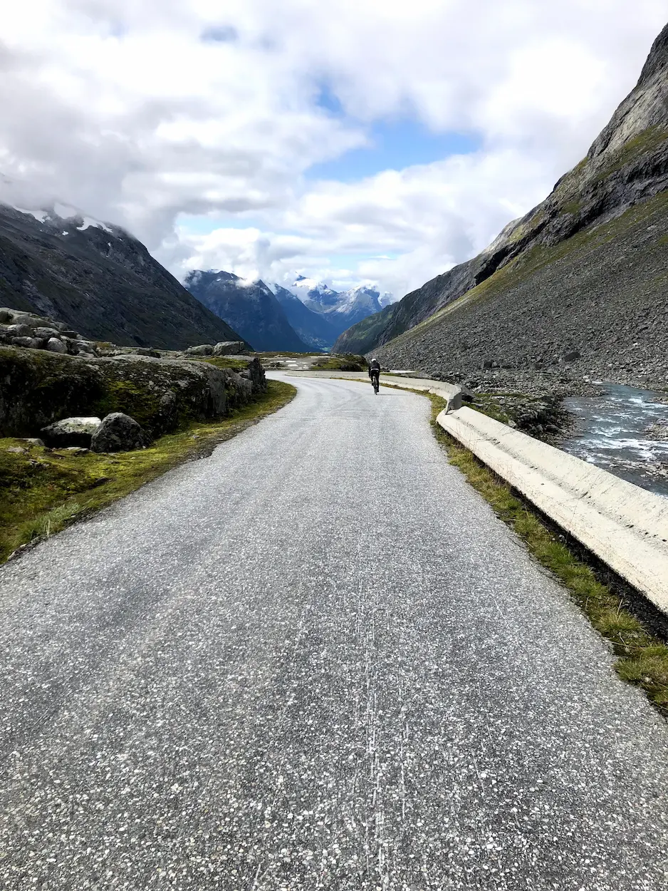
Near the top the road is surrounded by snow-flecked peaks even in August. The surface stays rough asphalt the whole way — coarse and old, exactly what you expect from a road that has been here since 1894. The gradient stiffens to nearly 8% on the final ramp to the 1,098-metre summit. Only at the very top, on the small plateau before the road tips over for the descent, does the surface give way to a short stretch of compacted gravel — compact, undramatic on 25 mm tyres. We stopped there, took photos, and turned around.
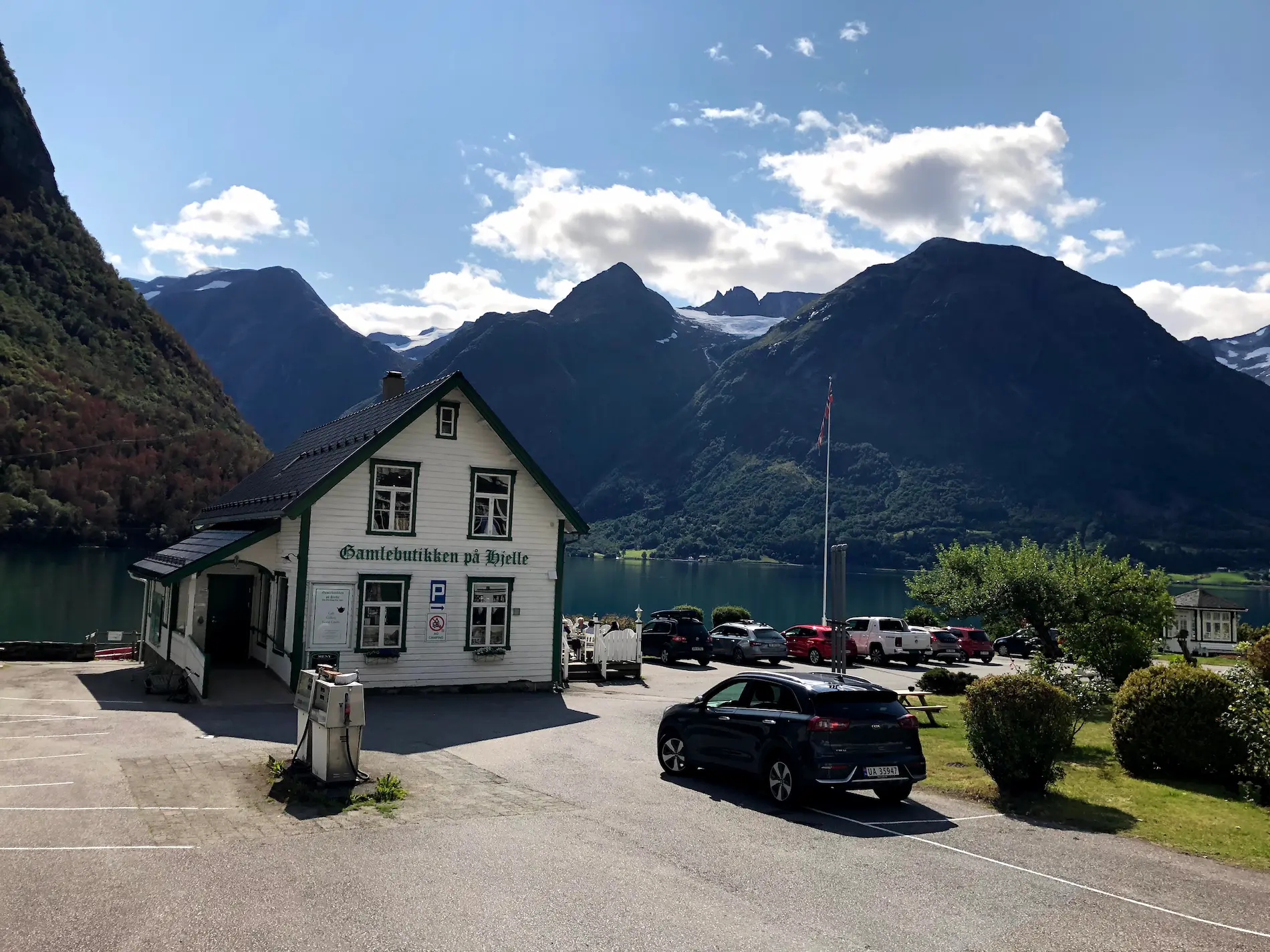
The descent is the same 18 kilometres in reverse, with the lake reappearing through the cloud layer below as you drop. Back at Hjelle, the Gamlebutikken — the old village shop on the lake — is the right place to refuel. Lunch outside, sun on the water, snow still visible on the peaks we had just climbed. That is what this ride is.
This is not a route for a fast time. It is a route for the kind of cyclist who wants to ride a road that has not changed since 1894 and is unlikely to change again. Pack everything you need before you leave Hjelle.
Kilometre by Kilometre
Roll out of Hjelle along the shore of Oppstrynsvatnet. The first kilometres are gentle — 0.4 to 4% — as the old road climbs into the valley. The asphalt is rough from the start. Glacial water on the right, the high peaks closing in ahead.
From kilometre 8 the gradient steps up to 6–7%, then settles in at 7–8% for the rest of the climb. Eleven kilometres without a single recovery section. The asphalt stays rough all the way — coarse and old, the surface of a road built in 1894. The final ramp to the 1,098-metre summit stiffens to nearly 8%. Only at the very top, a short gravel plateau before the descent. Snow patches on the peaks even in August. No services, no water — find your rhythm and ride it to the top.
Same 18 kilometres in reverse. Take it carefully on the short gravel plateau at the very top. The lake comes back into view as you drop, glacier-green in the sun. Finish at Gamlebutikken på Hjelle for lunch by the water — Hjelle Hotell next door if you want to stay the night.
Gallery
Route map & elevation profile
Key Climbs
Highlights
- •Gamle Strynefjellsveg — one of Norway's historic mountain roads, opened in 1894
- •Sustained, unrelenting climb — 11 km at 7-8% with no real recovery
- •Turquoise glacial water in Oppstrynsvatnet at start and finish
- •Snow patches on the peaks even in August at the 1,098m summit
- •Rough asphalt all the way — just a short gravel plateau at the summit. 25 mm tyres are ample.
- •Hjelle Hotell (est. 1894) at the lake-side: historic basecamp with sauna and swimming
Must know
- ⚠25 or 28 mm road tyres are fine — rough asphalt all the way, with just a short compacted gravel plateau at the very summit.
- ⚠No real recovery sections from km 8 to the top — find your rhythm early.
- ⚠Hjelle Hotell (est. 1894) on Oppstrynsvatnet is the natural base — sauna and swimming in the glacial lake. A destination in itself.
- ⚠No cafés, water taps or shops on the route — pack lunch and a full bidon at Gamlebutikken before you leave Hjelle.
- ⚠Pack a windproof jacket for the descent — the summit at 1,098m is cold even in August.
- ⚠Road typically open July to early October. Check vegvesen.no before riding.
Café & Water
- km 0Gamlebutikken på Hjelle
The old village shop at Hjelle on the shore of Oppstrynsvatnet. Idyllic stop — turquoise glacial water with snow-capped peaks behind. Lunch and drinks. The only food stop on the route.
Frequently asked questions
- What tyres do I need for Gamle Strynefjellsveg?
- 25 or 28 mm road tyres are fine. The surface is rough asphalt all the way up — only a short compacted gravel plateau at the very top. Nothing loose, nothing dramatic.
- Is there anywhere to stop for food or water?
- No cafés, shops or water taps on the route itself. Stock up at Gamlebutikken in Hjelle before you start, or bring everything you need. The closest food after the descent is back at the same shop.
- Where should I stay?
- Hjelle Hotell (est. 1894) is right at the start of the climb — historic, cyclist-friendly, with sauna and swimming in the glacial lake. Book ahead in summer, the village is small.
- When does the road open?
- Approximately July to early October — exact dates depend on snow. The summit sits at 1,098m and snow can linger into June. Check vegvesen.no before riding.
Where to stay
Hjelle
Hjelle Hotell (est. 1894) is the natural basecamp — at the western end of Oppstrynsvatnet, with sauna and swimming in the glacial lake. A destination in its own right. Gamlebutikken next door is the only food and supply stop on the route.
Know a better line?
Submit your local route and get featured with your own author profile, Strava, Instagram and Buy Me a Coffee link.
Share a Route → →Similar routes
Geiranger — Dalsnibba HC
Day 1 of the Geiranger 3-day loop — Dalsnibba climb with the Hellesylt-Geiranger UNESCO ferry
Trollstigen — 11 Hairpins
Day 2 — Ørnevegen + Trollstigen double from Geiranger
Sognefjellet & Tindevegen
Same Western Fjords queen-stage league — Northern Europe's highest pass road from Skjolden
Route Details
- Country
- Norway
- Region
- Western Fjords
For experienced cyclists. Significant elevation and demanding distances.