
About this Route
← Western Fjords Cycling GuideTwo of Norway's greatest mountain roads in a single out-and-back. From Skjolden at sea level, you climb to Sognefjellshytta at 1,434m, descend to Turtagrø, then plunge down the savage Tindevegen to Øvre Årdal — before climbing back out. The Western Fjords queen stage: Sognefjellsvegen from Skjolden over Northern Europe's highest mountain pass at 1 434m, then Tindevegen from Øvre Årdal back up to Turtagrø — two HC climbs and 4 134m of climbing in a single day. 129 kilometres, 4,134 metres of climbing, all earned twice.
Sognefjellet–Tindevegen is not a loop in the ordinary sense. It's a reckoning. Starting and finishing in Skjolden at the inner end of Lustrafjorden, this route forces you to climb from sea level to high alpine terrain — twice — before you're done.
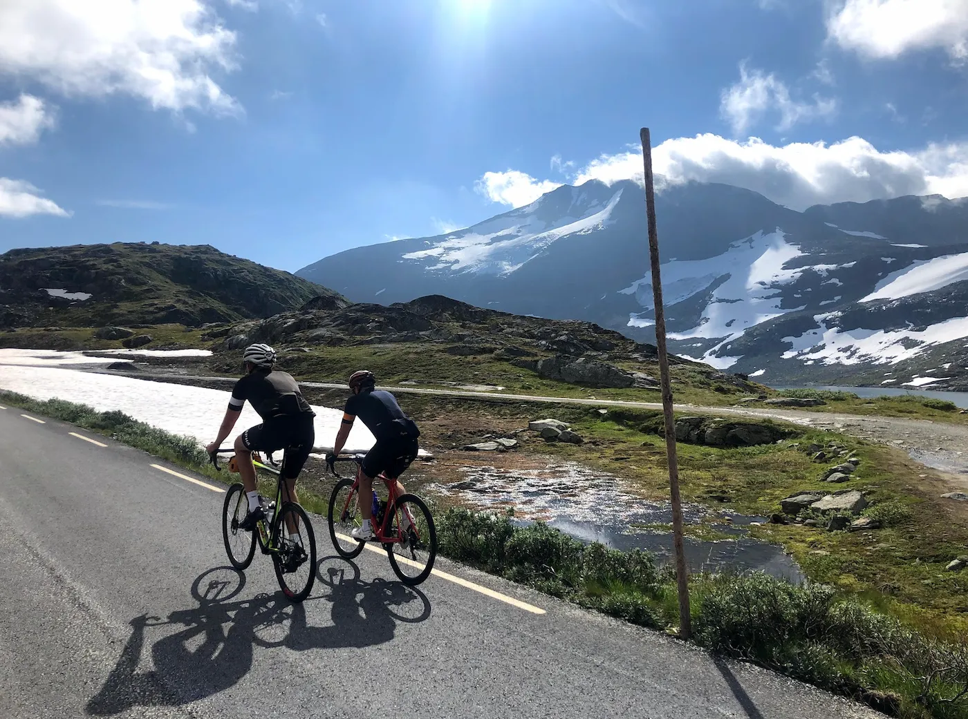
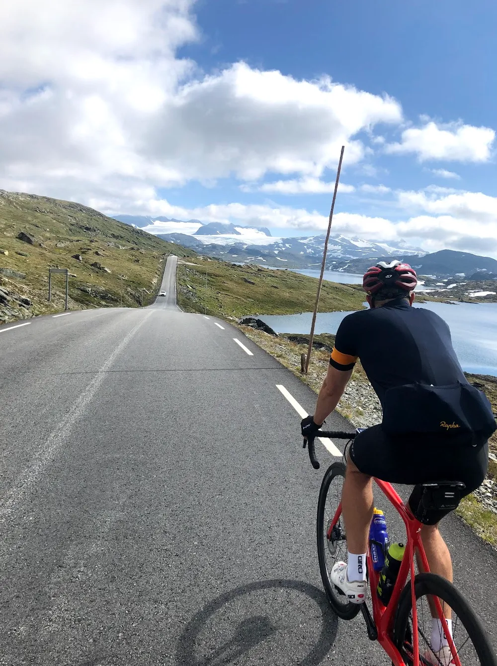
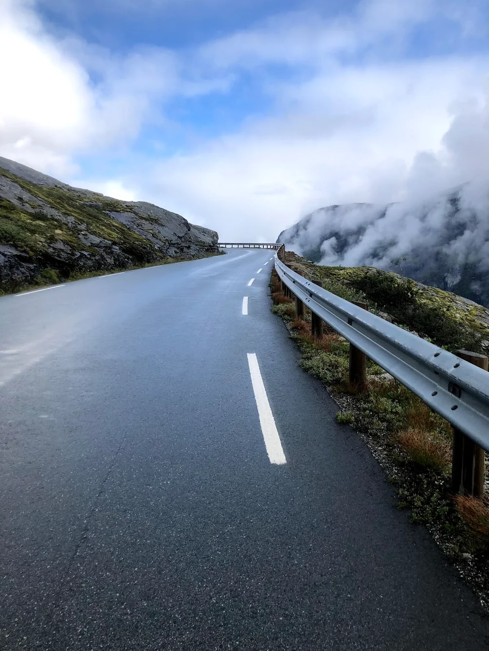
The first climb follows RV55, Northern Europe's highest mountain pass road, winding past Fortun and up through sharp hairpins toward Turtagrø. Above the tree line the road flattens across a stark alpine plateau to Sognefjellshytta at 1,434 metres. Sognefjellet is the gateway to Jotunheimen National Park — "Home of the Giants," with Galdhøpiggen, Norway's highest peak at 2 469m, visible to the east. Trek Travel ranks the climb as #8 on their Great Rides list. When I rode this in August 2020, we arrived in shorts and jerseys, sweating in the heat — and found cross-country skiers gliding past on the snowfields above us. In mid-August. That contrast never leaves you.
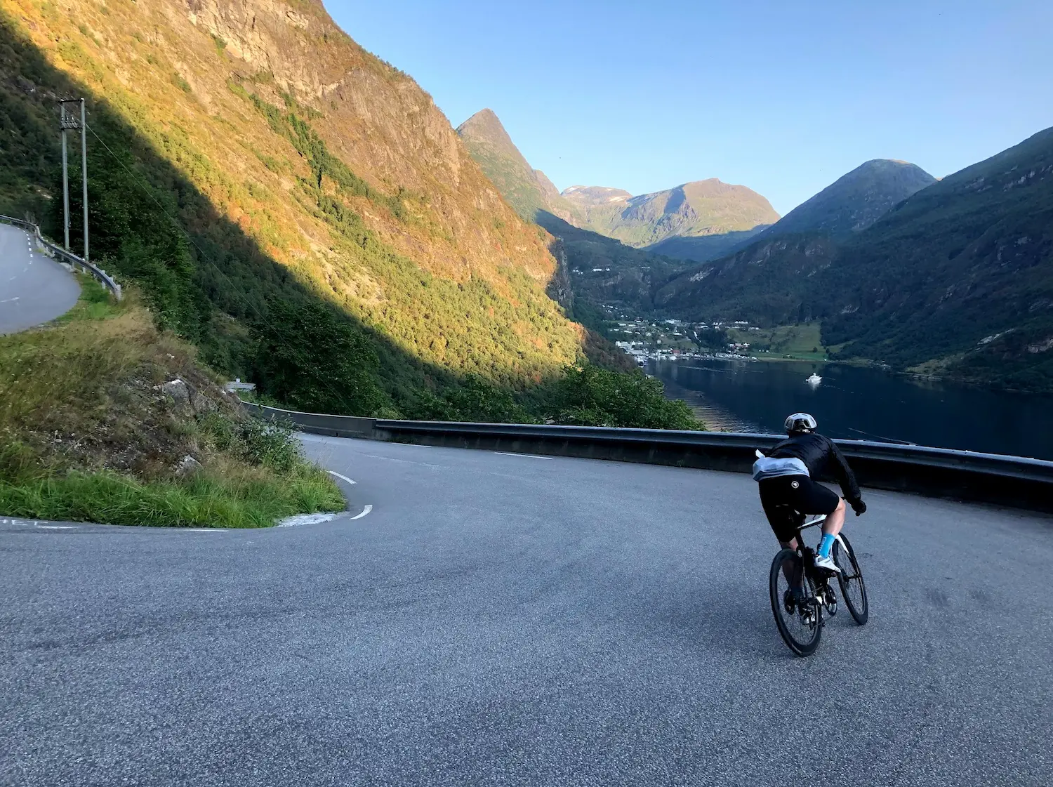
From Turtagrø, the road climbs once more to the top of Tindevegen before plunging almost vertically into Øvre Årdal with the fjord visible far below. At the bottom, stop at Tya Bakeri — fresh baguettes and pastries that taste better than anything after four hours of climbing. This stop is not optional.
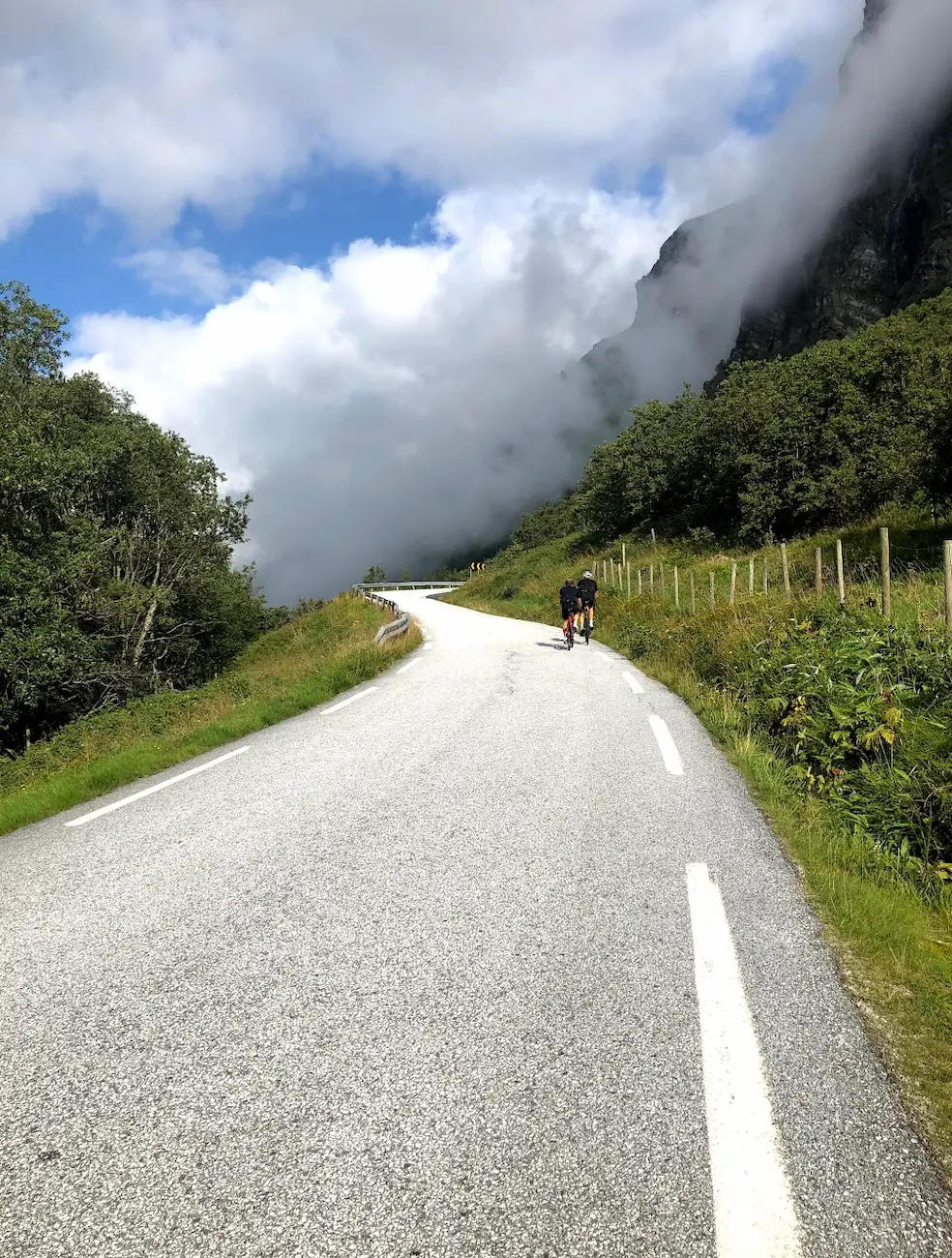
Then comes the sting in the tail. Tindevegen must be climbed back up — from near sea level to over 1,200 metres, with Sognefjellet already in your legs. At its steepest I found myself zigzagging across the full width of the road just to keep the pedals turning. By the top, the three of us were completely cooked.
Once back at Turtagrø for the final time, only the long descent to Fortun and the flat return along the river to Skjolden remain. Back in Skjolden, we went straight into Lustrafjorden. Cold, clear water after seven hours in the saddle — the only fitting way to end a day like this.
Check your brakes before you leave. The descents to both Årdal and Skjolden are long, steep and unforgiving.
Kilometre by Kilometre
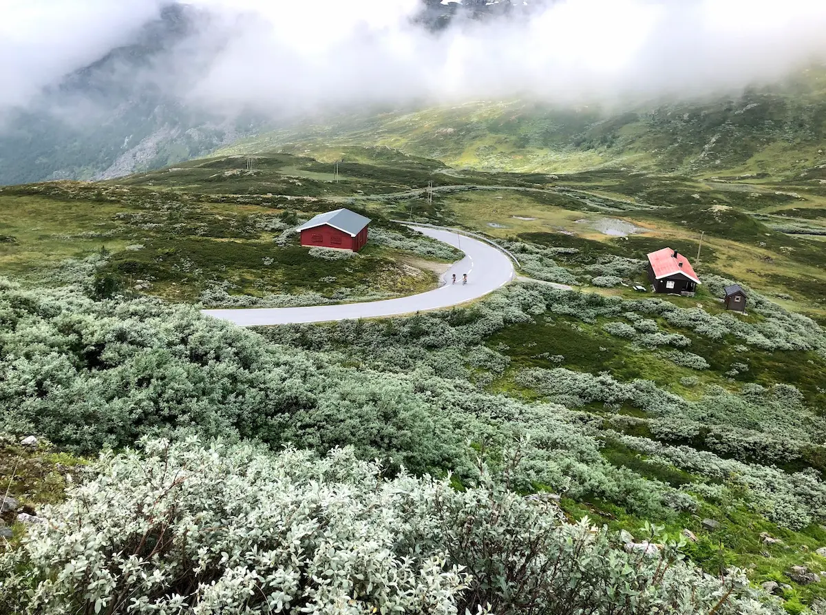
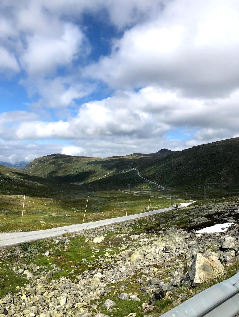
The Sognefjellsvegen climb starts immediately from Skjolden at sea level on Lustrafjord — County Road 55 ascends to Sognefjellshytta at 1 434m over 24 kilometres. From Skjolden at sea level the road climbs immediately on RV55. Consistent gradient throughout — long, steady and relentless. The landscape transforms from fjord-side farms to open alpine terrain. Glaciers appear to the north and Jotunheimen peaks surround you near the 1,434m summit. Sognefjellshytta mountain lodge at the top is your first turnaround point and an essential stop for food and water.
A fast descent back toward Turtagrø. Enjoy it — this is the only easy section of the day. Turtagrø Hotel is your strategic base, passed three times in total. Stop here for a coffee or lunch before the second challenge begins.
Tindevegen turns right at Turtagrø — the private toll road climbs 18km from Øvre Årdal to 884m, free for cyclists. The Hurrungane massif with 23 peaks above 2 000m fills the view to the west. Both Sognefjellet and Tindevegen rank Hors Catégorie. At Turtagrø you turn onto Tindevegen — a narrow, private mountain road with almost no traffic. The descent to Øvre Årdal is savage: you drop almost vertically toward the fjord with the valley floor visible far below. Øvre Årdal at sea level is your second turnaround. Rest here before the day's hardest climb.
Now you climb Tindevegen back up to Turtagrø. This is the mental and physical crux of the route — 18km at 7.4% average with ramps to 11%, after already having 68km in your legs. Almost no traffic. Extraordinary views of the Hurrungane peaks and Store Skagastølstind. Dig deep.
From Turtagrø the final leg begins — a technical descent through hairpins past Fortun and the flat riverside road back to Skjolden. Your legs are empty but the fjord is waiting. Dinner in Skjolden while looking up at the mountains you just climbed is the only appropriate way to finish.
Gallery

Route map & elevation profile
Key Climbs
Fortun – Sognefjellshytta
HCTindevegen fra Årdal — Offisiell
HCBerdalen – Bommen
Cat 3Rv55 Climb (Upper)
Cat 3Highlights
- •Northern Europe's highest mountain pass at 1 434m — Fantesteinen summit on the Sognefjellsvegen
- •Two HC climbs in one ride — Sognefjellet (RV55) and Tindevegen, the figure-8 from Skjolden
- •Sognefjellshytta mountain lodge at the summit — open May through October, only refuel point at altitude
- •Hurrungane peaks at Turtagrø — 23 peaks over 2 000m visible from the junction
- •PJAMM-style hardness anchor: cycled by Trek Travel as #8 on their Great Rides list
- •Gateway to Jotunheimen National Park — "Home of the Giants" with Galdhøpiggen visible to the east
Must know
- ⚠Sognefjellsvegen (RV55) opens late May, closes early November — check official Statens vegvesen status before departure
- ⚠Tindevegen is a private toll road — free for cyclists, drivers pay at the Øvre Årdal toll station
- ⚠No water or food between Skjolden and Sognefjellshytta (24km, 1 434m climb) — refill at Sognefjellshytta or carry enough
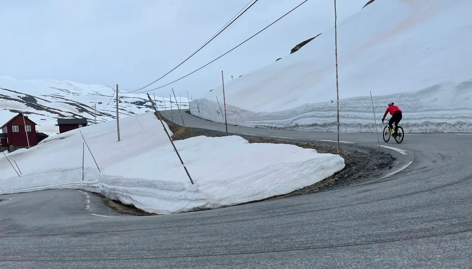
- ⚠Weather can shift from sea-level summer to subzero alpine in 90 minutes — pack a windproof jacket and full-finger gloves
- ⚠The descent from Sognefjellshytta to Turtagrø is fast and exposed — check brakes at the summit before starting down
Café & Water
- km 24Sognefjellshytta
Summit, km 24 — Mountain lodge at 1 434m on the Sognefjellsvegen. The only food and water stop at altitude. Open late May through October. Lunch, coffee, hot soup — refueling for the descent and the Tindevegen climb that follows.
- km 36Turtagrø Hotel
Junction, km 36 — Historic hotel at 884m where the Sognefjellsvegen meets the Tindevegen turnoff. You pass it three times on the figure-8: descending from Sognefjellet, climbing up Tindevegen on return, descending again toward Skjolden. Strategic warm-up and warm-down point.
- km 58Tya Bakeri & Kafé
Øvre Årdal, km 58 — Handcraft bakery in central Øvre Årdal, established 2015 and inspired by Bakeriet i Lom. Located on Storevegen 16. The turnaround stop at the bottom of Tindevegen before you climb back. Pastries, sandwiches, local beer if you've earned it.
Frequently asked questions
- How high is Sognefjellet?
- 1 434 metres at the Fantesteinen summit on the Sognefjellsvegen — Northern Europe's highest mountain pass. The road climbs from sea level at Skjolden to the summit in 24 kilometres.
- Can I cycle Tindevegen?
- Yes — the Tindevegen is a private toll road that's free for cyclists. The 32km road climbs from Øvre Årdal (sea level) to Turtagrø (884m) with 18 kilometres averaging 7%. Open late April through November.
- What's the difference between Sognefjellet and Aurlandsfjellet?
- Two separate HC climbs in Norway's Western Fjords region. Sognefjellet is Sognefjellsvegen from Skjolden (24km, 1 434m summit), Northern Europe's highest mountain pass through Jotunheimen. Aurlandsfjellet is the Snow Road from Aurland (16km climb, 1 306m summit), the dramatic fjord-to-plateau route via Stegastein. Both are HC, but they're different routes with different character.
- Sognefjellet vs Tindevegen — which is harder?
- Different difficulties. Sognefjellet from Skjolden is longer (24km vs 18km) with more vertical (1 434m vs 1 295m), but Tindevegen is steeper on average (7% vs 6%) with brutal switchbacks in the first 10km. Most riders find Tindevegen harder when ridden second on the figure-8 — fresh legs change the equation.
- When does Sognefjellsvegen open for cycling?
- Typically late May through early November. Statens vegvesen publishes opening and closure dates each season — check before departure. Even after opening, snow walls can line the road through July, and weather can close the pass overnight in autumn.
Where to stay
Nes Gard, Luster
Boutique farm hotel with 20 rooms, traditional farm cuisine, library and lush garden. Located near Breheim glacier centre with views to Lustrafjord and Feigumfossen waterfall. 15 min drive from Skjolden.
Skjolden Hotel
Traditional fjord hotel with restaurant, micro-brewery, panoramic fjord views. Bike rental, parking, free Wi-Fi. Open mid-April through late September. Walking distance to ferry pier, Coop grocery store, and the start of the Sognefjellsvegen climb.
Know a better line?
Submit your local route and get featured with your own author profile, Strava, Instagram and Buy Me a Coffee link.
Share a Route → →Similar routes
Lom - Sognefjellshytta
Just the Sognefjellet half — out-and-back from Lom without the Tindevegen leg
Trollstigen — 11 Hairpins
Other Wedge 1 fjord queen stage — Trollstigen and Geiranger Eagle Road
Geiranger — Dalsnibba HC
Different fjord region — Geiranger and Dalsnibba instead of Sognefjellet
Route Details
- Country
- Norway
- Region
- Western Fjords
Elite level. Extreme elevation, altitude and distance. Serious preparation required.