About this Route
← Western Fjords Cycling GuideOne of the most dramatic climbs in Norway. From Aurland at sea level, the Snow Road climbs 1,286 metres in just 17 kilometres — an average of 7.5% with no respite. The climb starts from Aurlandsvangen at sea level and reaches the Stegastein viewpoint by bike at km 7.5 — a cycling perspective on Norway's most photographed cantilever platform. Pass the iconic Stegastein viewpoint, suspended 650 metres above the Aurlandsfjord, before the open high-mountain plateau. A Norwegian Scenic Route and a bucket-list climb for any serious cyclist.
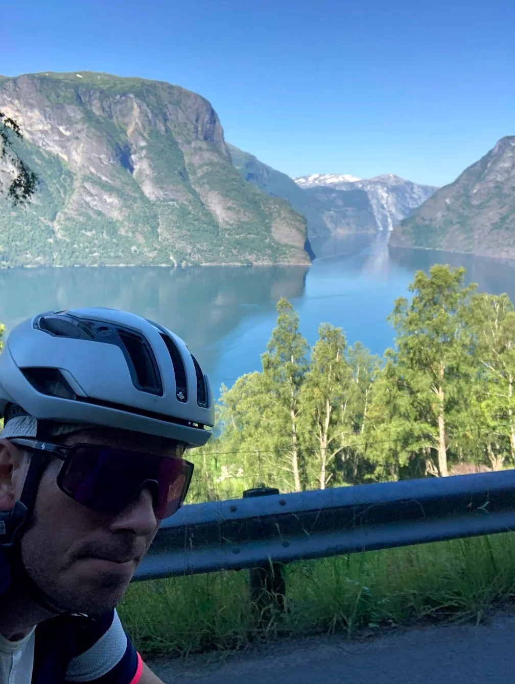
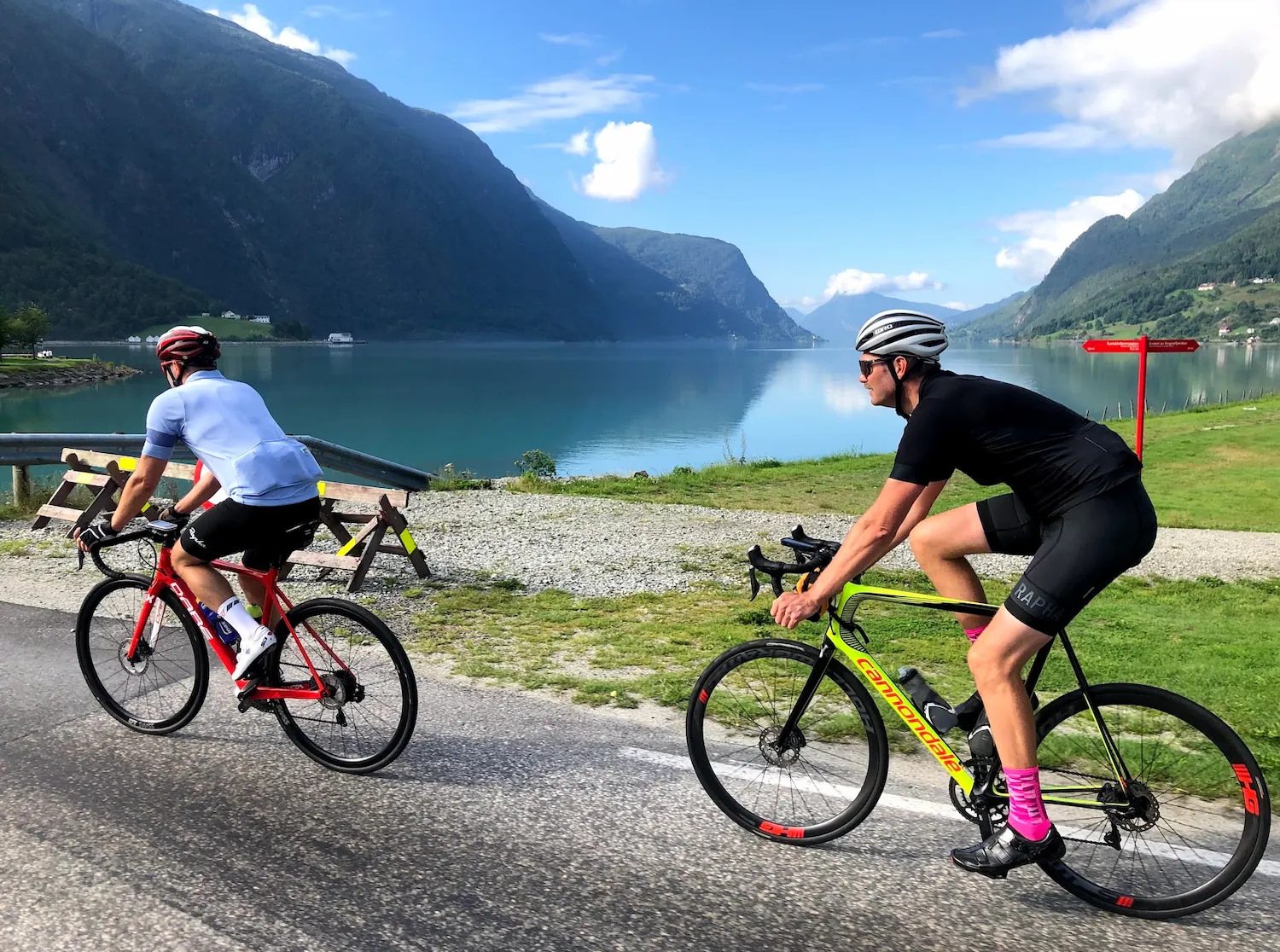
Aurland sits at the head of the Aurlandsfjord — a deep arm of the Sognefjord, the world's longest ice-free fjord. From the village at sea level the road climbs 1,281 metres in 16.5 kilometres at a relentless 7.7% average. PJAMM ranks this Norway's fourth-hardest road climb, and the gradient explains why: 14 of the 17 kilometres sit between 6 and 9% with no real recovery anywhere on the mountain.
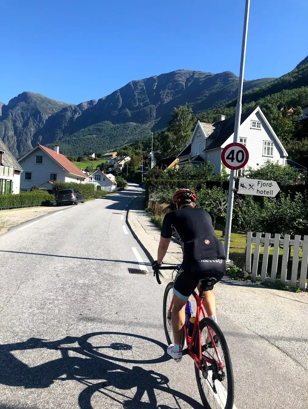
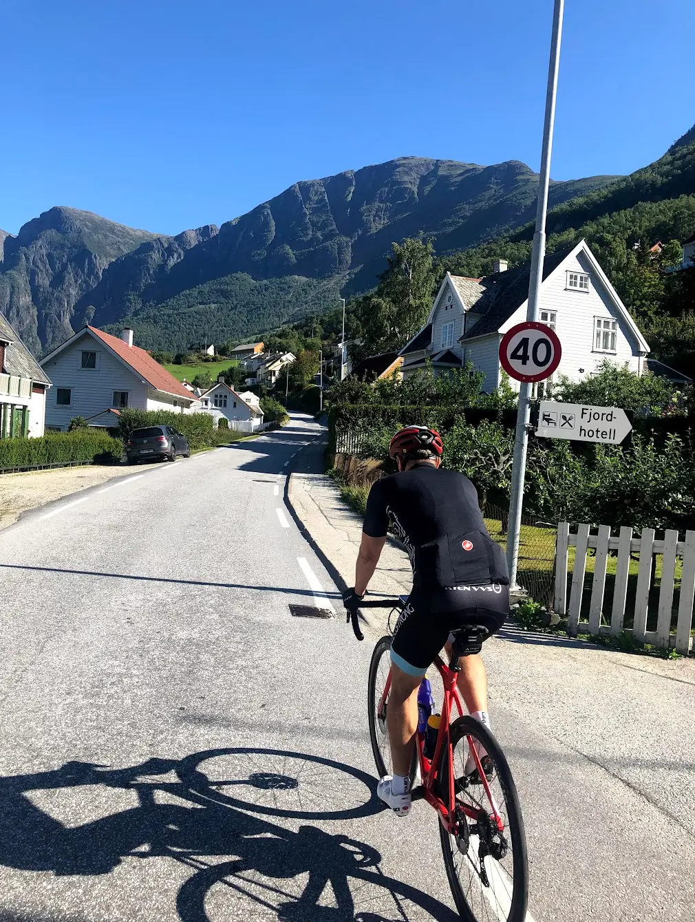
When I rode this in August 2020, we drove from Skjolden that morning with the bikes on the roof — day three of a Sognefjord tour, after Sognefjellet on day one and the inner-fjord loop past Urnes and Nigardsbreen on day two. We left the car at Vangsgaarden, the old guesthouse in the village. Without us being staying guests, they let us use the facilities for free. In small Norwegian villages, you just ask. Across the road at SPAR I packed lunch into the jersey pockets — there are no cafés or water taps between Aurland and the summit, ninety minutes of climbing without a stop. Plan accordingly.
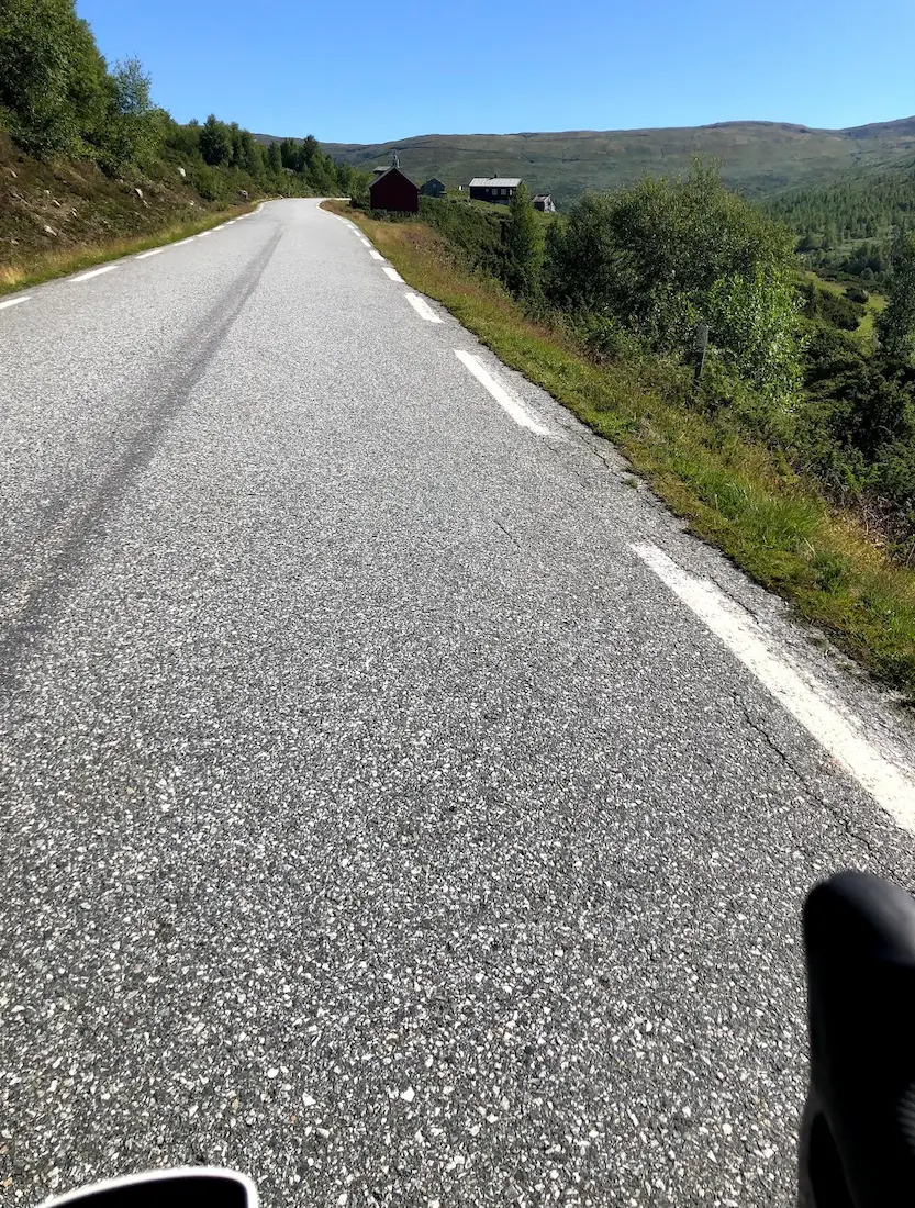
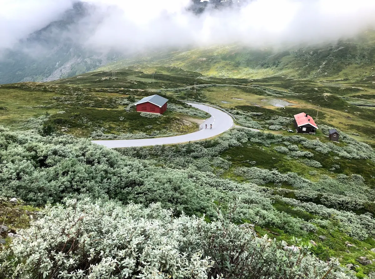
The road tilts upward from the first pedal stroke. The lower section runs along the fjordside before the first switchbacks bite — eight tight hairpins carved into the mountainside before km 7, with the Aurlandsfjord dropping away between the turns. Tourist traffic to Stegastein can be heavy in summer; in 2020 with foreign borders mostly closed, the climb was packed with Norwegian motorhomes squeezing past on the narrow lower hairpins. Read the traffic before you commit to a switchback. Start early if you can.
Stegastein viewpoint arrives at km 7.5, sitting on the steepest sustained kilometre of the entire climb — km 8 to 9 averages 8.8%. When you round the platform you're in the middle of the hardest gradient on the mountain, and the parking is chaos: cars stacked on the verge, motorhomes turning, people crossing the road for the photo. I rode straight past, decided to take the stop on the descent, and saved my legs for the upper plateau. Designed by Todd Saunders and Tommie Wilhelmsen and opened in June 2006, the platform extends 30 metres into open air, 650 metres above the fjord. Worth every minute when you go back. Just not on the way up.
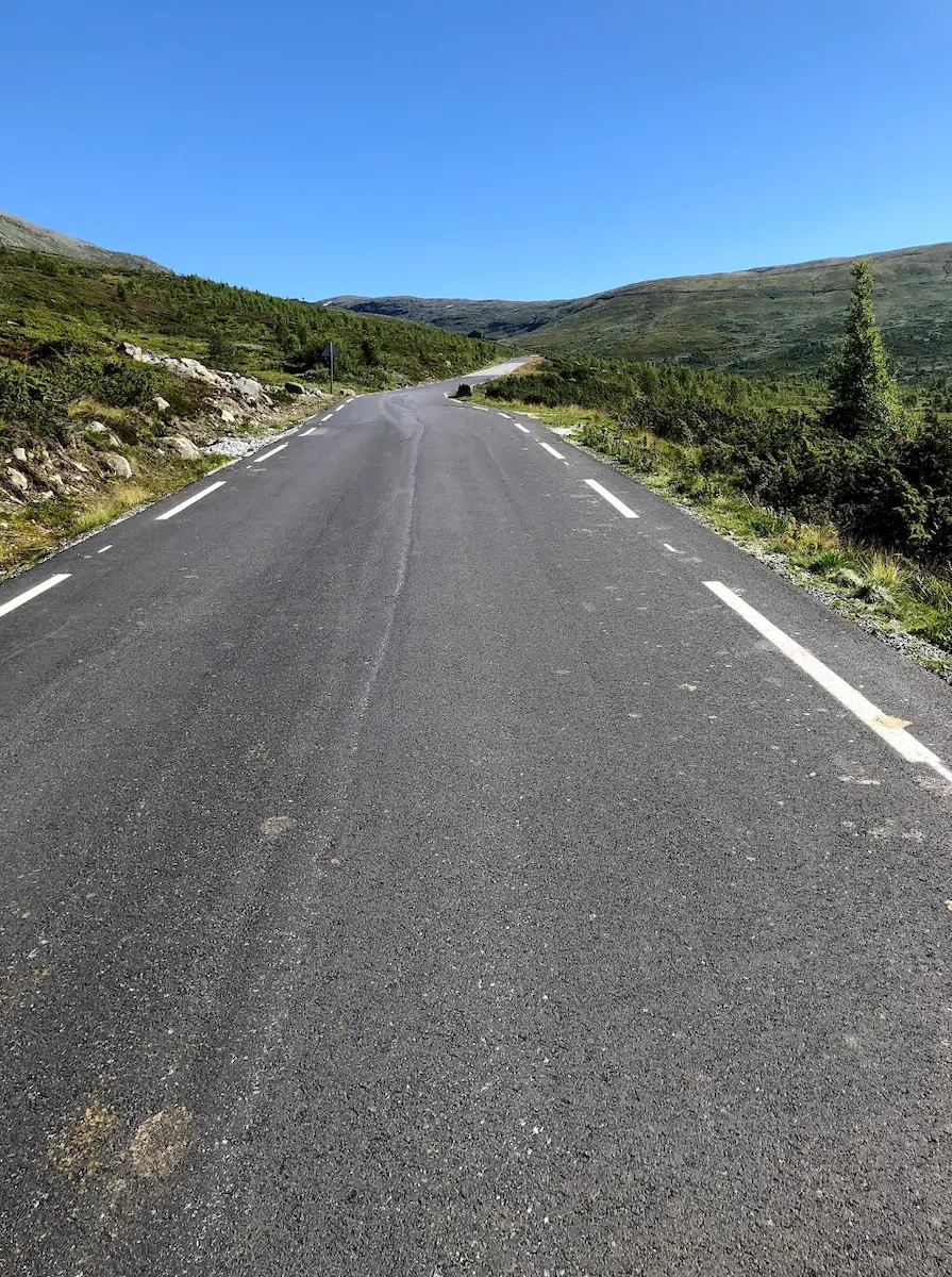
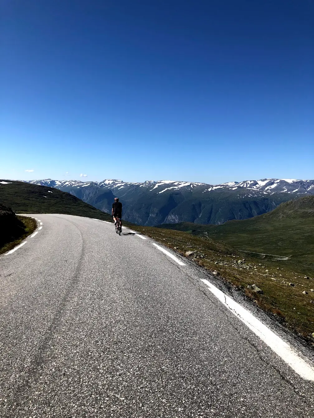
Above Stegastein the road quietens completely. The tree line falls behind and the terrain opens into a vast alpine plateau — long, exposed, straight roads with sight lines that make your riding partner look like a dot ahead. Sheep wander onto the asphalt without much concern for traffic. The gradient stays close to 8% for another six kilometres, broken only briefly by a slacker section near km 12. Even in mid-August there were patches of snow at the road edge above 1,200 metres. Bring a jacket for the descent. A few hundred metres before the final ramp someone had chalked Well done across the asphalt. By that point I needed it.
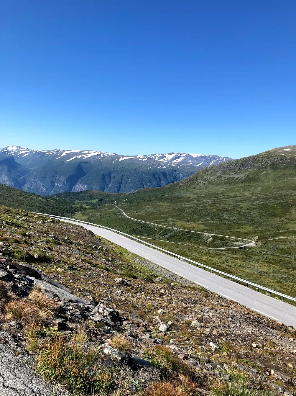
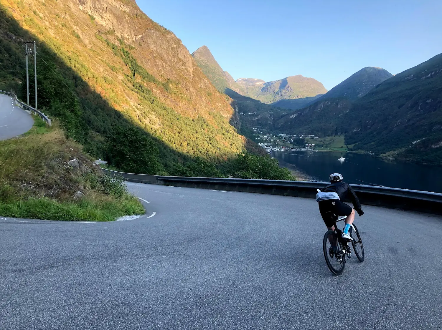
The summit on the GPX track sits at 1,286 metres; the road carries on a few hundred more to the official high point at 1,306. From there it's an out-and-back — the same 16.5 kilometres in reverse. Check your brakes before letting go. The descent is fast, the road is narrow, and Stegastein on the return was exactly the chaos I'd predicted that morning: slow, careful, and full of campervans pulling into the parking lot. I stopped at the platform, walked to the edge, looked straight down at the fjord, and watched the queue form behind me.
Back in Aurland we showered at Vangsgaarden — the staff didn't blink — and rolled the hundred metres along the river to Marianne Bakeri & Kafe. Bread, pizza and soup, eaten slowly in the satisfying weight of having spent the morning in the saddle. We ate ourselves full.
For pacing, my Strava time on the climb was 1:26:50 from Aurland to the summit — not a leaderboard time, but a useful reference. Most strong amateurs land between 1:15 and 1:45 on a still day.
Kilometre by Kilometre
The Snow Road cycling climb begins immediately from Aurlandsvangen at sea level — first switchbacks bite by km 2, the Stegastein viewpoint sits at km 7.5. The climb begins almost immediately from Aurland at sea level. The lower section runs along the fjordside before the first hairpins bite — eight tight switchbacks carved into the mountainside between km 2 and km 7, the Aurlandsfjord dropping away between the turns. The gradient holds 7–9% throughout. Stegastein viewpoint arrives at km 7.5 — a 30-metre cantilevered platform 650m above the fjord, designed by Todd Saunders + Tommie Wilhelmsen and opened in 2006. Best appreciated on the descent: the parking is chaos in summer and you're sitting on the steepest sustained kilometre of the climb (km 8–9 averages 8.8%).
Above Stegastein the road quietens completely and the landscape transforms. The tree line falls behind and the terrain opens into a vast alpine plateau of rock and lingering snow. The gradient stays close to 8% for another six kilometres, broken only briefly near km 12 before stiffening again toward the top. Snow patches linger at the road edge even in August above 1,200m. The GPX summit sits at 1,286m; the road carries on a few hundred metres to the official high point at 1,306m. Genuinely remote — the fjord is only 16 kilometres behind you.
Out-and-back: the same 16.5 kilometres in reverse. Check your brakes at the summit before letting go. The descent is fast, the road is narrow, and Stegastein on the return is the only mandatory stop — full of summer tourist traffic, but the platform is the moment to appreciate the fjord with fresh eyes (and not while in the red zone on the climb). Roll the final hairpins carefully and finish at Marianne Bakeri & Kafe by the river mouth in Aurland.
Gallery
Route map & elevation profile
Key Climbs
Highlights
- •PJAMM's 4th hardest climb in Norway — 16.5km at a relentless 7.7% average with no real recovery
- •Stegastein viewpoint at km 7.5 — 30m cantilevered platform 650m above the Aurlandsfjord, opened 2006 (Saunders + Wilhelmsen)
- •Eight tight hairpins on the lower section between km 2 and km 7 with the fjord dropping away below
- •Snow patches at 1,286m even in August — and "Well done" chalked on the asphalt before the summit
- •One of Norway's 18 designated National Tourist Routes (Fv5627, formerly Fv243)
- •The only practical cycling route between Aurland and Lærdal in summer — Lærdal Tunnel is closed to cyclists
Must know
- ⚠Road open approximately 1 June – 15 October (Fv5627, formerly Fv243). Check our Aurlandsfjellet opening guide or vegvesen.no for exact dates — snow can delay opening into early June.
- ⚠Lærdal Tunnel (E16) is closed to cyclists. Snøvegen is the only practical cycling route between Aurland and Lærdal in summer.
- ⚠Motorhome season (July–August) brings heavy traffic on the narrow lower hairpins — start by 8am to avoid convoys, and read the road before committing to a switchback.
- ⚠No cafés or water taps between Aurland and the summit — pack lunch and at least one full bidon at SPAR before you leave the village.
- ⚠Snow patches remain at the summit even in August. Pack a wind jacket for the descent from 1,286m.
- ⚠Stegastein viewpoint at km 7.5 sits on the steepest sustained kilometre (8.8%) — stop on the way DOWN, not up. Parking is chaos and your legs need the upper plateau.
Café & Water
- km 0Marianne Bakeri & KafeMon–Fri 09:00–17:00, Sat 10:00–16:00
At the river mouth in Aurland, by the fjord. Bread, pizza and soup — the post-ride stop. No cafés or water between here and the summit, so this is also where you start.
- km 0SPAR AurlandMon–Sat 09:00–20:00, Sun 09:00–18:00 (open Sundays)
Across from Vangsgaarden. Pack lunch and a full bidon here — there is nothing on the climb.
Frequently asked questions
- Can I cycle through Lærdal Tunnel?
- No — the 24.5km Lærdal Tunnel (E16) is closed to cyclists. Snøvegen (Fv5627, formerly Fv243) over Aurlandsfjellet is the only cycling route between Aurland and Lærdal in summer.
- When does Aurlandsfjellet open?
- Typically around 1 June, closing mid-October. The lower section to Stegastein (the first 7.5km from Aurland) stays open year-round. Check vegvesen.no for exact dates — snow can delay full opening into early June.
- Where should I stay in Aurland?
- Vangsgaarden Gjestgiveri is the natural base — the village's oldest buildings (1770), bike-friendly, central, and the staff are welcoming to cyclists. SPAR for supplies, Marianne Bakeri & Kafe for the post-ride meal — both within a few hundred metres.
- How hard is Aurlandsfjellet really?
- PJAMM ranks it Norway's 4th hardest road climb. The 16.5km averages 7.7% with no real recovery sections — 14 of the 17 kilometres sit between 6 and 9%. Plan for 90–110 minutes in the saddle. The Strava segment typically takes strong amateurs 1:15–1:45 on a still day.
- What's the difference between Aurlandsfjellet and Sognefjellet?
- Two different mountain climbs in Norway's Western Fjords. Aurlandsfjellet is the Snow Road from Aurland (33km / 1308m), a shorter but steeper climb topping out at 1306m. Sognefjellet is Sognefjellsvegen from Skjolden (a longer route through Jotunheimen), Northern Europe's highest mountain pass at 1434m. Both are HC climbs, but they're separate routes with different character.
Where to stay
Aurland
Start and finish of the climb. Vangsgaarden Gjestgiveri is the obvious base — the village's oldest buildings (1770), bike-friendly, fjord-side, and the staff will let you shower after your ride if you ask nicely. SPAR is across the road for breakfast and lunch supplies, and Marianne Bakeri & Kafe by the river mouth is the only post-ride pizza-and-soup stop you'll need.
Know a better line?
Submit your local route and get featured with your own author profile, Strava, Instagram and Buy Me a Coffee link.
Share a Route → →Similar routes
Sognefjellet & Tindevegen
Rode the day before from Skjolden — 4,134m in one day if you want the full Western Fjords queen stage
Sognefjord Cycling — Urnes Stave Church & Nigardsbreen Glacier
The gentler day between Sognefjellet and Aurlandsfjellet on the Skjolden 3-day loop — Urnes Stave Church and Nigardsbreen glacier
Trollstigen — 11 Hairpins
Other iconic Norwegian tourist road — Trollstigen and the Eagle Road from Geiranger
Route Details
- Country
- Norway
- Region
- Western Fjords
Elite level. Extreme elevation, altitude and distance. Serious preparation required.