Sognefjord Cycling — Urnes Stave Church & Nigardsbreen Glacier
About this Route
← Western Fjords Cycling GuideA magnificent fjord loop from Skjolden combining two UNESCO-listed highlights in a single day. Cycle along the inner Sognefjord to Urnes — home to Norway's oldest stave church — crossing by ferry to Solvorn, then heading deep into Jostedalen to Nigardsbreen, one of Europe's most accessible glaciers. 143 kilometres of fjordside roads, mountain valleys and extraordinary scenery.
This route is one of those rides where the destination list alone sounds absurd — Norway's oldest stave church, a UNESCO ferry crossing, and a glacier arm of the largest ice cap in continental Europe, all in a single loop. When I rode this in August 2020, it was day two of a trip through Sogn og Fjordane, and the day exceeded every expectation.
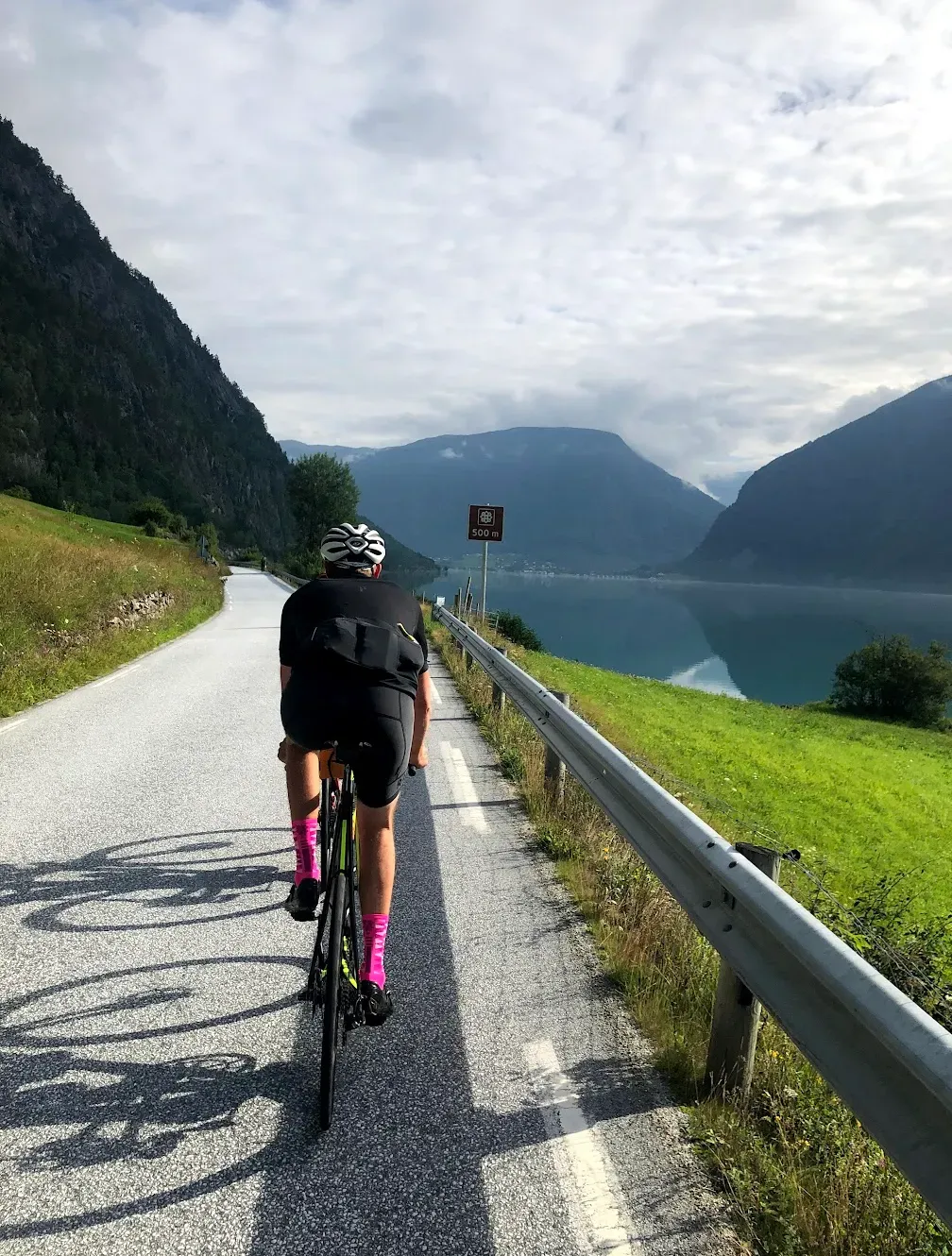
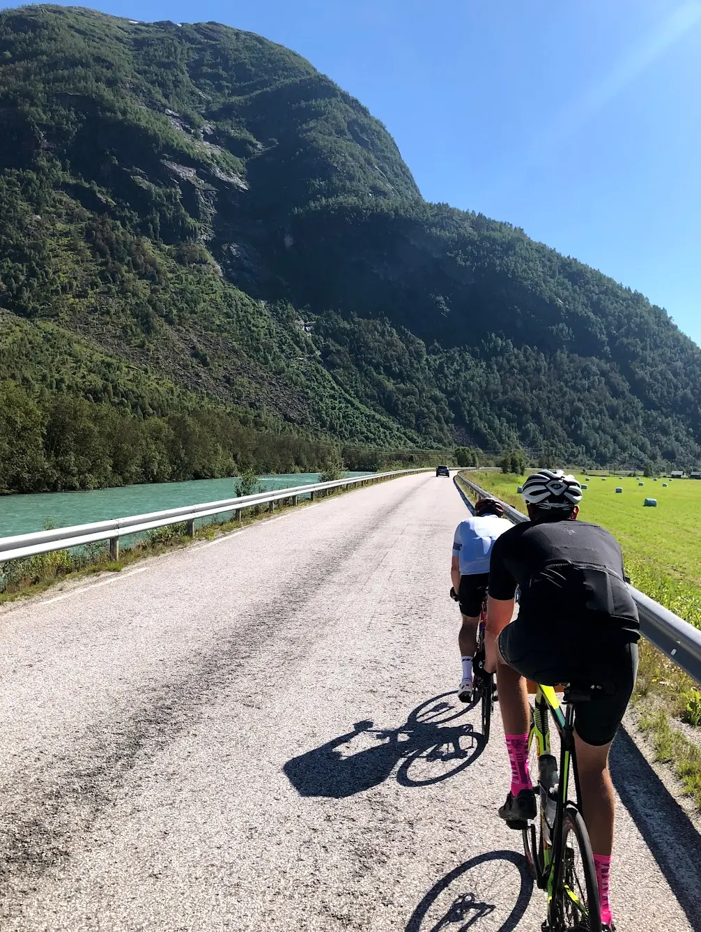
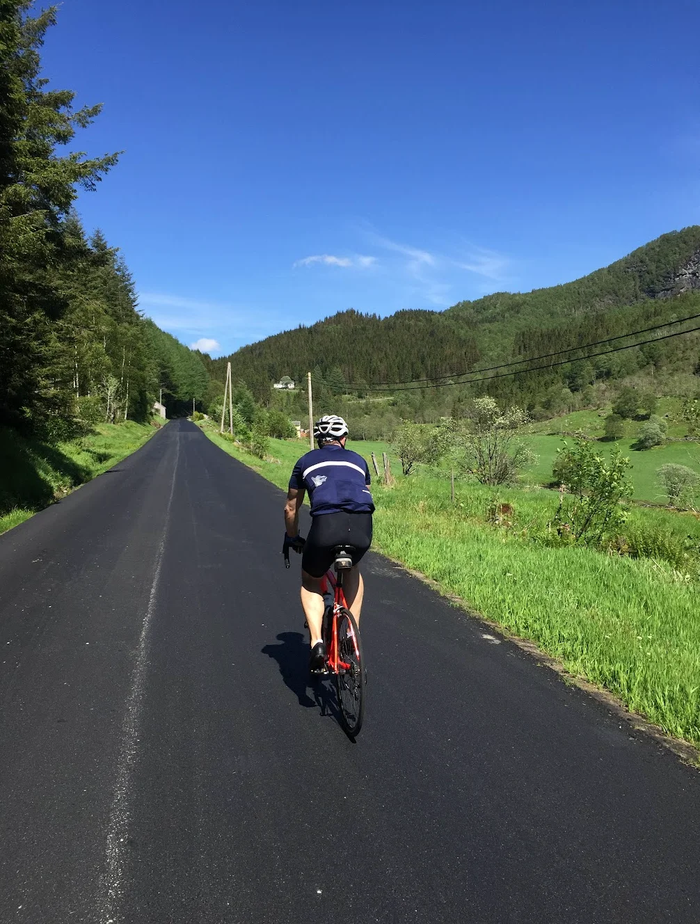
From Nes I headed east along Lustrafjorden toward Skjolden at the innermost tip of Sognefjorden. The road hugs the fjord the entire way — steep mountain walls rising directly from the water, and a stillness you rarely find on Norwegian roads. The tunnels changed the mood entirely. Three of them are pitch black and up to 900 metres long — no lighting, no margin for error. I had good lights but even so, the darkness was absolute. You hear water dripping from the ceiling and your own breathing, and then suddenly daylight hits and the fjord is right there again.
After Skjolden the route turns south along the western shore of Lustrafjorden toward Urnes. This stretch — sometimes called the Romantic Road — is genuinely beautiful. The road is narrow, the fjord is close, and the mountains across the water look painted. Urnes Stave Church sits on a hillside above the fjord, built around 1130 and somehow still standing. I spent twenty minutes there, which was not enough.
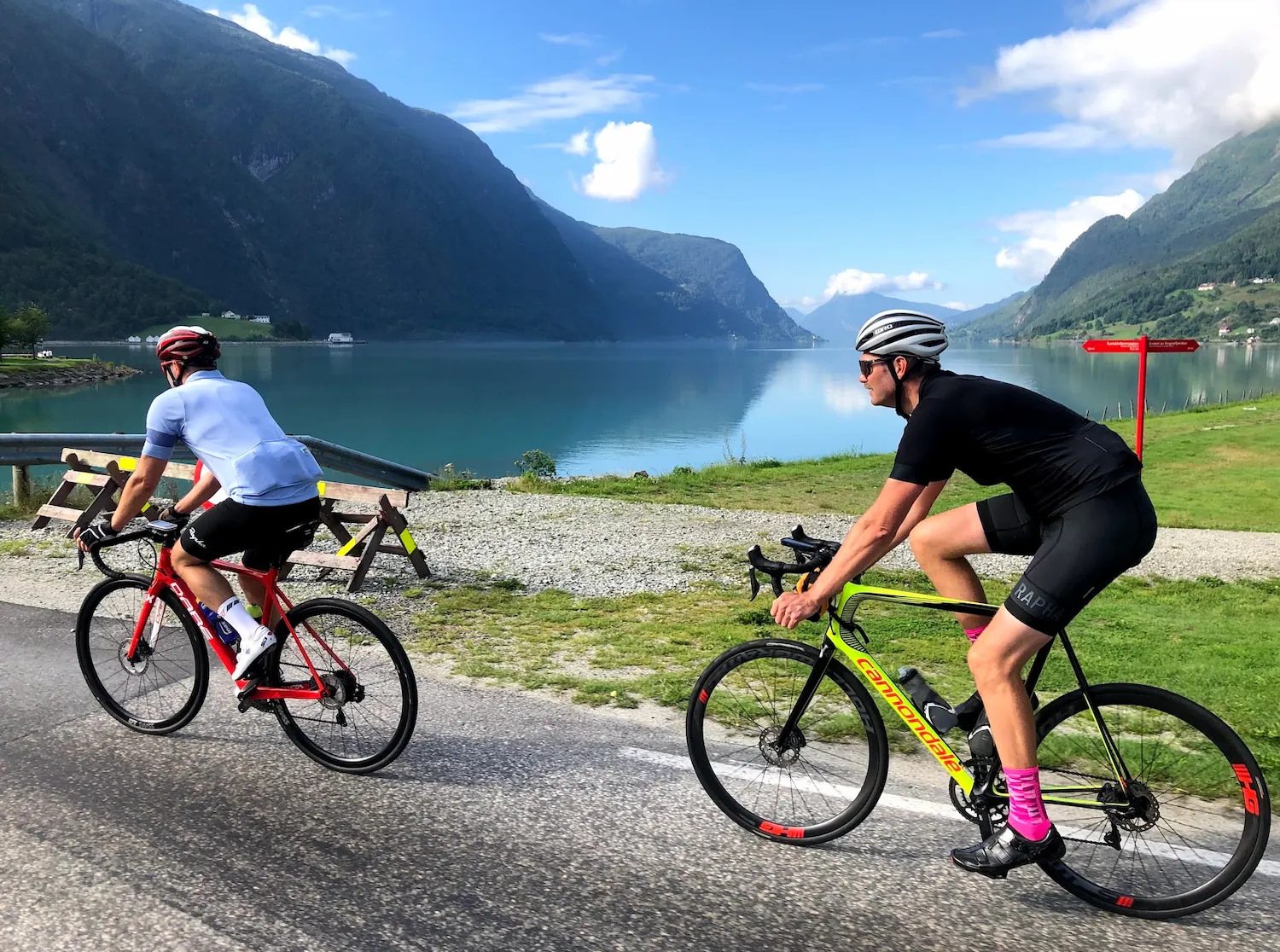
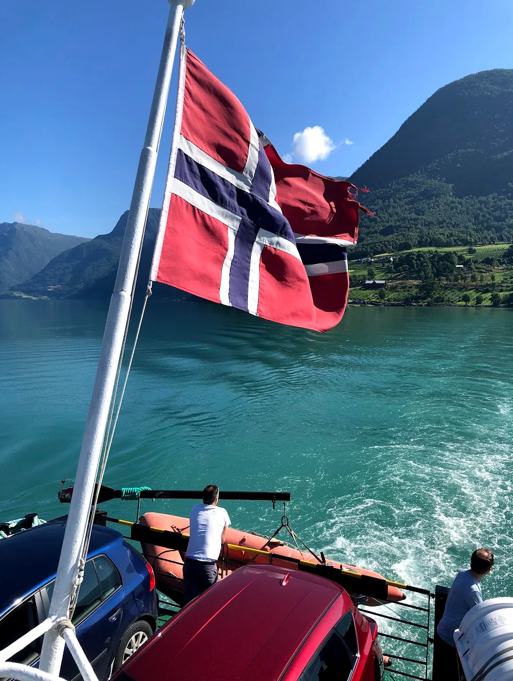
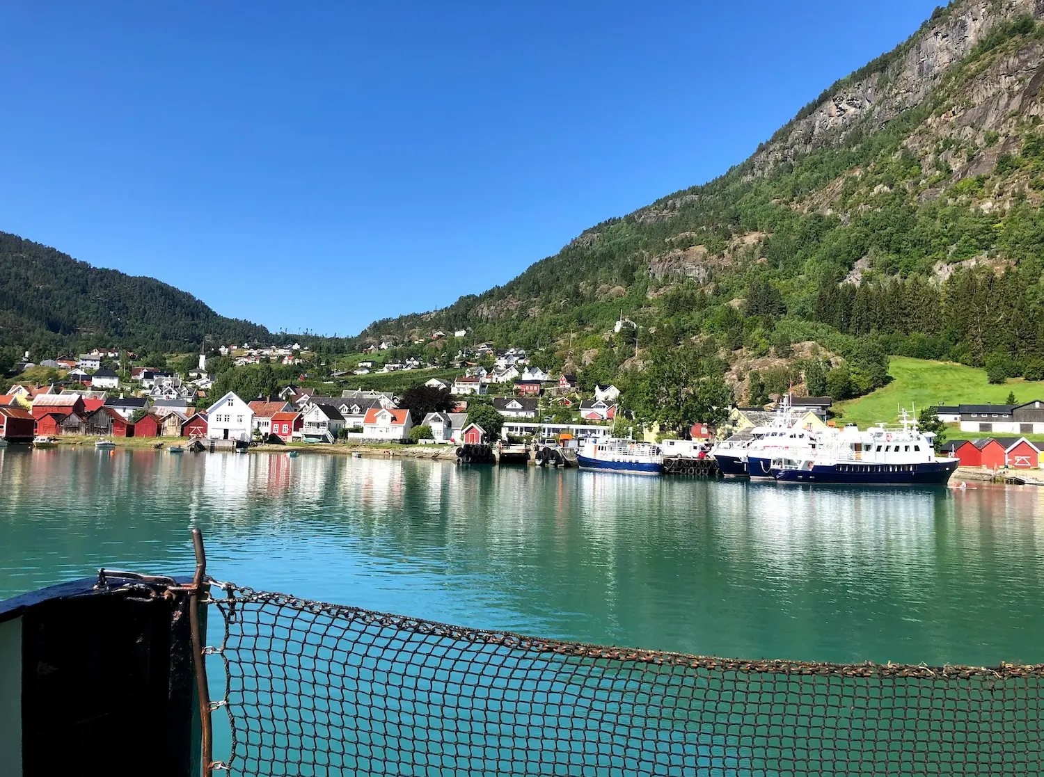
The ferry from Urnes to Solvorn is short but scenic — ten minutes across some of the most dramatic water in the inner Sognefjord. From Solvorn the road climbs hard, over 300 metres up to a high point before dropping into Gaupne. This was the steepest section of the whole ride and caught me off guard after the gentle fjordside roads.
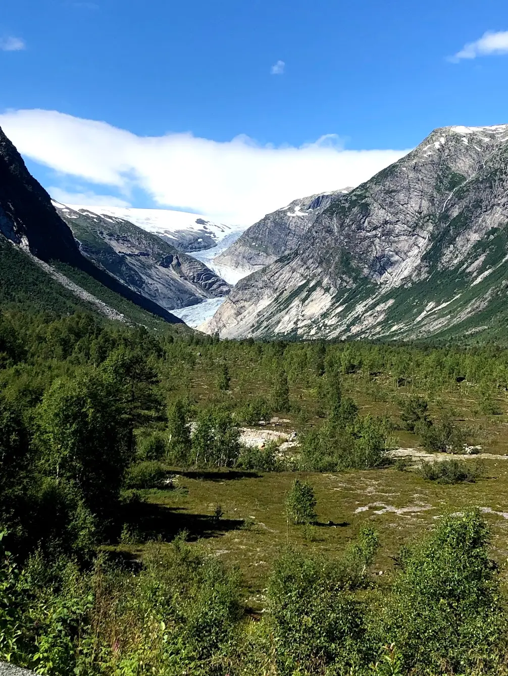
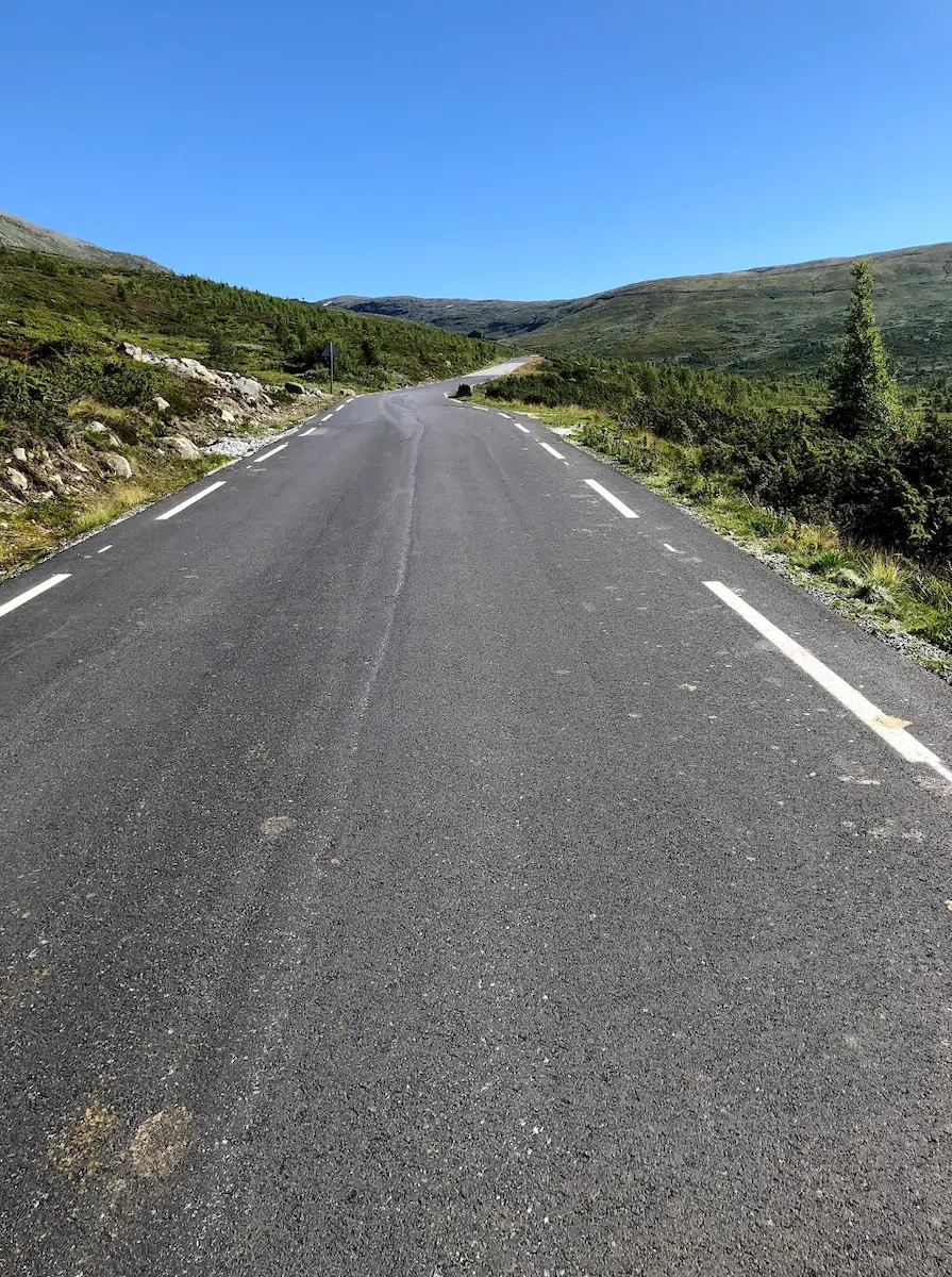
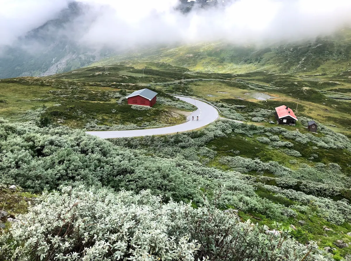
From Gaupne the route turns north into Jostedalen — a long, steady valley that leads all the way to Nigardsbreen. The gradient is gentle but relentless, and the valley narrows as you go. At the end of the road, the glacier tongue descends to a milky turquoise lake. When I was there the ice looked impossibly blue against the grey rock. A boat crosses the lake if you want to get closer, but even from the road the scale of the thing is humbling.
The return follows the same valley back to the fjord and then east along Lustrafjorden to Nes. By that point the light was low and golden on the water, and the tunnels felt less ominous the second time through.
Kilometre by Kilometre
The route can be started anywhere on this loop — Nes is the reference point. After 19km you reach Skjolden at the innermost tip of Sognefjorden. The road follows the fjord throughout, with steep mountain walls rising directly from the water. Important: the road passes through several unlit tunnels — front and rear lights are mandatory.
You reach Urnes after 48km. Urnes Stave Church (c. 1130) is Norway's oldest stave church and a UNESCO World Heritage Site — allow time to visit. The ferry from Urnes to Solvorn arrives at km 51. Check the timetable before your ride — departures are limited.
From Solvorn a climb of around 300 metres awaits before the road descends toward Gaupne and into Jostedalen. The valley road leads steadily to Breheimsenteret at Nigardsbreen (km 100) — the visitor centre for Jostedalsbreen, continental Europe's largest glacier. Good opportunity to buy drinks and snacks here.
The return follows the valley back to the fjord, then east along Lustrafjorden to Nes. You complete the loop at 143km. Remember the unlit tunnels on the return — lights remain essential throughout.
Gallery

Route map & elevation profile
Key Climbs
Highlights
- •Urnes Stave Church: Norway's oldest, built around 1130 and UNESCO-listed — one of the few places you ride straight past a World Heritage Site.
- •The ferry across the Lustrafjord: From Urnes to Solvorn — ten minutes on the water mid-ride, the fjord turned turquoise by glacial meltwater.
- •Nigardsbreen: The turning point at an arm of the Jostedalsbreen — mainland Europe's largest glacier, and one of the most accessible.
- •The fjord run along the Lustrafjord: The stretch between Urnes and Skjolden is known as "Den romantiske vegen" — past green farms, through dark tunnels, and alongside water that shifts colour with the light.
- •A true experience ride: Culture, fjord, and ice across 143 kilometres — day two of a classic three-day Sognefjord loop.
Must know
- ⚠This is a long day — 143 km asks you to pace yourself. No single climb is hard, but they add up over the distance.
- ⚠The ferry from Urnes to Solvorn is part of the route — check the timetable in advance. Departures aren't frequent, and a missed crossing can cost you half an hour or more.
- ⚠Bring good bike lights — the route has several dark tunnels where you need to be seen.
- ⚠Urnes Stave Church is worth a stop, but visits are managed with time slots and guided tours — expect a short wait in high season.
- ⚠Nigardsbreen itself requires a walk or boat ride from the car park — by bike you reach Breheimsenteret, the natural turning point with food and drink.
- ⚠The best season is May to October. The fjord climate is mild, but be ready for changing conditions and pack a windproof jacket for the long, open stretches.
Café & Water
- km 19Hauge gård
A farm shop and café with homemade baking and local berries, right on the fjord. A fine stop on the warm-up along the Lustrafjord before the day gets going.
- km 100Breheimsenteret
The turning point at Nigardsbreen, with a cafeteria and views of the ice. Last chance to top up on food and drink before you head back along the fjord.
Frequently asked questions
- Is this a hard route?
- Not in terms of climbing — there are no mountain passes. But 143 km and nearly 1,600 m of ascent make it a long day, and the many small rises wear on you. The challenge is endurance, not gradient.
- Do I have to take the ferry?
- Yes — the route crosses the Lustrafjord on the ferry from Urnes to Solvorn, a ride of around ten minutes. Check the timetable before you set off.
- Can I cycle all the way to the glacier?
- No — by bike you reach Breheimsenteret at Nigardsbreen. The glacier front itself requires a walk along the lake or a short boat trip, so treat the glacier as a "look-at" goal, not a cycle-to one.
- Is Urnes Stave Church worth a stop?
- Absolutely — it's Norway's oldest stave church (around 1130) and the only one on the UNESCO World Heritage List. Note that visits are managed, so allow for a short wait in high season.
- When is the route best?
- May to October, when the ferry runs and the toll road to the glacier is open. The fjord climate is mild, but the weather shifts quickly, and early/late season can bring cooler days by the fjord.
- Where does the route go?
- This ride follows the Lustrafjord, the innermost arm of the Sognefjord — the world's second-longest fjord. You start in Nes in Luster and ride a 143 km loop taking in Urnes, Solvorn, and Nigardsbreen.
Know a better line?
Submit your local route and get featured with your own author profile, Strava, Instagram and Buy Me a Coffee link.
Share a Route → →Similar routes
Aurlandsfjellet — Snøvegen
Adjacent fjord region — Aurlandsfjellet's Snow Road and Stegastein viewpoint
Western Fjords Cycling — Dale & Hyllestad Loop
Same Sognefjord region from a different base — west side instead of inner fjord
Sognefjellet & Tindevegen
Step into the high mountains — same region's flagship climb
Route Details
- Country
- Norway
- Region
- Western Fjords
For cyclists with some experience. Noticeable climbs requiring fitness.