
Cap Formentor, Sa Batalla & Sa Calobra
About this Route
← Mallorca Cycling GuideThe queen stage of Mallorca cycling. Cap Formentor, Sa Batalla and Sa Calobra back to back — three of the island's most iconic climbs in a single day, with the Mediterranean as a backdrop throughout.
The queen stage. Three of Mallorca's most iconic climbs in a single day — and a day you will not forget.
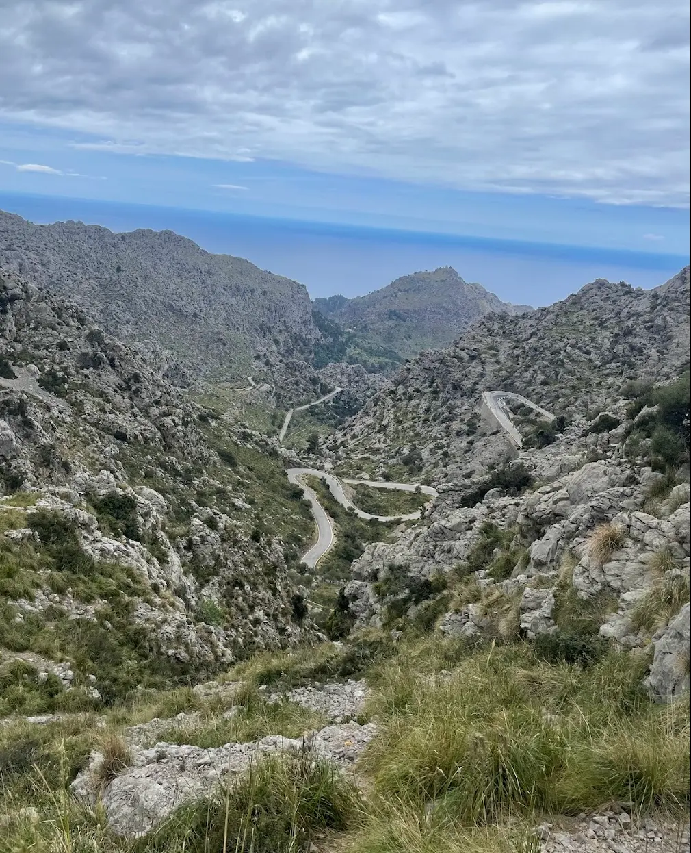
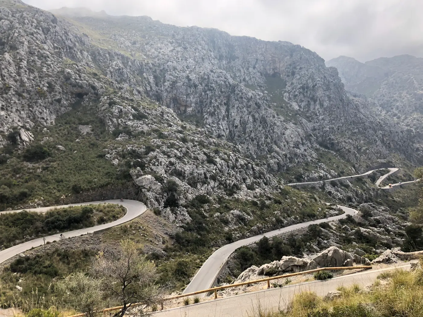
The Sa Calobra climb goes from the sea up to Coll dels Reis. The sign at the pass reads 682 metres. Two numbers circulate about the distance: 10 km at 6.8% if you measure the full way from the cove, or 9.4 km at 7.0% on the Strava segment that starts a little higher up. Both are correct — different starts, not different roads. 26 hairpins in total. The Nus de sa Corbata, the famous 270-degree corkscrew, sits near the top — where the road passes under itself. The road was built in 1933, designed by the Italian-Spanish engineer Antonio Parietti — the same man who designed the road out to Cap de Formentor. It is no accident that Mallorca's queen stage links the two.
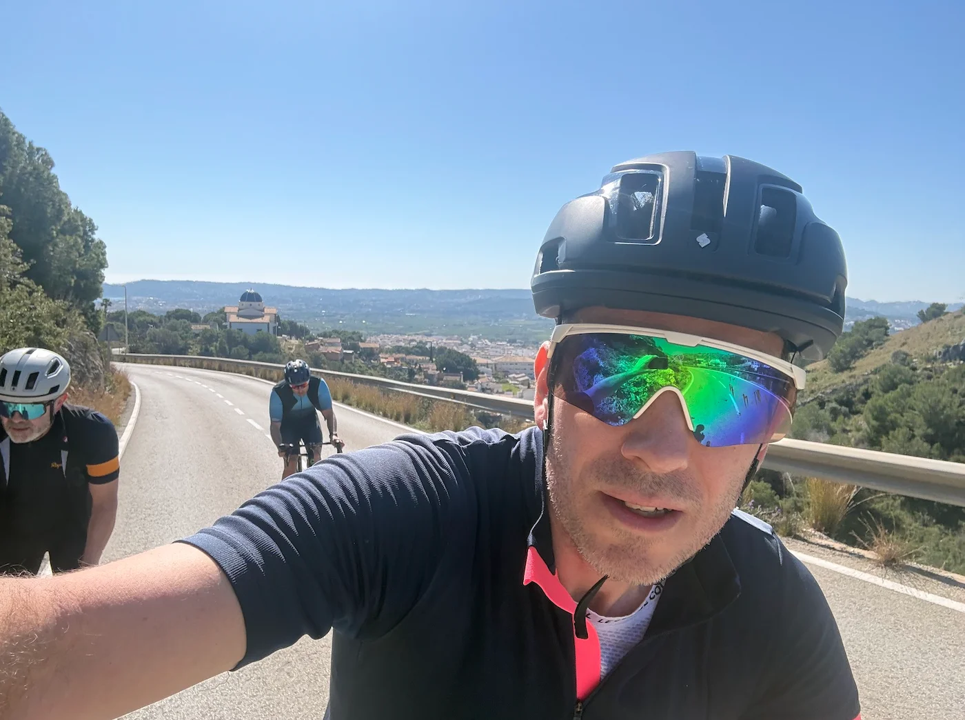
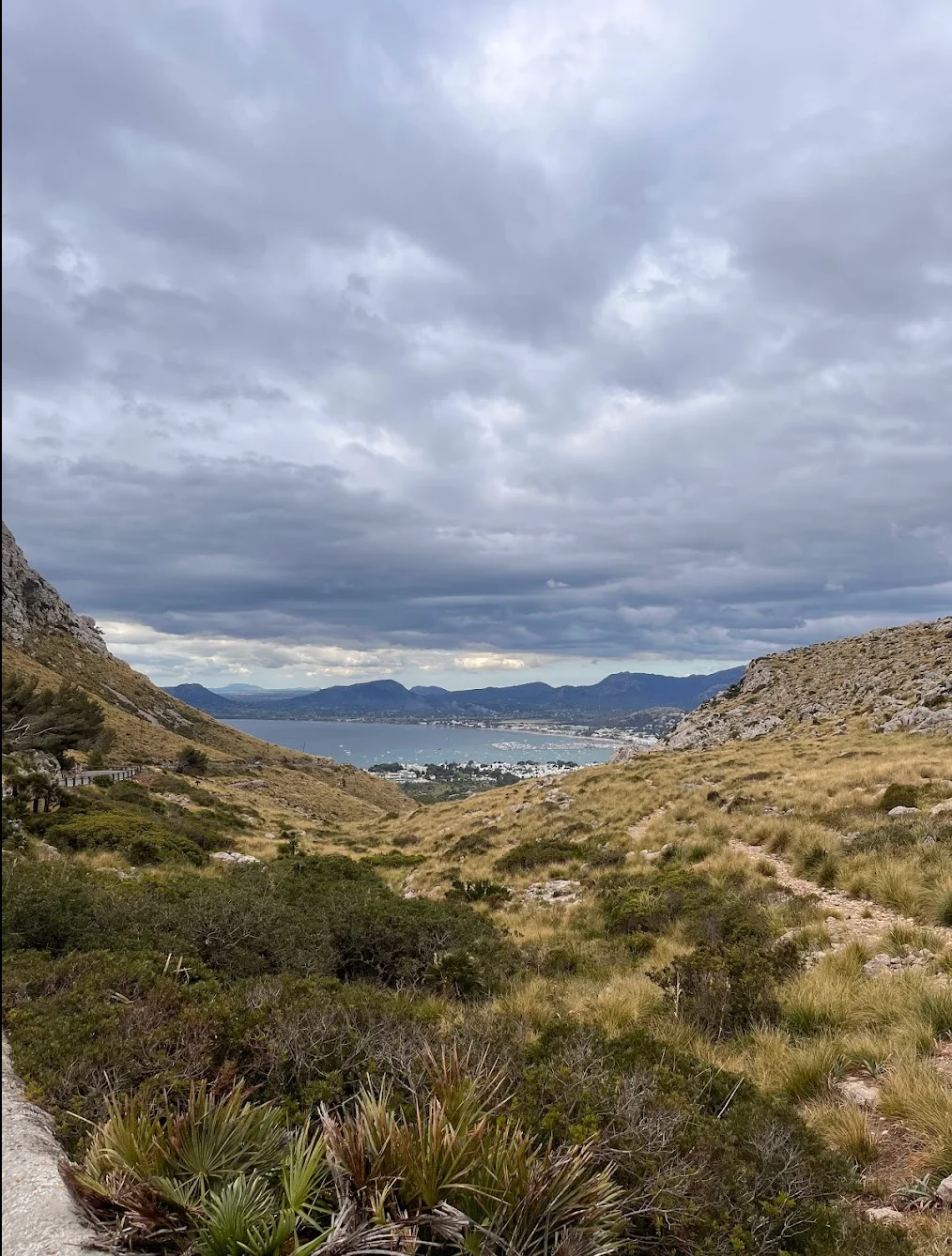
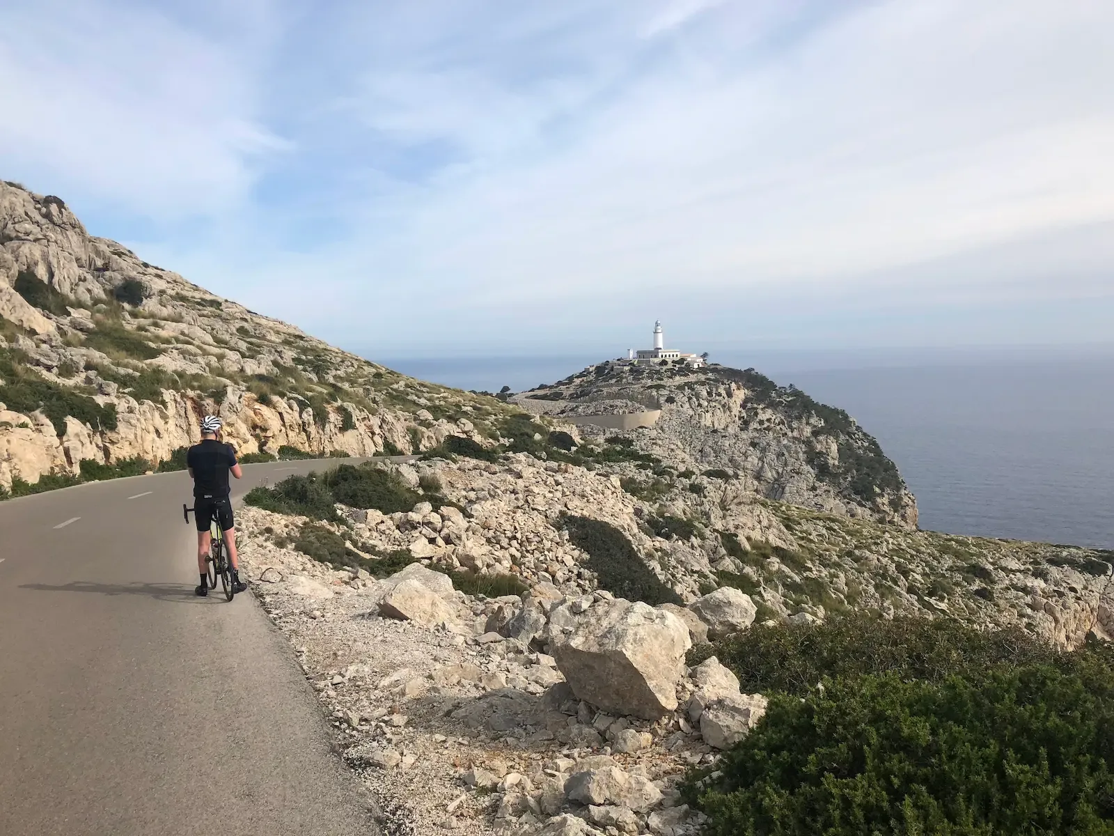
We started early for Cap Formentor, and the decision paid off immediately. The peninsula road in the early morning, before the tourist buses arrive, is something else entirely — quiet, dramatic limestone cliffs above turquoise water, the lighthouse appearing at the end of the road. We were on the road by 8am and had it almost to ourselves. After the return to Port de Pollença we stopped for a late breakfast — a good call before the real climbing began.
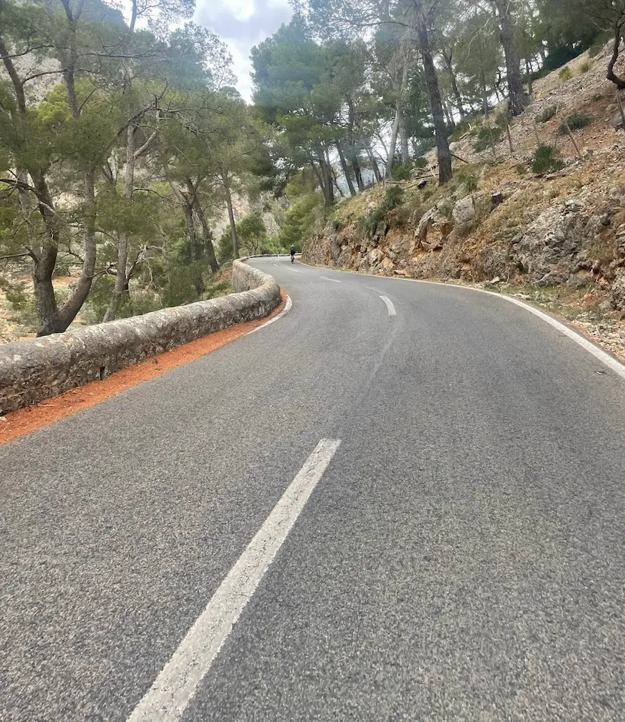
Sa Batalla is not the hardest climb on the island, but it might be the most enjoyable. Perfect asphalt, a steady and forgiving gradient, tall pine trees on both sides. We rode it at a comfortable pace and arrived at the Repsol station at the top feeling good. The ritual: everyone gathers, fills bottles, eats something at the café.
Then Sa Calobra.
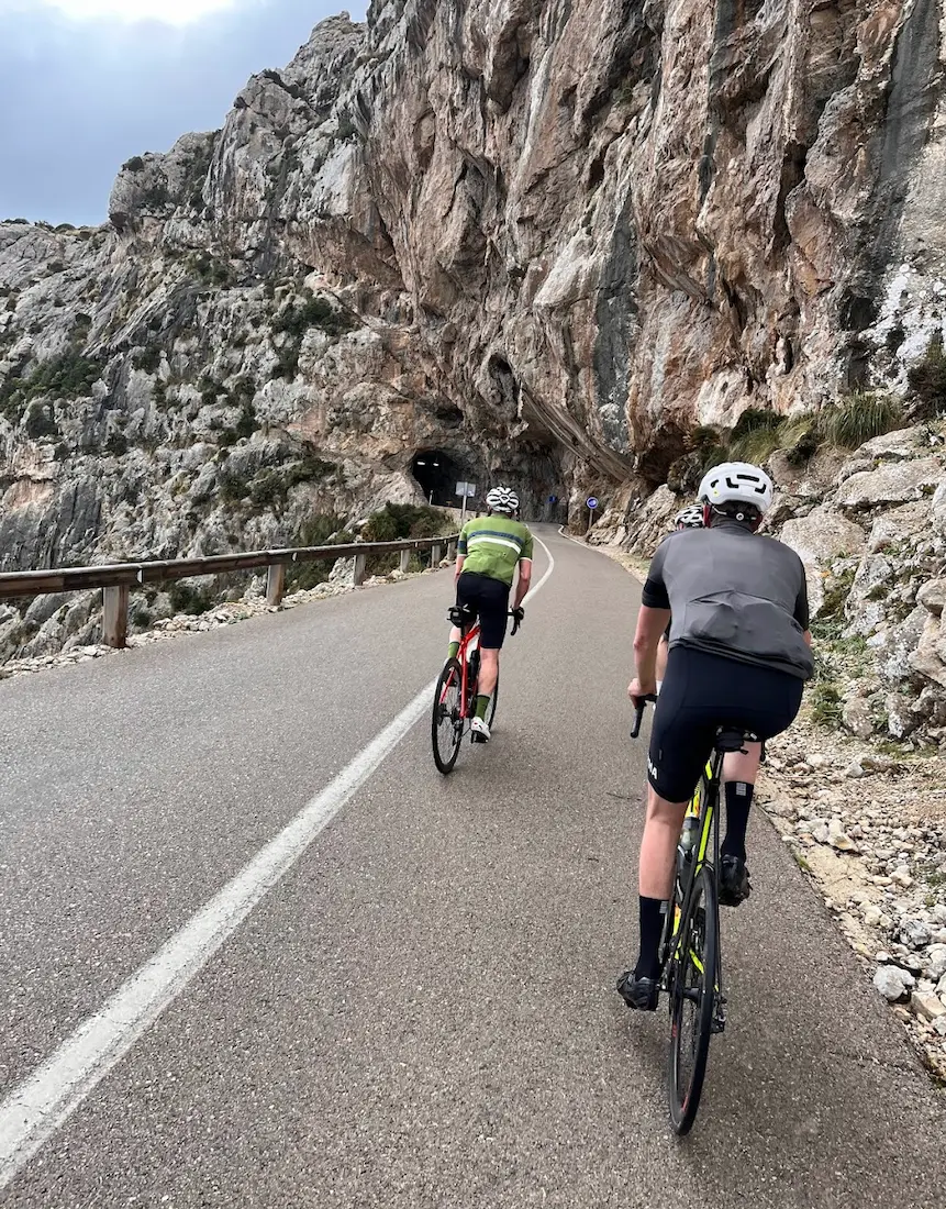
The descent first — "La Serp", The Snake. 26 hairpins corkscrewing 9.5 kilometres down to the hidden cove of Torrent de Pareis. Spectacular and technical — enjoy it, but ride carefully. Tourist buses share the road and they do not always leave much room around blind corners. At the bottom there are restaurants and a kiosk at the water's edge.
Then the climb back out. The same 9.5 kilometres, the same 26 hairpins, now at 7% average. It is tough — especially after everything that has come before — but the views opening up on the upper hairpins make it bearable. The final 2–3 km are the steepest and the hardest part of the day. Somewhere on the upper hairpins there is a photographer working — remember to smile. At the top, where the Sa Calobra road meets the main mountain road, there is a kiosk. We stopped here, ate, refilled, and let the legs recover before the final roll back to Port de Pollença. Exactly what was needed.
This is the day that defines a Mallorca cycling trip.
Kilometre by Kilometre
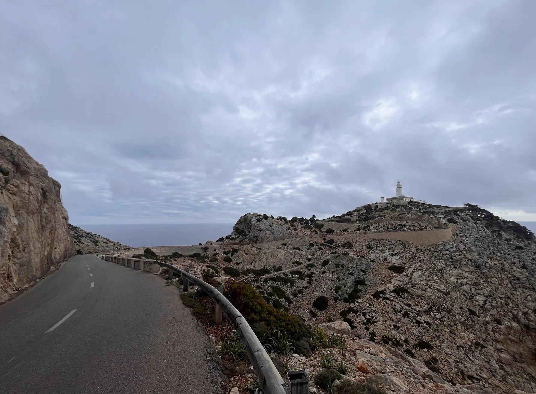
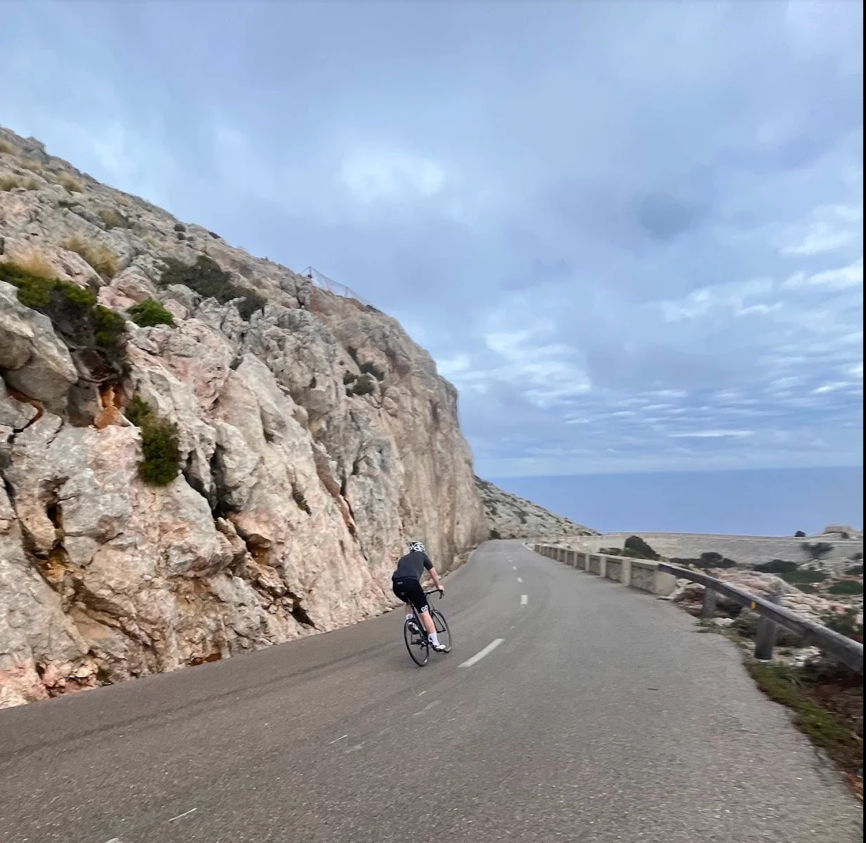
The first kilometres out of Port de Pollença roll flat along the bay before Coll de sa Creueta takes over — 3.28 km at 5.9%, the day's first real effort and the warm-up before you're out on the peninsula proper. After the pass, the road follows the spine of Cap de Formentor, with limestone cliffs dropping straight into the sea and the lighthouse appearing only at the very tip. There's one tunnel midway, about 300 metres long, lit since 2021 — take the sunglasses off before you enter, because the contrast from morning light to tunnel light hits harder than you'd expect. The turn-around is at Far de Formentor, and from there it's the same road back. You're back in Port de Pollença around km 28, and the real climbing of the day is still ahead.
After Port de Pollença, the road runs flat and easy through Pollença village and out across the agricultural plain toward Caimari around km 71.5. Sa Ruta Verda sits right by the road here — the last honest stop for coffee before Sa Batalla starts, and a good chance to fuel if you skipped breakfast. Behind Caimari, the Tramuntana rises straight up in front of you.
Sa Batalla starts right after Caimari — 7.83 km at 4.9% through dense pine forest, perfect tarmac. At the top sits the Repsol café, where everyone stops: fills bottles, eats a baguette, regroups before the next stretch. Most riders expect the road to head downhill after Sa Batalla, but you still have around 100 metres of climbing ahead, past the Lluc turn-off, before the road actually tips down toward the bridge. The junction at km 88.5 is the turn-off toward Sa Calobra.
From the junction at km 88.5, a short climb up to Coll dels Reis comes first — 2.66 km at 5.9%, 160 metres of elevation, easy to underestimate. Only over the top does the descent to Sa Calobra begin: La Serp, the snake, 26 hairpins corkscrewing 9.5 km down to the cove at sea level around km 98. The descent is technical and shares the road with tourist buses, so keep a cool head through the blind corners. There are restaurants at the cove if you want a longer break, but we usually just take a short stop, fill bottles, and start back up — you need enough water for the next 9.5 km of climbing. The climb back is the same 9.5 km, the same 26 hairpins, now at 7%, and the final 2–3 km are the steepest of the day. A photographer from mallorcacyclingphotos.com works somewhere on the upper hairpins, so remember to smile. The Nus de sa Corbata — the 270-degree corkscrew where the road passes under itself — sits near the top. At km 109 you're back at the kiosk by Coll dels Reis. After 9.5 km of climbing your legs need refuelling, and you still have 36 km to ride home.
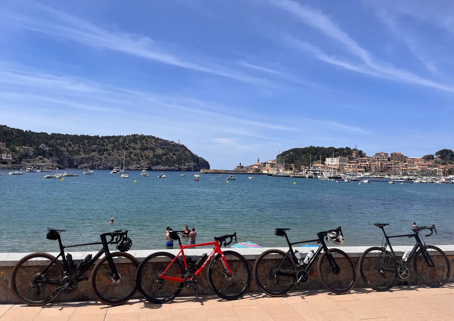
From the kiosk by Coll dels Reis, you roll back past Sa Batalla and take a left just before the Repsol station onto Coll de Femenia. From there it's a long, flowing descent through pine forest back to the Pollença plain, with good tarmac and the bay opening up below you. The last 36 km of the day are mostly downhill or flat, and you finish at the seafront in Port de Pollença at km 145.8. Stay Restaurant by the water is the right end to the day.
Gallery
Route map & elevation profile
Key Climbs
Coll de sa Creueta
Cat 3Sa Batalla
Cat 2Coll dels Reis
Cat 3Sa Calobra
Cat 1Highlights
- •Three of Mallorca's most iconic climbs in a single day — Cap Formentor, Sa Batalla, and Sa Calobra
- •Cap de Formentor at dawn: dramatic limestone cliffs above turquoise water, lighthouse at the end of the peninsula
- •Sa Batalla: 7.83 km at 4.9 % through pine forest to the legendary Repsol café
- •Sa Calobra: 26 hairpins corkscrewing 9.5 km down to the cove and back up — including the 270° Nus de sa Corbata loop
- •Built by Antonio Parietti in 1933 — the road to Coll dels Reis was carved out of the Tramuntana specifically for the view
- •Tom Pidcock holds the Sa Calobra KOM at 22:46 — a useful benchmark on the way up
Must know
- ⚠Start before 8 am — be off Cap de Formentor before the tourist buses arrive. The peninsula is a different road after 10 am.
- ⚠Tourist buses share the Sa Calobra road. Stay alert in blind corners on the descent. They do not always leave room.
- ⚠There is one lit tunnel on the Cap de Formentor road (Ma-2210, ~300 m). Take sunglasses off before entering — the contrast from morning sun hits harder than you expect.
- ⚠The Coll dels Reis kiosk at the top of Sa Calobra is your refuel — not the harbour at the bottom. Your legs need food at km 109, not km 102.5.
- ⚠Between Sa Batalla summit and the Sa Calobra junction there is roughly 100 m of additional climbing. It is not flat transport.
- ⚠Compact 50/34 with 32t at the back is the default Mallorca cassette. The final 2 km of Sa Calobra average 8 % with a 10.85 % peak in the steepest 250 m — gear accordingly, and check before you pack the bike: the gearing playbook has the details.
Café & Water
- km 14Cafeteria Far Formentor
Café at the lighthouse with a terrace dropping straight to the Mediterranean. Coffee and light food. Typically 10:00–16:00 March to October. A cortado on the terrace before turning back.
- km 71.5Sa Ruta Verda
One of the best cycling cafés on the island, right on the route before Sa Batalla starts climbing. The natural breakfast or second-breakfast stop if you started early from Port de Pollença.
- km 88.5Repsol Sa Batalla
Mallorca's most iconic cycling stop. Baguettes, coffee, and a view. Fill bottles here before the descent to Sa Calobra.
- km 109Kiosk Coll dels Reis
The refuel you have been waiting for. After 9.5 km of climbing back up from the cove, this is where you eat properly — not at the harbour below. Your legs need food at km 109, not km 102.5.
Frequently asked questions
- Where do I refuel after Sa Calobra — at the harbour or at the top?
- At the top. The Coll dels Reis kiosk at km 109 is the stop you want. The restaurants and kiosk at the harbour (km 102.5) are commercial and crowded, and the legs do not need food there — they need food after the climb back out, at km 109. Drink something at the bottom, save the proper refuel for the top.
- How steep is Sa Calobra really?
- The Strava segment is 9.44 km at 7.0 % average / 659 m elevation gain — that is the climb. The full ride from sea level is 10 km at 6.8 % / 693 m. The last 2 km average 8 %, and the steepest 250 m hits 10.85 %. Forget "12 % for the last 3 km" — that has been on cycling sites for years and it is wrong.
- Is there a lighter version of this route?
- Yes — dropping either Cap Formentor or Sa Calobra saves about 500–1,000 m of climbing. Cap Formentor only is Cap Formentor from Pollença (39 km / moderate). Sa Batalla + Sa Calobra without Cap Formentor is Sa Calobra from Pollença (105 km / hard). The full loop is the full experience, but the queen stage can be split.
- When is the road to Sa Calobra open?
- Year-round. The Sa Calobra road is sea-level to ~680 m and stays open through winter — though spring (March–June) and autumn (October–November) are the cycling seasons. Summer is rideable if you start before sunrise; the heat and tourist buses make midday Sa Calobra unpleasant.
Know a better line?
Submit your local route and get featured with your own author profile, Strava, Instagram and Buy Me a Coffee link.
Share a Route → →Similar routes
Coll de Sóller & Puig Major
Same epic level — swap Cap Formentor + Sa Calobra for Sóller + Puig Major
Cap Formentor from Pollença
Just the Cap Formentor opening leg — same lighthouse loop without Sa Calobra
Sa Calobra from Pollença
Drops Cap Formentor but keeps the queen-stage Sa Batalla → Sa Calobra core
Route Details
Elite level. Extreme elevation, altitude and distance. Serious preparation required.