About this Route
← Mallorca Cycling GuideThe definitive epic mountain stage on Mallorca — four of the island's most celebrated climbs in a single day, deep in the heart of the Serra de Tramuntana.
The route opens with two warm-up climbs in the Orient valley, climbs the famous hairpins of Coll de Sóller, and finds the main event after lunch in the Sóller valley: Puig Major (HC), the highest point any cyclist reaches on Mallorca. 135 km, 2,400 m of climbing, return via Lluc and Coll de Femenia.
We rank it alongside Sa Calobra as the island's two queen stages. A favourite for professional winter training, best in March–June or September–November.
Four climbs, 135 kilometres, 2,400 metres of elevation — and every one of those metres earned. A hard day in the saddle.
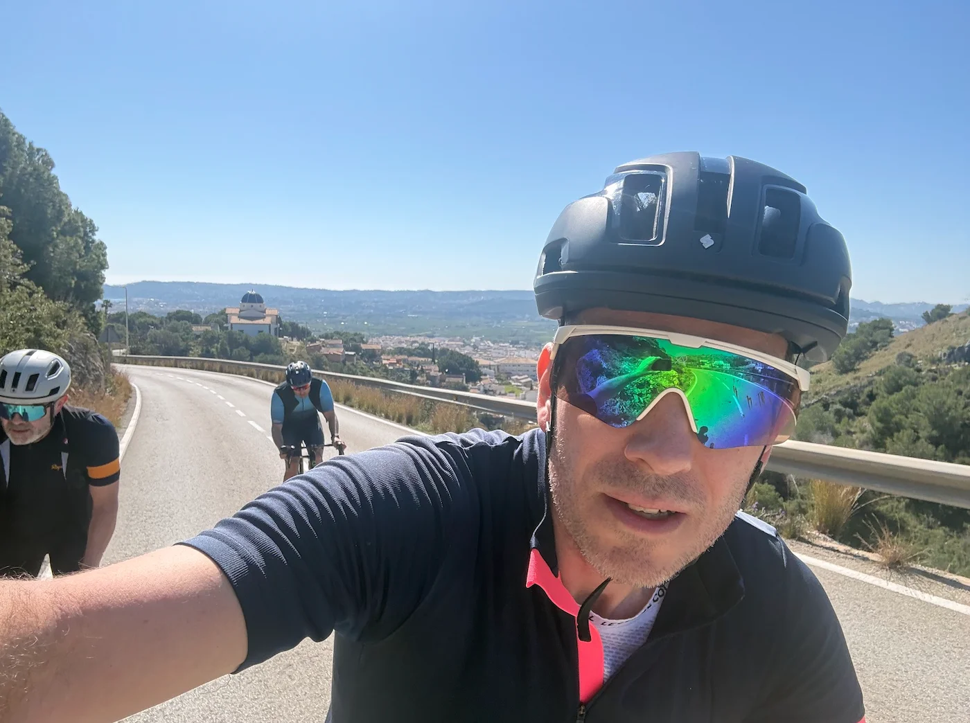
We rolled south from Port de Pollença, parallel to the mountains, and used Coll d'Honor and Coll d'Orient as a warm-up. Coll d'Honor is 2.7 km long with an average gradient of 4.7%. Coll d'Orient is 5.1 km long with an average gradient of 4.9%. Both are beautiful climbs through olive groves and quiet roads — exactly the right way to ease into a day like this.
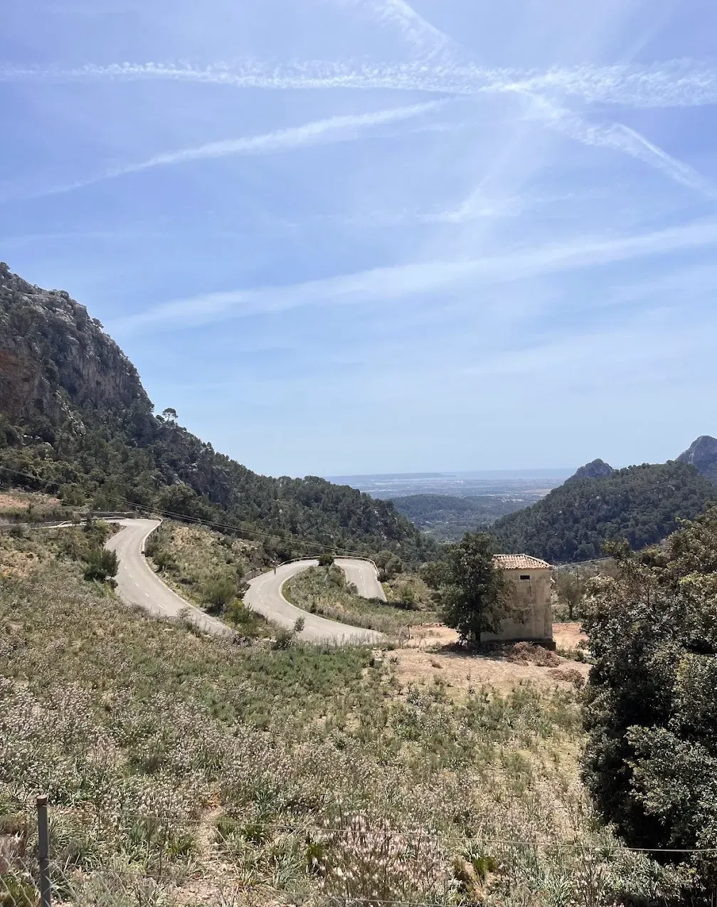
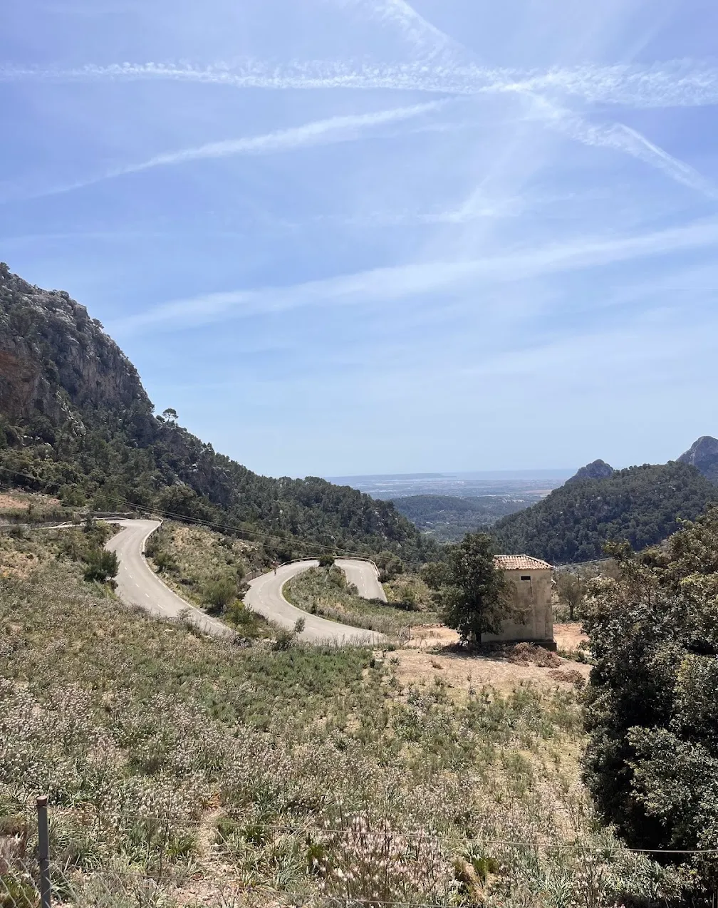
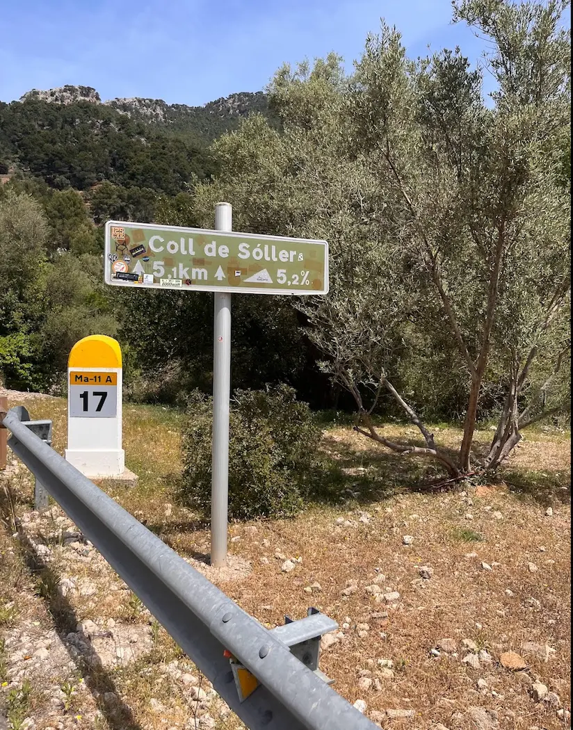
Then Coll de Sóller. If you love switchbacks the way I do, this is your climb. Coll de Sóller is 5.2 km long with a steady average gradient of 4.9% through 11 hairpins, one after another, winding up the mountain with almost no traffic — because all the cars use the tunnel. We did not stop at the café on the summit that day, but it is recommended and excellent if you want to refuel.
We descended into Port de Sóller for lunch. Good choice of restaurants, good food — but a word of warning from experience: don't eat too much. Some of us did, and the combination of a generous lunch and Puig Major immediately afterwards was not ideal.
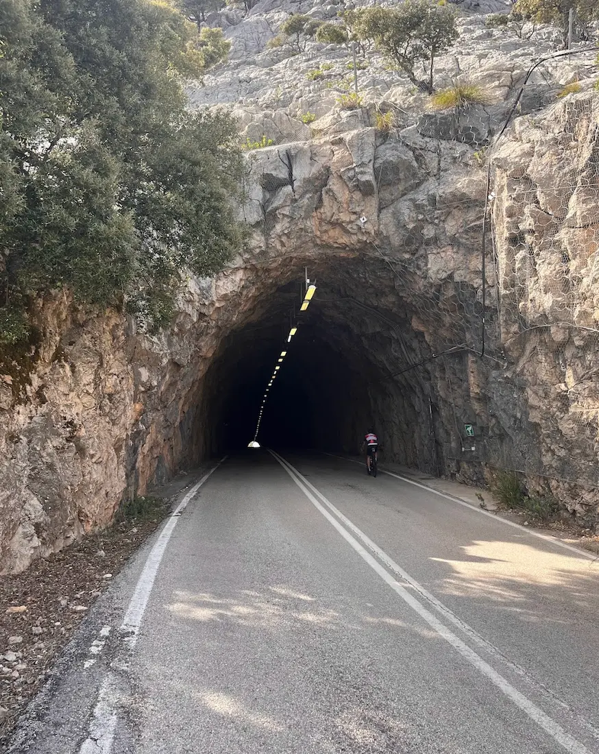
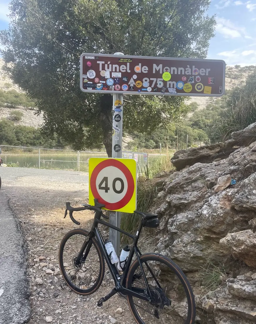
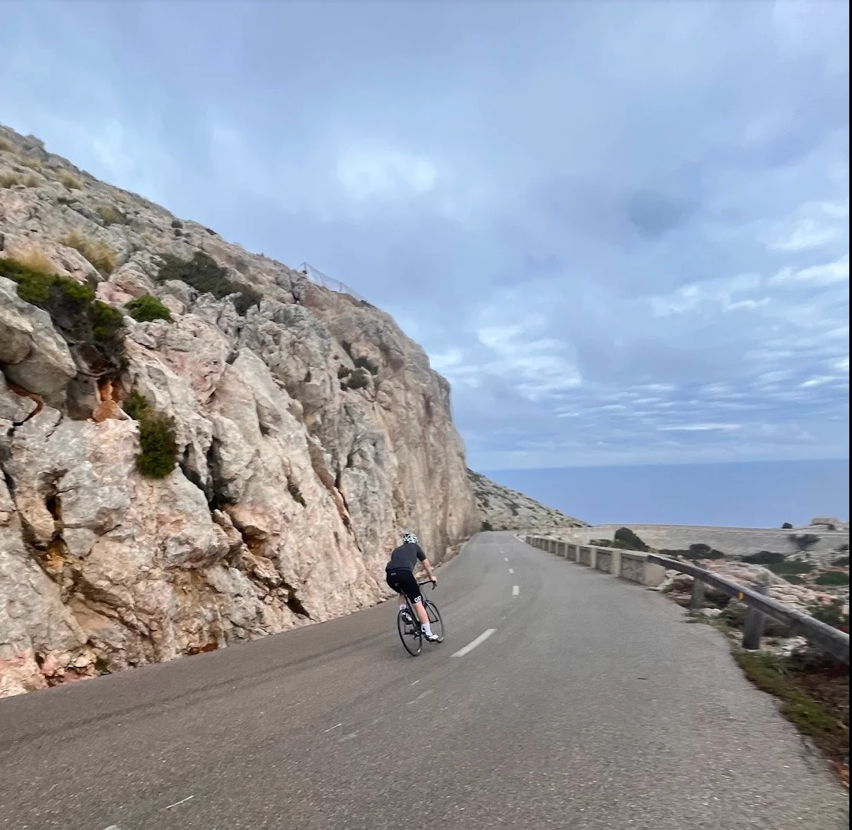
Puig Major is 14 km long with an average gradient of 6% — relentless and exposed. The landscape transforms from lush valley to bare alpine rock as you gain height. Pros have done the climb under 35 minutes at training camp; for us it took considerably longer, and the views made the effort worth it. At the top the road disappears into the Monnàber tunnel, which marks the summit at 872 m. The actual mountain peak 600 metres higher is military land — a radar station (EVA-7) has stood there since 1950, and the road is closed to cyclists except for one day a year, during the Marcha Cicloturista 'La Bola' in April. We waited there for each other. Watching the group come through one by one was one of those moments that makes a cycling trip memorable.
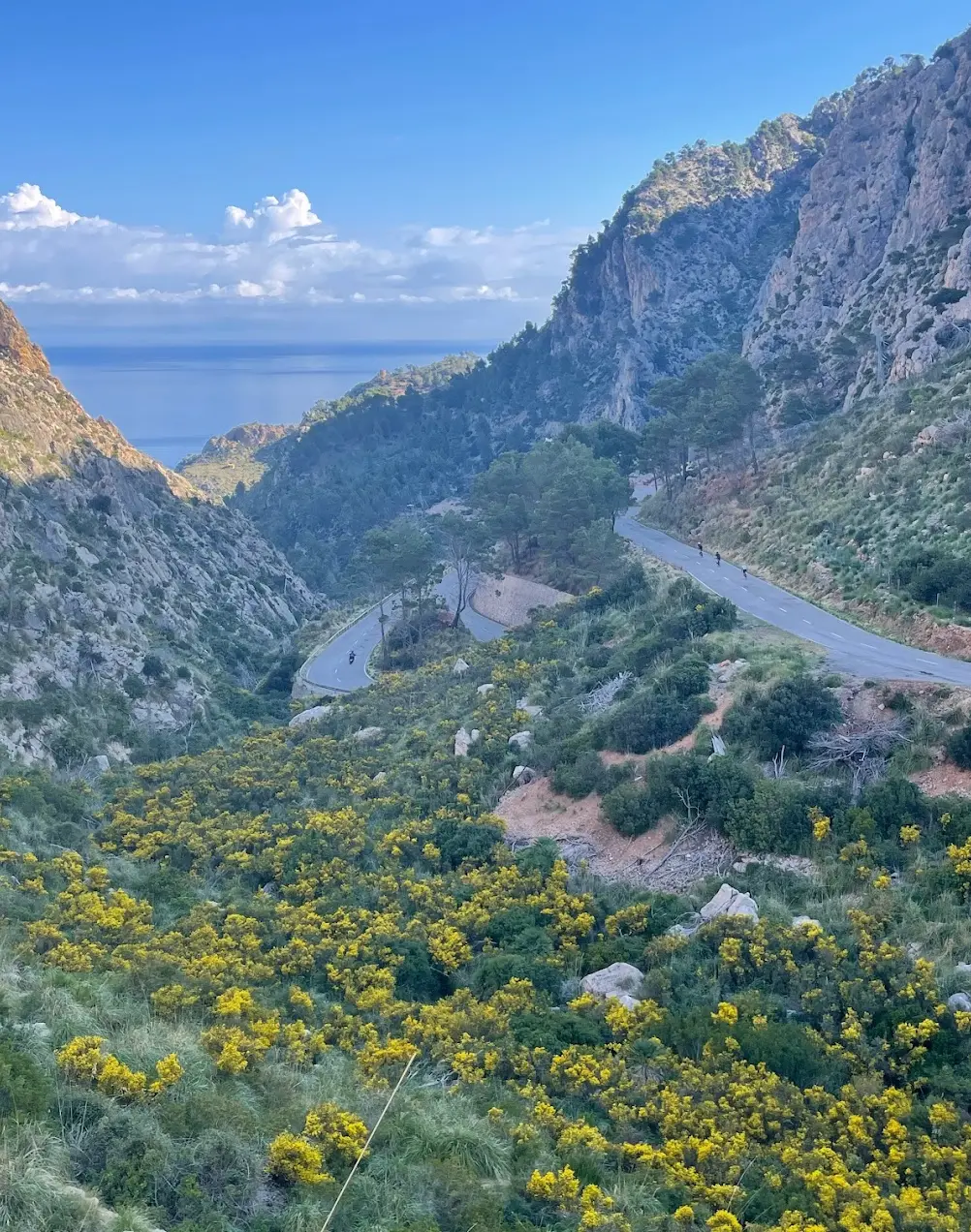
We rolled downhill from the tunnel — past the turquoise Gorg Blau and Cúber reservoirs, down through Lluc, and the final descent runs via Coll de Femenia with open views back toward Pollença Bay. A fitting end to the biggest day on the island.
Kilometre by Kilometre
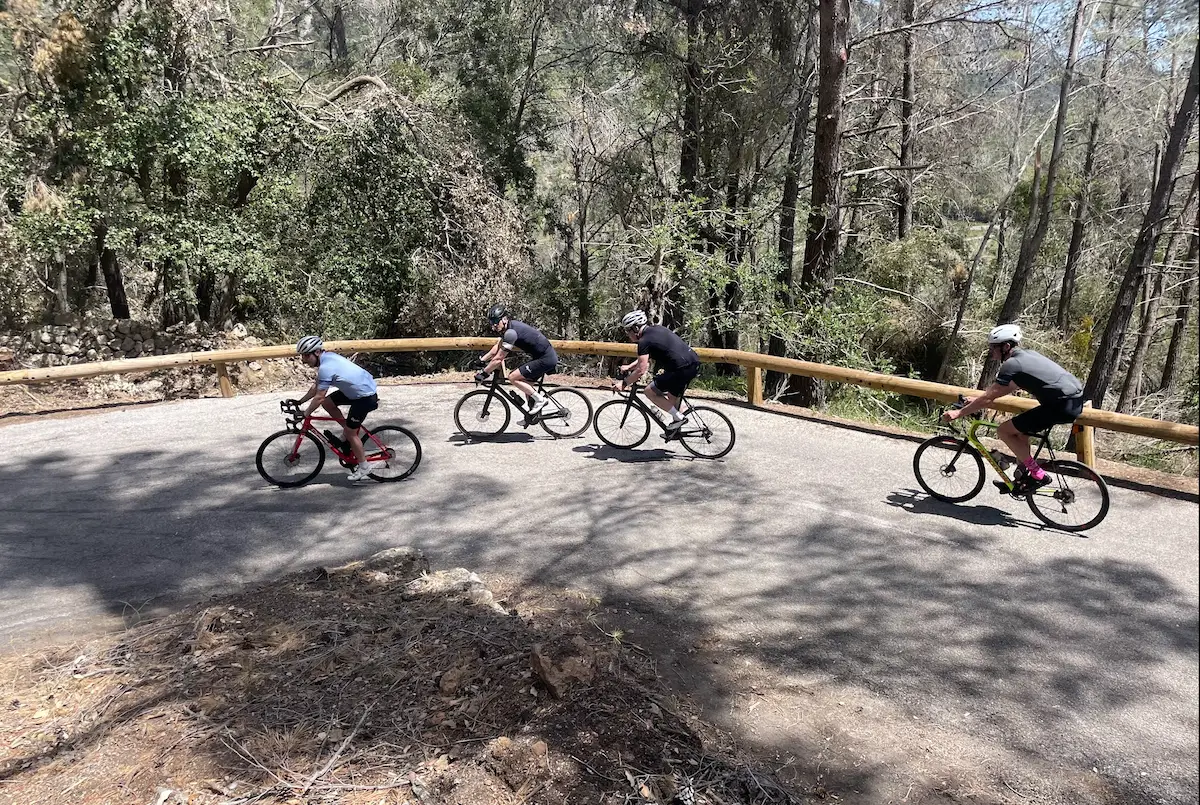
We leave the harbour and head south across the Pollença plain before the road begins to climb into the Tramuntana foothills. The hidden Orient valley opens up — olive groves, stone walls and the postcard village of Orient. Two shorter climbs, Coll d'Orient and Coll d'Honor, warm the legs before the day's main event.
From the charming village of Bunyola the road rises through 11 hairpin bends to the top of Coll de Sóller. Virtually car-free since all traffic uses the tunnel below — this is the climb as it should be experienced. The views south towards Palma from the summit are wide and open.
The technical descent into Sóller is fast and rewarding. The town sits in a beautiful orange-filled valley and the main square is the perfect lunch stop. This is not optional — eat and drink well here, but don't eat too much, before the biggest climb of the day.
The centrepiece of the route — nearly 14 km of continuous climbing to the highest point any cyclist reaches on Mallorca, gaining 826 metres. The landscape shifts from lush valley to bare alpine rock as we climb. The Monnàber tunnel near the summit opens onto the dramatic Gorg Blau and Cúber reservoirs — two turquoise lakes surrounded by the island's highest peaks.
The long return descends past the Coll dels Reis junction to Sa Calobra and through the monastery village of Lluc. Coll de Femenia is the final climb before a long swooping descent back to the Pollença plain and the harbour at Port de Pollença.
Gallery
Route map & elevation profile
Key Climbs
Coll d'Orient
Cat 3Coll d'Honor
Cat 4Coll de Sóller
Cat 2Puig Major
HCHighlights
- •Four HC/Cat climbs in one loop, 2,400 metres of elevation — a hard day in the saddle.
- •Puig Major HC — the highest point any cyclist reaches on Mallorca (872 m road summit). The closing climb pros use at winter training camps.
- •Coll de Sóller — 11 hairpins through an almost car-free climb. A technical gem.
- •The Sóller valley — orange groves, charming main square, the ideal mid-route lunch stop.
- •The Cúber and Gorg Blau reservoirs — two turquoise lakes ringed by the island's highest peaks. A striking visual high point after the Puig Major summit.
Must know
- ⚠The Monnàber tunnel at the top of Puig Major is about 600 metres long. On hot days it's wonderfully cool — a refreshing finish to the climb.
- ⚠The actual mountain peak (1,445 m) is military land — the EVA-7 radar station has stood there since 1950. Closed to cyclists except for one day a year, during the Marcha Cicloturista 'La Bola' in April.
- ⚠Coll de Sóller is almost car-free because the tunnel below carries the through-traffic. 11 hairpins without cars — a rare experience in Europe.
- ⚠Best season is March–June and September–November. Summer is too hot; winter can be cold at the Puig Major summit.
- ⚠Brakes should be checked before this route. Two long, steep descents (Coll de Sóller down to the town, and Puig Major down to Lluc).
- ⚠Food and drink are best stocked in Sóller town between climbs 2 and 3. The café at the top of Coll de Sóller is also a good refuel stop.
- ⚠After the Puig Major summit there's a kiosk at the Coll dels Reis junction (the Sa Calobra turn-off) — the last easy stop before Lluc.
Café & Water
- km 57Reynés Cycling Café
Perfect lunch stop mid-route, before Puig Major. Several restaurants around the square, good selection of local food. Don't eat too much.
- km 118Repsol kiosk at the Coll de Femenia turn-off
Practical last stop before the descent back to Pollença. Drinks and simple food.
Frequently asked questions
- How high does the road go on Puig Major?
- 872 metres — that's where the road tops out at the Monnàber tunnel. The actual mountain peak is 1,445 m, but the 600 metres above is a military zone closed to cyclists except for one day a year, during the Marcha Cicloturista 'La Bola' in April.
- Why is Coll de Sóller almost car-free?
- The tunnel below carries all through-traffic between Palma and Sóller. Drivers take the tunnel, and cyclists get 11 hairpins on the old road almost to themselves.
- Is the Puig Major road open year-round?
- Yes. There's no winter closure. The season recommendation is about temperature and weather — March–June and September–November are best. Summer is too hot, and winter can be cold at the summit.
- What's the difference between Puig Major and Sa Calobra?
- Sa Calobra is an out-and-back spur down to the coast with 26 hairpins. Puig Major is an HC climb up to the island's highest cycling road. Two completely different experiences; many cyclists do both in the same week.
- How long does the Puig Major climb take?
- Pros do it under 35 minutes at training camp. Strong amateurs typically take 50–70 minutes. Recreational cyclists 75–90+ minutes. 13.7 km at 6% average.
- Where do you stop for lunch?
- Sóller main square, around km 57. It's the natural pause before Puig Major and has several restaurants. Don't eat too much — Puig Major is waiting right after.
Know a better line?
Submit your local route and get featured with your own author profile, Strava, Instagram and Buy Me a Coffee link.
Share a Route → →Similar routes
Cap Formentor, Sa Batalla & Sa Calobra
The other Mallorca queen stage — Cap Formentor + Sa Calobra instead of Puig Major
Andratx — Pollença Traverse
Includes Coll de Sóller as the centrepiece in a 146 km point-to-point traverse
Coll de Femenia & Sa Batalla Loop
Half the elevation, same Tramuntana character — good warm-up before this epic
Route Details
For experienced cyclists. Significant elevation and demanding distances.