
Andratx — Pollença Traverse
About this Route
← Mallorca Cycling GuideOne island, one day — 146 km point-to-point from Andratx to Port de Pollença through the full length of the Tramuntana. The MA-10 coastal road, Coll de Sóller and the quiet interior: three completely different experiences of Mallorca in a single long day.
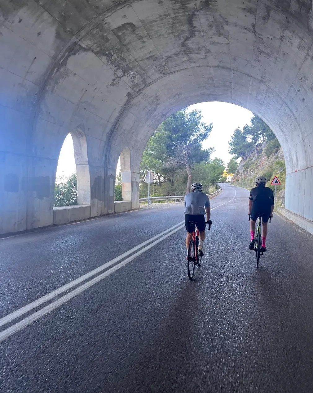
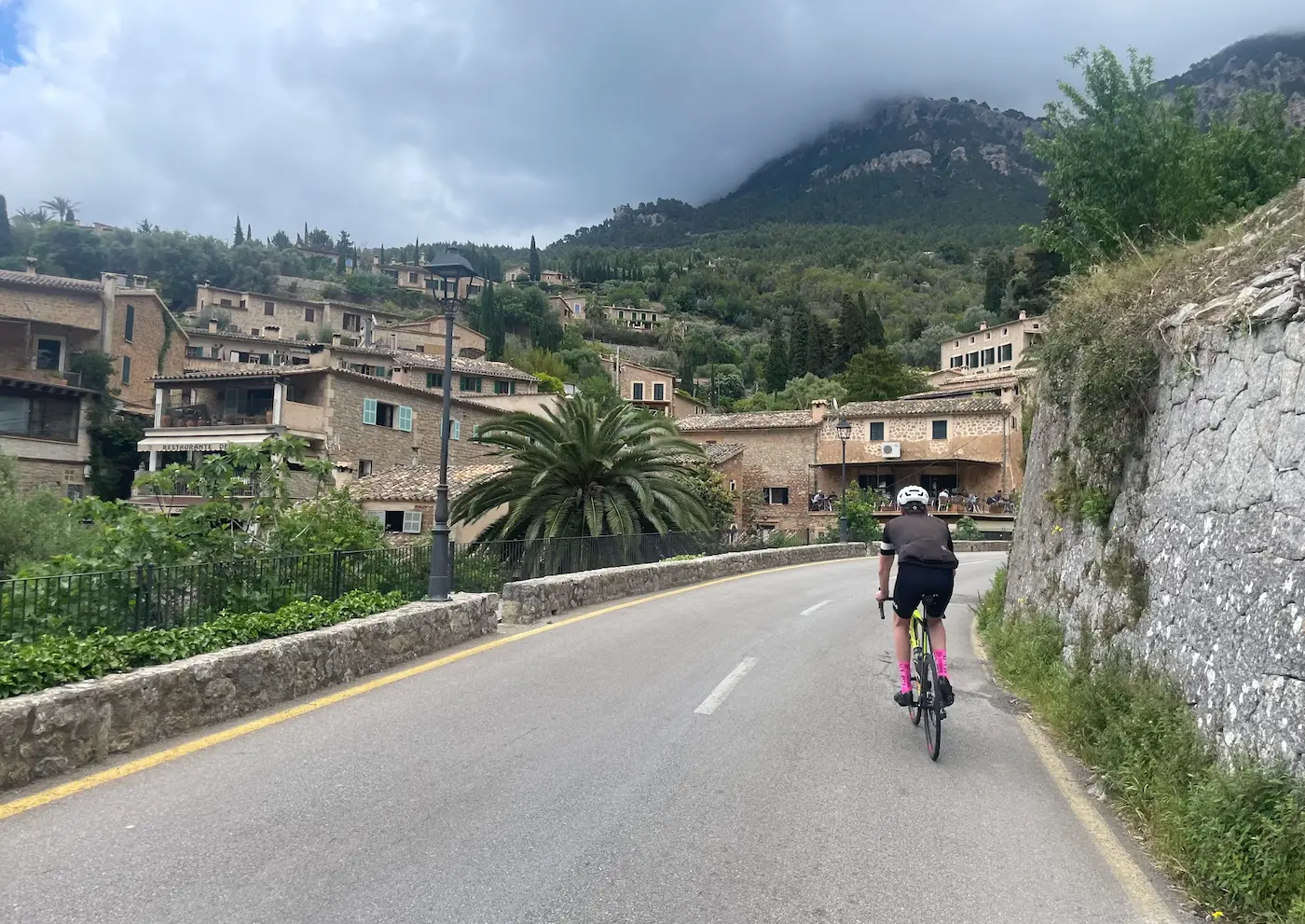
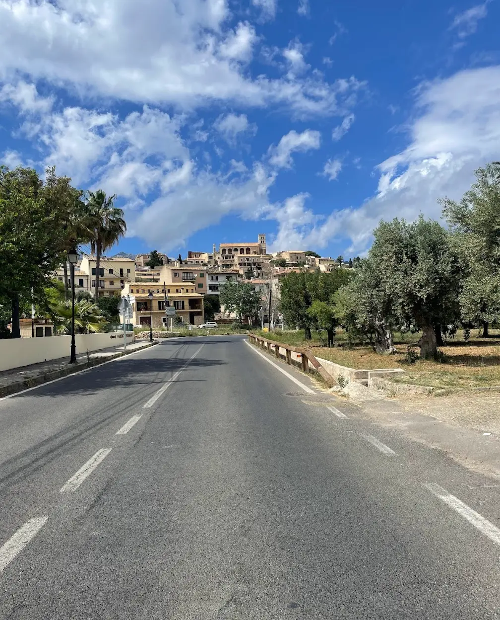
One island, one day — from Andratx in the southwest to Port de Pollença in the northeast through the Tramuntana's most celebrated landscapes. The route begins with the MA-10 coastal road, which follows the cliffs above the Mediterranean from Andratx all the way to Sóller. Through Estellencs and Banyalbufar — villages with ancient terraces dropping to the sea — and on through Valldemossa and Deià.
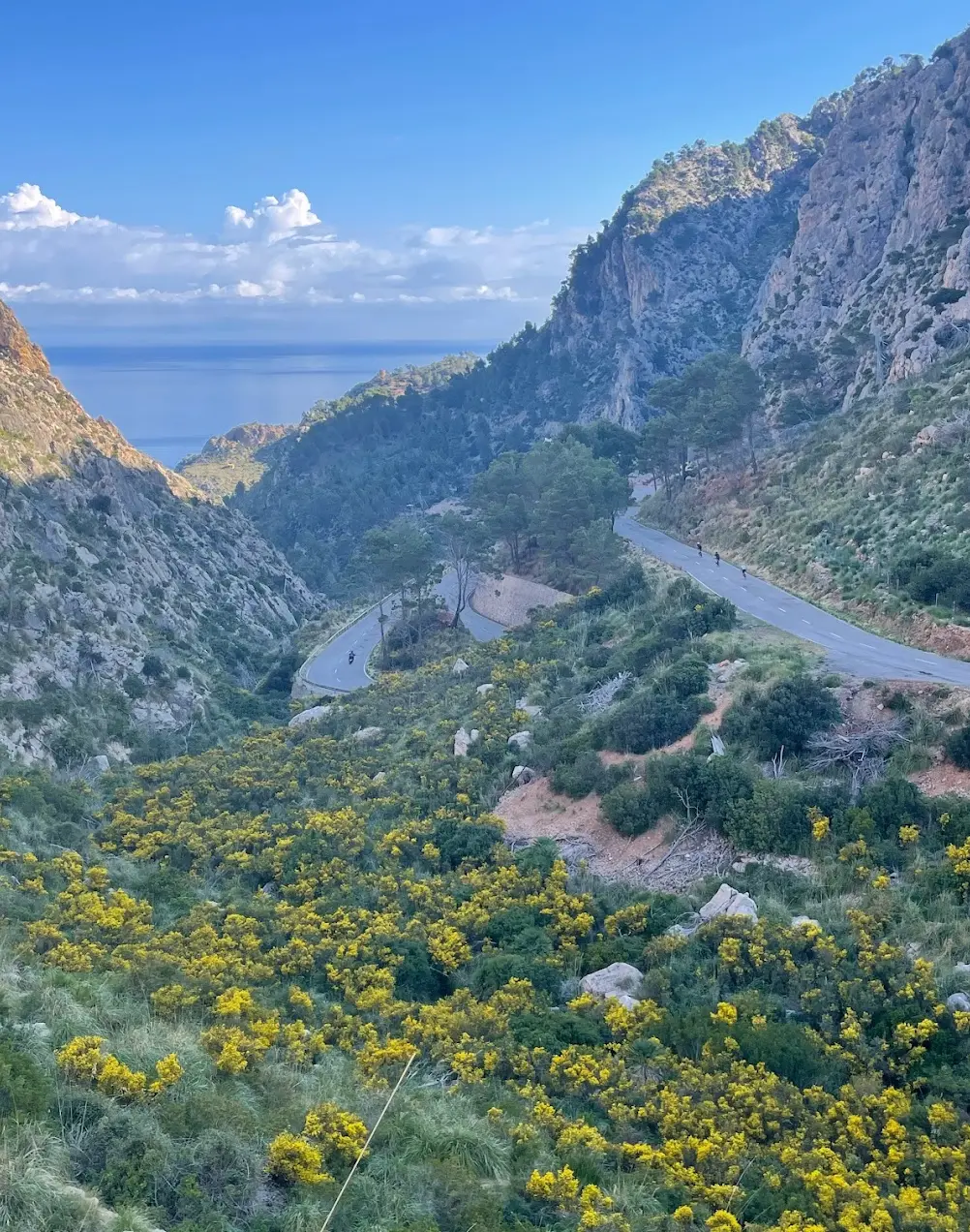
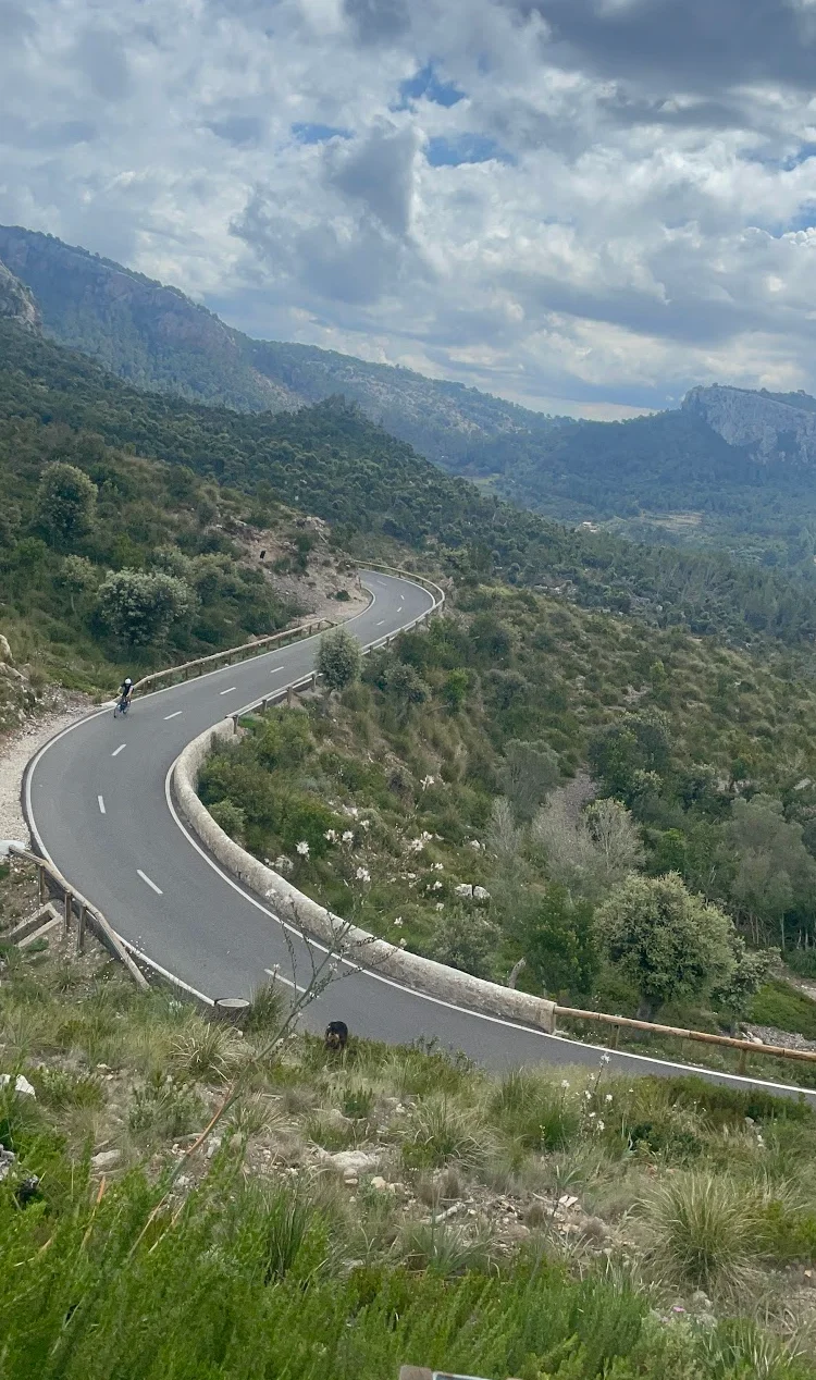
From Sóller the route tackles Coll de Sóller — around 30 hairpin bends through the forest on the north side, virtually no traffic since all heavy vehicles use the tunnel. The views from the top stretch south across the Palma plain and north back into the Tramuntana. After the descent to Bunyola the terrain flattens and the route crosses the agricultural land towards Inca. The final stretch follows the Camí Vell de Campanet — narrow lanes flanked by dry stone walls, almond trees and grazing sheep. Port de Pollença and the seafront promenade await at the finish.
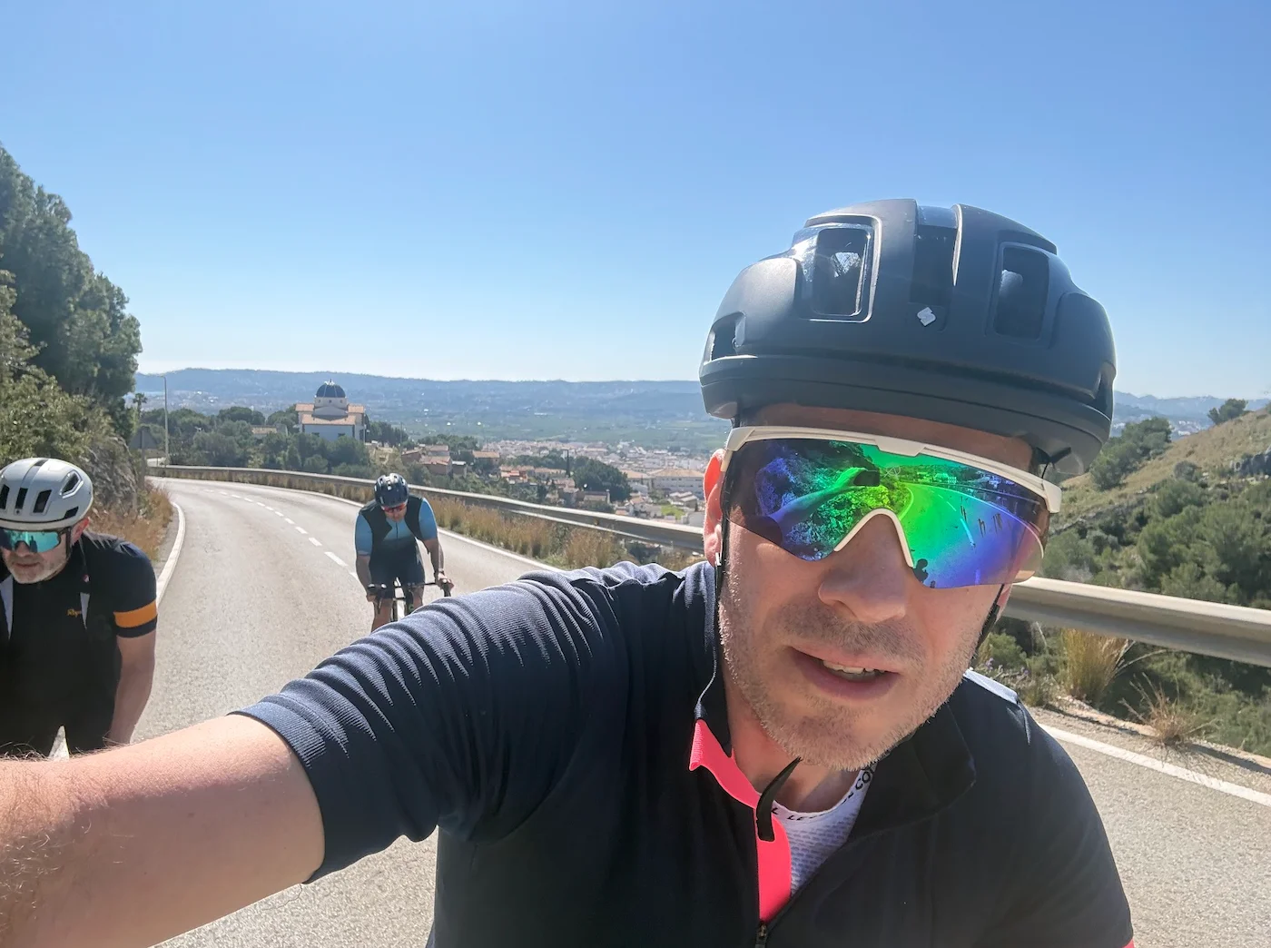
We took the shuttle bus from Port de Pollença to Andratx early in the morning — a good hour, a comfortable start to a long day. We booked through the Mallorca Cycle Shuttle website before leaving Norway, straightforward and practical. A good way to get some variety into the week.
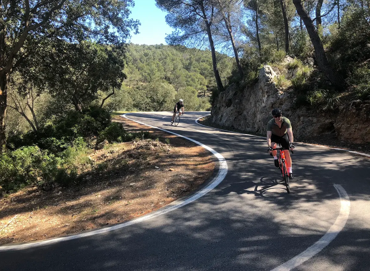
The MA-10 northward from Andratx is one of the finest stretches of road I have ridden. The sea lies to the left, the road winds along the mountainside, and the views give you no rest. Through Estellencs and Banyalbufar, where we stopped for coffee, and on through Valldemossa and Deià. None of it is flat, but none of it is brutal either.
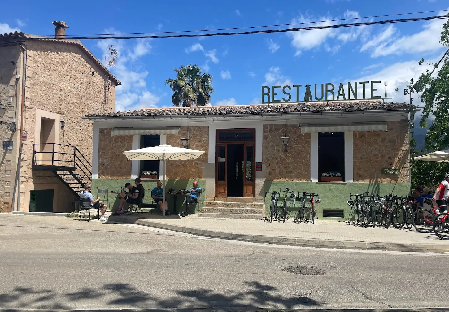
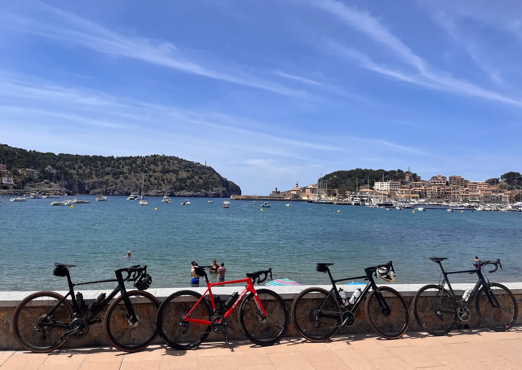
In Port de Sóller we stopped for a proper lunch — Restaurant Pizzeria Del Porto at the harbour, wide menu, recommended. From there we climbed Coll de Sóller. Around 30 hairpin bends on the north side, almost no traffic. We all gathered at Ca'n Topa at the top, filled bottles and ate something before the descent. Down the south side to Bunyola is over quickly, and from there the route turns flat through the interior via Inca and Campanet — a completely different Mallorca. Narrow lanes between stone walls, and then Port de Pollença and the seafront. A day that stays with you.
For those who want more climbing: from the Sóller valley you can add Coll d'Honor and Coll d'Orient through the inland section, and Sa Batalla further north towards Pollença. It makes the day significantly harder but stays on the same MA-10 corridor.
Kilometre by Kilometre
The spectacular opening act — the Ma-10 coastal road along the cliff edge with the open Mediterranean to the left. Several short punchy climbs from the very first kilometre through the ancient terraced villages of Estellencs and Banyalbufar. The road continues through Valldemossa and Deià before dropping down into the Sóller valley at sea level around km 64. Stop in Sóller before the main climb.
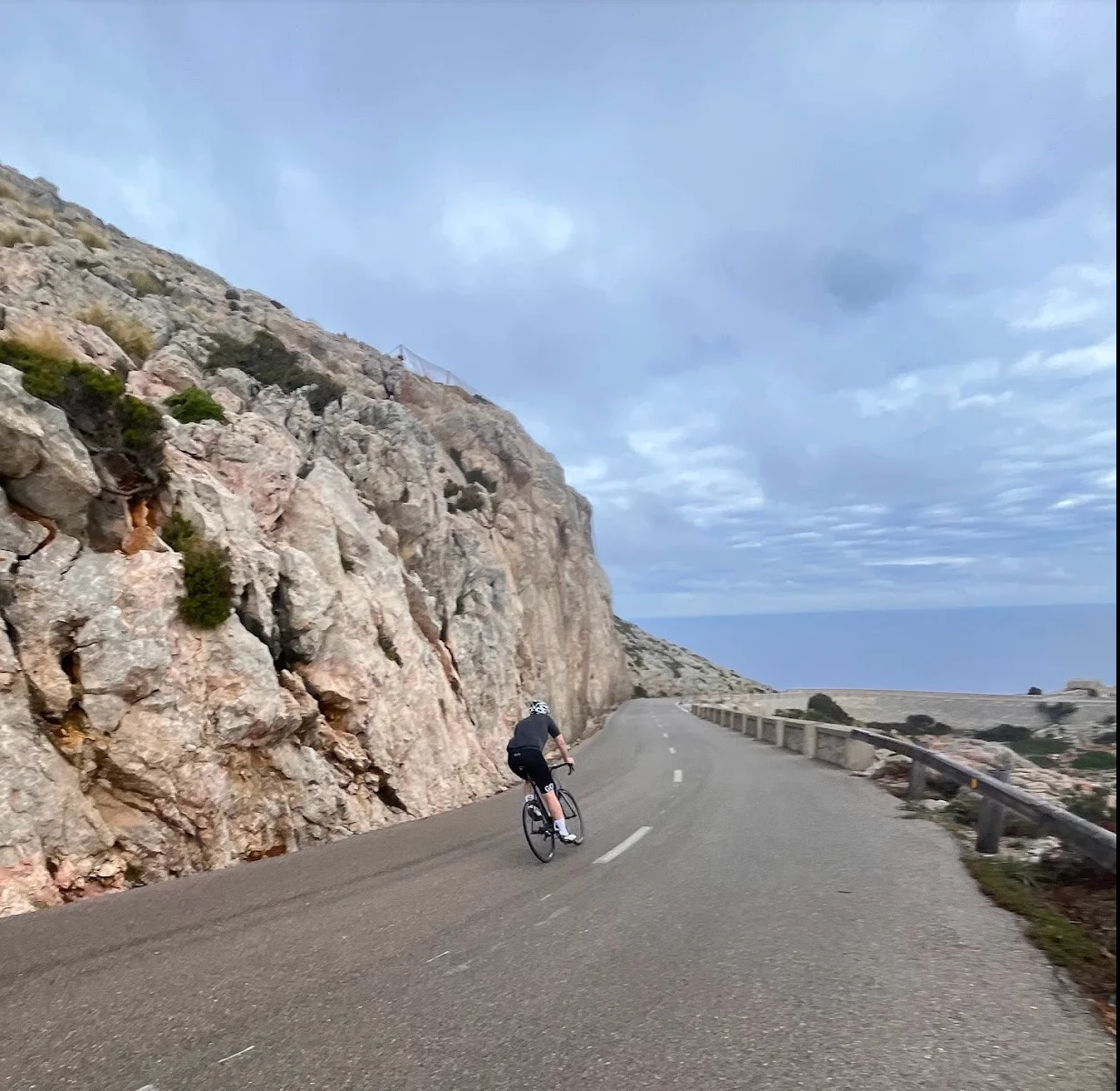
The climb begins at km 64 from the Sóller valley floor. Around 30 hairpin bends on the north side winding up through pine forest to the summit at around km 73 and 448 metres. Almost no traffic — all vehicles use the tunnel, leaving the road to cyclists. A restaurant at the summit is the natural stop before the fast, flowing descent.
After the descent the terrain flattens completely. Get aero, settle into a rhythm and make kilometres through the agricultural heart of Mallorca — a complete contrast to the drama of the morning. Quiet roads through lush farmland all the way to Inca.
From Campanet at km 115, quiet lanes wind through the hidden interior flanked by dry stone walls and almond trees. The silence here is a world away from the tourist coast. The route finishes at the seafront promenade in Port de Pollença.
Gallery
Route map & elevation profile
Key Climbs
Highlights
- •MA-10 coastal road from Andratx — cliff-edge riding above the Mediterranean, one of the great cycling roads in Europe
- •Coll de Sóller — around 30 hairpin bends through pine forest with virtually no traffic
- •Banyalbufar — ancient terraced village above the sea, the essential early stop
- •Port de Sóller detour — the most beautiful port on Mallorca, natural lunch stop at the halfway point
- •Camí Vell de Campanet — quiet stone-walled lanes through the hidden Mallorcan interior
Must know
- ⚠This is a point-to-point route. Mallorca Cycle Shuttle runs early-morning buses from Port de Pollença to Andratx — book online before you travel. Around one hour with bikes in the trailer.
- ⚠Ride north-bound (Andratx → Pollença). The MA-10 coastal section with fresh legs is the best part of the route, and the prevailing tramuntana wind tends to push you forward.
- ⚠Start early from Andratx — the coastal road is at its best before tourist traffic builds. Most cyclists are rolling by 08:00–09:00.
- ⚠The tunnels on the MA-10 between Andratx and Sóller require lights. Bring front and rear lights even on a sunny day.
- ⚠146 km and 2,900 m is a full day. Fuel consistently — there are cafés roughly every 25–30 km on the coastal section, and good options in Port de Sóller before Coll de Sóller.
- ⚠Want a harder day? From the Sóller valley you can add Coll d'Honor and Coll d'Orient, and Sa Batalla further north — same corridor, significantly more climbing.
Café & Water
- km 24Banyalbufar village café
Village café on the terraced hillside above the sea. Coffee and snacks, natural stop before the terrain intensifies.
- km 55IMPERFECTAS Specialty Coffee
Specialty coffee and breakfast in Sóller town centre. Open from 08:30.
Frequently asked questions
- Andratx to Pollença or Pollença to Andratx — which direction?
- North-bound (Andratx to Pollença). You hit the most beautiful section first, you climb Coll de Sóller's hairpins instead of descending them, and the prevailing tramuntana wind tends to push you. The reverse direction works but is materially less enjoyable.
- How long does the ride take?
- 146 km / 2 900 m typically takes 6–8 hours of moving time for an intermediate cyclist, plus 1–2 hours of stops. A full day in the saddle.
- How do I get back to Andratx after the ride?
- Most cyclists base in Port de Pollença for the week and shuttle to Andratx in the morning. Mallorca Cycle Shuttle is the option I've used — early morning departure from Port de Pollença, bikes in the trailer, around 1 hour to Andratx. Then you ride back.
- Do I need to be a strong cyclist to do this route?
- Intermediate fitness is enough. The 2 900 m of climbing is spread across a long day with no extreme gradients — Coll de Sóller's south face averages around 5–6%. Manageable for any cyclist comfortable with mountain days of 100 km+.
- Are the roads safe for cyclists?
- Yes. The Ma-10 coastal stretch has light traffic and good road surface. Coll de Sóller's south face has virtually no traffic — heavy vehicles use the tunnel. The inland section through Inca to Pollença is on quiet rural roads.
- Best time of year for the Mallorca grand traverse?
- Mid-March to early June, or mid-September to early November. Sweet spot is May — long days, mild temperatures, terraces in bloom on the Ma-10. Avoid December–February (too cold, too unstable for a 146 km exposed coastal ride).
Know a better line?
Submit your local route and get featured with your own author profile, Strava, Instagram and Buy Me a Coffee link.
Share a Route → →Similar routes
Coll de Sóller & Puig Major
Same Coll de Sóller centrepiece, but as a loop from Pollença instead of point-to-point
Palma to Andratx — Mallorca Coastal Cycling Loop
First section of this traverse covered as a shorter Palma loop
Cap Formentor, Sa Batalla & Sa Calobra
Comparable epic effort — different geography, similar day-defining scale
Route Details
Elite level. Extreme elevation, altitude and distance. Serious preparation required.