All Routes in Spain
Coll de Femenia & Sa Batalla Loop
One of the most popular mountain loops on Mallorca. The route heads north from Port de Pollença into the Serra de Tramuntana, combining Coll de Femenia and Coll de Sa Batalla — two classic climbs in one compact day.
Coll de Sóller & Puig Major
The definitive epic mountain stage on Mallorca — four of the island's most celebrated climbs in a single day, deep in the heart of the Serra de Tramuntana. The route opens with two warm-up climbs in the Orient valley, climbs the famous hairpins of Coll de Sóller, and finds the main event after lunch in the Sóller valley: Puig Major (HC), the highest point any cyclist reaches on Mallorca. 135 km, 2,400 m of climbing, return via Lluc and Coll de Femenia. We rank it alongside Sa Calobra as the island's two queen stages. A favourite for professional winter training, best in March–June or September–November.
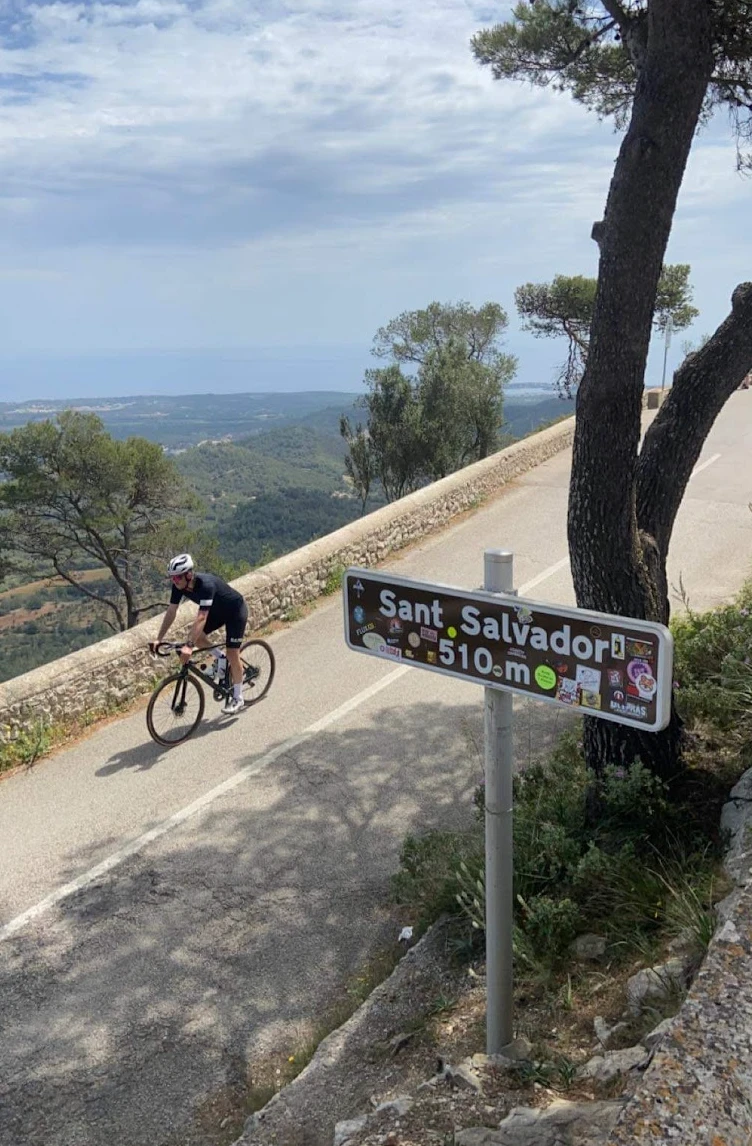
Sant Salvador Monastery Loop
The pilgrimage climb of Mallorca — Sant Salvador monastery sits alone on a 510-metre summit in the southeast of the island, far from the Tramuntana mountains, giving a 360-degree panorama over the entire island that no other climb can match. From Alcúdia Bay in the north to the Cabrera islands in the south, the view from the top is unlike anywhere else on Mallorca. From Port de Pollença the route heads south across the flat central plain — the Pla de Mallorca — on fast, open roads perfect for riding in a group and maintaining good tempo. The real Mallorca reveals itself here: fields, windmills and dry stone walls stretching to the horizon. Through Santa Margalida and into Petra, the island's unofficial cycling capital, where the town square is almost always packed with riders from across Europe. A coffee and a slice of almond cake at Can Tomeu is close to obligatory. Porreres is the natural lunch stop before the climbing begins — Cafeteria Es Poltre in the village centre is cyclist-friendly, portions are generous and service is fast. From Felanitx the road rises immediately towards Sant Salvador. Five kilometres at 7% average with several hairpin bends, passing the giant stone cross of Es Picot on a neighbouring summit before the monastery appears above. Inside, world championship jerseys donated by professional riders line the corridors — a reminder of how deeply cycling is woven into this place. The long return north across the plain is where wind awareness matters most. A headwind on the way home can be relentless on the open flatlands — save something for the final stretch back to Pollença.
Cap Formentor, Sa Batalla & Sa Calobra
The queen stage of Mallorca cycling. Cap Formentor, Sa Batalla and Sa Calobra back to back — three of the island's most iconic climbs in a single day, with the Mediterranean as a backdrop throughout.
Andratx — Pollença Traverse
One island, one day — 146 km point-to-point from Andratx to Port de Pollença through the full length of the Tramuntana. The MA-10 coastal road, Coll de Sóller and the quiet interior: three completely different experiences of Mallorca in a single long day.
Palma to Andratx — Mallorca Coastal Cycling Loop
One of the most beautiful coastal routes on Mallorca — a 77-kilometre loop from Palma along the spectacular southwest coastline, through glamorous harbour towns and back through authentic Mallorcan countryside. Leaving from Paseo Marítimo in Palma, the route immediately tackles Coll de sa Creu — a 5.8 km Cat 3 climb that gets the legs working from the very first kilometre. The reward is a fast descent down to the coast, where the route then follows the stunning southwest shoreline westward through Cala Major — where the Spanish royal family have their summer residence — past the fashionable enclaves of Illetes and Portals Nous, through Palmanova and Santa Ponça. Port d'Andratx is the jewel of the route: one of Mallorca's most beautiful harbour towns, perfect for a coffee stop watching the superyachts. From Andratx the route turns inland through Es Capdellà — authentic Mallorcan villages surrounded by olive groves and almond trees — before the descent back to Palma with the city's iconic cathedral visible in the distance.
Palma — Sa Batalla, Sa Calobra & Puig Major Epic
The ultimate challenge for riders based in or near Palma — conquering Mallorca's highest peaks in a single day from sea level at the harbour. Coll de Sóller, Puig Major, Sa Calobra and Sa Batalla: four of the island's most celebrated climbs, all in one epic loop. From Paseo Marítimo the route heads out across the flat plain before Coll de Sóller arrives — five kilometres of switchbacks with light traffic. Down into the Sóller valley for lunch before the biggest climb of the day: Puig Major, Mallorca's highest accessible point by bike, finishing inside the Monnàber tunnel at 872 metres. Then comes Sa Calobra — descended first on the famous corkscrew road to Torrent de Pareis at sea level, then climbed back out. 10 kilometres at 6.8% average, 26 hairpins. Everything you descend, you climb. The Sa Calobra road was built in 1933, designed by the Italian-Spanish engineer Antonio Parietti — the same man who designed the road out to Cap de Formentor. The Repsol station at the top of Sa Batalla marks the final summit. From there a long descent through pine forest and flat roads carry you back to Palma. A day that earns its difficulty rating.
Palma — Southeast Mallorca & Santanyí Cycling Route
A beautiful journey through the southeastern corner of Mallorca — a part of the island that operates at a completely different rhythm to the mountain roads of the Tramuntana. Open plains, authentic villages, dry stone walls and the golden sandstone town of Santanyí: this is the real Mallorca, away from the tourist crowds. From Palma the route heads southeast across the agricultural heartland of the island — the Pla de Mallorca. Wide open skies, ancient windmills that once pumped water to the fields, and the characteristic dry stone walls known as marges lining every road. Through Llucmajor — a well-known cycling hub with a good town square for a coffee stop — and on across the southern plains where almond and apricot trees mark the seasons. Santanyí is the jewel of the route. Built almost entirely from the golden local sandstone that was also used to construct Palma's famous cathedral, the old town is a beautiful maze of narrow streets, art galleries and excellent cafés. The main square is especially lively on market days — Wednesday and Saturday. A pamboli of local bread with oil, tomato and cured ham is the correct lunch order. The return passes through Ses Salines, where salt has been harvested for centuries, before the flat roads carry you back to Palma. A route where the pleasure is in the rhythm, the culture and the landscape rather than the climbing.
Palma — Port de Valldemossa & Port des Canonge
Two of Mallorca's most dramatic and least-discovered coastal descents in a single route from Palma — Port de Valldemossa and Port des Canonge. This is the route for riders who want to go beyond the famous climbs and find the roads that most tourists never reach. From Paseo Marítimo the route heads northwest over the first ridge via Coll des Vent before entering the western Tramuntana. Port de Valldemossa comes first — often called Sa Calobra's little sister, and rightly so. The descent is one of the most technically demanding and spectacular roads on the island: narrow, winding, with cliff faces and vertical drop-offs at every bend. At the bottom, Es Port restaurant overlooks the small harbour and is the perfect stop for a coffee or a quick espresso before the climb back up. The 4.86 km ascent at 7.5% average is no joke — this is a proper Cat 2 effort. The historic village of Valldemossa, with its famous monastery and cobbled streets, is the natural café stop before continuing to Port des Canonge — a labyrinth of hairpin bends through pine forest descending to a tiny, completely authentic fishing village where red cliffs meet turquoise water. The silence here is extraordinary. Everything you descend must be climbed back up before the return to Palma.
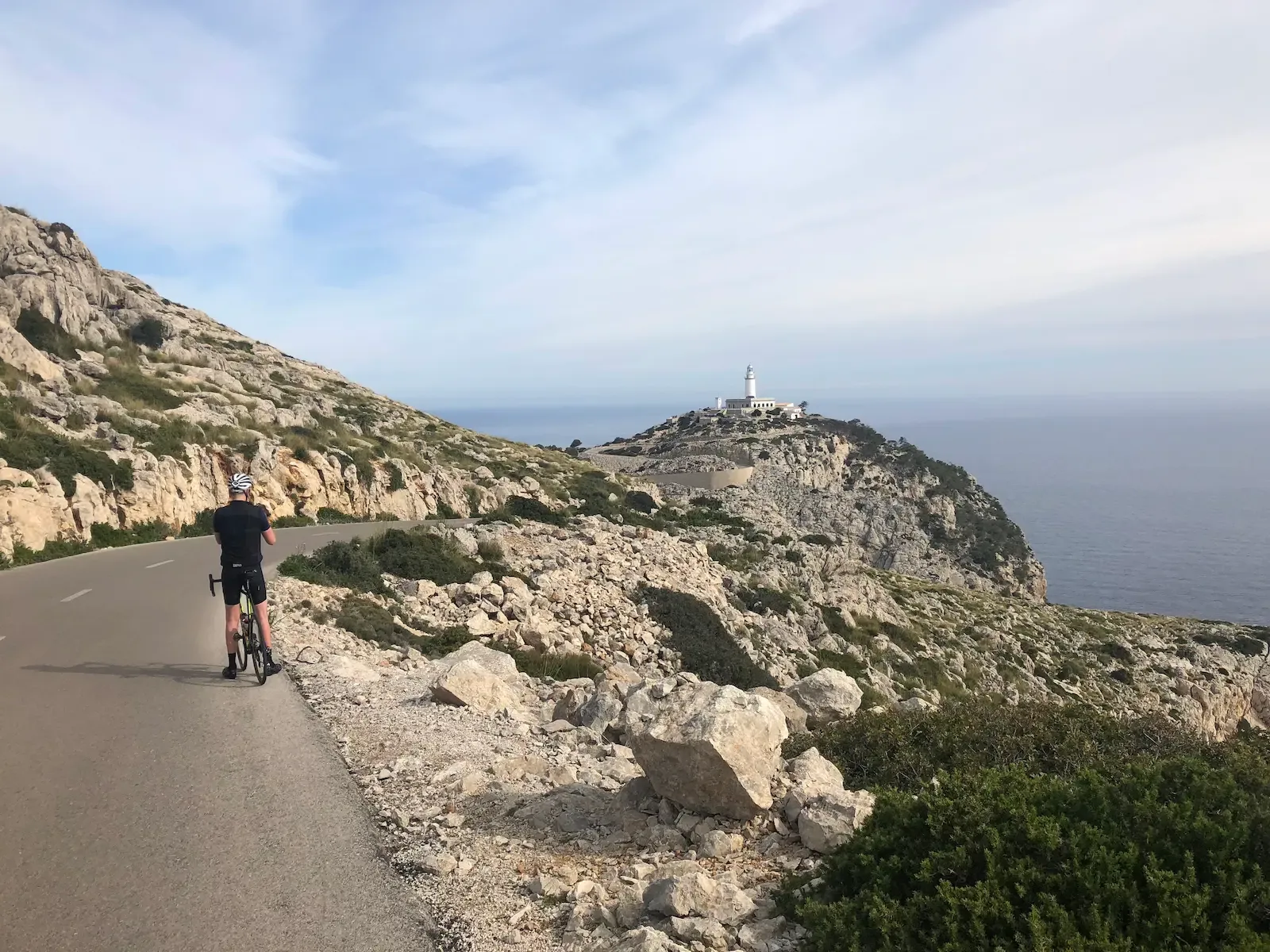
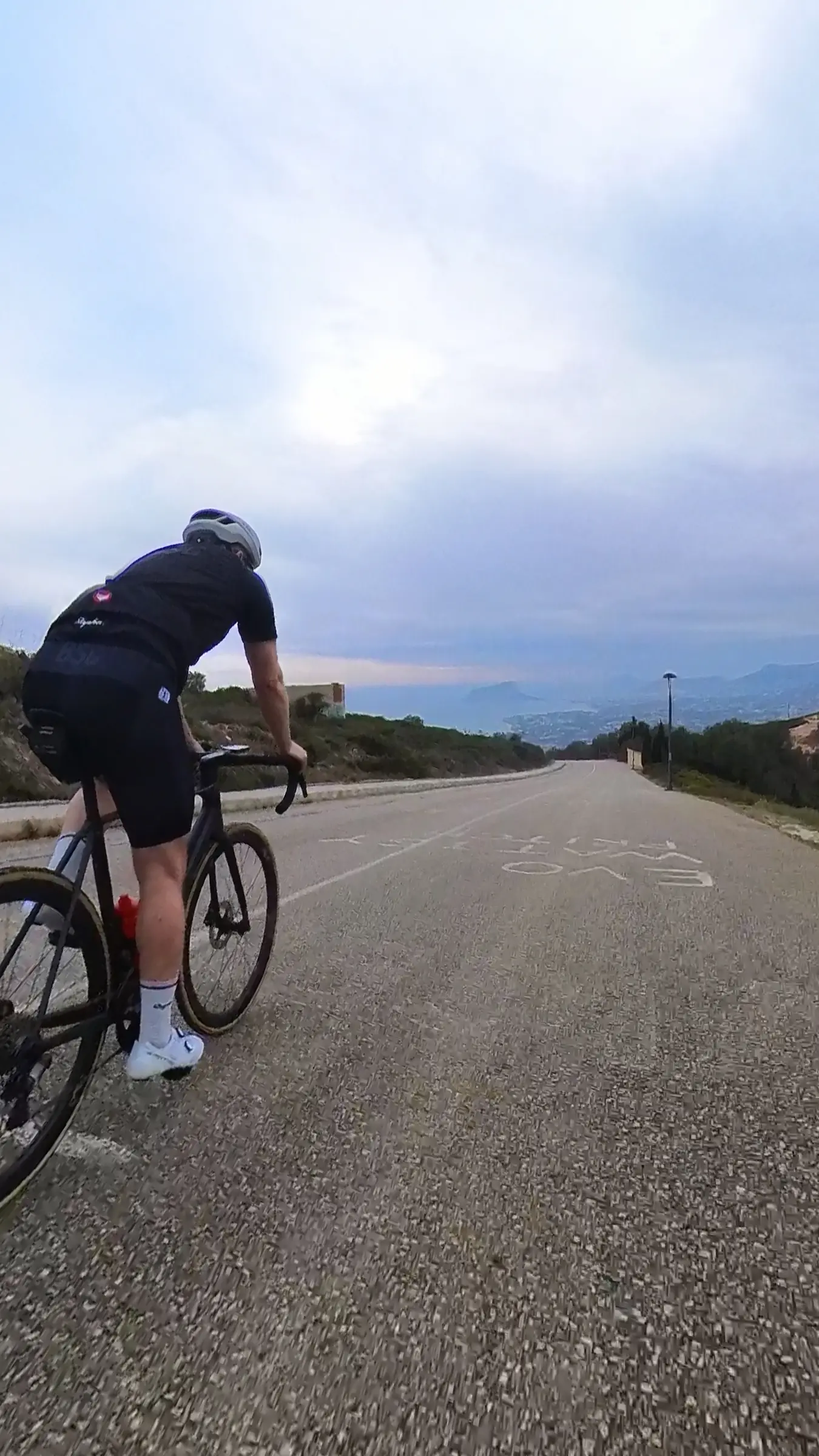
Cap Formentor from Pollença
One of the finest 40 kilometres I've ever ridden — and rolling enough to be tougher than the distance suggests. The Ma-2210 runs from Port de Pollença onto the Cap de Formentor peninsula through stacked hairpins and short tunnels cut straight through the limestone, all the way out to the lighthouse at Mallorca's northernmost tip. First comes Coll de sa Creueta up to Mirador des Colomer — the first real effort and the day's first proper view. From there it's short ramps and fast descents the rest of the way out, until the final sweeping bend opens onto Far de Formentor itself — the moment everyone comes here for. Around 880 metres of climbing, a cortado at the lighthouse café, and the best photograph of your trip. The road was built by Antonio Parietti in 1925, the same engineer who later built Sa Calobra.
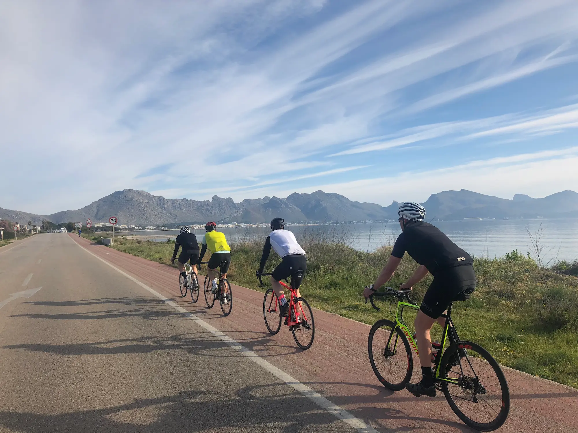
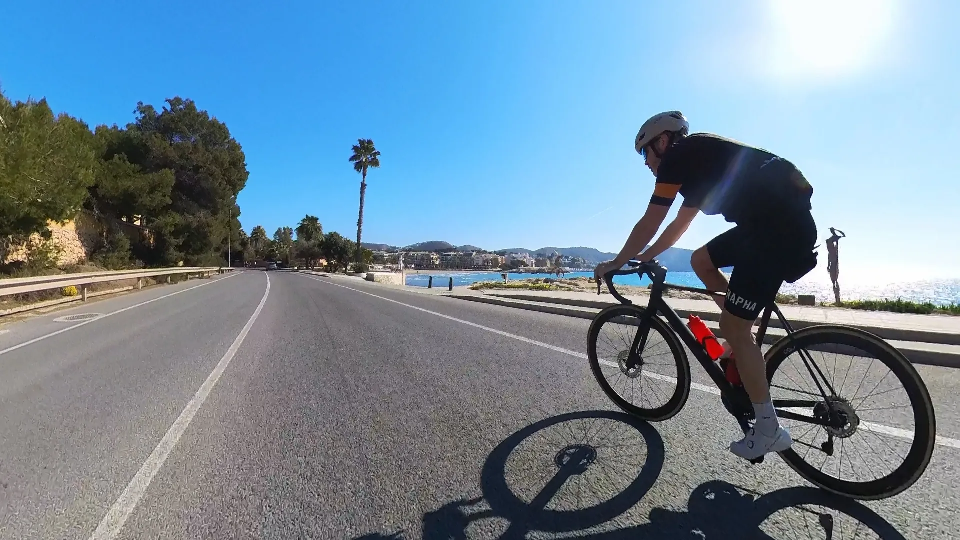
Port de Pollença to Alcúdia Bay rest-day loop
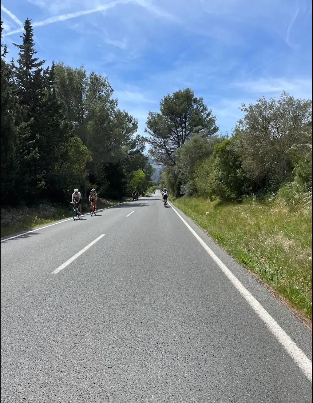
Most Mallorca itineraries treat rest days as an afterthought — a half-promise to "spin the legs" that turns into either a full day off the bike or, worse, a "shorter" ride that still ends up climbing 1,200 metres. This loop is built for the actual job: 63 kilometres, 346 metres of climbing, no decisions, no surprises, no Tramuntana on the menu. You roll south out of Port de Pollença on quiet inland roads. For the first ten kilometres or so, you'll see a steady stream of cyclists heading in the same direction — most are continuing west and up toward Sa Batalla or Coll de Sóller. You'll wave them off at the turn and keep going south, alone or in small groups, on roads where the local drivers know exactly how to pass you. The middle stretch through Sa Pobla and Santa Margalida is honest cycling country. Flat, agricultural, the kind of terrain where 25–30 km/h average comes naturally and conversation flows. There's no climbing pressure, no descents to manage. The road surface is clean. The shoulders on the larger connecting roads are wide enough that you barely register the occasional car. This is the part of the ride where you remember that cycling can also be a way to chat with your friends for an hour. Then the loop turns toward the coast at Can Picafort, and the ride changes character entirely. The road from Can Picafort up through Alcúdia and back along the bay to Port de Pollença is the reason this route earns its place in a 5-day itinerary. You're on the coastal road with the Mediterranean on your right and, in the distance, the Cap de Formentor mountain range rising over the bay. You won't see the lighthouse tower itself, but you'll see the mountains — the same range you climbed yesterday or will climb tomorrow, viewed from sea level, in a different light. This is also where the rest-day pacing makes the most sense. You stop for coffee. There's no shortage of options in either Can Picafort or Alcúdia old town — both are tourist towns with the kind of café-on-the-water that exists for exactly this purpose. Pick whichever one feels right. The coffee is the same; the view is the difference. The route is not technically demanding. There are no descents that require concentration, no roundabouts that you need to know in advance, no surprise gradients. The total climbing — 346 metres spread across 63 kilometres — works out to roughly 5.5 metres per kilometre. You won't notice it. This is by design. Best ridden as a recovery day between two harder Tramuntana days, the loop also works as a shake-out ride on arrival day or as a finish-day option for cyclists who want to end the week with a long, easy roll rather than another mountain. The flat profile means it sits well in almost any season — temperatures from 12°C upward are comfortable, and the wind off the bay tends to push you home rather than fight you on the way out. Bring less food than you'd take on a Tramuntana day. Take more time at the café. Save the legs. This is the rest day done properly.
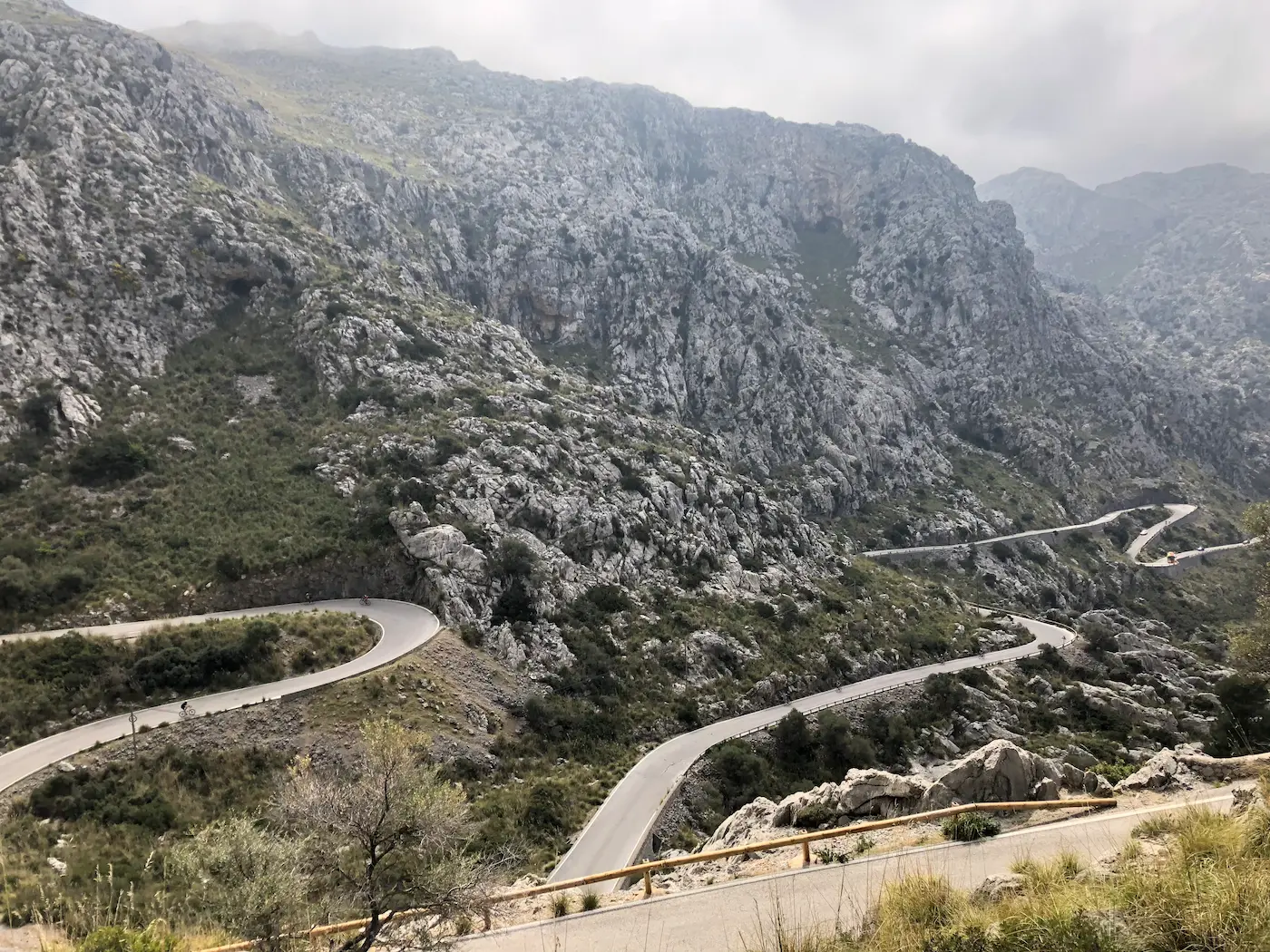
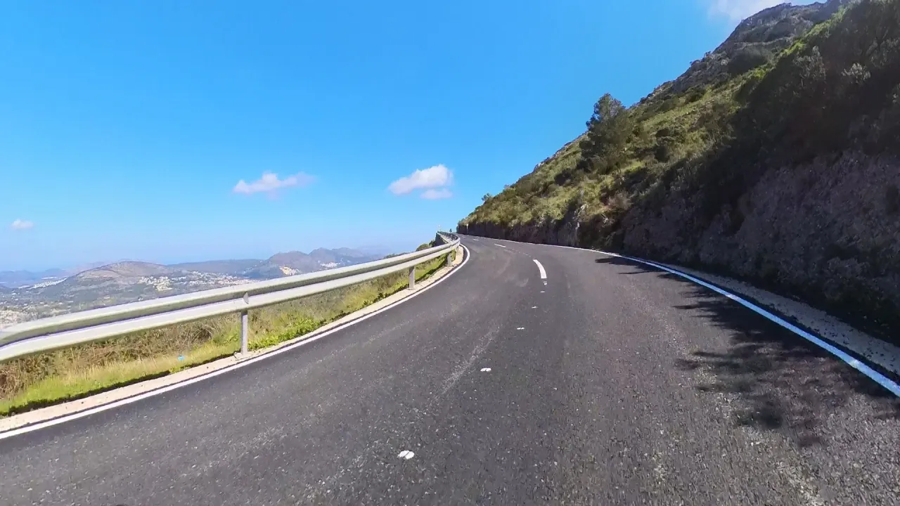
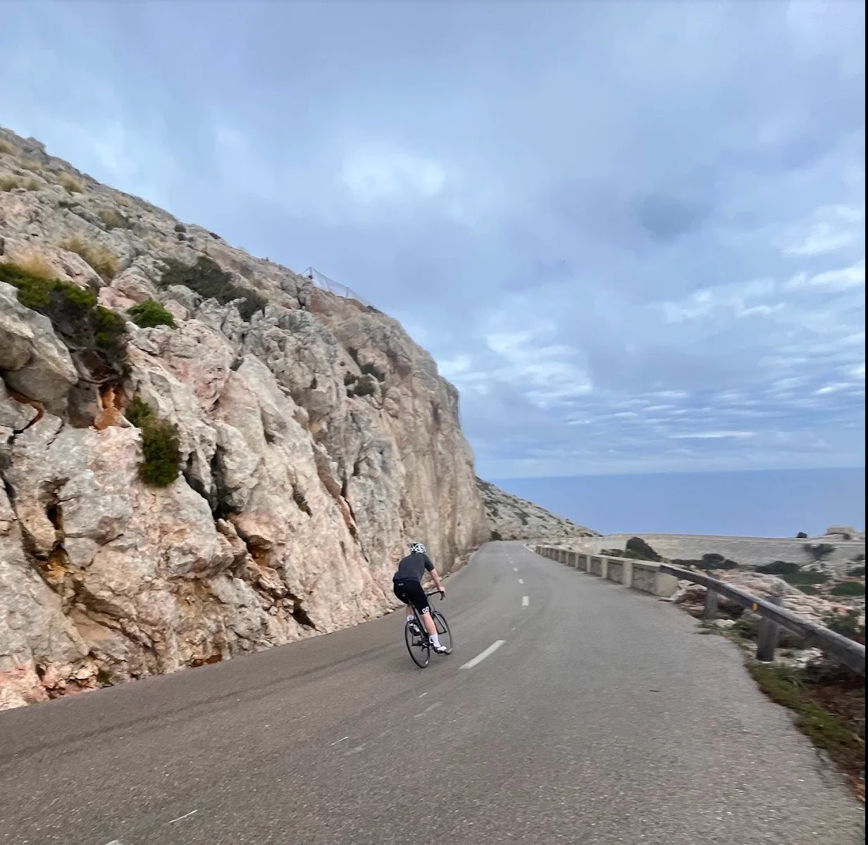
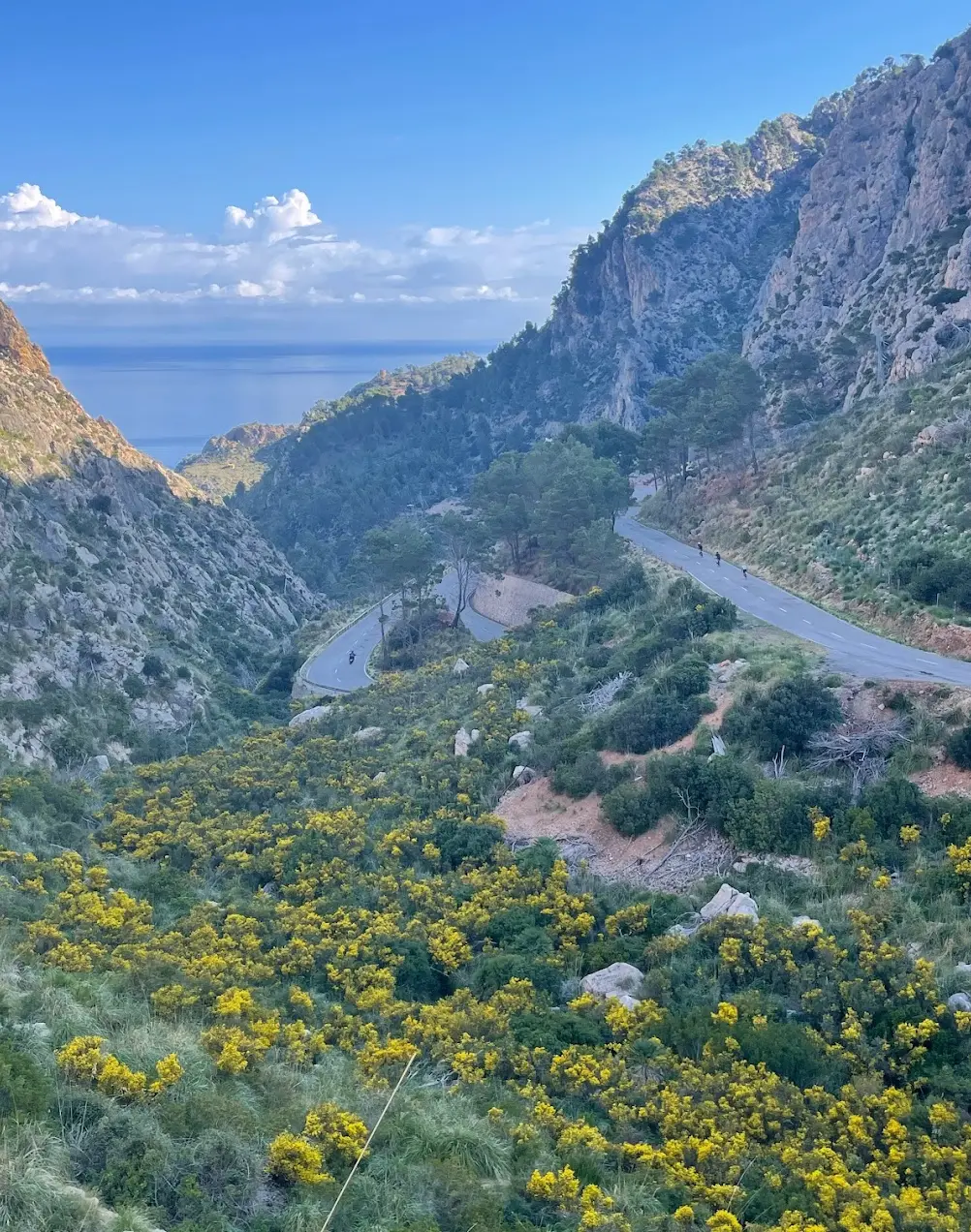
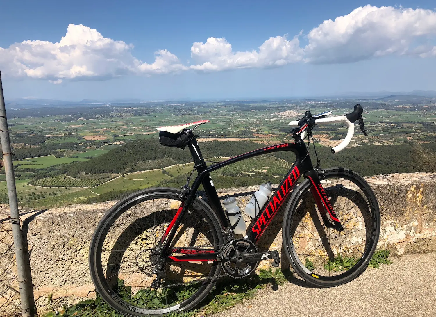
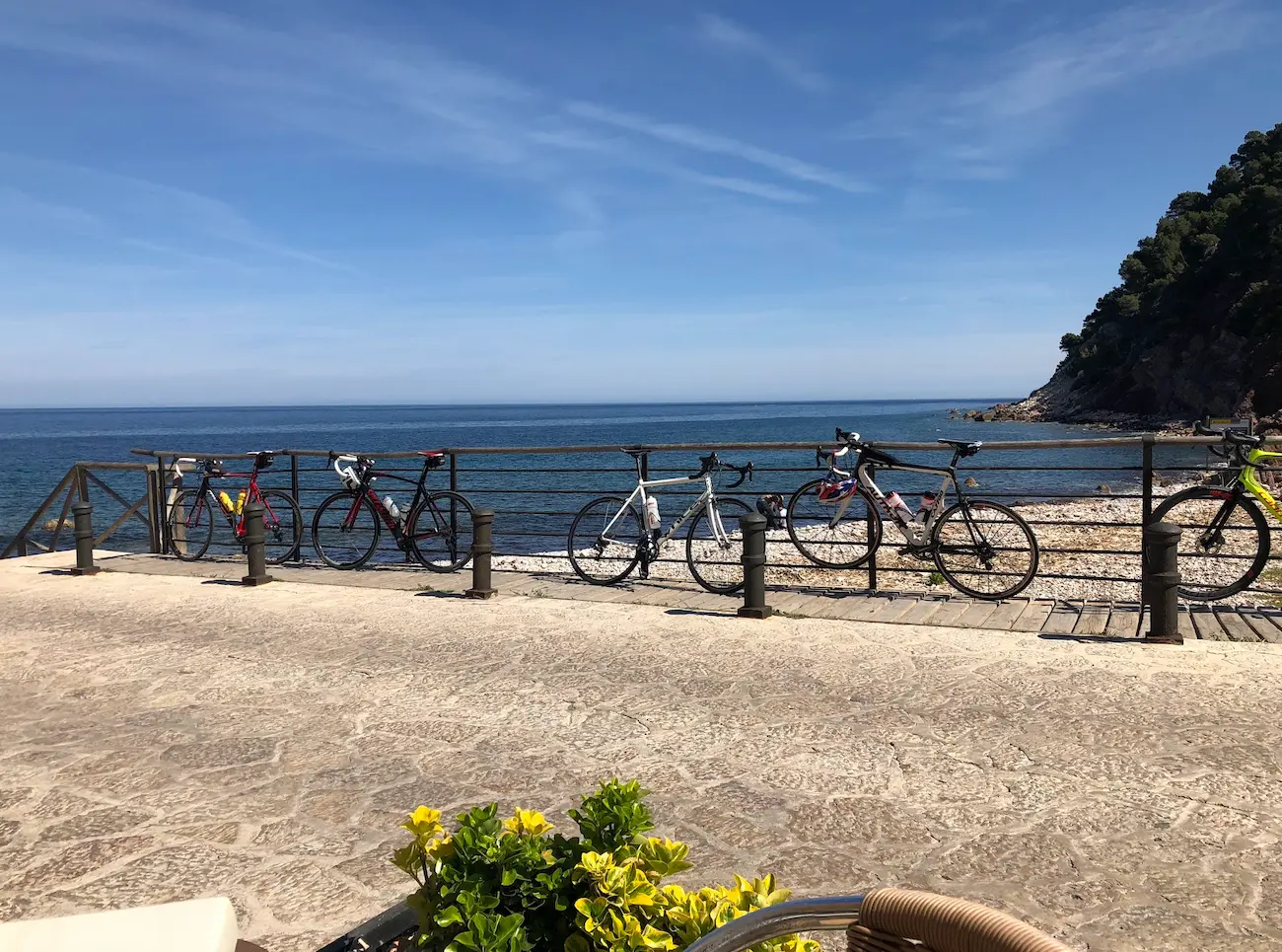
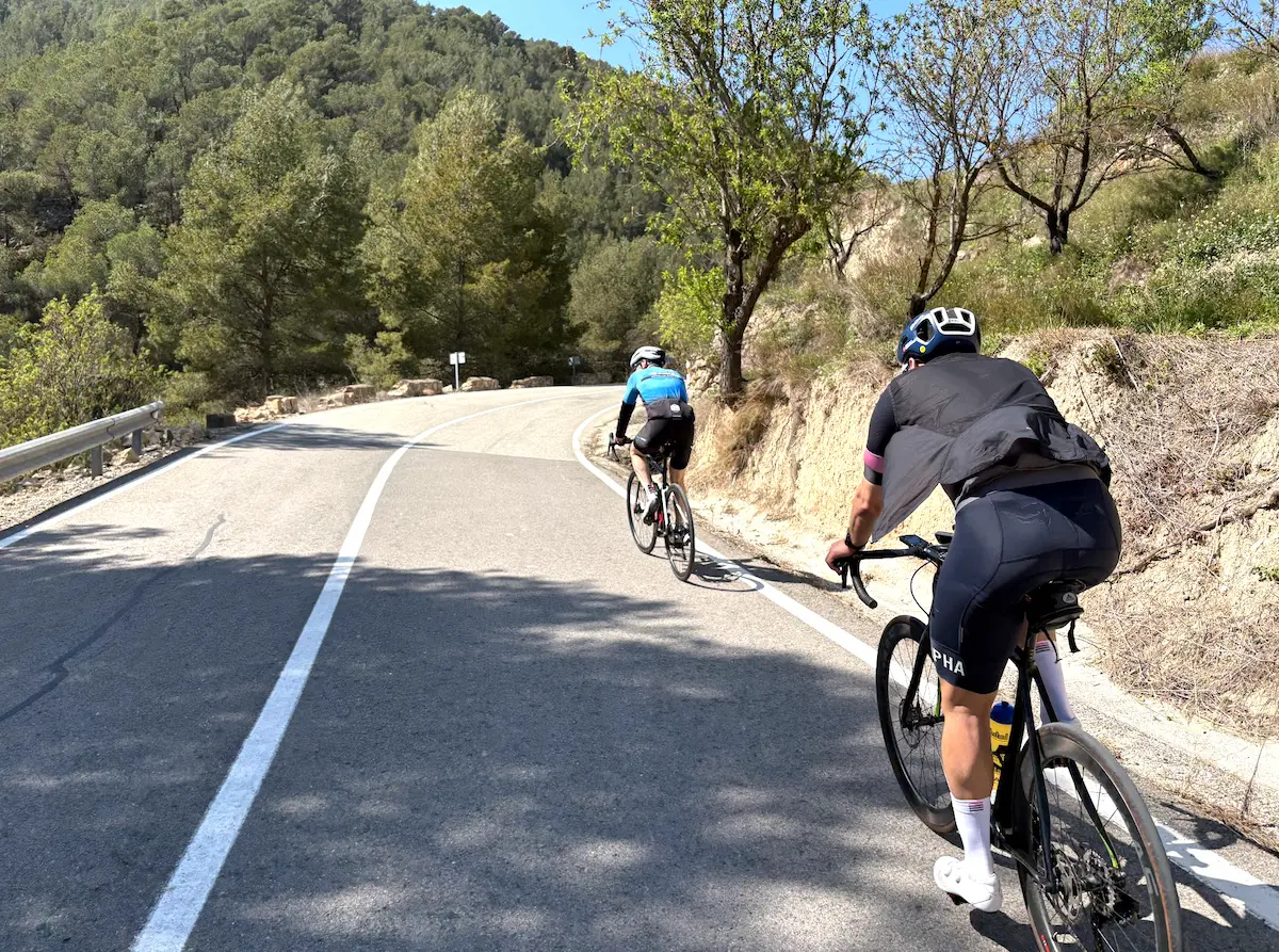
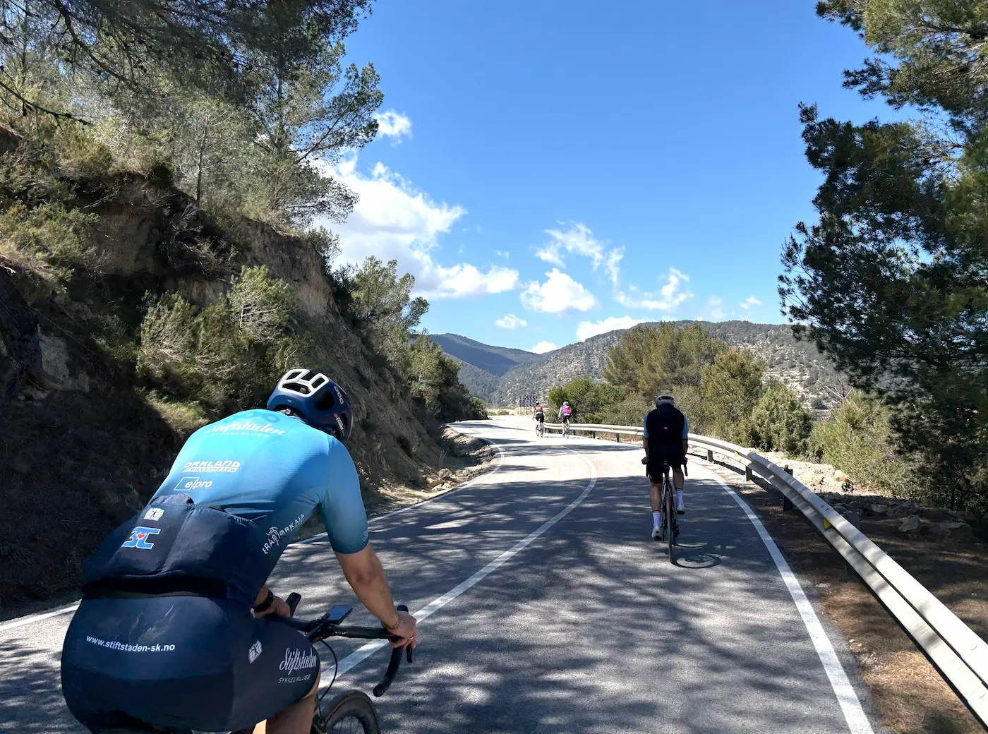
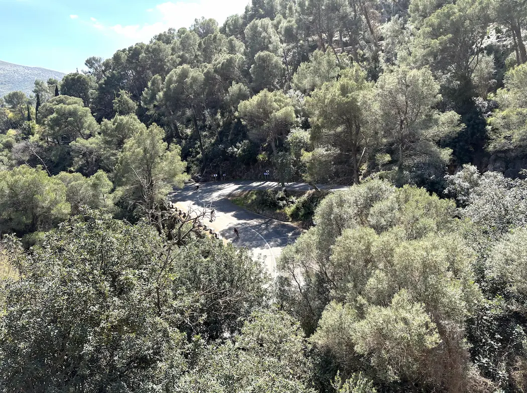
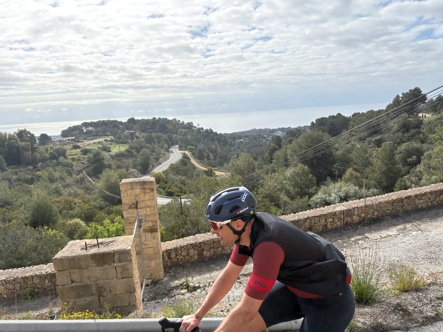
Sa Calobra from Pollença
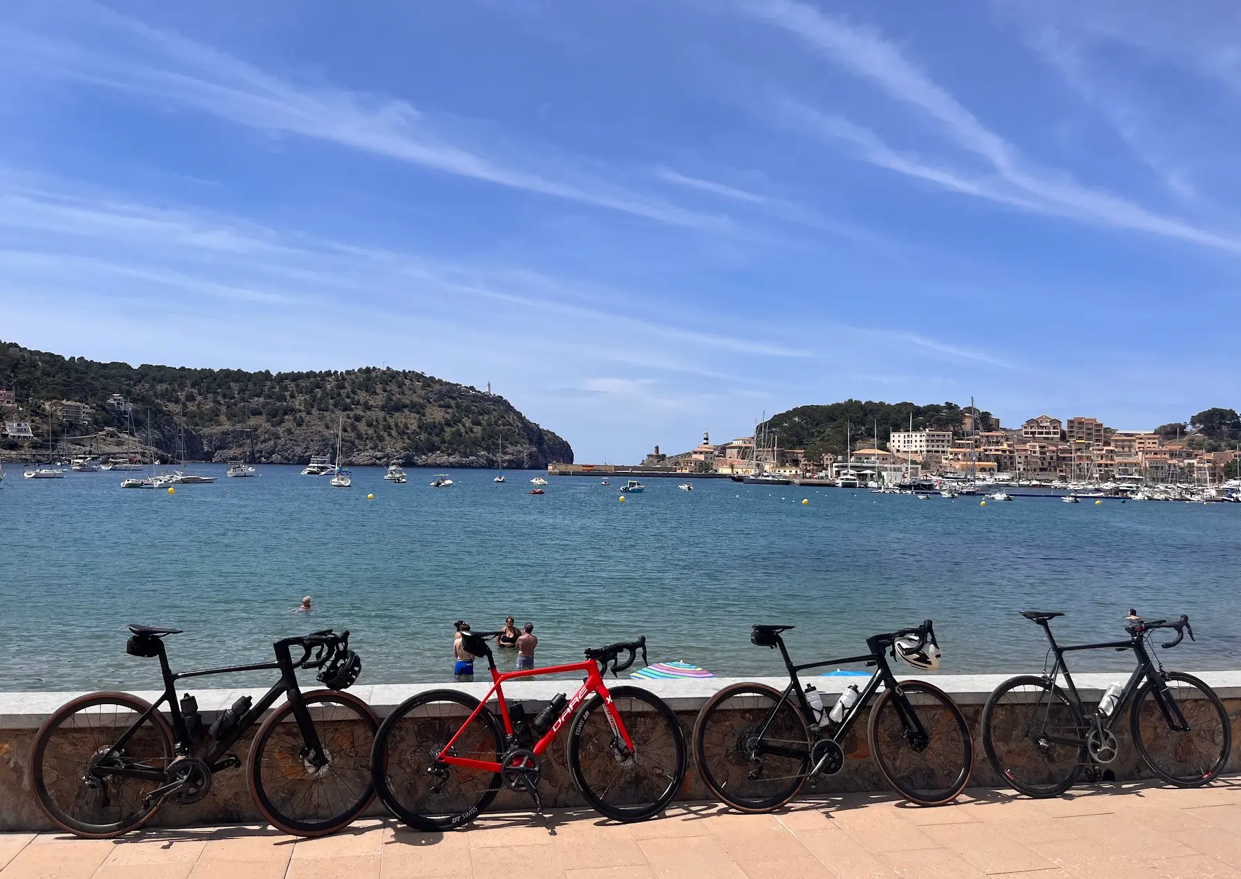
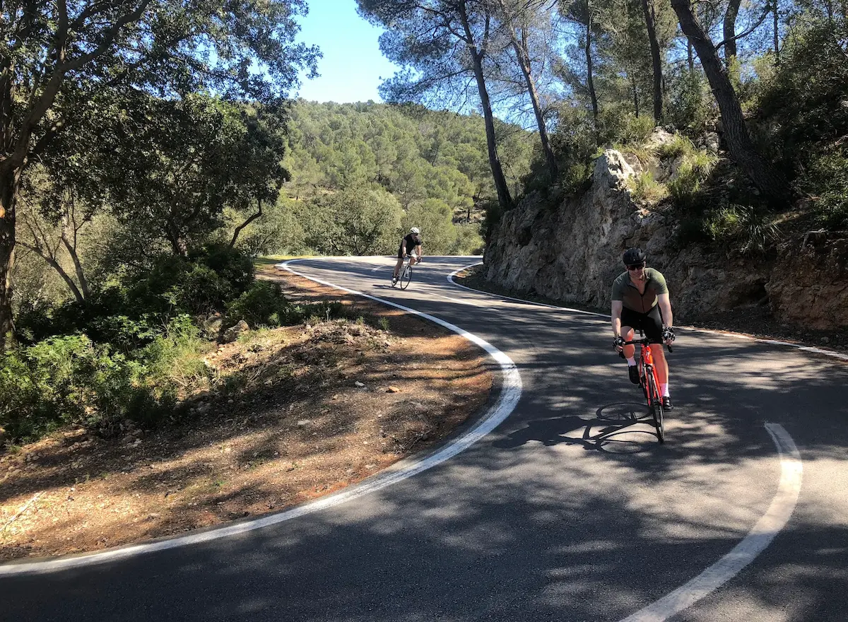
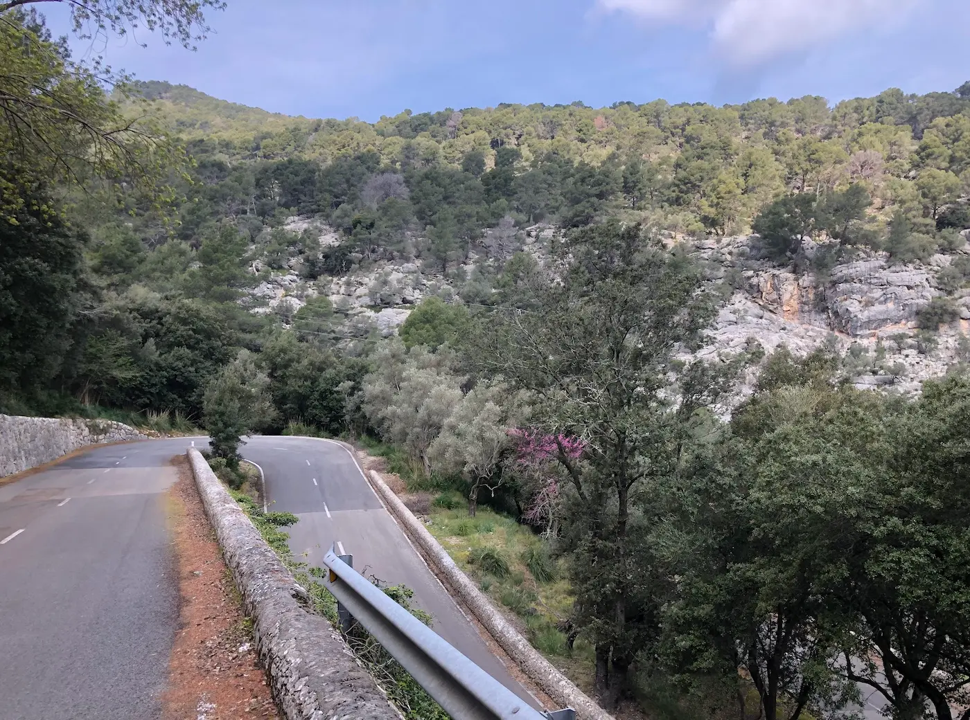
This is the day every Mallorca week is built around. Sa Batalla and Sa Calobra in a single ride from Port de Pollença — 105 kilometres, 2,108 metres of climbing, and the two most-photographed roads in European cycling on the same day. You don't ride this loop because it's the most efficient route to those climbs. You ride it because doing them back-to-back, from a Pollença base, is the queen stage that defines the Mallorca cycling trip. The morning starts in Port de Pollença with the kind of nerves that come with knowing the day. Wheels out around 9, normal breakfast, two bottles, gels and bars in the back pockets. The early start matters here for two reasons: heat later in the day if you're riding in spring or autumn, and traffic on Sa Calobra. The longer you wait, the more cars and rental scooters between you and a clean descent. The first 12 kilometres roll south on the same quiet inland roads you might take on a flat day, until you reach Caimari and the start of Sa Batalla. The climb is 7.8 kilometres and 381 metres at a steady 5–6% gradient. Olive groves either side of the road for the first kilometre, then the road begins to switchback. There's a moment early on where the serpentines stack tightly enough that you can look down and see other cyclists below you, like terraces. The first four kilometres are honest, regular climbing. Then a short flat stretch lets you catch your breath. Around 5.5 km you get a longer flat section — useful if you've been pushing too hard. From kilometre 6 it pitches up again to the Repsol station that marks the top of the segment. Bring some change. The petrol station and the restaurant next to it are where most groups stop to fill bottles and regroup. From Repsol the route climbs another 100 metres or so before dropping toward the famous bridge — a road junction marked by a small kiosk-café that's a useful refill point both before and after Sa Calobra. At the junction, you turn off toward Coll dels Reis. Don't underestimate this one: 2.66 kilometres at 5.9% averaging is its own climb, 160 metres of elevation, and it sits between you and the Sa Calobra descent. From the top of Coll dels Reis you roll down to the Sa Calobra cove on the same road you'll come back up. Sa Calobra is the climb that needs no introduction. 9.44 kilometres, 659 metres of climbing at 7.0% average, 26 hairpin bends. The top of the climb is Coll dels Reis at 682 metres. The Sa Calobra road was built in 1933, designed by the Italian-Spanish engineer Antonio Parietti — the same man who designed the road out to Cap de Formentor. Nus de sa Corbata — the famous 270-degree turn where the road loops over itself — sits near the end of the climb, with only 300–400 metres remaining to the top once you've passed it. Bradley Wiggins won the 2012 Vuelta a Mallorca here. The Strava-segment KOM is Tom Pidcock's 22:46 from December 2022. The descent down is technically demanding, particularly in the upper half, where blind hairpins meet narrow road. Be cautious: it's not unusual for buses and oncoming traffic to bring everything to a complete stop around a corner you can't see through. Plan for it. At the bottom there's a restaurant and a café that serve hot food. Some groups linger; others, like me, fill bottles and head back up. Water needs vary wildly with temperature — bring more than you think on a warm day. The climb back up rewards a controlled start. The first section runs through vegetation and lower forest with some shelter from wind. You'll pass the famous narrow section between two rock walls. Then the landscape opens up and the wind picks up across the exposed middle stretch — and from here you can look up and see the serpentines you're about to ride, stacked above you on the cliff face. Find your rhythm on watts and pulse. The climb gives you back what you spend on it if you stay patient through the middle. Once you've come back down from Coll dels Reis to the bridge junction, the cafe fills up with cyclists. Coffee, Coke, ice cream when the weather earns it. 15 to 30 minutes of pause depending on the day. The route home is a quieter pleasure. Back toward Repsol with 170 metres of climbing left in the legs, then a left turn just before the petrol station onto Coll de Femenia. From there it's a long, descending road back to Port de Pollença — sweeping bends, good asphalt, the bay coming into view through the trees. The ride finishes naturally at Stay Restaurant or one of the others by the water in Port de Pollença, with a cold drink and the satisfaction of having done the day. This is the queen stage. Ride it once, properly, and you understand why people come back to Mallorca year after year.
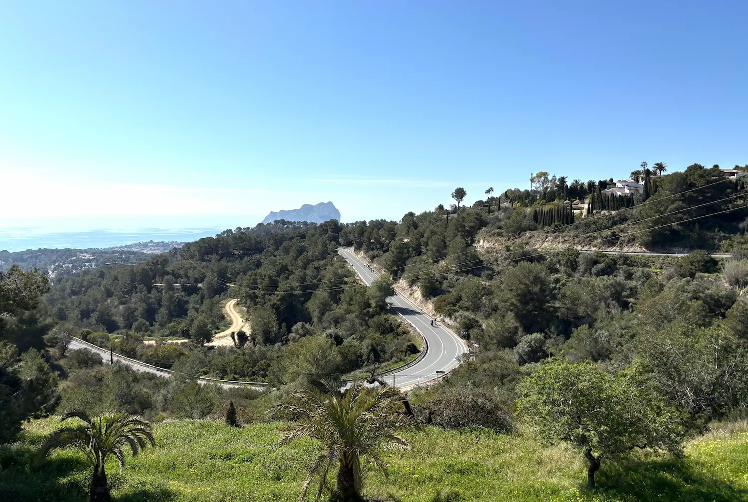
Calpe — Cumbre del Sol
A short, sharp introduction to Costa Blanca cycling. 43 kilometres from Calpe along the coast to Benitachell, then straight up Cumbre del Sol — 3.67km at 9.6% average with ramps pushing past 18% (max 19.6% per GPX). A Vuelta a España finish in 2015 and 2017, where Dumoulin defeated Froome and vice versa. The Strava segment KOM belongs to Mike Woods from the 2017 Vuelta. A perfect benchmark climb.
Calpe — Guadalest & Vall d'Ebo
A front-loaded epic through the Costa Blanca mountains, designed for maximum enjoyment. From Calpe, the route climbs deep into the interior — through the Guadalest valley to Puerto de Confrides, across the rolling inland plateau, and up the iconic Vall d'Ebo from the easy western side. The reward: one of the finest descents in Spain, plunging through hairpin bends above the orange groves toward Pego, with the Mediterranean glittering in the distance. 137 kilometres, 2,681 metres of climbing.
Calpe — Coll de Rates
The benchmark ride of Costa Blanca, built around Coll de Rates — one of the most analysed and ridden climbs in professional cycling. 6.43km at 5.5%, Category 2, favoured by WorldTour teams who winter in the area. Tadej Pogačar holds the Strava KOM at 11:57 (19 December 2025). The 117km route adds La Fustera, a 4km Category 3 approach climb, and returns through the vineyards and coastal hills of the Marina Alta.
Calpe — Port de Tudons & Puerto de Confrides
The queen stage of the Costa Blanca. From Calpe, the route rolls southwest along the coast before turning inland for Port de Tudons — 15.2km at 5.3%, Category 1, climbing from the Mediterranean to 1,025 metres through wild, empty mountain terrain. Puerto de Confrides follows from the south before the long, flowing descent through Guadalest valley returns you to the coast. 118 kilometres, 2,029 metres of climbing — one of the most demanding days you can ride from Calpe.
Calpe — Moraira & Dénia
77 kilometres of Mediterranean coastline from Calpe north through Moraira to Dénia, circling the Montgó natural park and returning via the quiet inland roads of the Marina Alta. Rolling coastal terrain, harbour towns, orange grove valleys, and some of the most scenic riding on the Costa Blanca.
Calpe — Finestrat & Guadalest
Five categorised climbs across 153 kilometres and 3,152 metres of elevation. Alt de Finestrat opens beneath the Puig Campana massif, followed by Port de Tudons, Alto de Torremanzanas, Port de Benifallim, and CV-710 to Confrides. Tadej Pogačar set the Strava KOM on CV-710 in December 2025 — 18:01 at 30.2 km/h. A route that rewards patience and consistent nutrition management.
Calpe — Vall d'Ebo & Castell de Castells
116 kilometres from Calpe through the Jalón valley and north to Pego, then inland to Port de la Vall d'Ebo from Pego — 7.82km at 6.0%, Category 2, widely considered the most scenic climb in the area. El Pla de Petracos and Alto de Castell de Castells follow before the return to Calpe. Three categorised climbs, 2,202 metres of elevation.
Calpe Cycling — Xaló Valley & Velosol Loop
The social ride of the Costa Blanca — a 41-kilometre loop from Calpe through the beautiful Xaló valley to Velosol Cycling Bar, the legendary café-stop that every cyclist in the region passes through eventually. This is the route where you ride alongside cyclists from across Europe, share a cortado at a table covered in pro cycling memorabilia, and feel what it means to be at the heart of a true cycling mecca. The Xaló valley is one of the finest cycling environments on the Costa Blanca — vineyard and almond-tree roads with exceptional tarmac quality, rolling terrain and virtually no traffic. In February, the almond blossom transforms the valley into something extraordinary. The roads are wide, smooth and fast — ideal for riding in a group and maintaining a good tempo. With 613 metres of climbing on rolling hills, this is an accessible route that rewards with big scenery and an unmissable café stop.
Estepona — Sierra Bermeja Loop
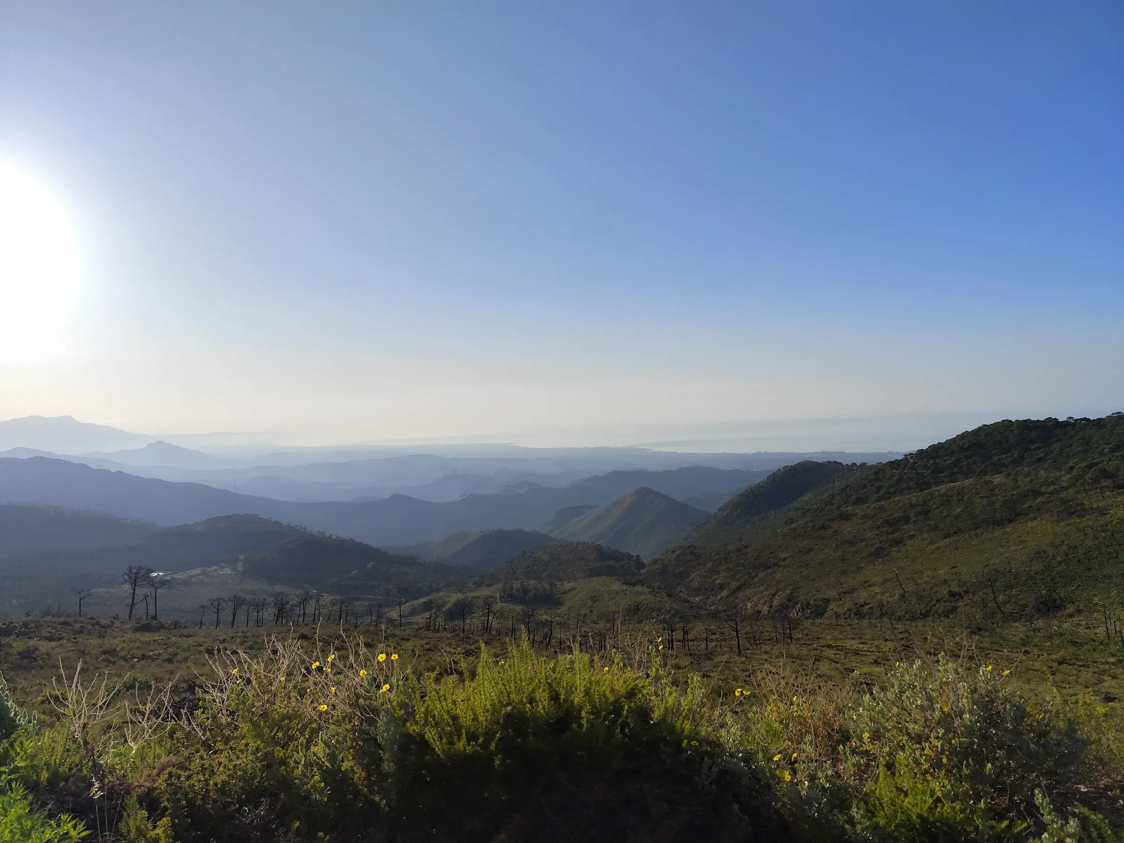
A brutal and beautiful loop from Estepona harbour that climbs Sierra Bermeja's red peridotite flanks to 969 metres — with views of Gibraltar and the African coast — before winding through the white villages of inland Andalusia and descending back to the Mediterranean. One of the most concentrated climbing experiences in southern Spain, compressed into 89 kilometres. The opening sets the tone: the road climbs straight out of Estepona harbour and barely lets up for the first 16 kilometres. This opening climb is Peñas Blancas, the route's Hors Catégorie monster. The MA-8301 is legendary for having virtually no straight sections — an endless succession of hairpins through dense Pinsapo forest, a protected Spanish fir that grows almost nowhere else in the world. By the time the summit area at Los Reales opens up at 969 metres, the better part of a thousand metres of climbing are in the legs and the coast is far below. On clear days the view stretches from Gibraltar to the Moroccan Atlas — two continents visible from the same saddle. What comes next is what makes the route. After the descent into the Andalusian interior, the landscape shifts entirely — from red peridotite rock to the olive groves and whitewashed hilltop villages of the Pueblos Blancos. Gaucín is the natural lunch stop, a quiet square with a couple of good restaurants well suited to cyclists on a long day. From here the return leg is anything but flat: another 500+ metres of climbing through a series of ridges — the A-377 ramp and the climb to Genalguacil among them — as the sting in the tail before the final descent back to the Mediterranean. Sierra Bermeja traps heat in summer — spring and autumn are the ideal seasons, and the winds (Levante from the east, Poniente from the west) can be real on the exposed upper sections. Come when the temperatures are moderate, pace yourself on the lower slopes, and this is one of the finest mountain days in southern Spain.
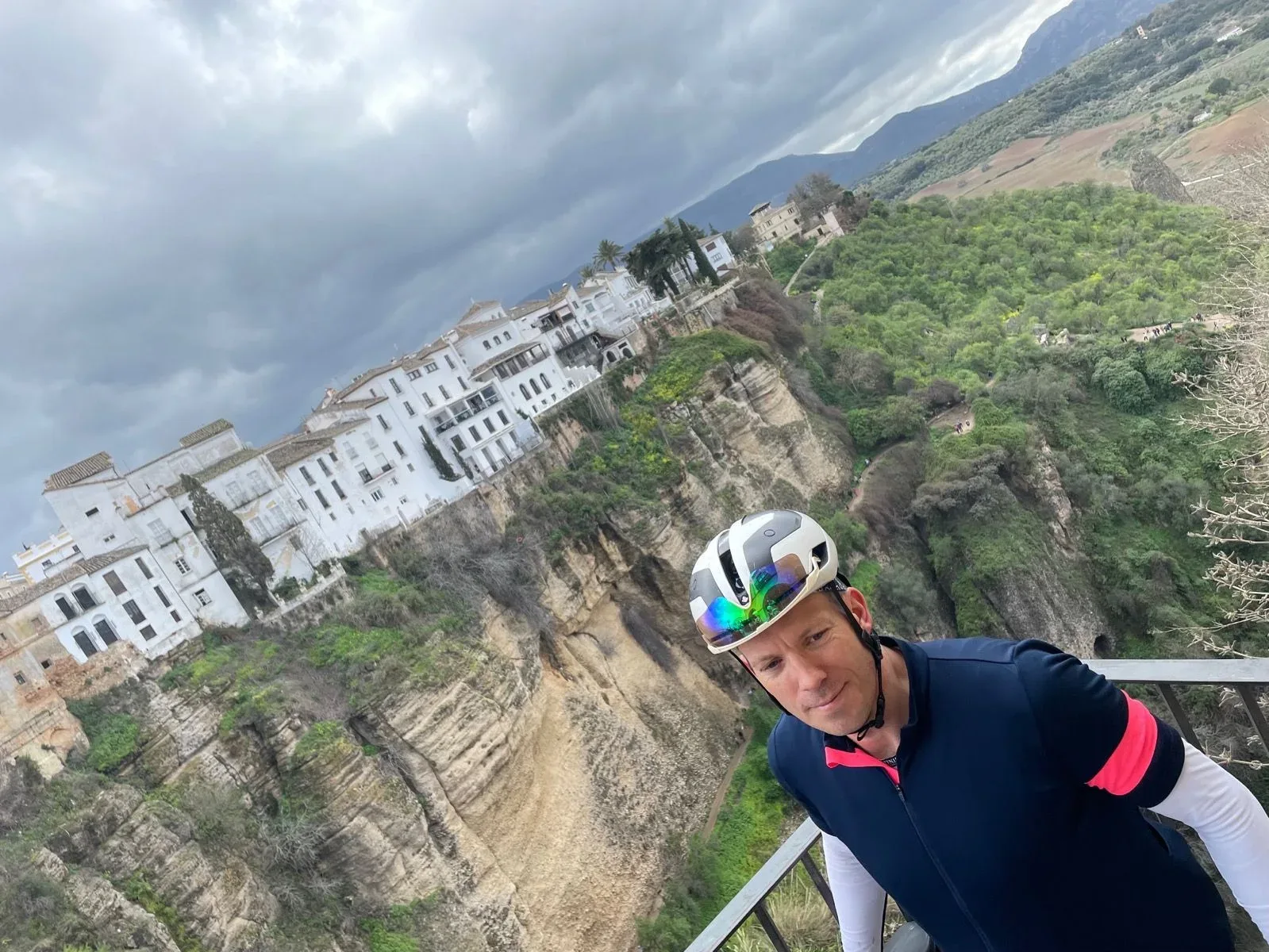
Marbella - Ronda - Marbella
A 151.2 km loop out of Marbella that trades the Costa del Sol for the Serranía de Ronda, climbing steadily to the clifftop town above El Tajo before a windswept return across the plateau. 2898 m of climbing, one regional classic ascent, and smooth tarmac throughout.
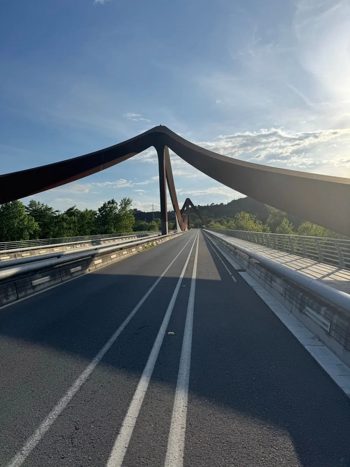
Girona - Sant Martí Sacalm
A 90.8 km loop out of Girona into the Guilleries massif, climbing the Pujada a Sant Martí Sacalm for 1,268 m of gain. The classic local rite of passage when the legs are finally ready to go uphill again.
Girona - Banyoles
A 48.2 km loop out of Girona with 427 m of climbing, threading quiet farm roads through the Pla de l'Estany to the shore of Lake Banyoles. The classic local spin — light on traffic, heavy on Catalan countryside.
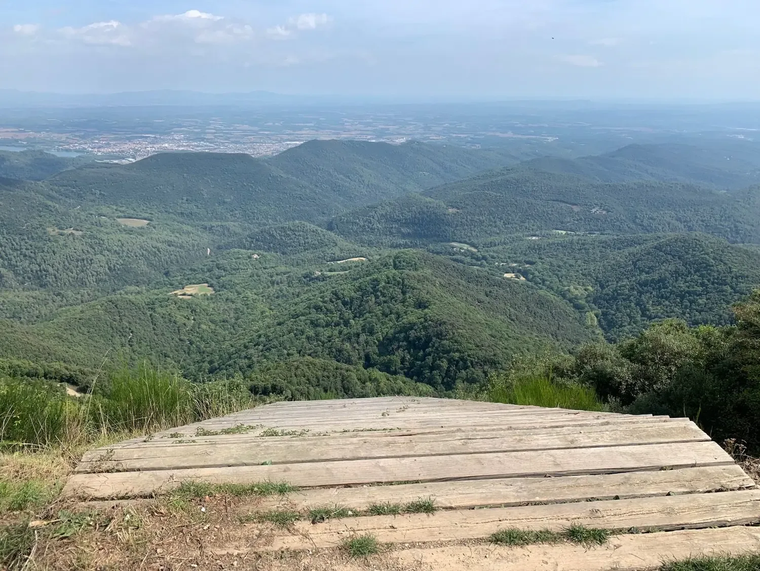
Girona - Rocacorba
A 70.7 km loop out of Girona with 1,309 m of climbing, built around one of the most talked-about ascents in European cycling: Rocacorba. Quiet farmland roads lead you to the foot of the climb, then it's just you, the gradient and the forest.