
Girona - Rocacorba
About this Route
A 70.7 km loop out of Girona with 1,309 m of climbing, built around one of the most talked-about ascents in European cycling: Rocacorba. Quiet farmland roads lead you to the foot of the climb, then it's just you, the gradient and the forest.
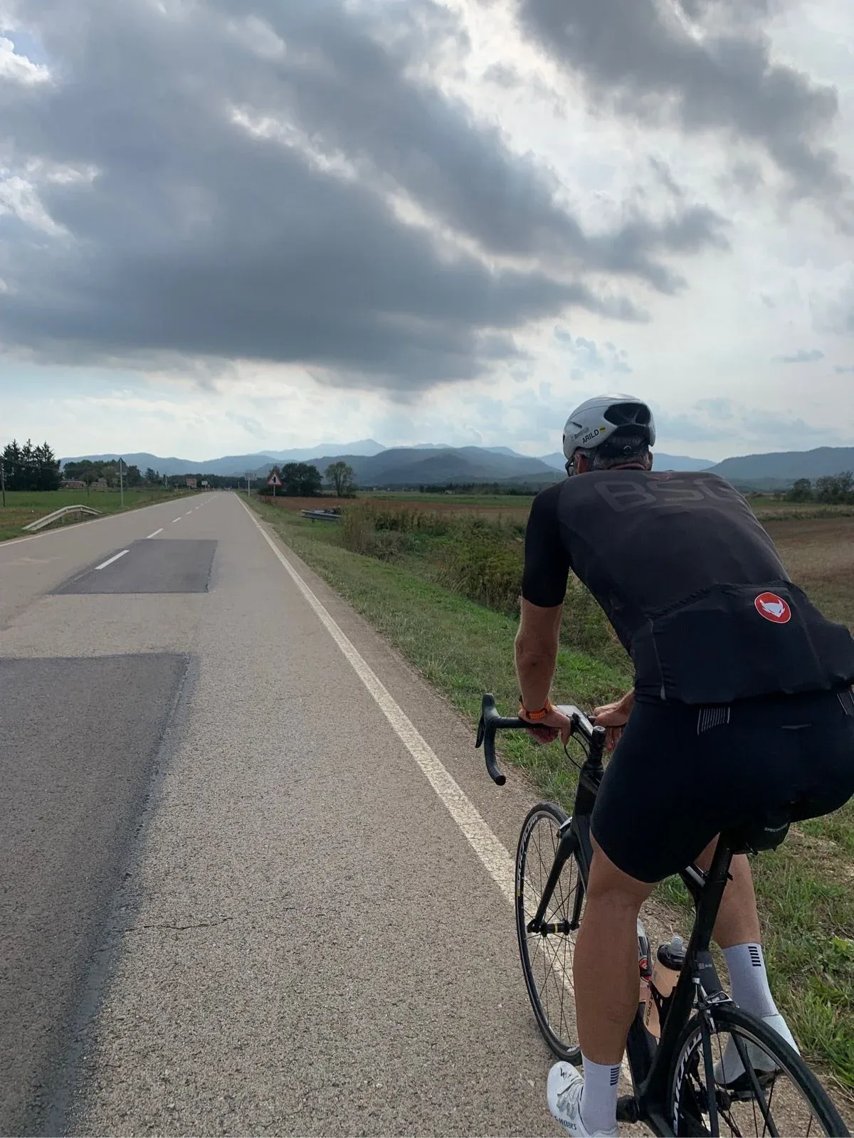
Rolling out of Girona in the early light, you slip through the farmland north of the city on narrow secondary roads — poplar lines, stone masies, the Guilleries and Collsacabra ridges slowly sharpening on the horizon. It's the kind of warm-up that lets you spin the legs loose without having to think. Traffic is almost non-existent once you're past the first roundabouts, and the road tilts so gently you barely notice the elevation creeping in.
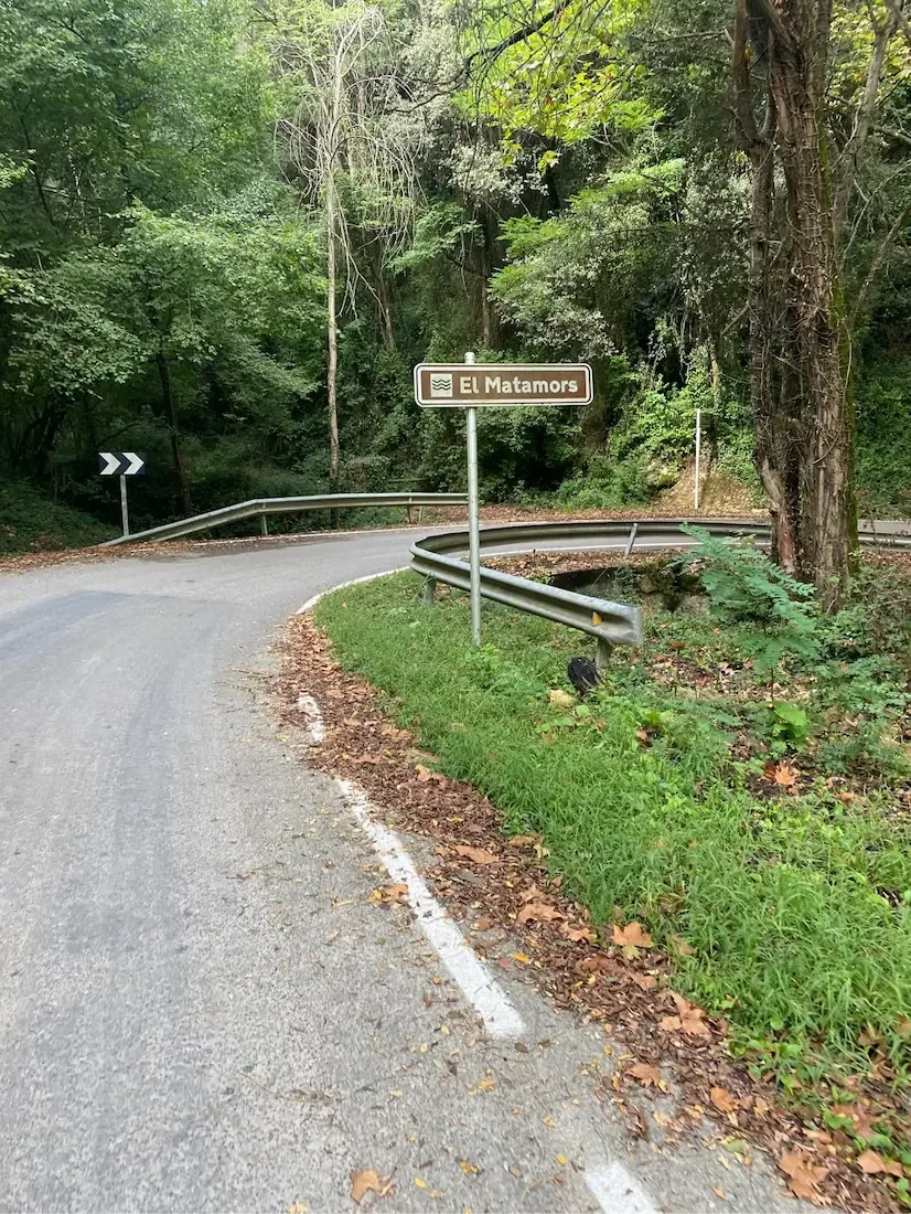
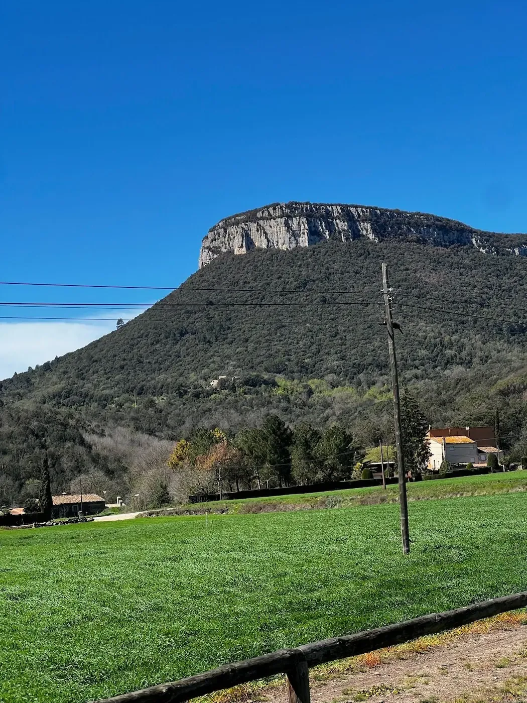
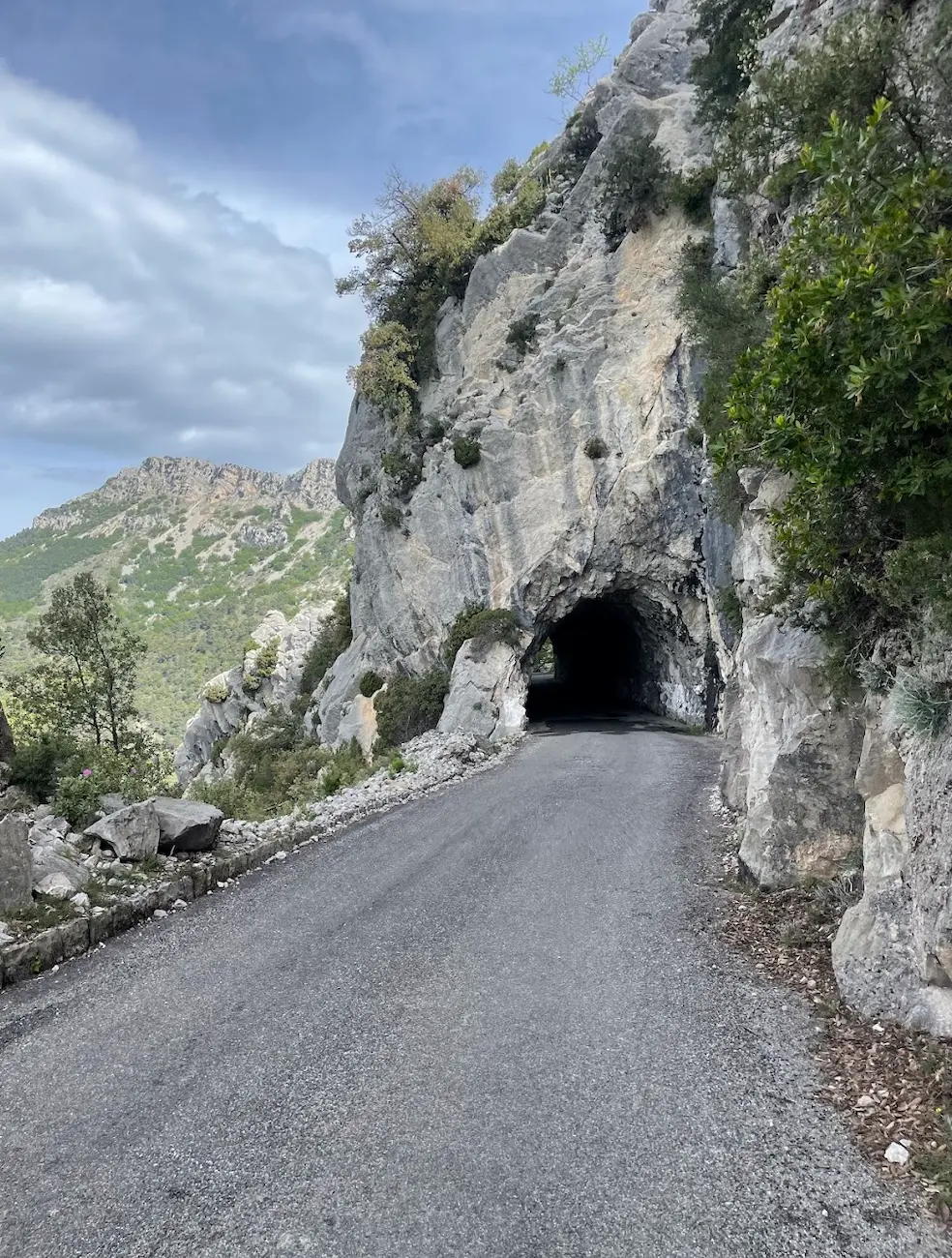
Through Canet d'Adri the character shifts. The pavement narrows, oak woodland closes in, and little hamlets tick by. You can feel the climb waiting. The brown El Matamors sign at a shaded hairpin is the unofficial start gun — from here it's proper Rocacorba, the same pitches that Pogačar, Van Vleuten and half the Girona pro scene use as their benchmark. Tough, but a fantastic climb.
And tough it is. The gradient is never consistent. You settle into a rhythm, the road kicks up, you stand, it flattens briefly, you sit, another ramp. Holm-oak and chestnut overhead, damp patches under the tyres, leaf litter in the corners even in dry weather. There's no traffic — it's essentially a dead-end road to the antennas at the top — so you can use the full width through the hairpins and focus on pacing rather than looking over your shoulder.
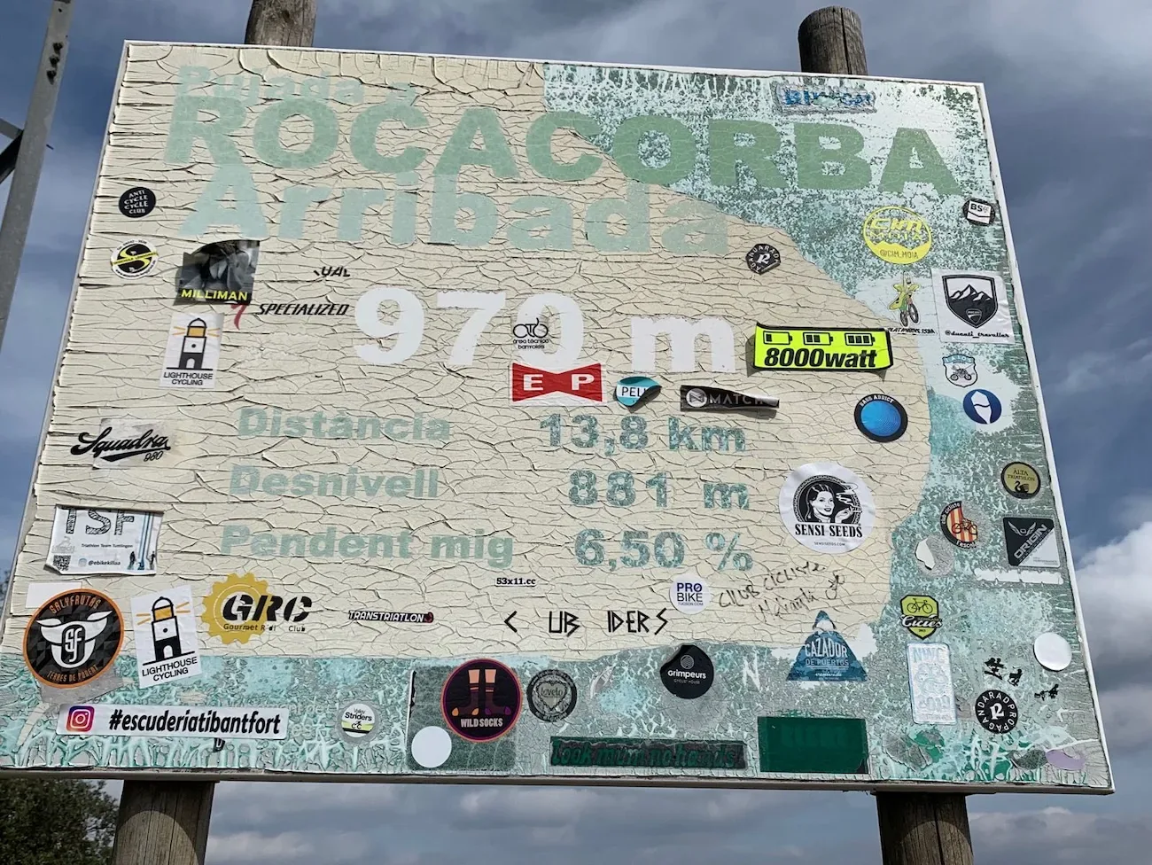
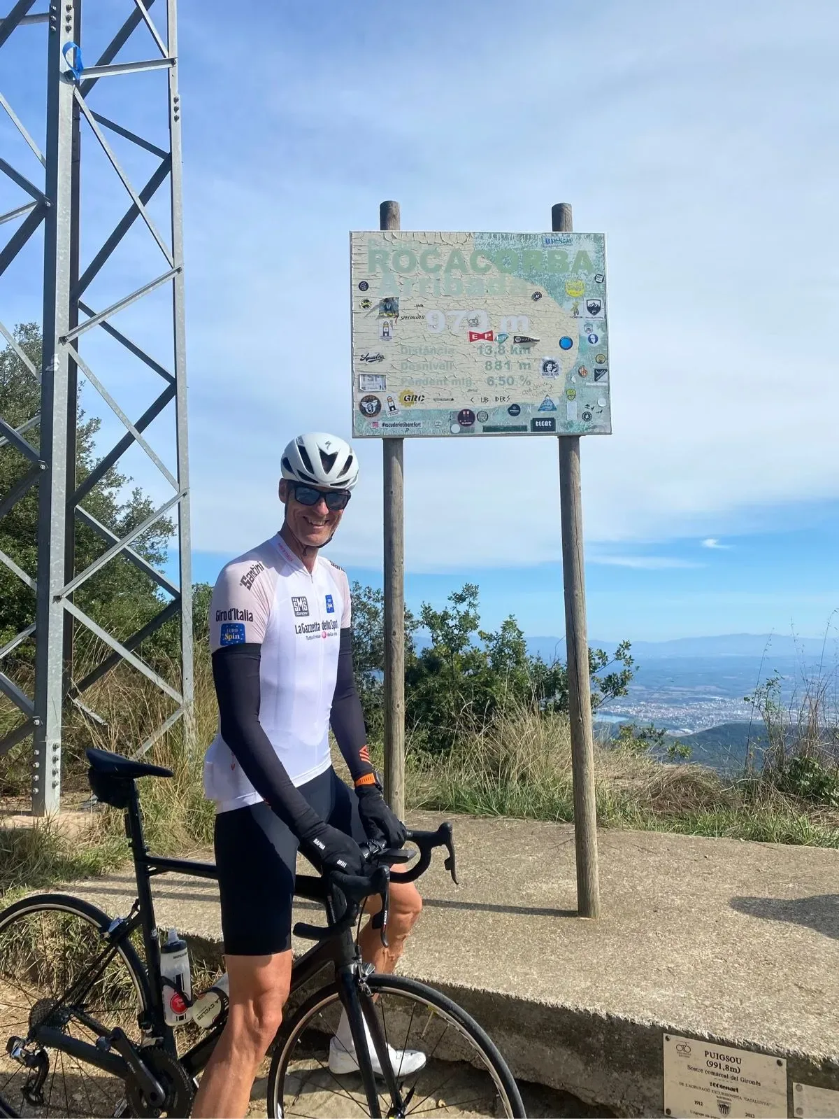
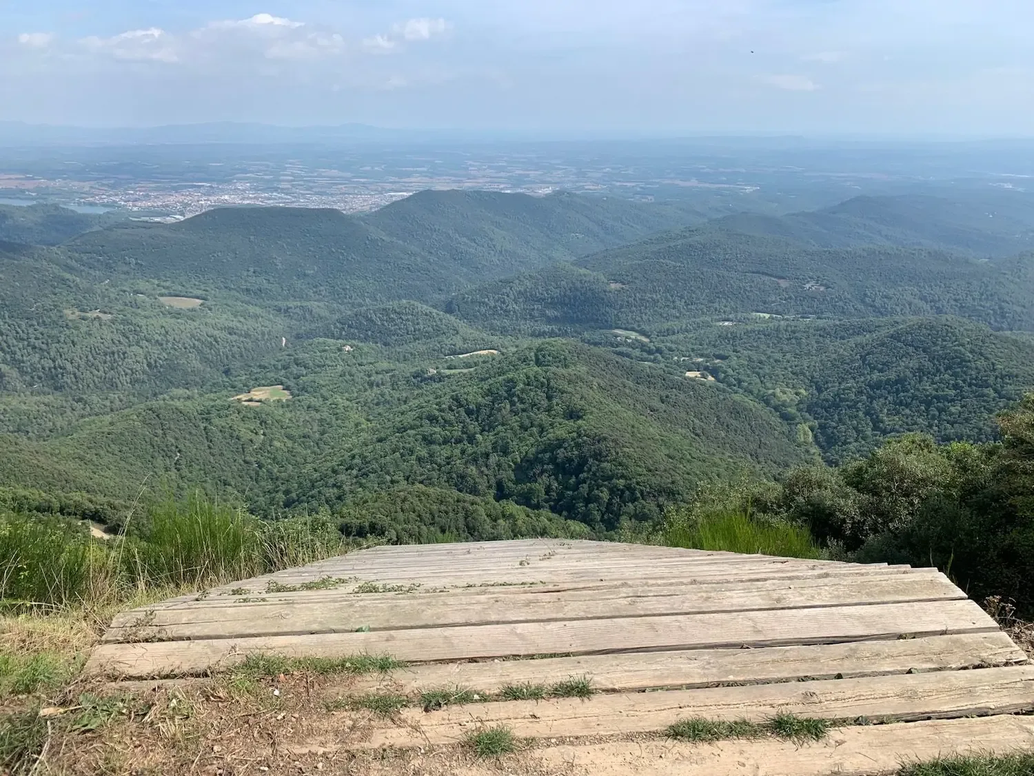
The forest opens near the summit and suddenly you're at the telecom towers and the sticker-plastered Rocacorba Arribada sign, the one every rider who comes to Girona eventually photographs. The view is the payoff: the Garrotxa volcanic hills rolling north, Lake Banyoles catching the light down on the Pla de l'Estany, and on a clear day the Costa Brava as a thin blue line to the east. Worth taking ten minutes up here before pulling on a gilet for the descent.
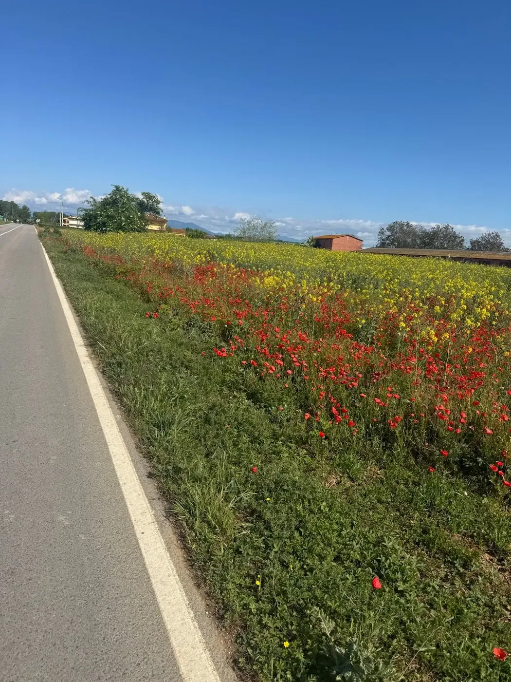
Going back down the same road demands attention — damp hairpins, gravel washed across the apex, and the occasional pine cone. Once you're back through Canet d'Adri the route opens onto the plain again and the final run home is fast and rolling under big Empordà skies, often with a tailwind pushing you toward the spires of the cathedral.

Kilometre by Kilometre
Secondary roads through farmland north of the city — poplar lines, stone masies, the Guilleries and Collsacabra ridges sharpening on the horizon. Easy spin to warm up; traffic is almost gone past the first roundabouts and the gradient barely registers.
The pavement narrows, oak woodland closes in, hamlets tick by. You can feel the climb waiting. The brown El Matamors sign at a shaded hairpin is the unofficial start — from here it's proper Rocacorba.
The peloton's benchmark: Pogačar, Van Vleuten, half the Girona pro scene use this road. Gradient is never consistent — it pitches, eases, then kicks again through holm-oak and chestnut. Damp patches, leaf litter in the corners, no traffic on this dead-end road to the antennas.
The forest opens near the top and you emerge at the telecom towers and the sticker-plastered Rocacorba Arribada sign. Garrotxa volcanic hills rolling north, Lake Banyoles catching the light, and on a clear day the Costa Brava as a blue line to the east. Take ten minutes up here.
Back down the same road — damp hairpins, gravel across the apex, the occasional pine cone demanding attention. Through Canet d'Adri and out onto the plain for the final run home: fast, rolling, often a tailwind, the cathedral spires of Girona reappearing ahead.
A big-sky rolling tempo run across the Selva and the Gironès on quiet secondary roads. The legs are doing the accounting from the climb but the roads keep you moving. Back across the Onyar bridges to coffee in the old town.
Gallery
Route map & elevation profile
Key Climbs
Highlights
- •Rocacorba is the climb the Girona pros use to measure their form. Bradley Wiggins, Chris Froome, and Annemiek van Vleuten have all posted times here. Riding it puts you on the same 9.94 km of tarmac they treat as a serious threshold test.
- •Rocacorba doesn't offer a steady rhythm — it ramps into double digits, eases off just enough to lure you in, then kicks again. The holm-oak forest closes in on the lower slopes before the road finally opens to the antennas and sanctuary at the top.
- •One of the finest viewpoints in Catalonia. On a clear day, the panorama spans from the blue line of the Costa Brava in the east to the Pyrenees in the north, with the Banyoles lake and the Empordà plain spread out below.
- •The Santuari de Rocacorba, a 12th-century sanctuary, sits just below the summit. The battered summit sign, plastered in stickers from every rider who has made the pilgrimage, is a landmark in its own right.
- •The climb is bookended by some of the region's best easy riding: a rolling farm-road spin out of Girona through Canet d'Adri to warm the legs, and a fast, open descent back to the city.
Must know
- ⚠Rocacorba is the ultimate test. It averages 7.4% over 9.94 km, but the gradient is erratic — expect double-digit ramps that kill your rhythm. Pace it conservatively; pros treat sub-30 minutes as a benchmark, but that's a professional standard, not a target for your first attempt.
- ⚠The climb is an out-and-back. The surface on the descent is patchy in places, with cracked tarmac and tight corners in the forest section. Stay off the brakes late and keep your speed in check on the way down.
- ⚠Les Estunes, near the foot of the climb in the Porqueres area, is your natural refuel stop. Open daily with an affordable lunch menu. There are no services on the climb itself, so top up on food and water here.
- ⚠The summit has antennas and the sanctuary, but zero services. Carry what you need for the ascent and descent. La Fábrica back in Girona is the natural post-ride finish.
- ⚠April to June and September to October are the prime months. The forest offers shade, but the exposed summit can be windy and cool even on warm days. Shaded parts of the descent stay damp well into the morning.
- ⚠Rocacorba and Sant Martí Sacalm are the two Girona benchmarks, and this is the harder of the pair. Sacalm is the Cat 2 warm-up; Rocacorba is the Cat 1 test. Build your fitness on Sacalm before tackling this.
Café & Water
- km 26Les Estunes
Your essential stop before Rocacorba, near the foot of the climb. Reliable Catalan home cooking and open daily — perfect for a quick refuel or a sit-down lunch. There is nothing to be had on the climb or at the summit.
- km 71La Fábrica
Girona's most iconic cycling café and the perfect finish to a Rocacorba day. Full food menu, and on weekday mornings you'll often find pro riders — the same ones whose times you were chasing — at the next table.
Frequently asked questions
- How hard is the Rocacorba climb?
- It's a Cat 1 climb, 9.94 km at 7.4%, with an uneven gradient that kicks into double digits. The full loop from Girona is 70.7 km with 1,309 m of climbing. It's the hardest benchmark in the region and a genuine test. Fit riders should plan 3.5–4.5 hours.
- Why is Rocacorba famous?
- It is the primary training benchmark for the Girona-based pro peloton. Bradley Wiggins, Chris Froome, and Annemiek van Vleuten have all used it as a threshold test, and a sub-30-minute ascent is a recognised mark of top form. The climb finishes at a cluster of telecom antennas beside the 12th-century Santuari de Rocacorba.
- How does it compare to Sant Martí Sacalm?
- Sacalm is the gentler Cat 2 climb most riders tackle first in the season. Rocacorba is a steeper, harder Cat 1 with a pro-level reputation. Most build their fitness on Sacalm before taking on Rocacorba.
- Where does the climb start?
- This loop climbs Rocacorba from the Girona side, via Canet d'Adri. You can also climb it from the Banyoles side, which is the shorter approach pros usually take. The mountain is technically called Puigsou; Rocacorba is the sanctuary and the climb, with the summit at around 992 m.
- Where can I get food and water?
- Les Estunes (km 26) is the main refuel stop, open daily with an affordable lunch menu. There is no water at the summit, so carry enough for the entire climb and descent. La Fábrica in Girona is the natural spot at the end of the ride.
- How do I get to Girona?
- High-speed AVE train from Barcelona (35–40 mins). By car, it's 100 km northeast of Barcelona via the AP-7. Girona airport (GRO) has several low-cost connections. The route starts in Girona's old town.
Know a better line?
Submit your local route and get featured with your own author profile, Strava, Instagram and Buy Me a Coffee link.
Share a Route → →Similar routes
Route Details
- Country
- Spain
- Region
- Girona & Costa Brava
For cyclists with some experience. Noticeable climbs requiring fitness.