
About this Route
← Mallorca Cycling GuideOne of the finest 40 kilometres I've ever ridden — and rolling enough to be tougher than the distance suggests. The Ma-2210 runs from Port de Pollença onto the Cap de Formentor peninsula through stacked hairpins and short tunnels cut straight through the limestone, all the way out to the lighthouse at Mallorca's northernmost tip. First comes Coll de sa Creueta up to Mirador des Colomer — the first real effort and the day's first proper view. From there it's short ramps and fast descents the rest of the way out, until the final sweeping bend opens onto Far de Formentor itself — the moment everyone comes here for. Around 880 metres of climbing, a cortado at the lighthouse café, and the best photograph of your trip. The road was built by Antonio Parietti in 1925, the same engineer who later built Sa Calobra.
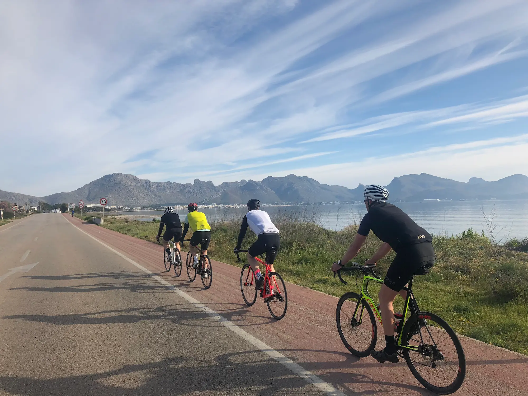
One of the finest 40 kilometres I've ever ridden. The first stretch out of Port de Pollença is flat along the harbour, past the marina and the cafés putting out their chairs. If you've left early, the Ma-2210 is almost yours when it peels north onto the peninsula.
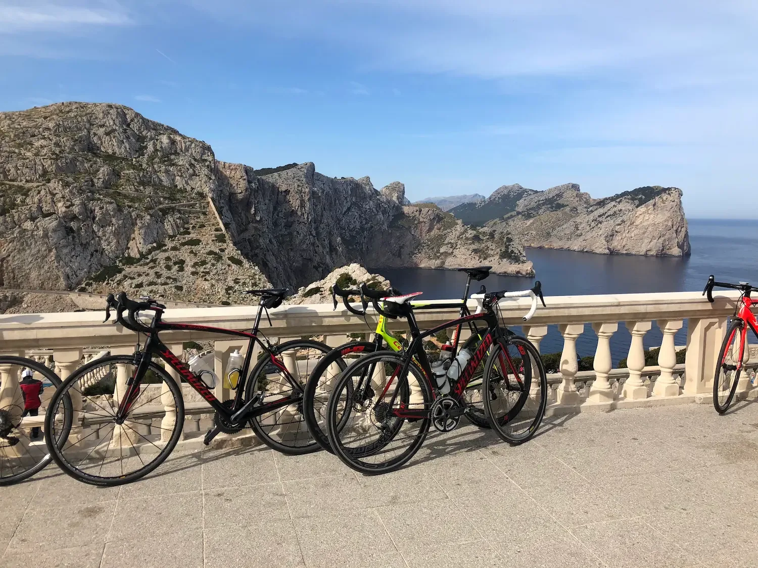
The first real effort is the climb up to Mirador des Colomer — Coll de sa Creueta. Pine forest, hairpins you only just catch through the trees, and then the viewing terrace opens over the Es Colomer islet. Everyone leans their bike against the same stone railing and takes the same photo. Do it anyway. If your legs are good and you don't mind a steeper road on rougher surface, take the small right-hand turn just past Mirador — the road most riders skip. Two and a half kilometres at 10 to 14 per cent up to Talaia d'Albercutx, the old watchtower above the cape. The view from up there is something else.
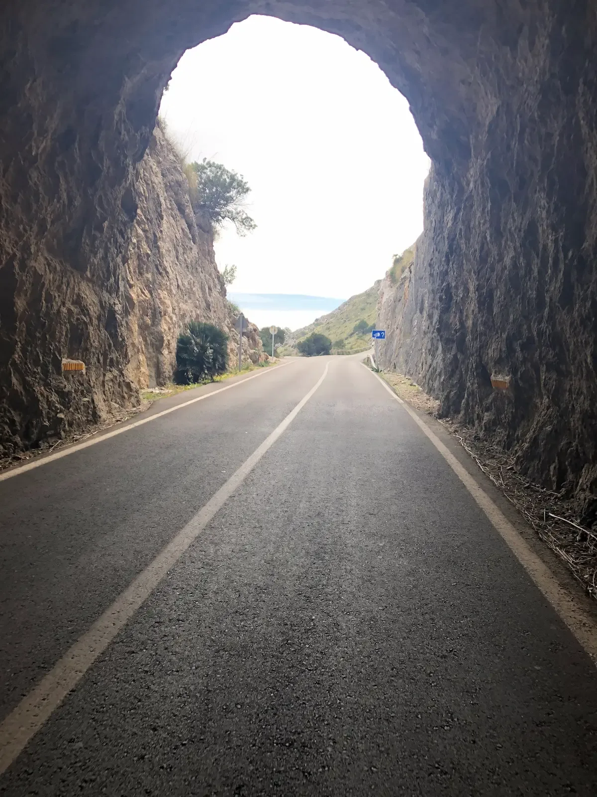
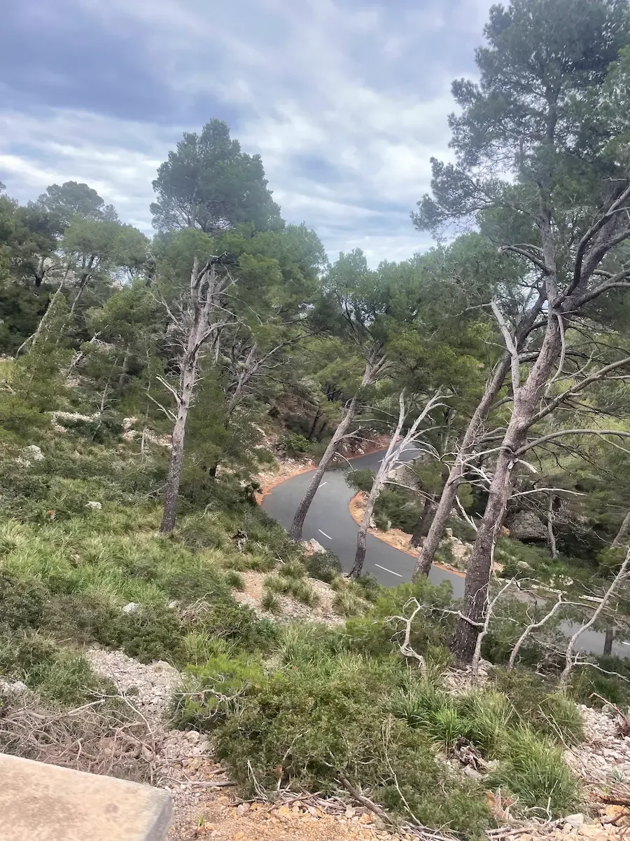
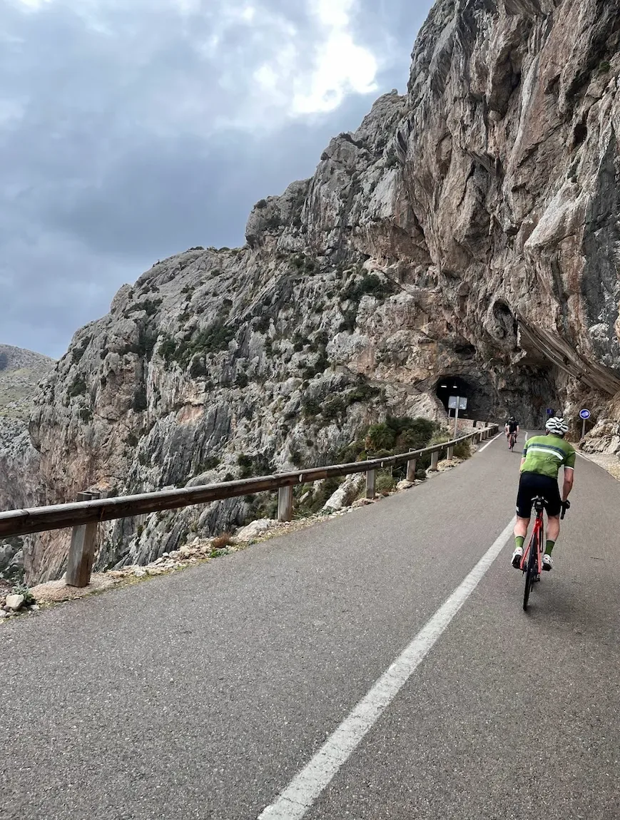
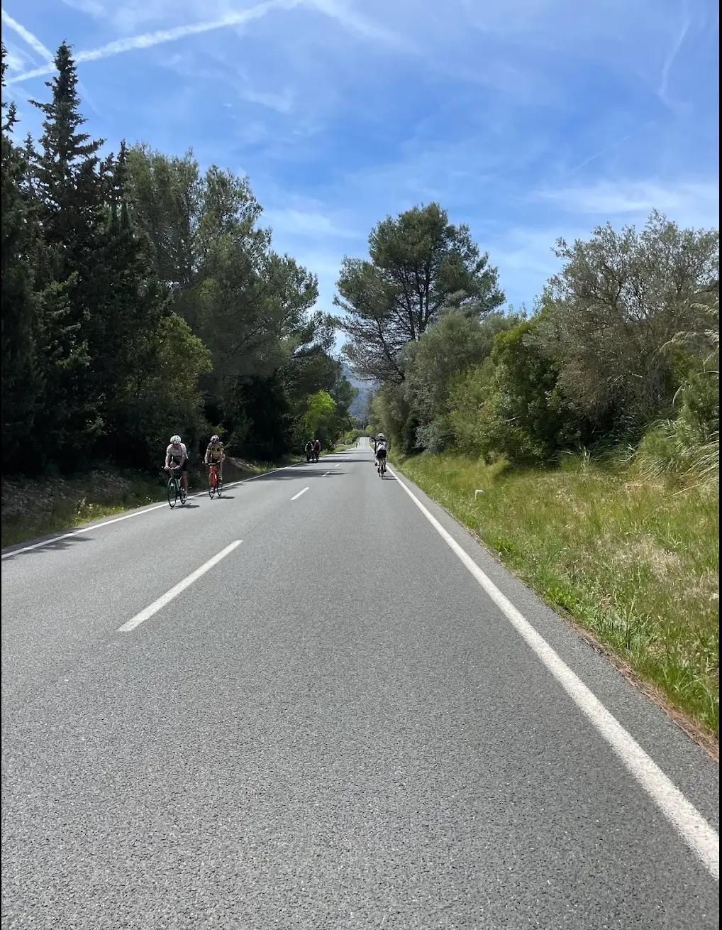
Past the mirador, it's up and down the whole way — short ramps, fast descents, and you're shifting gears constantly. Short tunnels are cut straight through the limestone, and one in particular — the cinematic tunnel-arch — is the photograph you take home. There's no rhythm to settle into out here; the road keeps changing on you.
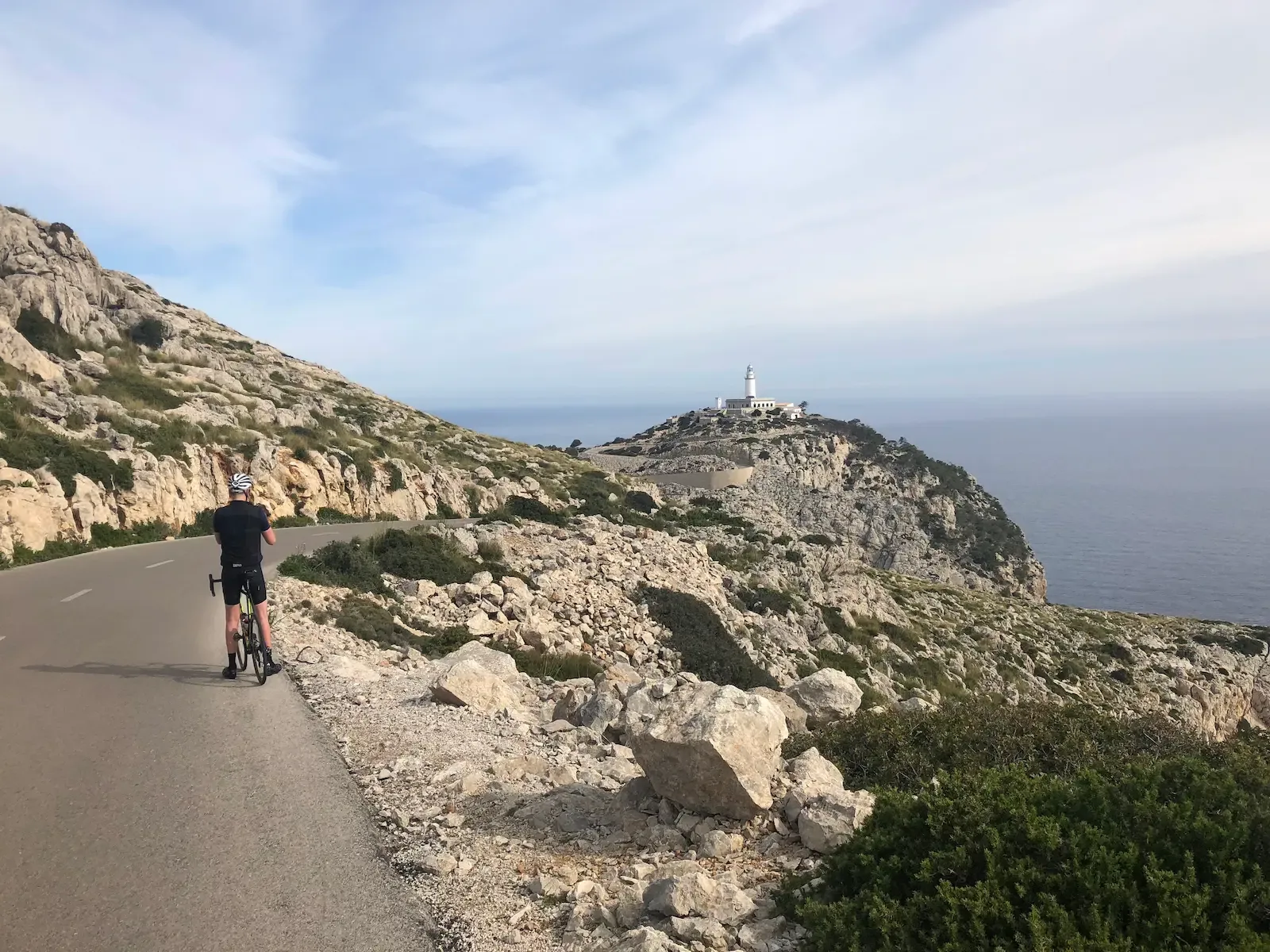
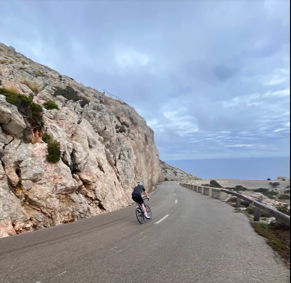
The final ramp out to Far de Formentor is steep and exposed. Scrub and stone, little shade, until the white lighthouse finally shows itself at the end of the cape — still a climb away. Mallorca Cycling Photos has a photographer at the last hairpin where you finally see the tower; smile when you spot it, he's earned it. The café at the lighthouse opens around ten, March to October when the weather holds, and the terrace drops straight to the Mediterranean a couple of hundred metres below. A cortado with that view is worth the climb twice over.
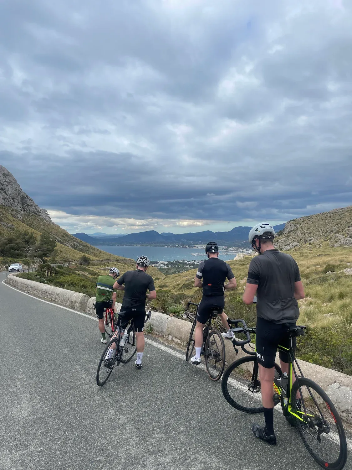
The way back rides like a different road. What was downhill is now uphill, and you barely recognise it. Eventually Badia de Pollença opens up ahead, with the harbour, the town, and the Serra de Tramuntana behind. Back in Port de Pollença, grab an ensaïmada on the seafront and start planning the next one before your legs stiffen up.
The road itself was built by Antonio Parietti in 1925 — the same Mallorcan engineer who later built Sa Calobra.
Kilometre by Kilometre
Flat along the harbour in Port de Pollença for the first kilometres, then the Ma-2210 peels north onto the peninsula. From kilometre 3 the Coll de sa Creueta starts — 3.3 km at 5.9 %, open and exposed, up to the viewing terrace at Mirador des Colomer at 207 m. Just past the terrace a side road climbs right to Talaia d'Albercutx: 2.5 km at 10 to 14 % on rougher surface, an optional detour for an even bigger view.
Past the Mirador the road plunges down the other side — the steepest kilometre touches more than 6 % down. You pass the turn-off to Platja de Formentor on the way down and reach a low point near the sea before the second climb begins around kilometre 10. It's shorter and gentler than Coll de sa Creueta — easy 2 to 3 % that eases you back up.
Up and down the whole way out here — short ramps, fast descents, and you're shifting gears constantly. The road runs through short tunnels cut straight through the limestone, and one in particular — the tunnel-arch around kilometre 13 — is the photograph you take home. It's narrow and unlit, so take off your sunglasses before you ride in. You top out around kilometre 15 at 219 m and hold the height as the road winds out toward the cape.
From kilometre 20 the road opens onto the final ramp out to the lighthouse — 3.5 km averaging 3.5 %, steeper at the end. Scrub and stone, little shade, and Mallorca Cycling Photos has a photographer at the last hairpin where you finally see Far de Formentor itself. Smile for the camera, then push on up to the café terrace at the lighthouse.
You roll fast down from Far de Formentor — what was a climb is now a descent. From kilometre 30 the climb back up to Mirador des Colomer begins, this time from the north side — 4 km at 4.8 % through pine forest where the hairpins barely show between the trees. Past Mirador you drop down Coll de sa Creueta back into Port de Pollença, and barely recognise the route from the way out.
Gallery
Route map & elevation profile
Key Climbs
Coll de sa Creueta
Cat 3Mirador Formentor
Cat 3Highlights
- •Coll de sa Creueta — The first real climb up to Mirador des Colomer at 207 m. 3.3 km at 5.9 %, open and exposed, with Pollença Bay growing larger behind you.
- •Mirador des Colomer — The viewing terrace over the Es Colomer islet and the coastline down to Cala Figuera. The classic stop-and-photo moment halfway out.
- •The tunnel-arch around km 13 — A limestone tunnel cut straight through the cliff, narrow and unlit. The photograph you take home from the ride.
- •Far de Formentor — The lighthouse at Mallorca's northernmost tip, and the emotional peak of the ride when you round the final bend. Café terrace above the Mediterranean.
- •Talaia d'Albercutx (optional detour) — Old watchtower 2.5 km to the right just past Mirador des Colomer. 10 to 14 % on rougher surface, but the view over the cape is something else.
Must know
- ⚠Start early. Less traffic, better light, and the café opens around the time you come back down. Bonus: the sun isn't in your eyes on the first kilometres heading north onto the peninsula.
- ⚠The tunnels are unlit. Take off your sunglasses before you ride in. The road is narrow and traffic comes both ways.
- ⚠The wind on the cape can be strong. It is called "the meeting point of the winds". Exposed sections — especially near Mirador des Colomer and on the final ramp — can have heavy crosswinds. Check the forecast.
- ⚠Closed to cars in high season. From 15 May to 15 October the Ma-2210 is closed to cars 10:00–22:00. Bikes are always allowed. That makes summer rides more attractive than people expect.
- ⚠The café opens around ten. Cafeteria Far Formentor is typically open 10:00–16:00 March to October, but it's not guaranteed. Fill your bottles in Port de Pollença before you set off.
- ⚠The Talaia detour is only for confident climbers. 2.5 km at 10 to 14 % on rough surface. Needs good legs and low gearing. Skip it if you're not sure.
Café & Water
- km 22Cafeteria Far Formentor
Café with a terrace that drops straight to the Mediterranean. Coffee, water and light food. Typically open 10:00–16:00 March to October, but not always. Recommended: a cortado on the terrace with the view.
- km 9Beach café at Cala Formentor
Beach café with a terrace for a short stop if you want to break up the climb, or for a swim on the way back. Light food, drinks, and water refills.
- km 39Tolo's Club / Marina Bar
Two recommended stops along the harbour in Port de Pollença. Both are solid choices for coffee, an ensaïmada, and a debrief after a Cap ride.
Frequently asked questions
- Should I do Cap de Formentor on its own, or as part of the Sa Calobra loop?
- Cap de Formentor on its own (this route) is 39 km out-and-back with 880 metres of climbing — perfect for arrival day or a shorter day on the bike. The Sa Calobra loop is an epic 130+ km day that opens with Cap de Formentor and adds Sa Batalla and Sa Calobra. If you have one day on Mallorca, take Cap de Formentor on its own. If you have a big day in the legs, take the long one.
- Is the ride suitable for beginners?
- It's technically manageable on paper — moderate rating, short distance, no extreme steep climbs on the main road. But the rolling terrain demands constant gear changes and makes the ride tougher than the distance suggests. If you're comfortable with descents and rolling terrain, it's accessible. Skip the Talaia detour.
- When is the best time to cycle Cap de Formentor?
- March to May, or September to early November — mild weather, fewer tourists, and the café usually open. Summer is too hot in midday, but early morning works (start before 8). Winter is possible if the wind is calm, but the café is closed.
- What about car traffic on the Ma-2210?
- From 15 May to 15 October the road is closed to cars 10:00–22:00 (with exceptions for buses, taxis and residents with permits). Bikes are always allowed. Other seasons have car traffic all day, so an early start is recommended to avoid the tourist crowds.
- Should I take the Talaia d'Albercutx detour?
- If you have good legs and low gearing, yes. 2.5 km at 10 to 14 % on rougher surface, up to an old Saracen watchtower with 360-degree views. Skip it if you're not sure of your climbing form or have a tight schedule.
- What about water and food on the route?
- The only reliable stop along the way is Cafeteria Far Formentor at the top, and only if it's open. Fill your bottles in Port de Pollença before you set off, and take snacks for the way out.
Know a better line?
Submit your local route and get featured with your own author profile, Strava, Instagram and Buy Me a Coffee link.
Share a Route → →Similar routes
Cap Formentor, Sa Batalla & Sa Calobra
Same Cap Formentor opening, then continues into the full queen stage
Port de Pollença to Alcúdia Bay rest-day loop
Same Pollença base — flat alternative for rest day
Coll de Femenia & Sa Batalla Loop
Same base, first proper mountain day after the Cap Formentor warm-up
Route Details
For cyclists with some experience. Noticeable climbs requiring fitness.