
Estepona — Sierra Bermeja Loop
About this Route
A brutal and beautiful loop from Estepona harbour that climbs Sierra Bermeja's red peridotite flanks to 969 metres — with views of Gibraltar and the African coast — before winding through the white villages of inland Andalusia and descending back to the Mediterranean. One of the most concentrated climbing experiences in southern Spain, compressed into 89 kilometres.
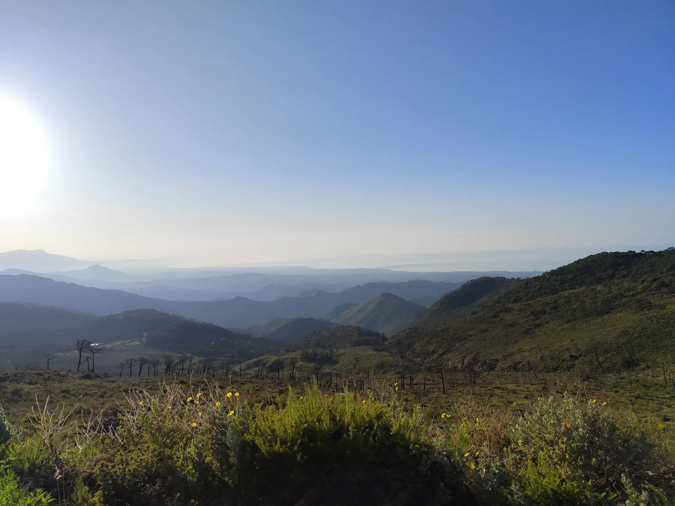
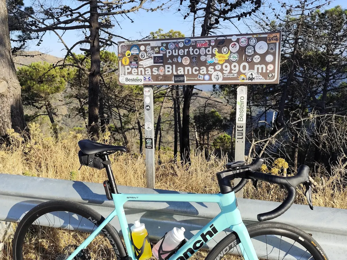
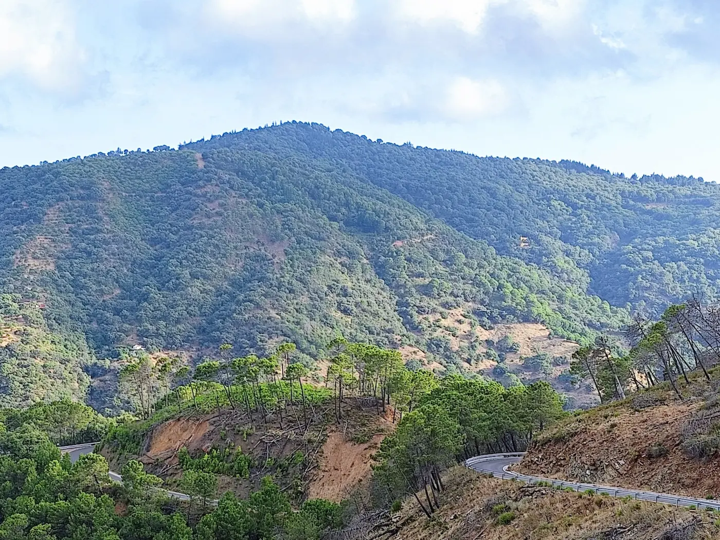
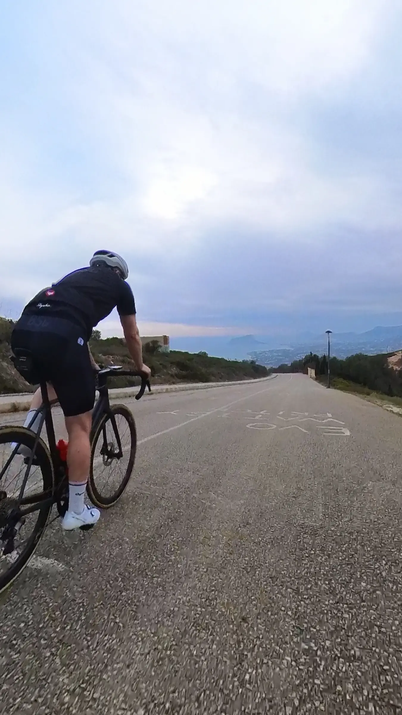
The opening sets the tone: the road climbs straight out of Estepona harbour and barely lets up for the first 16 kilometres. This opening climb is Peñas Blancas, the route's Hors Catégorie monster. The MA-8301 is legendary for having virtually no straight sections — an endless succession of hairpins through dense Pinsapo forest, a protected Spanish fir that grows almost nowhere else in the world. By the time the summit area at Los Reales opens up at 969 metres, the better part of a thousand metres of climbing are in the legs and the coast is far below. On clear days the view stretches from Gibraltar to the Moroccan Atlas — two continents visible from the same saddle.
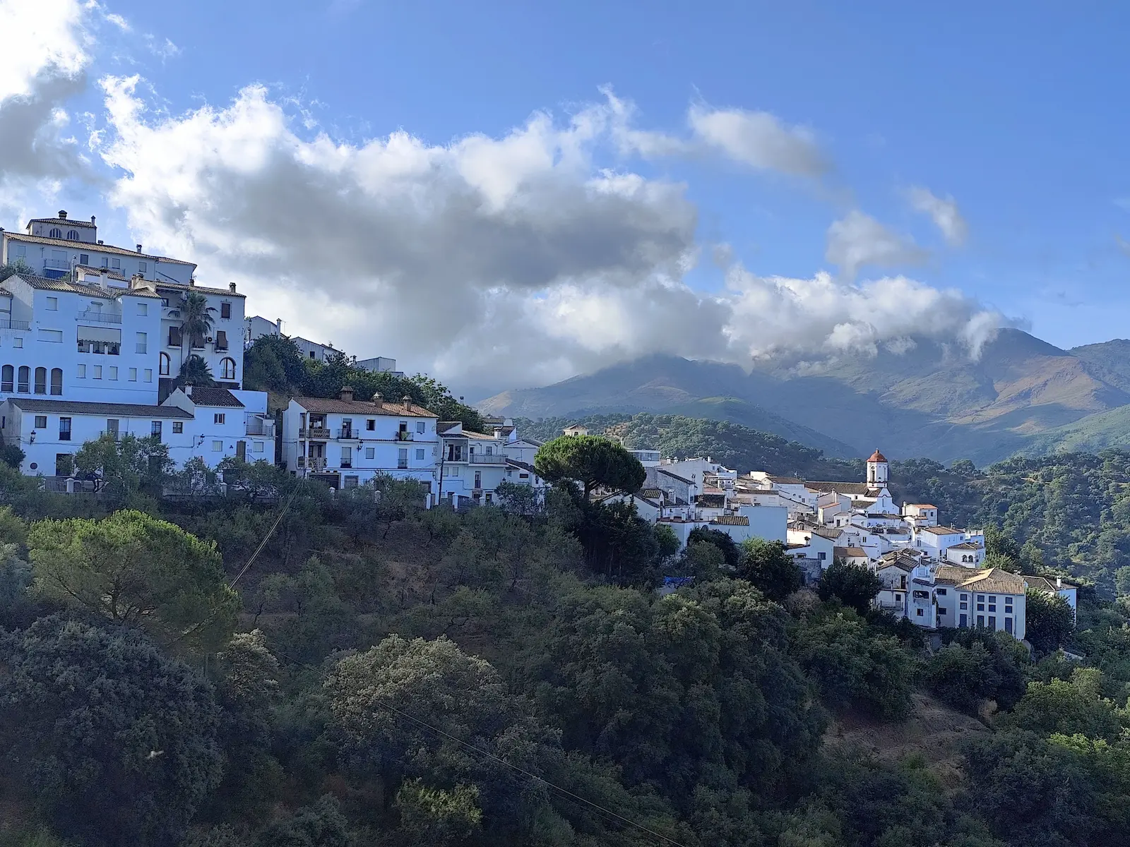
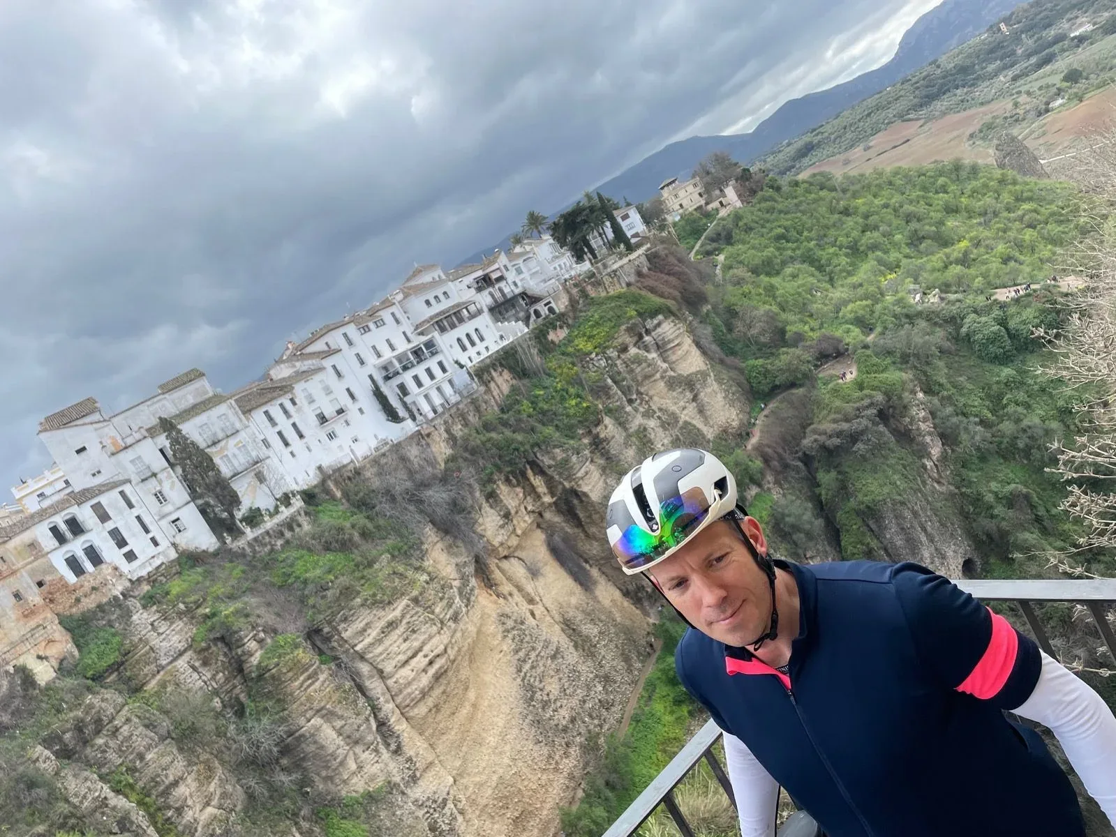
What comes next is what makes the route. After the descent into the Andalusian interior, the landscape shifts entirely — from red peridotite rock to the olive groves and whitewashed hilltop villages of the Pueblos Blancos. Gaucín is the natural lunch stop, a quiet square with a couple of good restaurants well suited to cyclists on a long day. From here the return leg is anything but flat: another 500+ metres of climbing through a series of ridges — the A-377 ramp and the climb to Genalguacil among them — as the sting in the tail before the final descent back to the Mediterranean.
Sierra Bermeja traps heat in summer — spring and autumn are the ideal seasons, and the winds (Levante from the east, Poniente from the west) can be real on the exposed upper sections. Come when the temperatures are moderate, pace yourself on the lower slopes, and this is one of the finest mountain days in southern Spain.
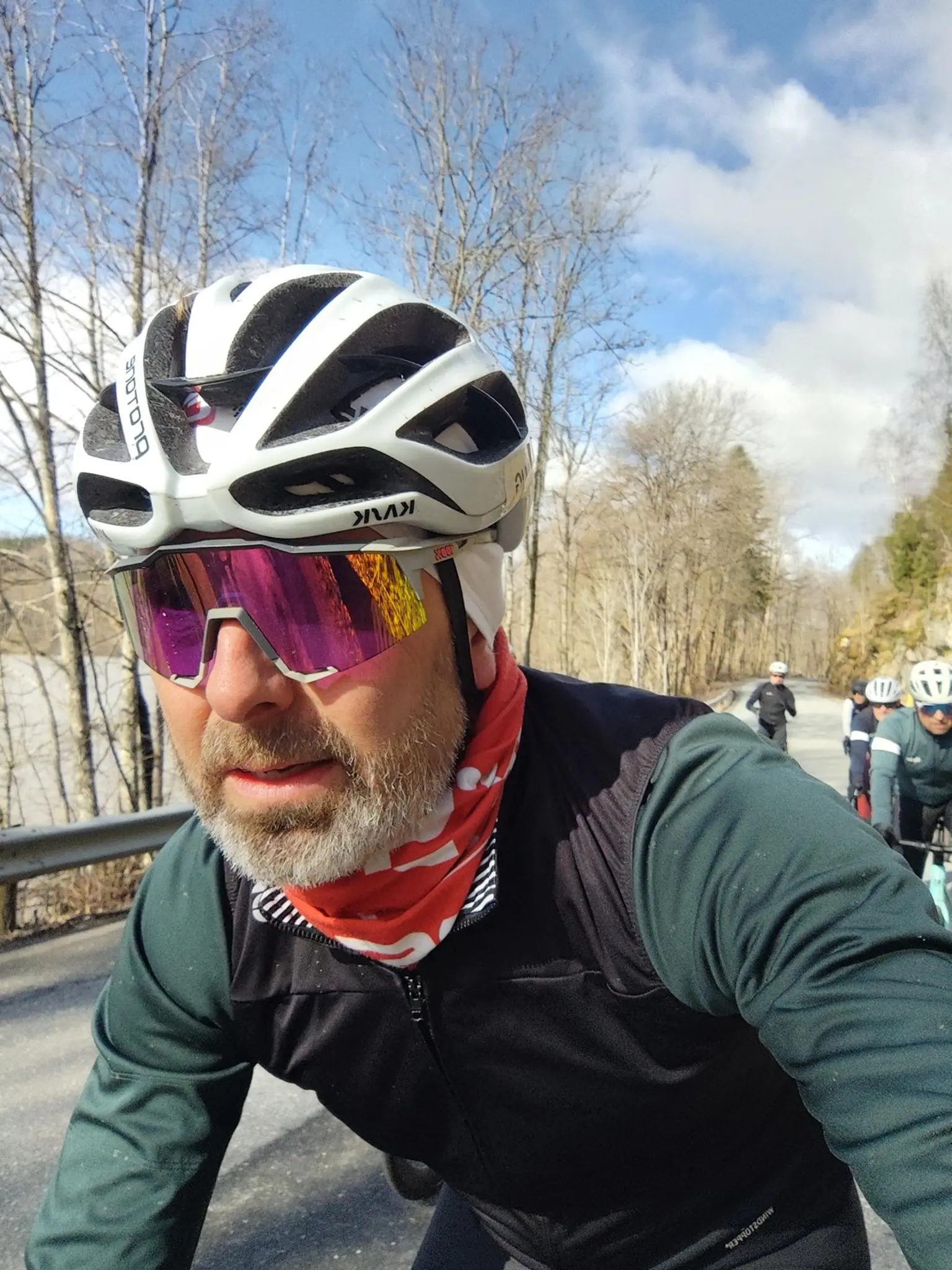
I rode this in July 2025. Sierra Bermeja in summer is not the textbook choice — the heat builds fast on the lower slopes and the upper sections are exposed — but we started early and it was more than worth the effort.
Beautiful surroundings and an endless number of hairpins. That is how I would describe this route in one line. It is quite a hard day out — I will not pretend otherwise — but so worth it. The climb out of Estepona is relentless. The hairpins just keep coming, one after another, winding up through the pine forest with the sea dropping away behind you. There are hardly any flat metres to recover on. At the top, though, the views make the effort make sense — the Mediterranean on one side, Africa visible on a clear day, Gibraltar down the coast.
Gaucín is the right place to stop for food on the return. There are a couple of restaurants to choose from on the square and it breaks the ride up at the right point. One warning: do not start too hard. There is a lot of climbing after Peñas Blancas that catches people out if they have spent everything on the first summit.
Kilometre by Kilometre
The route leaves Estepona harbour and wastes no time. The climbing begins within the first kilometre and builds relentlessly up the MA-8301 — a road with virtually no straight sections — through dense Pinsapo forest to the Los Reales summit area at 969m. Over 950 metres of elevation in 16 kilometres. The views back over the Costa del Sol and across to Africa open up progressively as you climb.
After the summit the route descends into the Andalusian interior. The landscape changes completely — from the red peridotite rock of Sierra Bermeja to a quieter, more sheltered valley with olive groves and the classic white villages (Pueblos Blancos) clinging to the hillsides. The El Espino climb stiffens the legs on the run-in before Gaucín, the natural stop for food and water at km 55.
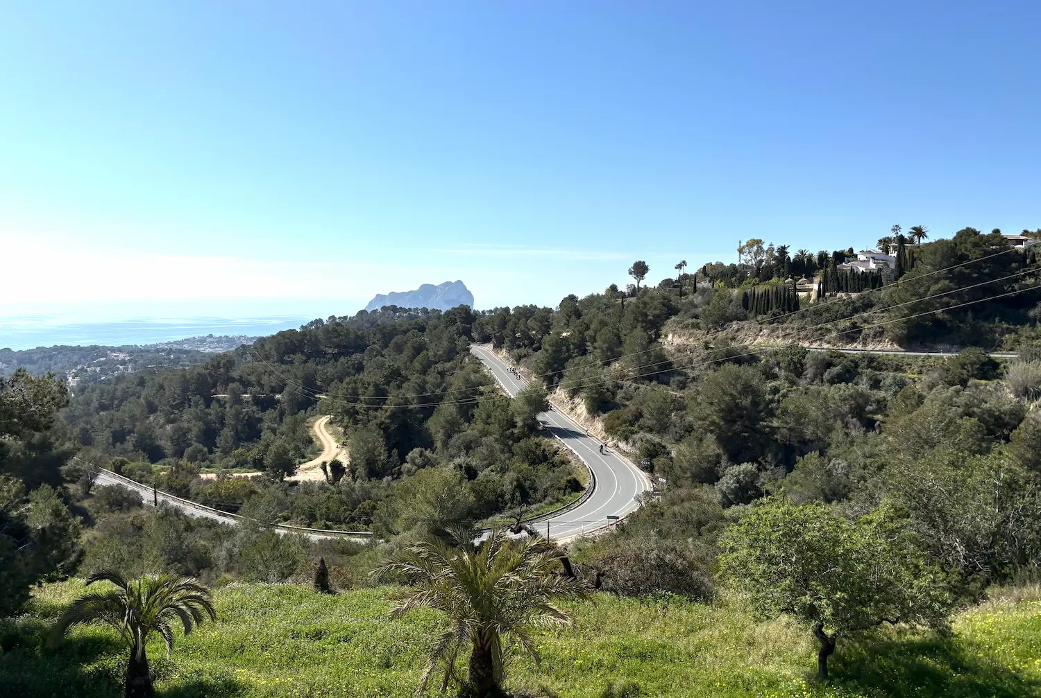
The return leg is far from flat. The route drops into the Genal valley before climbing back over a series of ridges — the A-377 ramp and the rise towards Genalguacil among them — with another 500+ metres of ascent and the legs already feeling the morning's efforts. The roads are quiet and the scenery is Andalusian at its finest.
The route finds its way back down to the coast through a series of sweeping descents. The Mediterranean comes back into view and the air warms noticeably as you lose altitude. The final kilometres bring you back through Estepona and to the harbour where the ride began.
Gallery
Route map & elevation profile
Key Climbs
Highlights
- •Peñas Blancas: A brutal 14-kilometre grind straight from sea level to 969m. A legendary Hors Catégorie climb that serves as the ultimate test for your climbing legs.
- •The view towards Africa: On clear days the Los Reales ridge gives you Gibraltar and the Moroccan coast across the water. One of the strangest views you'll earn on a bike.
- •The Sierra Bermeja pinsapo forest: The road winds through one of the last stands of Spanish fir – a protected ancient forest found only in these coastal mountains.
- •White villages and empty roads: The route drops into the remote Genal valley past Gaucín with its Moorish castle perched above the valley. Narrow roads, almost no traffic.
- •Four passes in one day: Peñas Blancas, El Espino, Genalguacil and the A-377 ramp. With four categorised climbs in under 90 kilometres, the legs never get a free kilometre.
Must know
- ⚠Don't underestimate the distance: 89 kilometres sounds manageable, but with 2,600 metres of climbing and intense Sierra Bermeja heat, it's a long, heavy day. Out of Estepona harbour before 8am.
- ⚠Peñas Blancas is a genuine HC: A real fitness and equipment test — not a standard Cat 1. Find your rhythm from the first pedal stroke. Three more serious climbs wait after the summit.
- ⚠Water desert for the first 55 km: There are no reliable water stops between Estepona and Gaucín. Start with full bottles and use every opportunity to refill.
- ⚠Mandatory lunch in Gaucín: The village at km 55 is your only real food and water stop. Eat properly — the last 34 kilometres home still require serious effort.
- ⚠Watch for Atlantic gusts: Sierra Bermeja catches Atlantic wind. Check the forecast — strong gusts on the fast, technical descents can be dangerous.
- ⚠Season: March–May and September–November. Midsummer turns these mountain slopes into a furnace. November can bring fast-moving weather with rain and mist on the summits.
Café & Water
- km 55La Esquinita
The only reliable stop on the route. Eat properly and fill your bottles here — the first 55 kilometres have no guaranteed refuel points, and you need fuel for the final 34 home to Estepona.
Frequently asked questions
- How hard is Peñas Blancas really?
- It's a genuine Hors Catégorie (HC) climb – literally meaning 'beyond category'. Starting 14 kilometres of climbing straight from the beach will completely grind down your legs if you open too hard. Sit in, spin a sensible gear, and save some energy for the three climbs that follow the summit.
- How long does this route take?
- Most active cyclists will clock between 6 and 8 hours total, including stops. Get out early — Sierra Bermeja gets seriously hot by midday, and you don't want empty bottles or dead legs when the technical descents require concentration.
- What's the food and water situation?
- Gaucín at km 55 is your only guaranteed refuel point. The first 55 kilometres — including the entire Peñas Blancas climb — have no reliable stops. Start with full bottles from Estepona harbour and don't pass Gaucín without stopping.
- When is the best time of year?
- Spring (March–May) and autumn (September–November) are the prime months. Avoid midsummer — from June to August these slopes become a furnace. November can bring fast-changing weather with mist and wind on the summits.
- Do I need special gearing?
- Yes — a compact chainset (50/34) with at least a 32t cassette makes Peñas Blancas significantly more manageable. Carry enough tubes and tools as you are a long way from a bike shop, and run a rear light on flash through the forested sections.
- Can I shorten the route?
- No — this is a big, remote loop with no easy shortcuts back to the coast. Gaucín at km 55 is the only realistic bail-out point if you completely blow up. Go in mentally prepared to finish the entire loop.
Know a better line?
Submit your local route and get featured with your own author profile, Strava, Instagram and Buy Me a Coffee link.
Share a Route → →Similar routes
Marbella - Ronda - Marbella
Adjacent Costa del Sol epic — Ronda mountain town instead of Sierra Bermeja
Calpe — Cumbre del Sol
Different Spanish coastal climb — steeper Cumbre del Sol benchmark
Calpe — Coll de Rates
Costa Blanca's iconic climb — comparable steady-gradient character
Route Details
- Country
- Spain
- Region
- Costa del Sol
Elite level. Extreme elevation, altitude and distance. Serious preparation required.