About this Route
← Western Fjords Cycling GuideFrom the UNESCO-listed Geirangerfjord at sea level, climb 1,500 metres to Dalsnibba — one of Norway's longest and most spectacular HC climbs, with 35 hairpin bends — 11 of them on the Nibbevegen toll road up to the Geiranger Skywalk — and Europe's highest fjord view from a road. The route continues through Stryn before finishing at the ferry quay in Hellesylt, where the boat returns to Geiranger across the fjord.
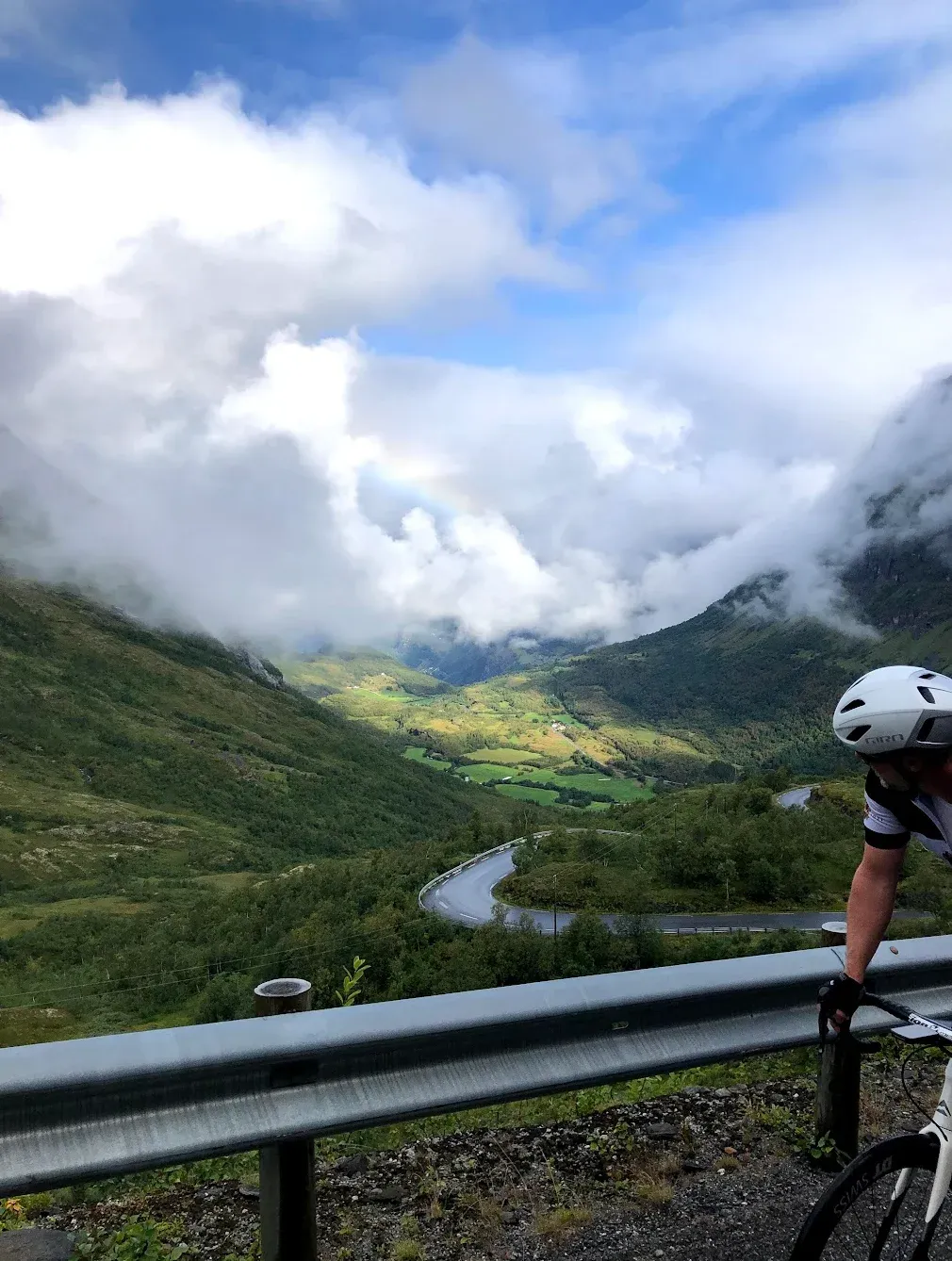
When I rode this in August 2021, I started from the waterfront in Geiranger at sea level and the climbing began within the first kilometre. There is no warm-up here — the road tilts upward immediately and does not relent for 21 kilometres. The lower section follows the main road out of Geiranger before branching onto the Nibbevegen toll road. Cyclists pass the barrier without dismounting. The gradient on Nibbevegen reaches 12.3% in places and the hairpins are tight — I counted them to keep my mind off the effort.
At 1,500 metres the Geiranger Skywalk appeared through the clouds. The day I was here the visibility was perfect — the cruise ships in Geirangerfjord looked like bath toys far below. The cafe at the summit is excellent and I needed every calorie it offered. Dalsnibba is rated the fifth hardest climb in Norway by PJAMM, and after riding it I have no reason to argue.
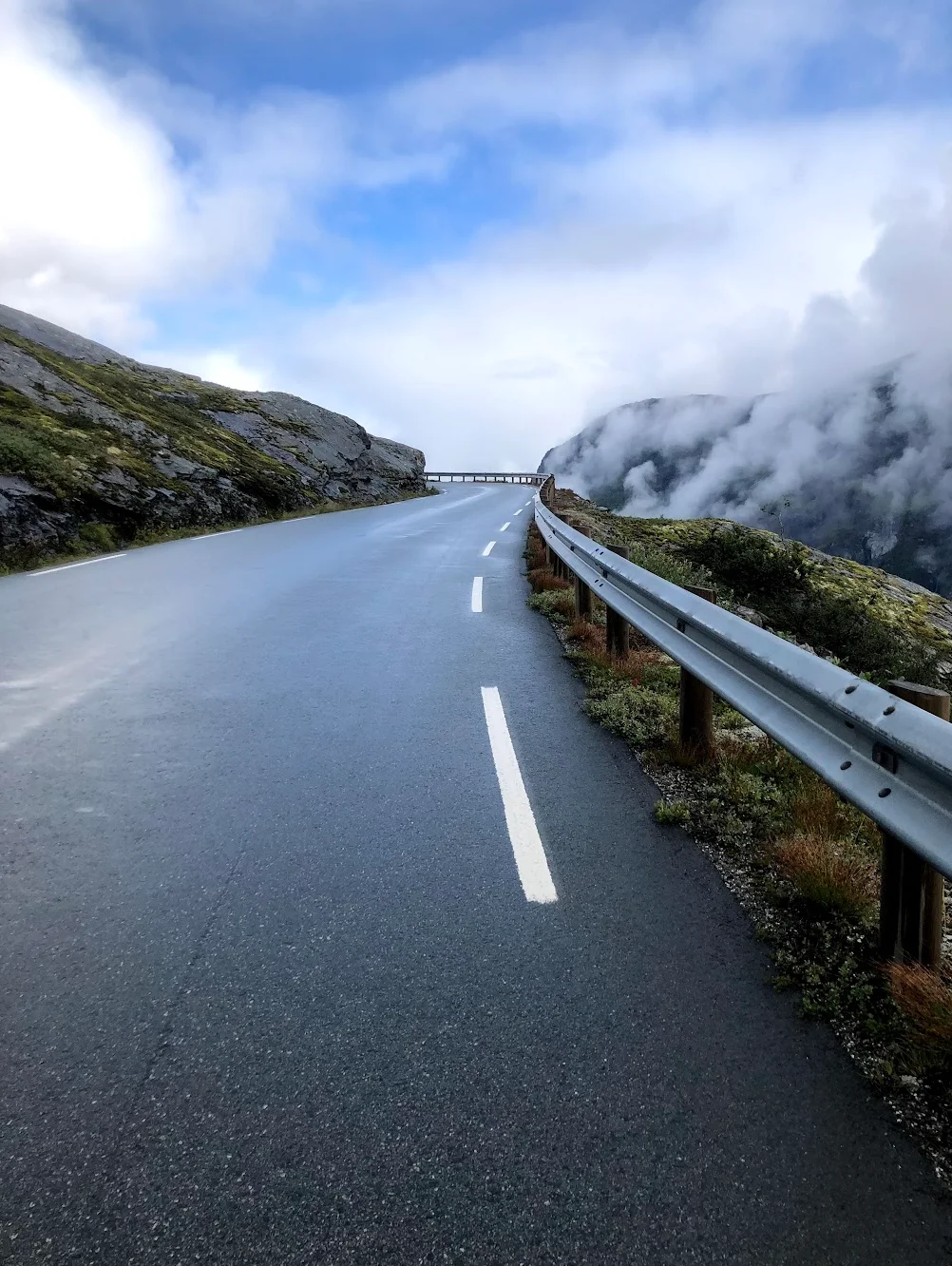
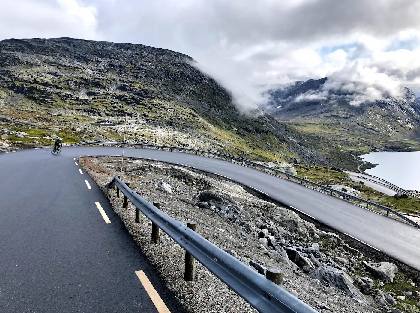
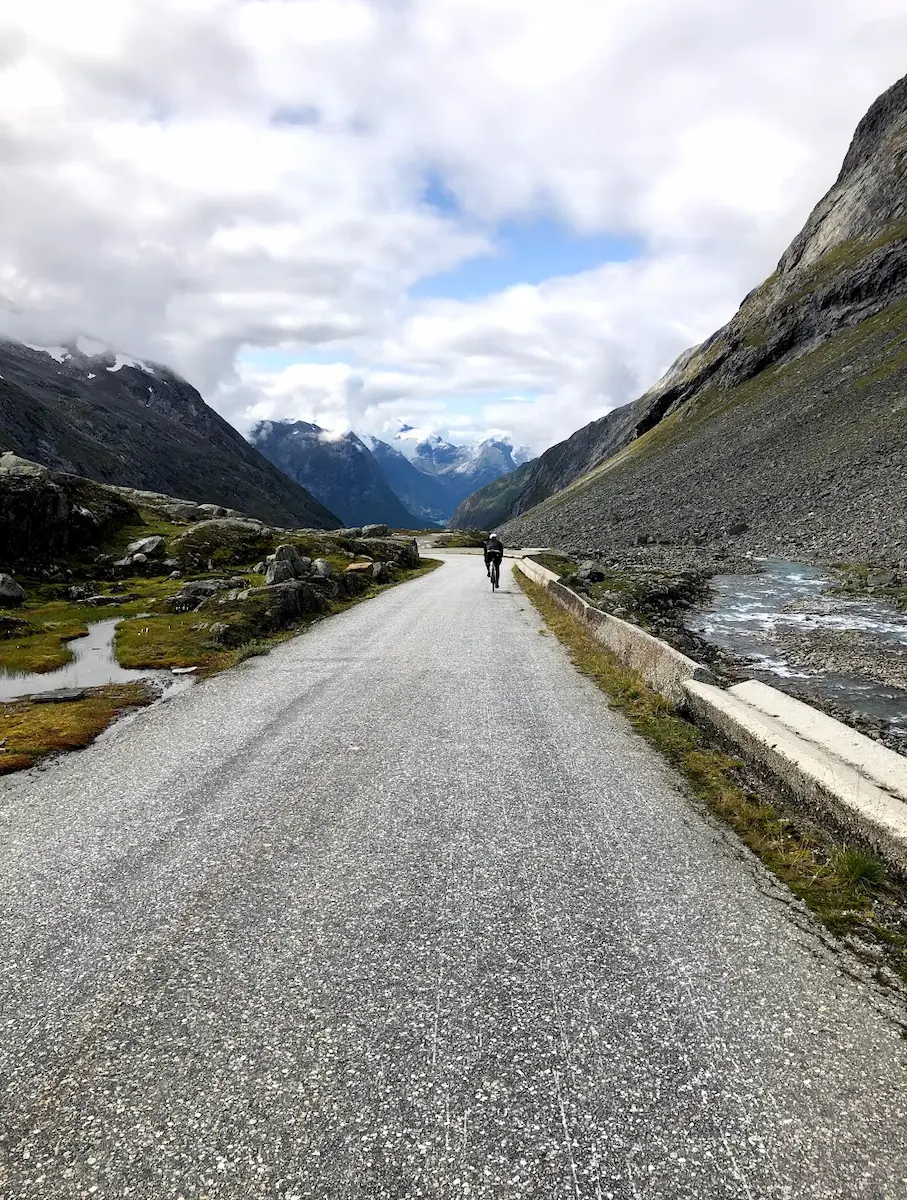
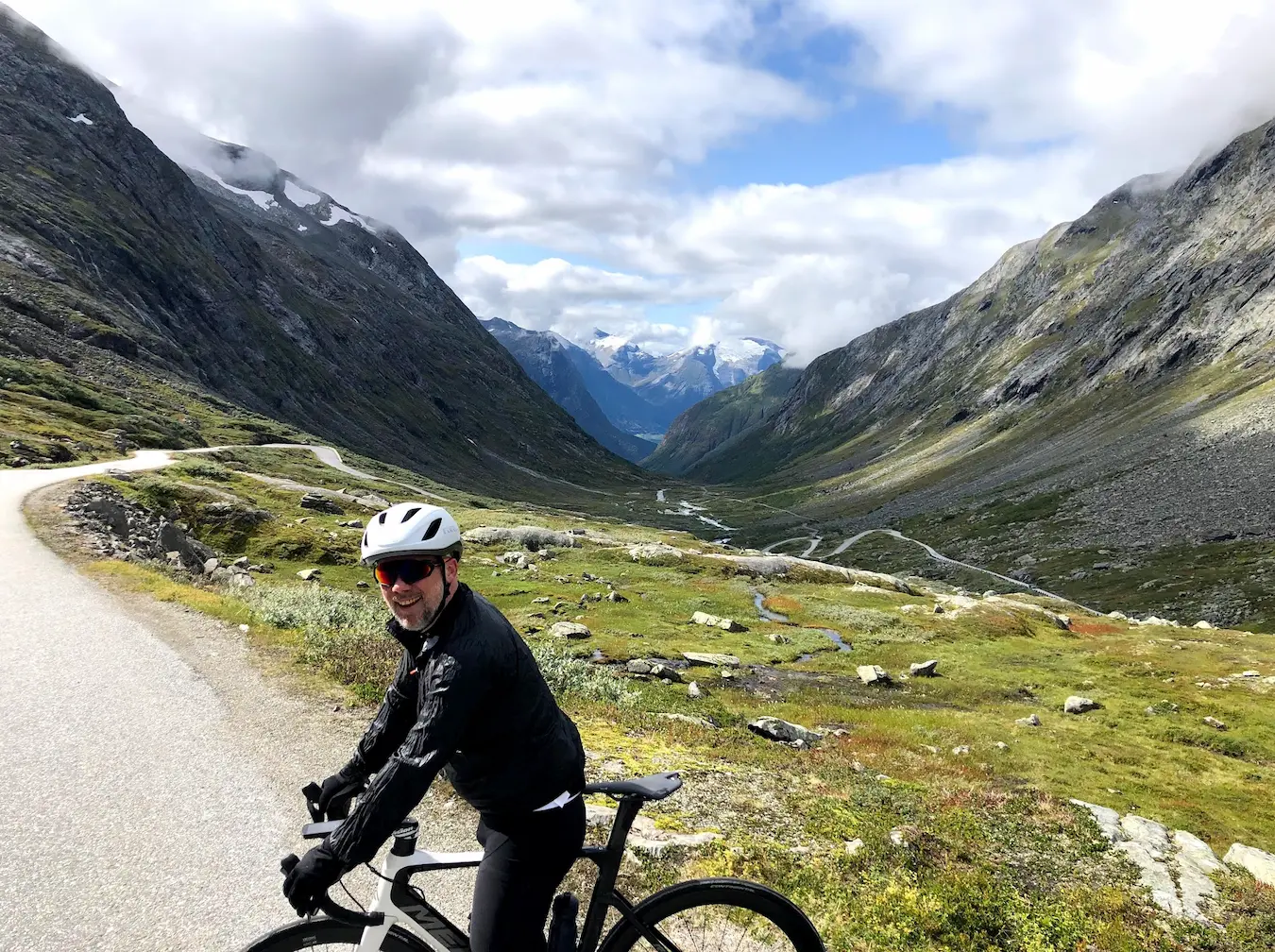
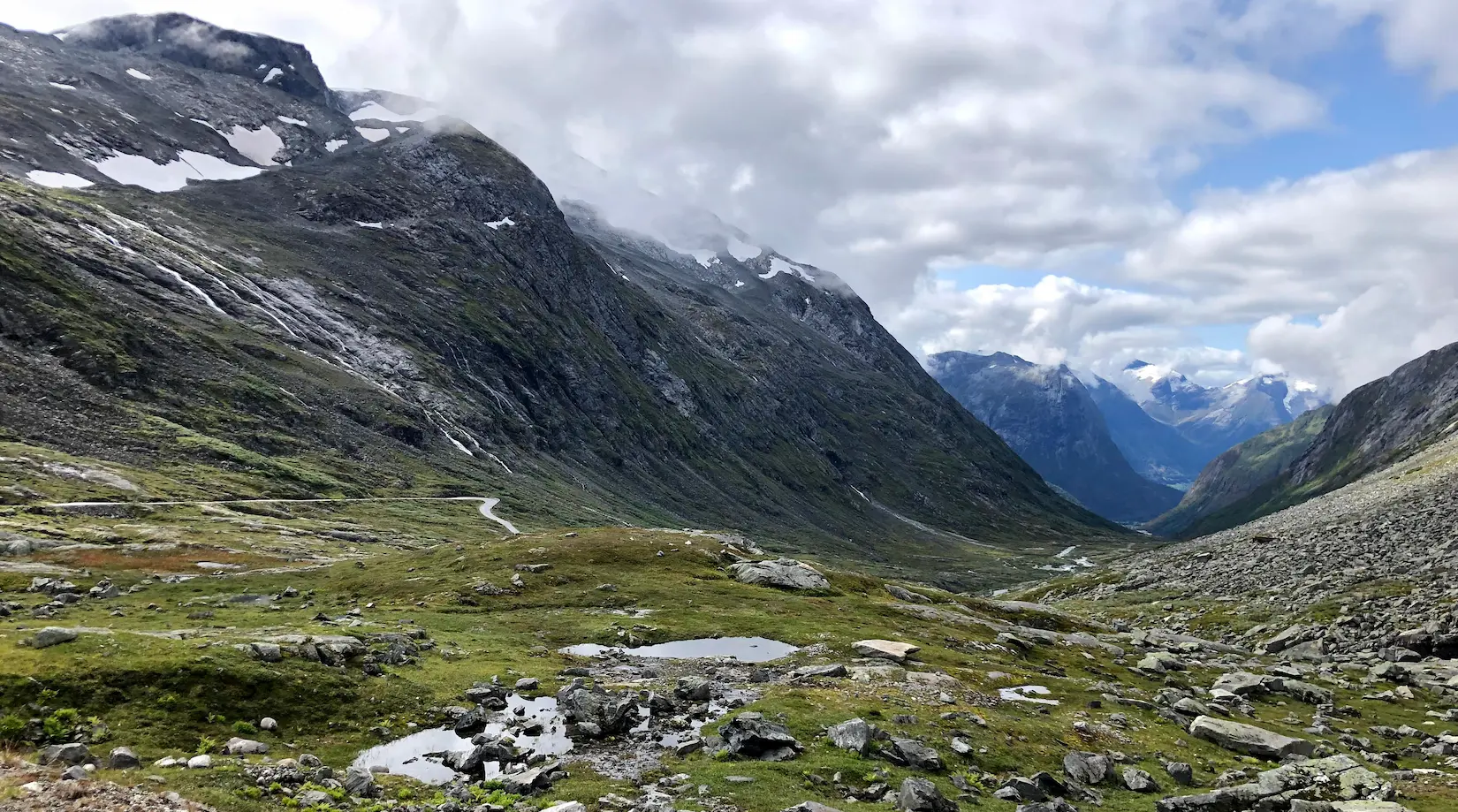
The descent back from the summit is fast and the road surface is good, but temperatures dropped sharply — I was glad to have arm warmers. From the main road the route heads east and then south toward Grotli before turning onto Gamle Strynefjellsvegen. This historic mountain road was built by hand between 1889 and 1894, and it shows — the road is narrow, the surface rougher, and the scenery feels almost untouched. It climbs to over 1,100 metres before dropping through a series of dramatic switchbacks. This section was the surprise of the day. I had come for Dalsnibba but the old Strynefjell road was equally memorable.
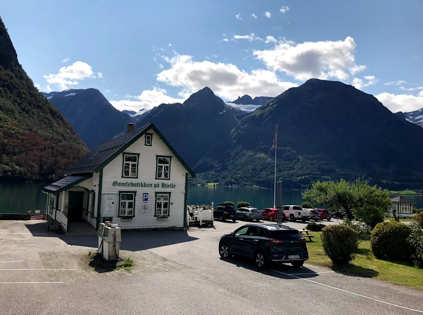
The descent from the old road brings you to Hjelle, where Gamlebutikken is the perfect lunch stop — exactly where you need it after five hours of mountain roads. From Hjelle the route continues west through Stryn and along the fjord toward Hellesylt. This final stretch is mostly flat and fast, a welcome relief after over 2,500 metres of climbing.
The ride ends at the Hellesylt ferry quay. The boat back to Geiranger takes about an hour through the UNESCO-listed fjord, past the Seven Sisters and Bridal Veil waterfalls. Sitting on that ferry with empty legs and a cold drink, watching the same mountains I had ridden over slide past at water level — that was a fitting end to one of the best days I have ever had on a bike.
Kilometre by Kilometre
From Geiranger centre the Dalsnibba climb begins immediately — no warm-up. 21km at 7% average to the Geiranger Skywalk at 1,500m. The gradient steepens on the upper Nibbevegen toll road (cyclists pass the barrier without dismounting). At the summit, the Skywalk café offers coffee with continental Europe's highest fjord view from a road.
A long descent from Dalsnibba before the route heads west through dramatic mountain terrain. The historic Gamle Strynefjellsvegen — built in 1889 — is one of Norway's most celebrated mountain roads. At km 85 you reach Gamlebutikken in Hjelle: an excellent lunch stop with spectacular views, perfectly timed at the bottom of the Strynefjell descent. From here it is largely flat into Stryn.
From Hjelle the road is mostly flat through Stryn and along the fjord toward Hellesylt. You arrive at the Hellesylt ferry quay at km 162. The ferry back to Geiranger takes approximately 60 minutes through UNESCO-listed fjord scenery past the Seven Sisters and Bridal Veil waterfalls — a perfect end to the day.
Gallery

Route map & elevation profile
Key Climbs
Highlights
- •Geiranger Skywalk at 1,500m — Europe's highest fjord view by road, and the top of an HC climb you take on a bike
- •Hellesylt–Geiranger UNESCO ferry: 1 hour through the world's most dramatic fjord
- •Mystical cloud layers during the Dalsnibba climb — first kilometres near 8%
- •The final 4.5 km to the Dalsnibba plateau averages 9.5% — fryktelig bratt
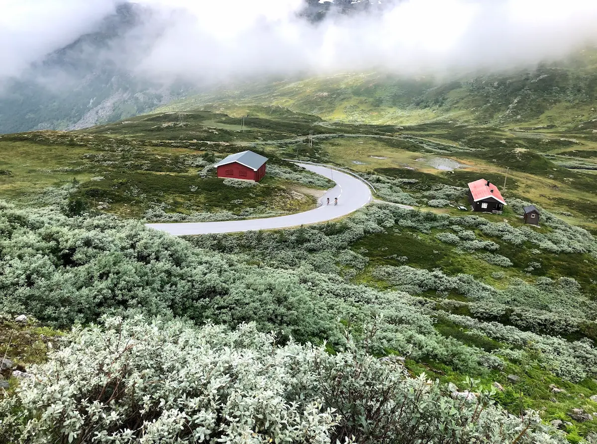
- •Lunch at Gamlebutikken på Hjelle by turquoise Oppstrynsvatnet — sun and snow-capped peaks
- •Gamle Strynefjellsveg — historic mountain road on asphalt, with a short gravel plateau at the top before it drops toward Stryn
- •Sveler with brunost or smørkrem on the ferry — both are correct answers
Must know
- ⚠Geiranger Skywalk sits at 1,500m (the Dalsnibba peak itself is 1,476m) — clouds can close in fast. Tommy rode in August and saw nothing at the top. Come back if the view is socked in.
- ⚠The Hellesylt–Geiranger ferry (~1 hour) is a UNESCO World Heritage fjord crossing — sit on the roof deck.
- ⚠Sveler (Norwegian waffles) are a ferry tradition. Get one with brunost or smørkrem.
- ⚠Gamle Strynefjellsveg's descent is asphalt — the only gravel is a short plateau at the top before the road drops. 25 or 28mm is plenty.
- ⚠Start before 9am — tourist buses begin arriving in Geiranger from mid-morning and the Dalsnibba road gets busy.
Café & Water
- km 85Gamlebutikken på Hjelle
Lunch stop with turquoise glacial lake and snow-capped peaks. Idyllic — exactly where you need it after the Dalsnibba climb and the historic Strynefjell descent.
- km 21Geiranger Skywalk café (Dalsnibba summit)
At the 1,500m platform. Coffee and the finest fjord view in Norway — when the clouds permit.
Frequently asked questions
- What if the summit is in clouds?
- It happens. Tommy rode Dalsnibba in August 2021 and saw nothing at the top. The climb is worth it regardless — come back another day for the view.
- Can I skip the ferry?
- You could drive around, but don't. The Hellesylt–Geiranger crossing is a UNESCO World Heritage experience. Budget 1 hour and buy a svele.
- How hard is Dalsnibba?
- PJAMM ranks it among Norway's hardest road climbs. 21 km at 7% average from sea level, but the final 4.5 km to the plateau averages 9.5% — that is the part that hurts.
- What tyres do I need?
- 25 or 28mm road tyres are plenty. The Gamle Strynefjellsveg descent is asphalt — the only gravel is a short, compact plateau at the top before you start dropping. Nothing dramatic.
- Dalsnibba or Trollstigen — which do I ride first?
- Both start from Geiranger, so you can pair them from one base, but they're different mountains with different shapes. Dalsnibba is a long HC climb to 1,500m; Trollstigen is shorter and steeper with its hairpins stacked tight. Riding both, take Dalsnibba first while your legs are fresh.
- How high is Dalsnibba really — 1,500m or 1,476m?
- Both are right, for different things. The road and the Geiranger Skywalk top out at 1,500m — that's where you ride, and it's Europe's highest fjord view by road. The Dalsnibba peak itself is 1,476m, above the platform. For a cyclist, 1,500m is the number that counts.
- Are Nibbevegen and Gamle Strynefjellsveg the same historic road?
- No. Both are on the route, but they were built fifty years apart. Nibbevegen up to Dalsnibba was finished in 1939; Gamle Strynefjellsveg was built by hand between 1889 and 1894. Two separate pieces of Norwegian road history on one ride.
Know a better line?
Submit your local route and get featured with your own author profile, Strava, Instagram and Buy Me a Coffee link.
Share a Route → →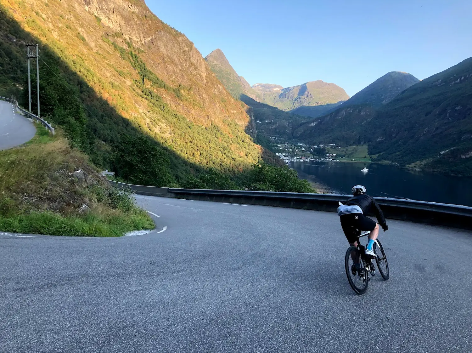
Route Details
- Country
- Norway
- Region
- Western Fjords
Elite level. Extreme elevation, altitude and distance. Serious preparation required.