
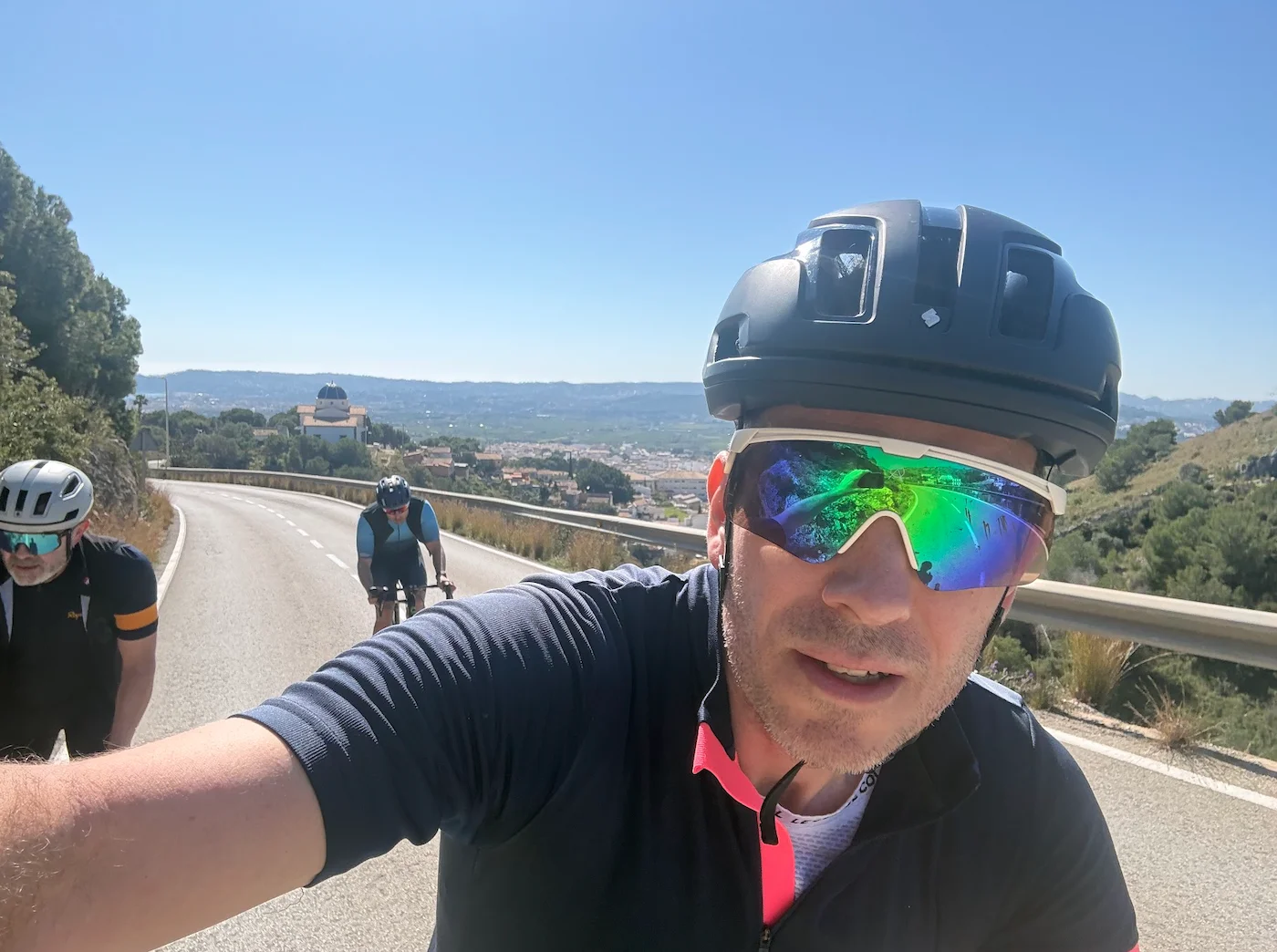
About this Route
← Western Fjords Cycling GuideTrollstigen and Ørnevegen in a single loop from Geiranger — two of Norway's 18 Norwegian Scenic Roads in one day. You climb Ørnevegen out of town, take the Eidsdal ferry, work your way up the Valldøla valley to Stigrøra, descend the eleven hairpins of Trollstigen before turning and climbing them back up. 159 km, 3,556 m of climbing, two ferry crossings.
The Trollstigen loop from Geiranger gives you two of Norway's 18 designated Norwegian Scenic Roads in one day — Ørnevegen and Trollstigen — in a 159 km loop with 3,556 m of climbing. What makes the ride distinct is that you cycle Trollstigen's eleven hairpins from both sides on the same day: first down, then up again, with the Valldøla valley and two ferry crossings in between.
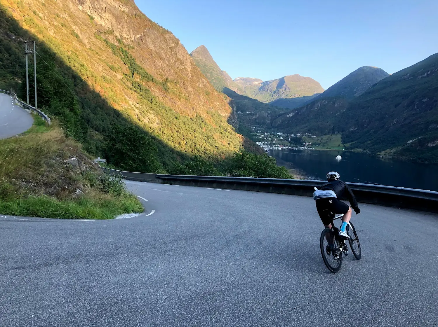
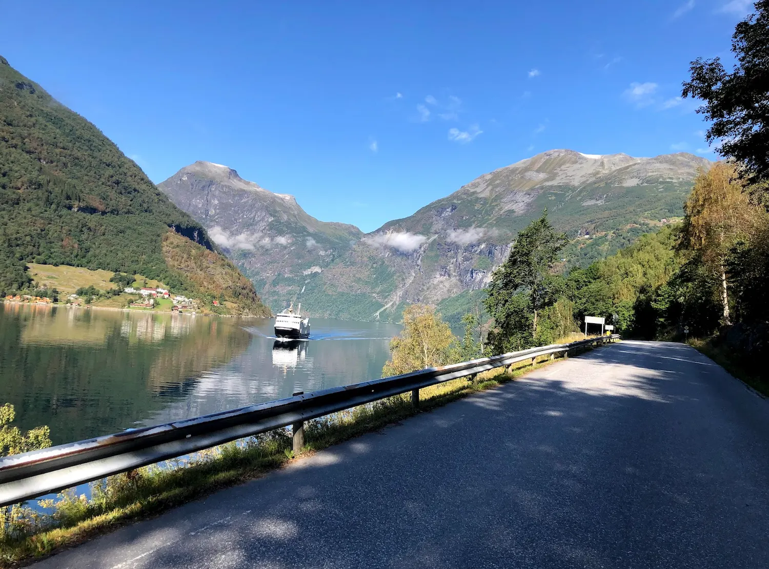
The day starts with Ørnevegen out of Geiranger. 6.9 km at 8.2% average up Fv63 to the Ørnesvingen viewpoint — the final hairpin before the plateau. From there you see the Seven Sisters waterfall pouring down the opposite cliff face, the cruise ships reduced to dots in the fjord, and Dalsnibba rising above everything to the south. The road continues across the plateau and descends to the Eidsdal ferry at km 30. Grab a svele on the ferry — brunost or smørkrem, both are correct answers.
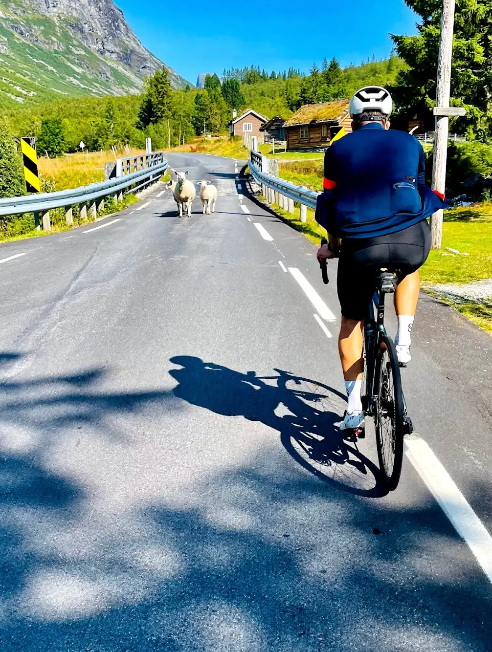
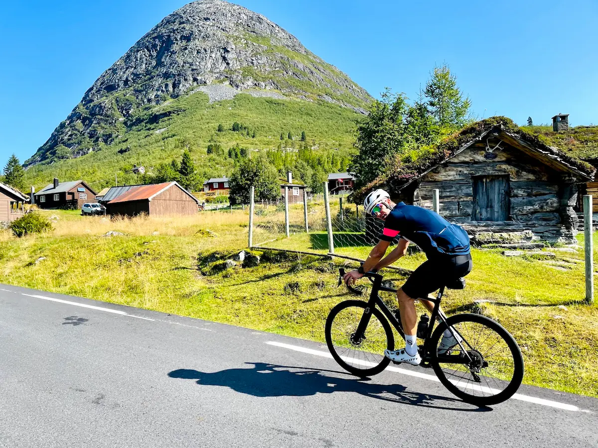
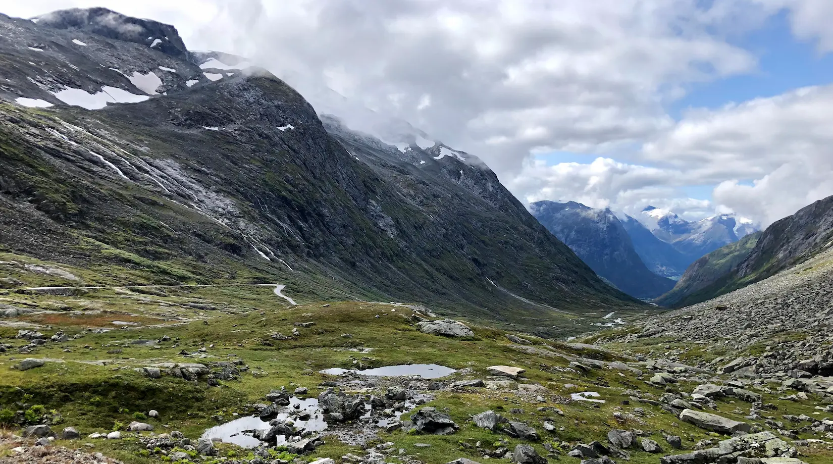
From Linge, Fv63 follows the fjord northeast through Valldal and into the Valldøla valley. The first 14 km are a long, gentle approach — good terrain to eat on, because the second big climb of the day begins quietly. The rise to Stigrøra (858 m) averages 3.4% over 14 km with a steeper final section at 6.8%, but this is not Trollstigen itself — it's the ridge it sits on. Trollstigen, as the road is actually named, is the hairpin section on the north side dropping into Isterdalen.
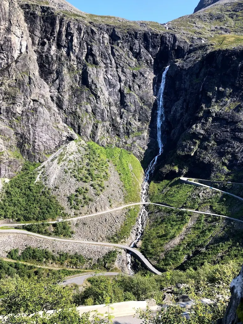
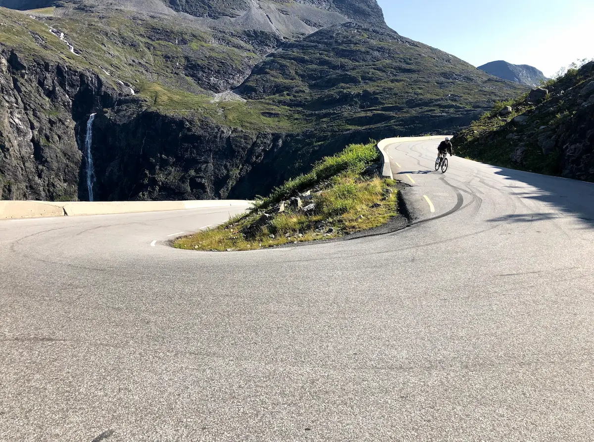
Once you cross the Stigrøra plateau, Trollstigen opens up beneath you — and the descent begins. The eleven hairpins each carry the name of the foreman who built them in 1936, and Stigfossen thunders 320 m down the cliff alongside the road — on several of the bends, spray reaches the tarmac. Bispesvingen is the last hairpin before Isterdalen opens up. The road is narrow and technical, with up to 2,500 vehicles a day in peak summer, so start early and brake before each hairpin, not in it.
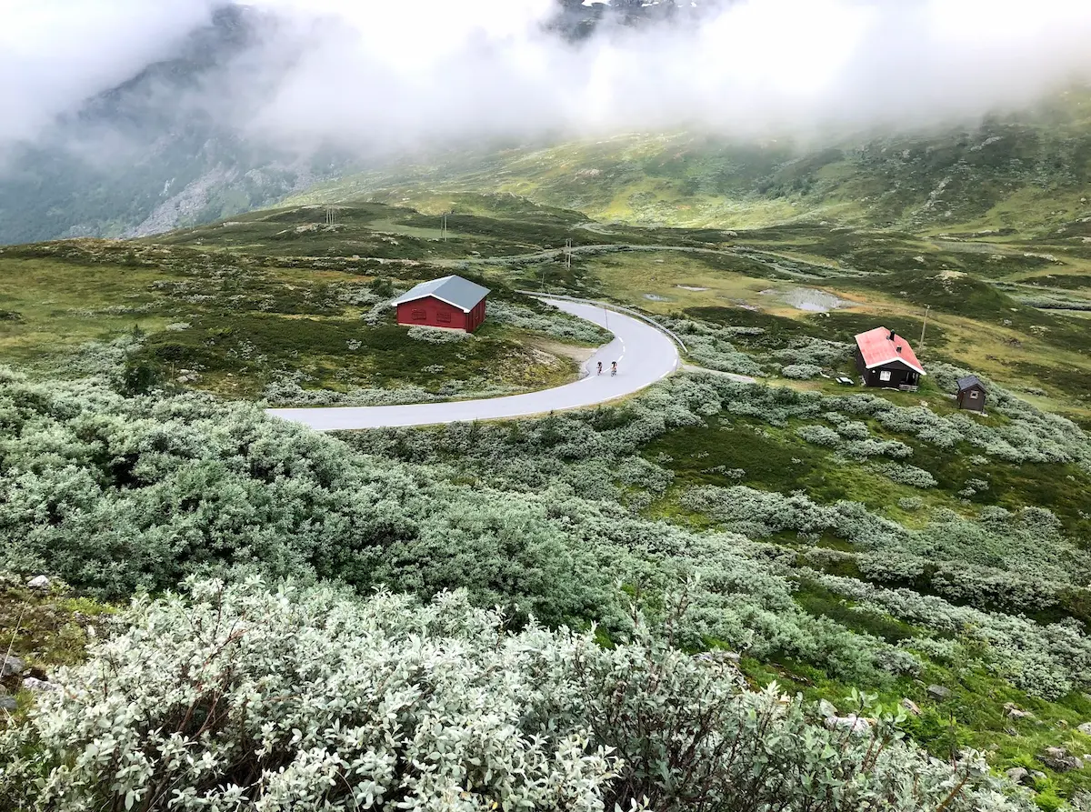
After Isterdalen you turn. This is where the Trollstigen climb begins — 7.9 km at 8.2% average up to Stigrøra, the same hairpins you just descended. The climb is remarkably consistent for its length: roughly 90% of the gradient sits between 5% and 10%, with no long flat sections to rest the legs. The steepest hairpins in the upper part touch 10–12%. Stigfossen follows you all the way up the same way it did on the descent, only from a different angle: you watch the waterfall grow larger with every hairpin you clear. Watch for traffic in the upper bends — buses and motorhomes use the full width through the hairpins, and cyclists need to give them room. The Trollstigen café at the summit viewpoint is mandatory: coffee and waffles with a view straight down the bends you've now ridden in both directions.
The return follows the same route back: down Valldøla, ferry from Linge to Eidsdal, then the climb up the Eidsdal side toward Ørnesvingen — not Ørnevegen, but the road that ends at the same viewpoint from the back. From there you descend Ørnevegen, the same road you climbed in the morning.
Kilometre by Kilometre
From Geiranger the route climbs Ørnevegen — 6.9 km at 8.2% average up to the Ørnesvingen viewpoint at 568 m of climbing. The views over the Geirangerfjord are extraordinary. The road continues across the plateau and down to the ferry dock at km 30 — an ideal stop for a svele with brunost or smørkrem on the ferry.
After the Eidsdal–Linge ferry crossing the route continues northeast through Valldal and into the Valldøla valley. The first 14 km are a long, gentle approach with mild gradient — terrain that lets the legs recover before the main climb to the Stigrøra plateau begins.
After the Stigrøra plateau at 858 m, the descent drops down the eleven hairpins of Trollstigen into Isterdalen — Stigfossen thunders 320 m down beside the road. In Isterdalen you turn and climb Trollstigen itself back up the same way: 7.9 km at 8.2% average with the steepest hairpins at 10–12% in the upper part. The Trollstigen café at Stigrøra is a mandatory stop.
The return follows the same route back through the Valldøla valley and across the Linge–Eidsdal ferry at around km 133. Then a climb up the Eidsdal side to the Ørnesvingen viewpoint, before the long descent down Ørnevegen — the same road you climbed in the morning — back to Geiranger.
Gallery
Route map & elevation profile
Key Climbs
Highlights
- •Trollstigen's eleven hairpins from both directions on the same day — first down to Isterdalen, then back up to Stigrøra
- •Ørnesvingen viewpoint with the Seven Sisters waterfall, the Geirangerfjord and Dalsnibba in one panorama
- •Stigfossen waterfall thundering 320 m down beside Trollstigen — spray reaches the tarmac on several hairpins
- •Two of Norway's 18 Norwegian Scenic Roads in a single loop, both starting from fjord level
- •Svele on the Eidsdal ferry — brunost or smørkrem, your choice
- •The Trollstigen café at the Stigrøra viewpoint: coffee and waffles with a view straight down the eleven hairpins
Must know
- ⚠Trollstigen was closed in 2024 after rockfall and reopened on 11 July 2025 — check Statens Vegvesen for daily status before riding
- ⚠Tourist traffic on Trollstigen is heaviest between 10:00 and 18:00 in summer — up to 2,500 vehicles per day. Start early or late to ride the hairpins without buses
- ⚠The Eidsdal–Linge ferry runs every 30 minutes in summer. Check fergeruter.no for the daily schedule before planning your timing
- ⚠The Oppskredtunnelen tunnel between Eidsdal and Geiranger has a gravel bypass on the side — take it, don't ride through the tunnel
- ⚠The Ørnevegen descent back to Geiranger is long and steep — check your brakes before you start down. Light traffic in the morning, heavier after 10:00
- ⚠Shops in the small villages between Valldal and the Trollstigen café have limited opening hours — stock up in Valldal or on the Eidsdal ferry before entering the Valldøla valley
Café & Water
- km 30Eidsdal ferry
The kiosk on the ferry dock sells sveler with brunost or smørkrem. Recommended stop before the Trollstigen climb.
- km 95Trollstigen café (Stigrøra)
At the turnaround after the Trollstigen climb. Coffee and waffles with a view straight down the eleven hairpins. Open May to September.
- km 133Eidsdal ferry return
A second svele at the same kiosk, or a pause before the final climb back toward Ørnesvingen.
Frequently asked questions
- How long does the Trollstigen loop take?
- Plan 8 to 12 hours in the saddle, depending on pace, plus ferry waiting and crossing time (roughly 30–40 minutes total), plus café and photo stops. Most riders set aside a full day from early morning to late afternoon.
- Is Trollstigen the same as Trolltunga?
- No — they're different attractions in different parts of Norway. Trollstigen is a road of eleven hairpin bends in Romsdalen, opened in 1936 and part of the Norwegian Scenic Route Geiranger–Trollstigen — you cycle or drive it. Trolltunga is a rock formation above Lake Ringedalsvatnet, 350 km south near Odda — you hike 27 km round-trip to reach it. Both names start with "Troll-" but that's the only thing they share.
- Can I cycle Trollstigen safely with tourist traffic?
- Yes, but timing matters. Between 10:00 and 18:00 in July and August, up to 2,500 vehicles a day climb the road — buses, motorhomes, rental cars. The road is narrow, the hairpins tight, and visibility around bends limited. Start before 09:00 or after 18:00 and traffic is manageable. Daylight lasts past 23:00 in Norwegian summer, so a late-afternoon start works. In June and early September, traffic drops sharply.
- How does Trollstigen compare to Ørnevegen in difficulty?
- Both average 8.2% — Ørnevegen is 6.9 km / 568 m, Trollstigen 7.9 km / 672 m. Ørnevegen is shorter but steepest in the first hairpins, and you ride it cold straight out of Geiranger. Trollstigen is longer and more evenly graded, and comes after 80 km in the legs. Many riders find Ørnevegen the harder climb of the day — the short distance and immediate steep start give the legs no time to warm up.
- Should I stop at Ørnesvingen on the way up?
- Save it for the descent. On the way up your legs are too cooked to take in the view properly, and you break the climbing rhythm. On the descent back into Geiranger at the end of the day you can stand there with fresh eyes and the full panorama of the fjord below, no clock ticking.
- When is the best time to ride this loop?
- Late June or early September. Both Norwegian Scenic Roads are fully open, tourist traffic is moderate, and temperatures manageable. July and the first half of August are Norway's fellesferie (collective summer holiday) — traffic peaks and ferries fill up. Check Statens Vegvesen for daily road status, especially early and late in the season.
Where to stay
Havila Hotel Geiranger
Havila Hotel Geiranger sits centrally on the fjord and works as a natural base for the Trollstigen loop. I stayed here in 2021 — the hotel is fine, breakfast OK, but it's the location that matters. You roll out the front door and you're climbing Ørnevegen from the first pedal stroke. Bookable through the usual channels or havilahotels.no.
Know a better line?
Submit your local route and get featured with your own author profile, Strava, Instagram and Buy Me a Coffee link.
Share a Route → →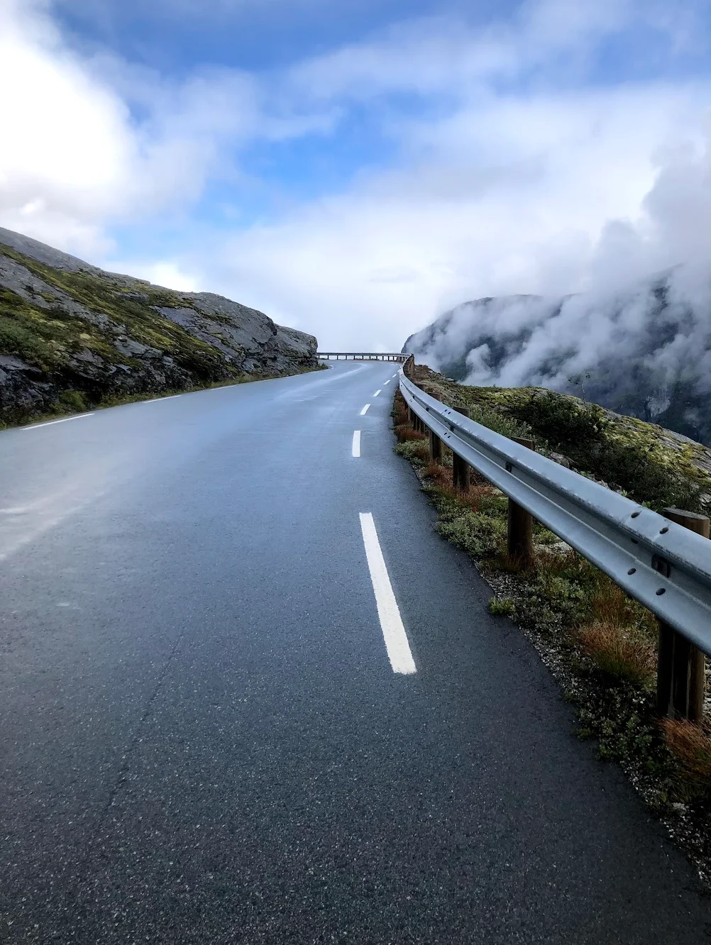
Route Details
- Country
- Norway
- Region
- Western Fjords
Elite level. Extreme elevation, altitude and distance. Serious preparation required.