Om denne ruten
← Western Fjords Cycling Guide41,9 km tur-retur fra Hjelle langs Oppstrynsvatnet og opp en av Norges vakreste historiske fjellveier. Gamle Strynefjellsveg, bygget for hånd mellom 1889 og 1894, klatrer 1 062 høydemeter i 18 km på grov asfalt — 7–8 % uten pusterom fra km 8, snøflekket toppmøte på 1 098 moh.
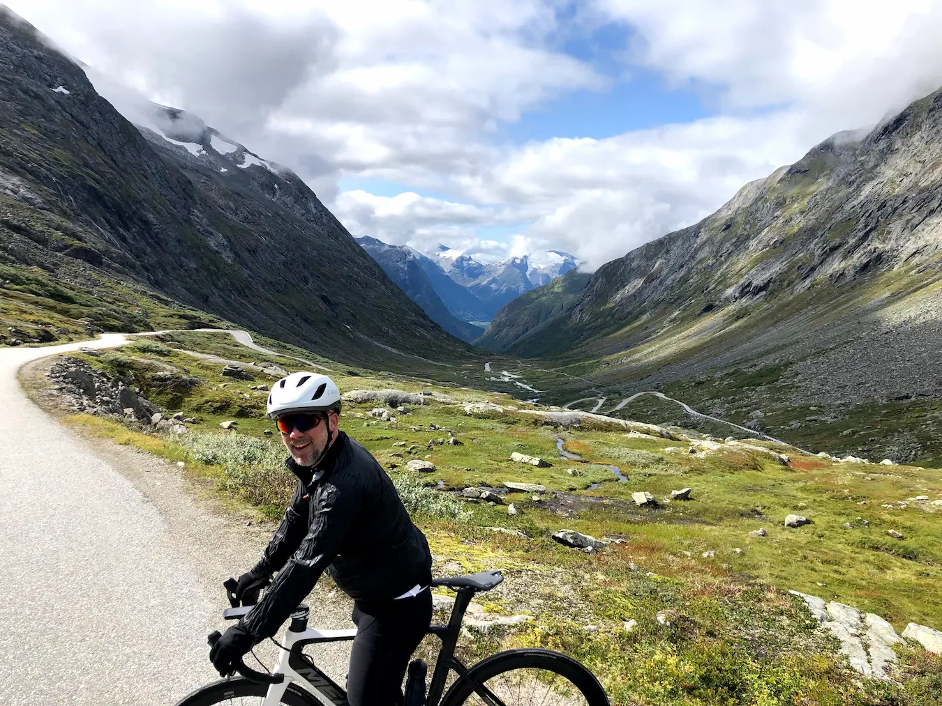
Da jeg syklet dette i august 2021, startet og avsluttet vi på Hjelle ved Oppstrynsvatnet — en liten bygd i vest-enden av sjøen der luften er kjølig, vannet er turkisgrønt fra brevannene, og den gamle fjellveien begynner å stige i det du svinger inn på den. Vi hadde syklet Dalsnibba og tatt Hellesylt-Geiranger-fergen dagen i forveien, og dette var dagen etter. Annet terreng, samme skala.
Gamle Strynefjellsveg ble hugget ut av disse fjellene for hånd mellom 1889 og 1894. Det synes. Asfalten er grov, veien er smal, og underlaget ujevnt på den måten bare en 130 år gammel fjellvei kan være. Det er ingen oppvarming i konvensjonell forstand — de første syv kilometerne er milde til moderate med 0,4 til 4 % stigning, men klatringen er allerede i gang og du kjenner veien vippe under deg når du spinner ut av Hjelle.
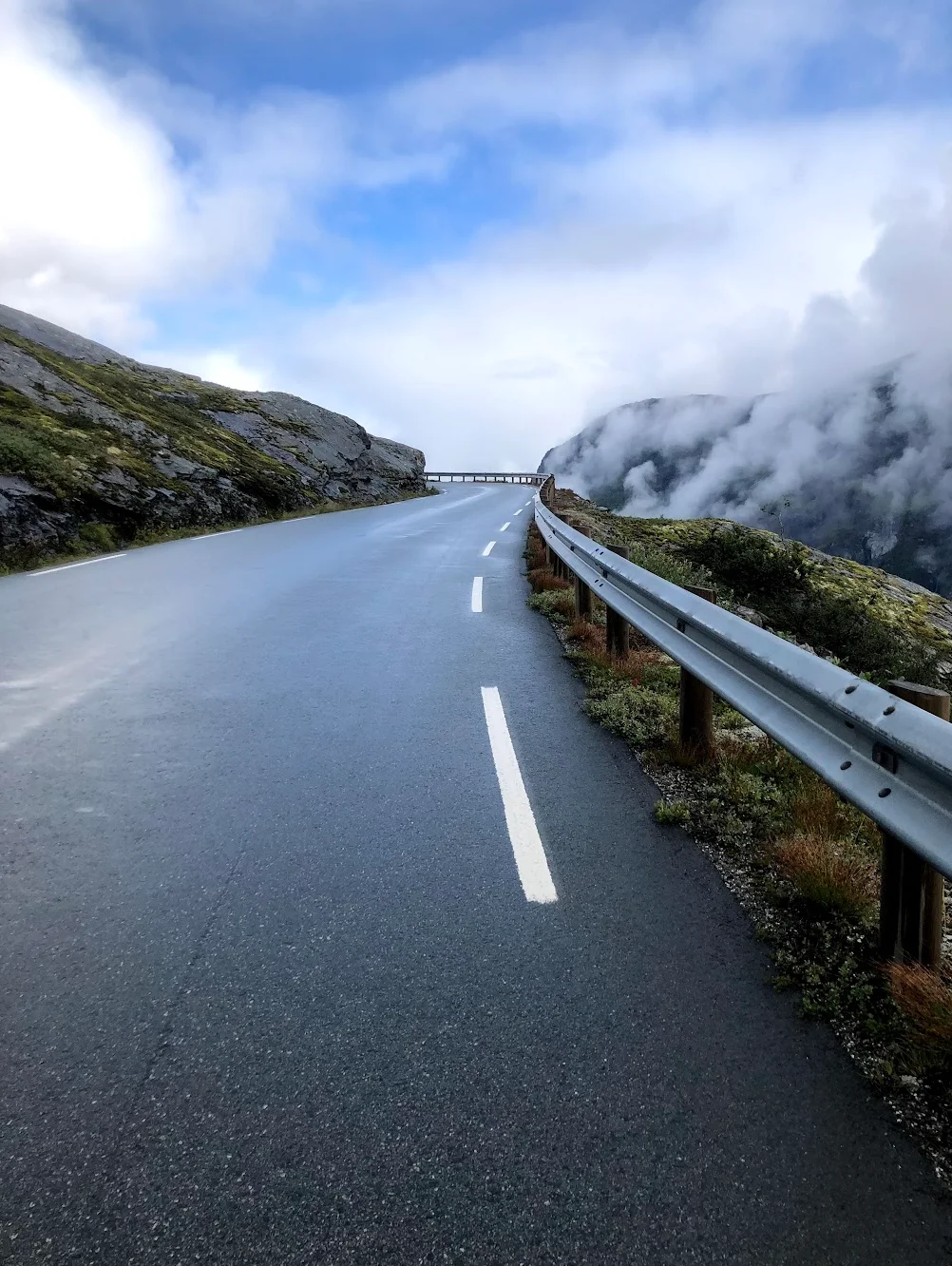
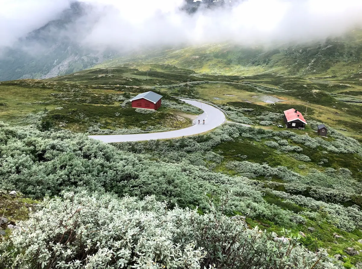
Fra kilometer 8 slår gradienten seg til ro. 6,5 % i starten, deretter 7, deretter 8 — og den blir der. Elleve kilometer med vedvarende klatring uten ett eneste pusterom. Du finner rytmen, eller du lider. Vi hadde skyer som rullet rundt oss mens vi klatret, med det mystiske lyset du bare finner i norske høyfjell om sommeren — sikten skiftet fra fullt panorama til grå-hvit sky og tilbake igjen, noen ganger i løpet av en enkelt kilometer.
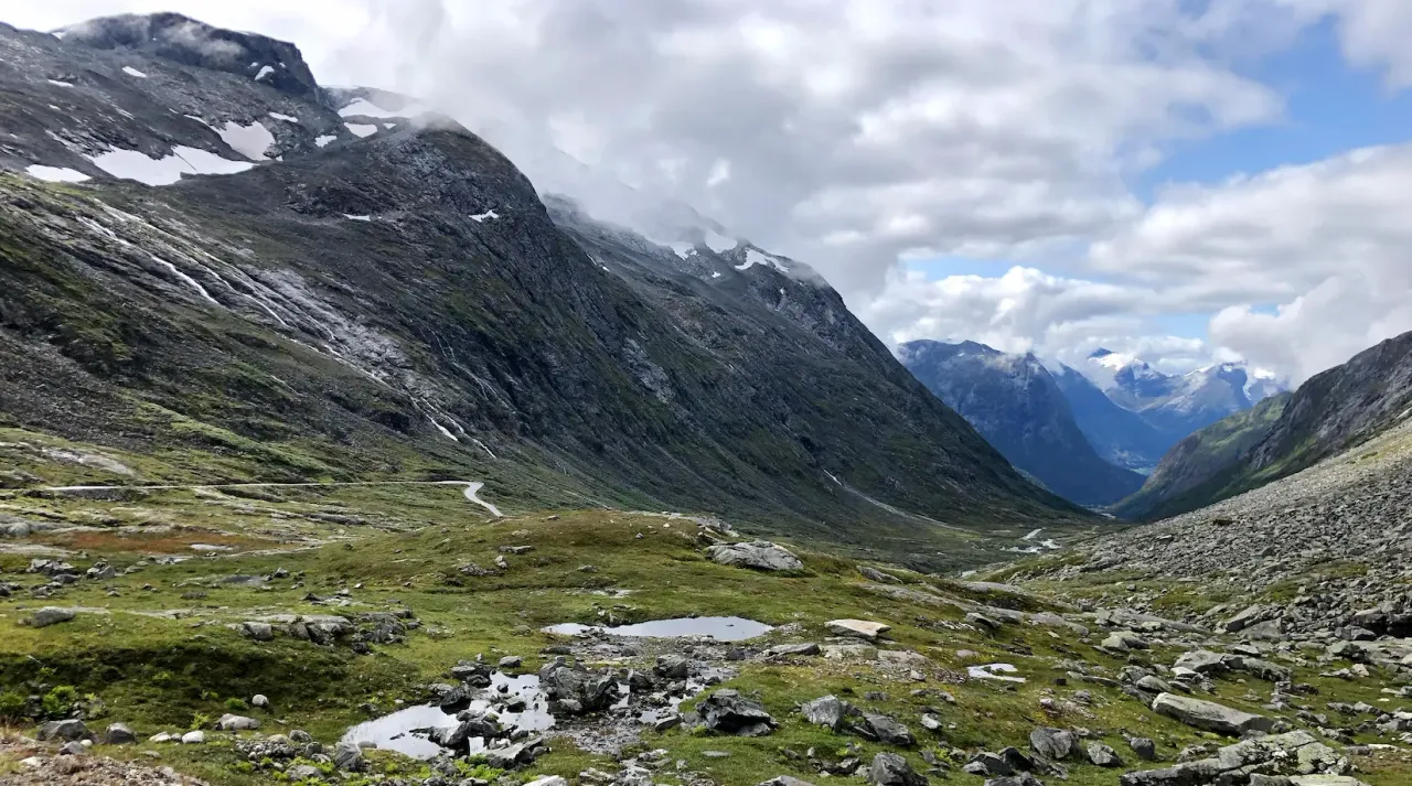
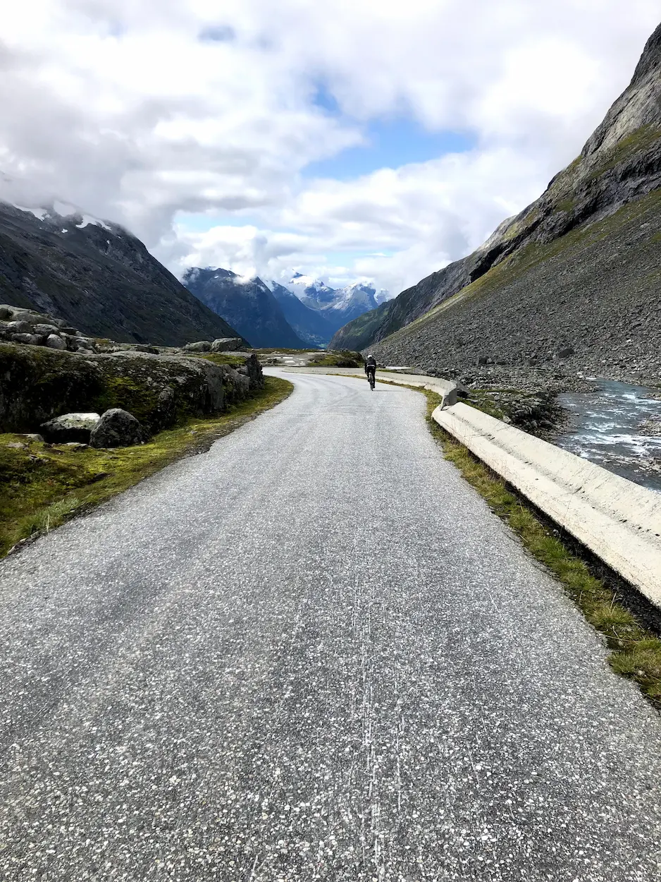
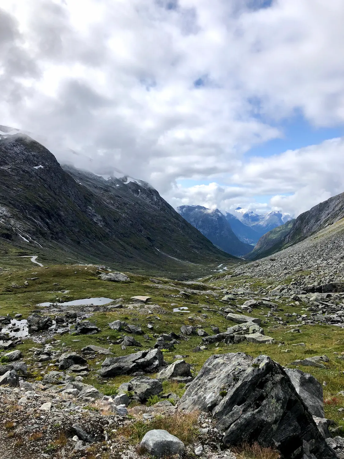
Nær toppen er veien omkranset av snøflekkede topper selv i august. Overflaten holder seg som grov asfalt hele veien — grovkornet og gammel, akkurat slik du forventer av en vei som har ligget her siden 1894. Gradienten strammes til nesten 8 % på den siste rampen mot toppen på 1 098 moh. Bare øverst, på det lille platået før veien tipper over til nedstigningen, er det et kort grusparti — kompakt og uproblematisk på 25 mm dekk. Vi stoppet der, tok bilder og snudde.
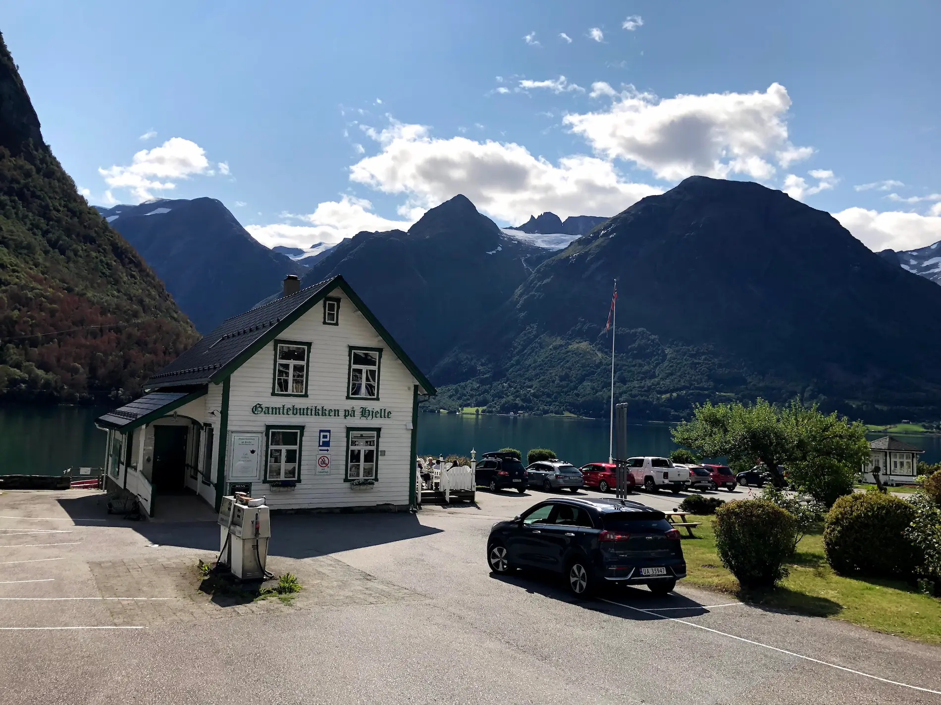
Nedstigningen er de samme 18 kilometerne i revers, med sjøen som dukker opp gjennom skydekket under deg mens du faller ned. Tilbake i Hjelle er Gamlebutikken — den gamle bygdebutikken ved sjøen — det rette stedet å fylle på. Lunsj ute, sol på vannet, snø fortsatt synlig på toppene vi akkurat hadde klatret. Det er det denne turen er.
Dette er ikke en rute for en rask tid. Det er en rute for syklisten som ønsker å sykle en vei som ikke har endret seg siden 1894 og er usannsynlig å gjøre det igjen. Ha med det du trenger fra Hjelle.
Kilometer for kilometer
Rull ut av Hjelle langs bredden av Oppstrynsvatnet. De første kilometerne er milde — 0,4 til 4 % — mens den gamle veien klatrer inn i dalen. Asfalten er grov fra start. Brevannet til høyre, de høye toppene som lukker seg foran deg.
Fra kilometer 8 trapper gradienten opp til 6–7 % og setter seg til 7–8 % for resten av klatringen. Elleve kilometer uten ett eneste pusterom. Asfalten holder seg grov hele veien opp — gammel og ujevn, slik en 130 år gammel fjellvei skal være. Den siste rampen mot toppen på 1 098 moh strammes til nesten 8 %. Snøflekker på toppene selv i august. Ingen servering, ingen vann — finn rytmen og ri til topps.
De samme 18 kilometerne i revers. Ta det forsiktig på det korte grusplatået øverst. Sjøen kommer tilbake i synet mens du faller ned — isgrønn i solen. Avslutt på Gamlebutikken på Hjelle til lunsj ved vannet — Hjelle Hotell rett ved siden av hvis du vil overnatte.
Galleri
Kart og høydeprofil
Viktige klatringer
Høydepunkter
- •Gamle Strynefjellsveg — en av Norges historiske fjellveier, åpnet i 1894
- •Vedvarende, kompromissløs klatring — 11 km på 7–8 % uten ekte pusterom
- •Turkisgrønt brevann i Oppstrynsvatnet ved start og mål
- •Snøflekker på toppene selv i august på 1 098 moh
- •Grov asfalt hele veien — bare et kort grusplatå øverst. 25 mm dekk er mer enn nok.
- •Hjelle Hotell (est. 1894) ved sjøen: historisk base med sauna og bading
Må vite
- ⚠25 eller 28 mm landeveisdekk er fint på det korte grusplatået øverst — det er kompakt.
- ⚠Ingen ekte pusterom fra km 8 til toppen — finn rytmen tidlig.
- ⚠Hjelle Hotell (est. 1894) på Oppstrynsvatnet er den naturlige basen — sauna og bading i brevannet. Et reisemål i seg selv.
- ⚠Ingen kafeer, vannkraner eller butikker på ruta — pakk lunsj og full bidon på Gamlebutikken før du drar fra Hjelle.
- ⚠Pakk en vindtett jakke for nedstigningen — toppen på 1 098 moh er kald selv i august.
- ⚠Veien er typisk åpen fra juli til begynnelsen av oktober. Sjekk vegvesen.no før du sykler.
Kafé og vann
- km 0Gamlebutikken på Hjelle
Den gamle bygdebutikken ved Hjelle på bredden av Oppstrynsvatnet. Idyllisk stopp — turkisgrønt brevann med snøkledde topper bak. Lunsj og drikke. Det eneste matestoppssted på ruta.
Ofte stilte spørsmål
- Hvilke dekk trenger jeg for Gamle Strynefjellsveg?
- 25 eller 28 mm landeveisdekk er rikelig. Underlaget er grov asfalt hele veien opp — det eneste unntaket er et kort kompakt grusparti på det lille platået øverst, rett før nedstigningen begynner. Ingenting dramatisk.
- Er det noen steder å stoppe for mat eller vann?
- Ingen kafeer, butikker eller vannkraner på selve ruta. Fyll opp på Gamlebutikken i Hjelle før du starter, eller ha med alt du trenger. Nærmeste mat etter nedstigningen er i samme butikk.
- Trenger jeg gravel-sykkel for Gamle Strynefjellsveg?
- Nei. Ruta er asfalt hele veien — bare et kort kompakt grusparti på platået øverst. En vanlig landeveissykkel med 25 eller 28 mm dekk er alt du trenger.
- Hva er forskjellen mellom Gamle Strynefjellsveg og Strynefjellstunnelen?
- Den moderne veien over Strynefjellet er Rv. 15, med tunneler som tar biltrafikken gjennom fjellet i dag. Gamle Strynefjellsveg er den historiske fjellveien fra 1889–1894 som går over fjellet — fortsatt åpen om sommeren. Du sykler den gamle veien, ikke den nye Rv. 15-traseen.
- Når åpner veien?
- Omtrent fra juli til begynnelsen av oktober — eksakte datoer avhenger av snøforholdene. Toppen ligger på 1 098 moh og snø kan ligge inn i juni. Sjekk vegvesen.no før du sykler.
- Hvor skal jeg overnatte?
- Hjelle Hotell (est. 1894) er rett ved starten av klatringen — historisk, sykkelvennlig, med sauna og bading i brevannet. Book tidlig om sommeren, bygda er liten.
Hvor du bør bo
Hjelle
Hjelle Hotell (est. 1894) is the natural basecamp — at the western end of Oppstrynsvatnet, with sauna and swimming in the glacial lake. A destination in its own right. Gamlebutikken next door is the only food and supply stop on the route.
Kjenner du en bedre trasé?
Send inn din lokale rute og bli omtalt med din egen forfatterprofil, Strava, Instagram og lenke til Buy Me a Coffee.
Del en rute → →Lignende ruter
Geiranger — Dalsnibba HC
Dag 1 av Geiranger 3-dagers rundløype — Dalsnibba-klatring med Hellesylt-Geiranger UNESCO-ferge
Trollstigen — 11 Hairpins
Dag 2 — Ørnevegen + Trollstigen-dobbel fra Geiranger
Sognefjellet & Tindevegen
Samme Vestlands-epic-tur-liga — Nord-Europas høyeste passvei fra Skjolden
Detaljer om ruten
- Land
- Norway
- Region
- Western Fjords
For erfarne syklister. Betydelig høydemeter og krevende distanser.