Col du Galibier 2026: when does it open?

The Col du Galibier (D902) opens in two stages. The road tunnel under the summit (which carries through-traffic between the Maurienne and the Lautaret) usually opens first — typically late May or early June, depending on snow clearance. The summit road over the col, which is what cyclists ride, opens 1–2 weeks later — usually in early to mid-June. The cycling-friendly season runs from then until the autumn closure in mid- to late October. Always confirm current status before travelling: the Département de la Savoie (north side, Valloire/Plan Lachat) and Département des Hautes-Alpes (south side, Lautaret) publish real-time road information, and conditions can change quickly even mid-summer.
Last verified: 20 June 2026.
2026 status — open
Last updated 20 June 2026.
- Tunnel (D902 through-traffic): open since 29 May 2026.
- Summit road (cyclists): open since 5 June 2026.
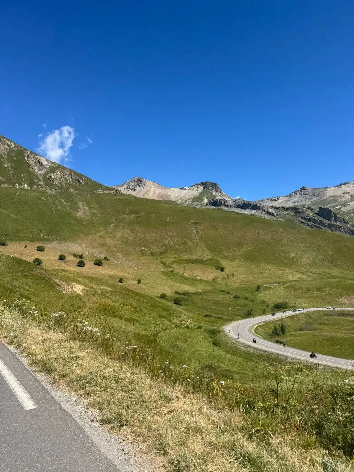
- Galibier Challenge cyclosportive (6–7 June 2026) ran on schedule — the first major event over the col this year.
- Both approaches passable: Maurienne (north) and Lautaret (south).
Expect late-spring conditions above 2 400 m through mid-June: snow walls along the road, cold and exposed summit, occasional thunderstorm closures. Confirm live status before riding via Département de la Savoie and Conseil départemental des Hautes-Alpes (links in Sources below).
When does the Galibier typically open and close?
The Col du Galibier sits at 2 642 m, well above the treeline. The road climbs from both sides — Valloire / Plan Lachat in the north, Lautaret in the south — and the final exposed pitches above 2 400 m are the limiting factor for snow clearance.
Two-stage opening: tunnel first, summit road second
The col has two parallel routes near the top: a 365 m road tunnel at 2 556 m (built in the 1880s) that carries through-traffic between the Maurienne valley and the Lautaret, and the summit road that climbs over the actual col at 2 642 m. The tunnel opens first — typically late May or early June — once the lower approaches and tunnel access are cleared.
The summit road over the top, which is what cyclists ride, opens 1–2 weeks later — usually in early to mid-June. This is the date that matters for cycling. Until the summit road is officially open, the only legal way over is the tunnel (open to motor traffic; cyclists are typically prohibited inside).
Closing in autumn is usually mid- to late October. Earlier closures happen if heavy autumn snowfall makes the upper road unsafe. The annual Galibier Challenge cyclosportive, held the first weekend of June, is timed to the typical summit-road opening — a useful indicator of when the cycling season starts most years.
Confirm the current year before travelling. The Département de la Savoie (Maurienne / north side) and Conseil départemental des Hautes-Alpes (Lautaret / south side) publish live road status. Cross-checking both is the safest approach, since either side can be cleared independently.
Why does the opening date vary?
The Galibier is one of the highest paved cols in the French Alps. The road climbs through a series of altitude zones — from forested switchbacks below the Télégraphe, through alpine pasture in the Valloirette valley, then bare scree and exposed rock above Plan Lachat. The upper kilometres get the worst of the late-spring weather: late snowfall, wind-blown drifts, and freeze-thaw cycles that can damage the road surface and require repair work before opening.
Even after the official opening, conditions can change quickly. Summer thunderstorms over the Massif des Écrins regularly close the col for hours at a time. Early-season cyclists frequently encounter snow walls 1–3 m high on either side of the road, especially on the south side near the Lautaret tunnel.
The départements Savoie and Hautes-Alpes publish updates as conditions change, both on official traffic-information pages and through regional press. Always confirm before you drive to the start.
Planning your ride
Pack for high-altitude weather, even in summer
It can be 30°C in Valloire and 5°C at the summit. Always carry:
- Wind- and rain-proof jacket — essential for the descent
- Long-finger gloves
- Arm warmers and a neck gaiter
- A second base layer in your back pocket
The drop from the summit to the Col du Lautaret is fast, exposed and cold even on a warm day. Zip up before you tip over.
Time of day
Afternoon thunderstorms over the Écrins are common from late June onwards. Early starts (06:00–07:00 from Saint-Michel-de-Maurienne) get you over the top before the build-up. Evenings are also low-traffic if you are based in Valloire — but watch the forecast and the cloud line.
Traffic
Peak summer (July–August) brings heavy camper and motorbike traffic, especially on the upper Galibier hairpins. Hold your line and expect overtakes on the climb. Late June and early September are the calmest cycling windows — open road, fewer cars, weather still predictable.
Resupply
Valloire is the last proper town before the col — bakeries on the main square, water fountains, and a final shop. After Plan Lachat there is nothing until you reach the Col du Lautaret pass house on the south side, which has a terrace café open in summer.
Can I ride Galibier before the official opening?
No. The road is physically blocked at both ends until the départements declare it open. The barriers exist for a reason: the upper kilometres carry serious snow walls and unstable cornices through April and most of May.
You can still ride the lower approaches at that time of year. The Col du Télégraphe (1 566 m) on the Maurienne side opens earlier in the spring — typically by early May — and gives you a solid 12 km, 800 m climbing day from Saint-Michel-de-Maurienne. From the south, the Col du Lautaret (2 058 m) is plowed all winter as it carries year-round traffic between Briançon and Grenoble. The Galibier itself is the missing link in early season.
Frequently asked questions
How high is the Col du Galibier?
The summit on the D902 sits at 2 642 m above sea level. A 365 m road tunnel below the summit at 2 556 m carries through-traffic when open; cyclists ride over the top on the open-air summit road.
When does the Col du Galibier typically open for cyclists?
Early to mid-June in most years. The road tunnel opens 1–2 weeks earlier (late May or early June), but the summit road over the col — which is what cyclists ride — comes 1–2 weeks after the tunnel. The annual Galibier Challenge cyclosportive in early June is timed to the typical summit-road opening.
When does the Galibier close in autumn?
Mid- to late October in normal years. Earlier closures happen if heavy autumn snowfall makes the upper road unsafe.
How long is the climb to Col du Galibier from Saint-Michel-de-Maurienne?
34 km from Saint-Michel to the Galibier summit, taking in the Col du Télégraphe (1 566 m) and a short descent to Valloire on the way. Total elevation gain on the climb portion is roughly 2 000 m.
Do cyclists pay a toll on the Galibier?
No. The D902 is a public road; there are no tolls for any vehicle. The road is closed in winter for snow, not for access control.
Ride these routes
Sources
- Département de la Savoie — traffic information
- Conseil départemental des Hautes-Alpes — état des routes
- Météo-France
- La Route des Grandes Alpes
- Le Dauphiné Libéré (regional press)