Gjøvik — Oslo Gravel
About this Route
← Oslo & Oslofjord Cycling GuideOne of the great gravel classics of Eastern Norway — 149 kilometres from the shores of Lake Mjøsa to the Oslo waterfront, through deep forests, quiet farm tracks and some of the finest gravel roads on the continent. With 80% of the route on unpaved roads, this is a ride best suited to gravel and mountain bikes — or a road bike with clearance for wide gravel tyres.
The classic way to ride this route is to take the Gjøvikbanen train from Oslo to Gjøvik — about two hours — and spend the day riding home. The train leaves early, the forest roads are quiet in the morning, and arriving at Sørenga by the Oslo fjord after a long day in the woods is one of those cycling experiences you do not forget.
From Gjøvik station the route climbs immediately into Totenåsen — the first big test, rewarded with panoramic views over Mjøsa and the wide farming valleys of Toten. Then south through Hadeland's open cultural landscape, past Brandbu, and into the deep quiet of the Hadeland forests where gravel roads thread between forest lakes and dense spruce forest. The final act is Nordmarka from north to south — past Gjerdingen, Sandungen and Kikut, the heart of Oslo's outdoor playground — before the long descent to Maridalsvannet and the city below.
This is one of those rides that sounds almost too good to be true — take the morning train from Oslo to Gjøvik, step off the platform, clip in, and spend the rest of the day riding home through some of the finest gravel terrain in Eastern Norway. When I rode this, I caught the early Gjøvikbanen and was rolling by half past nine. The ride starts with a punch: straight out of Gjøvik the road climbs hard into Totenåsen, gaining over 350 metres in the first 20 kilometres. The gravel begins almost immediately, and the views back over Lake Mjøsa from the top are worth every metre of that opening effort.
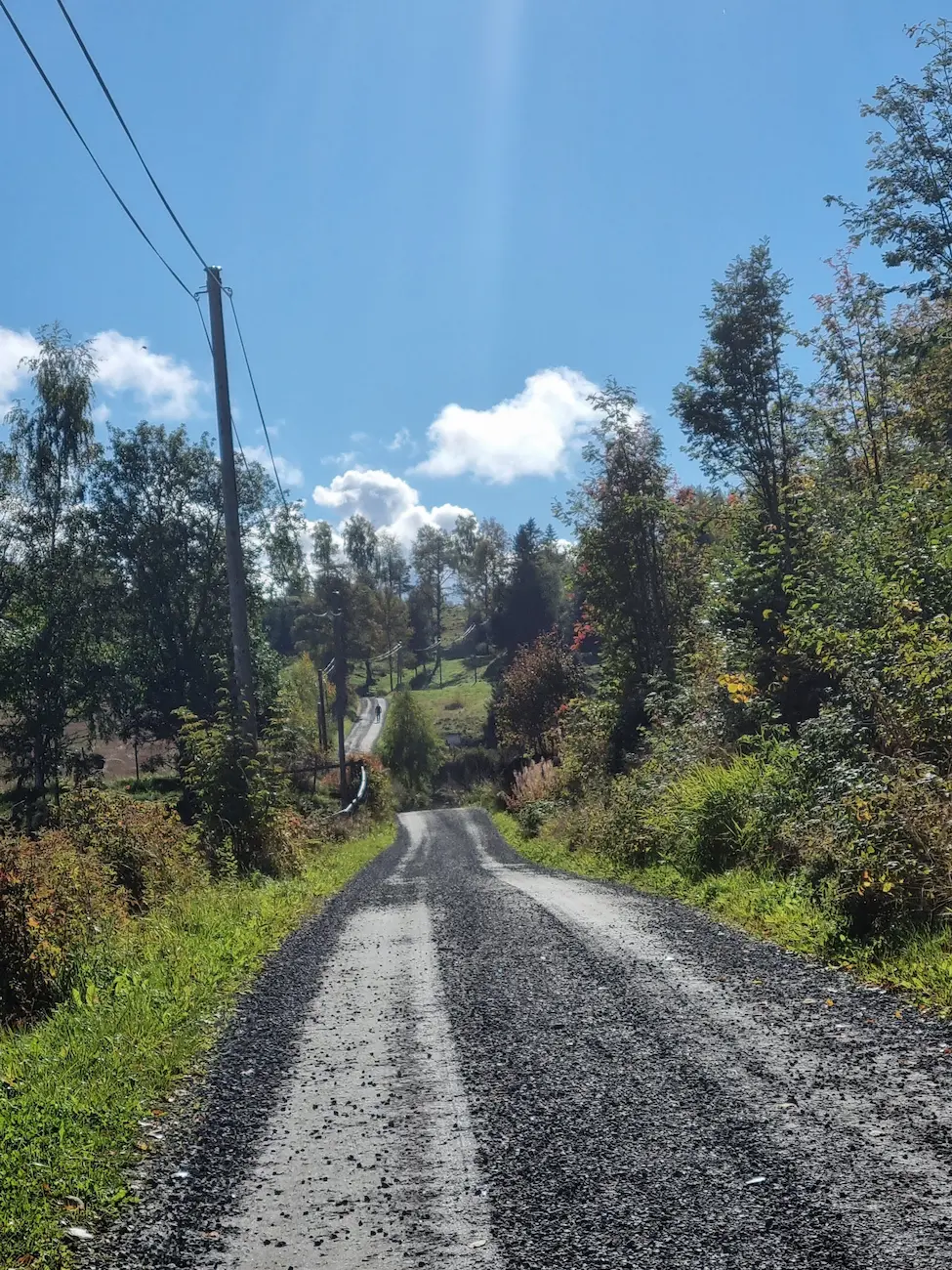
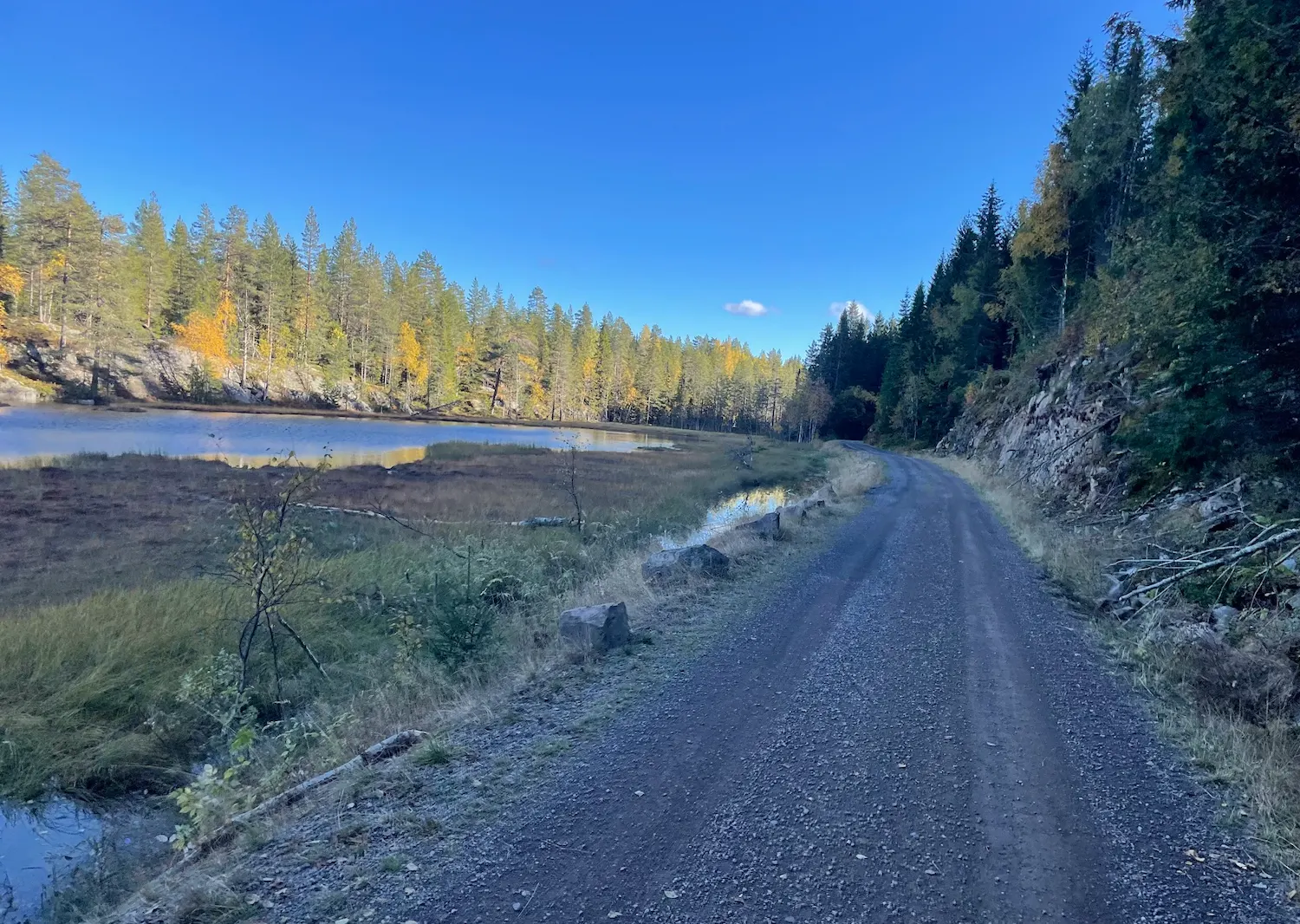
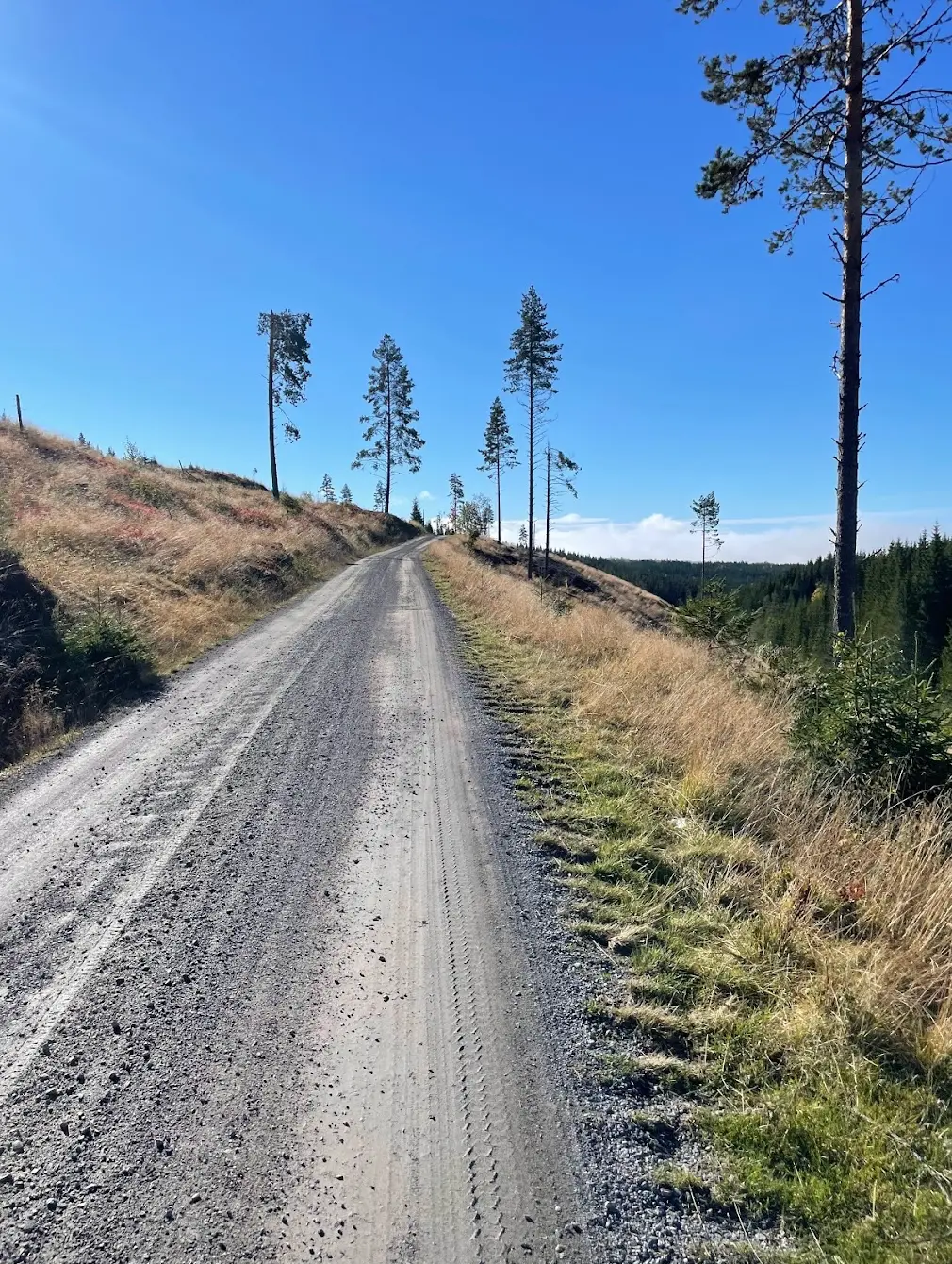
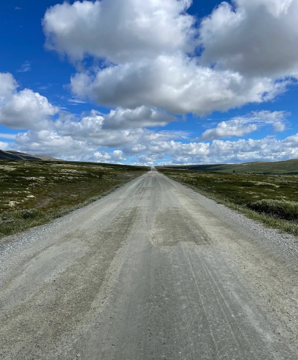
The descent from Totenåsen drops you into Hadeland — open farming country with rolling gravel tracks and long views towards Randsfjorden. Brandbu arrives around km 68 and this is a stop you cannot skip. Stock up on food and water here, because the next resupply is a very long way off. The route turns south into the Hadeland forests after Brandbu, and this is where the character of the ride changes completely. Mile after mile of quiet forest gravel, spruce and pine closing in on both sides, small lakes appearing through gaps in the trees. Almost no traffic. Just the crunch of tyres on gravel and the occasional bird. This section between km 68 and 100 is the soul of the ride.
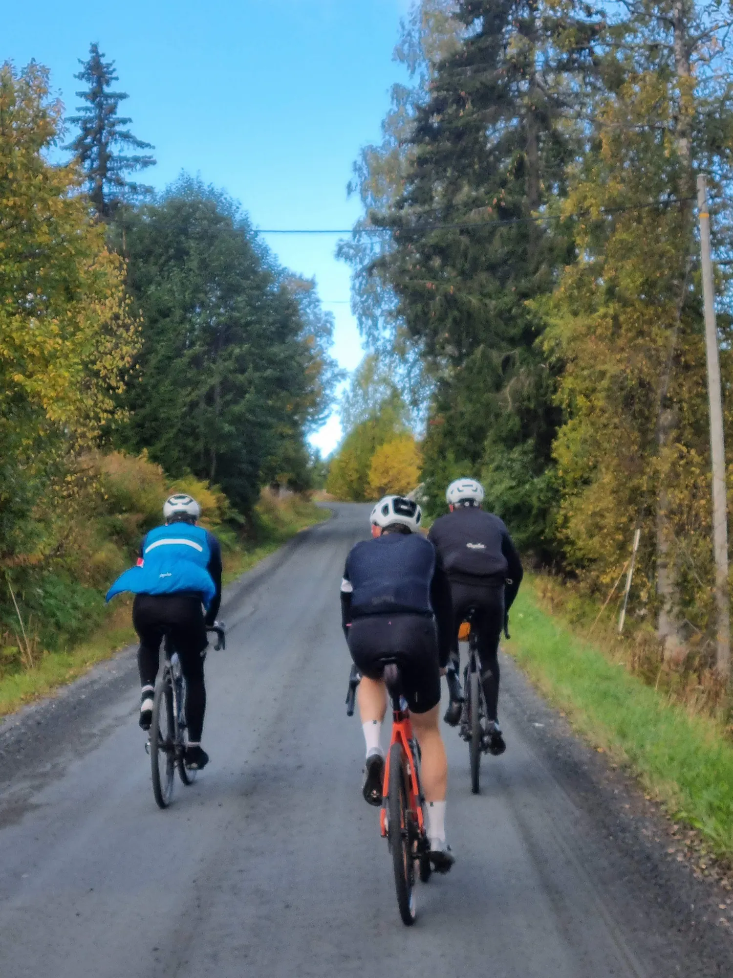
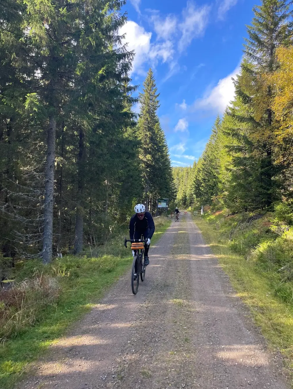
The final act is Nordmarka — Oslo's forested backyard — entered from the north. The climb past Mylla around km 100 takes you to the highest point of the entire route at 580 metres, and from there the gravel roads thread south past Gjerdingen and Sandungen towards Kikutstua. Stop there for a waffle — it is an institution and you will have earned it. The last 20 kilometres descend through the forest past Sognsvann and down to the city. I arrived at Sørenga as the evening light was fading, legs properly spent, and jumped straight in the fjord. One of the best days I have had on a bike.
Kilometre by Kilometre
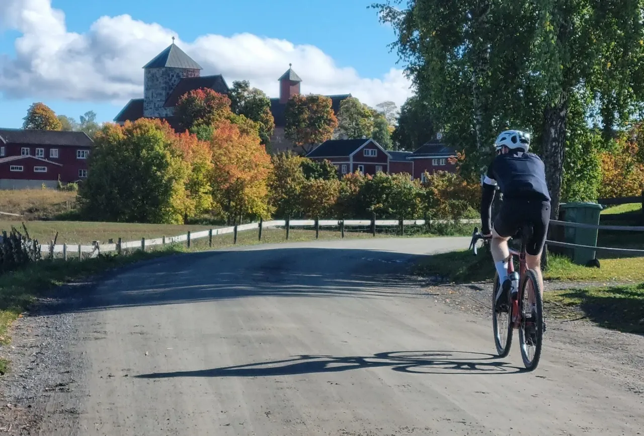
Leave Gjøvik station and climb immediately into Totenåsen. The opening kilometres are the hardest — a tough climb rewarded with some of the finest views on the entire route: Mjøsa stretching south and the wide farming valleys of Toten spread out below. The gravel begins here and does not really stop until Oslo.
Descend from Totenåsen into the open cultural landscape of Hadeland. Rolling terrain through farming country with views towards Brandbukampen and Randsfjorden. Brandbu is the natural mid-point stop — pick up food and water here before the transition into the deep forest sections of the day.
The quietest and most remote section of the route. Kilometre after kilometre of first-class gravel roads through dense spruce and pine forest, past small forest lakes and hunting cabins. Almost no traffic. From the dip at Brandbu you climb steadily to Mylla at 580 m, the highest point of the day and the threshold into Nordmarka.
Cross into Nordmarka at Mylla and follow the classic gravel roads south past Gjerdingen, Sandungen and Kikut — the heart of Oslo's outdoor playground. Stop at Kikutstua for a waffle before the long descent past Maridalsvannet to the city. The route finishes at Sørenga by the Oslo fjord.
Gallery

Route map & elevation profile
Highlights
- •Train up, ride home — take the Gjøvikbanen to Gjøvik and point the bike back to Oslo, no car logistics
- •Totenåsen straight out of Gjøvik: the hardest climbing of the day, paid back with panoramas over Lake Mjøsa
- •The Hadeland forests — some 30 km of near-empty, first-class gravel between Brandbu and Mylla, the quiet heart of the ride
- •Nordmarka from the north past Gjerdingen and Sandungen, with a waffle stop at Kikutstua before the final descent to the city
- •Finishing at Sørenga on the Oslo fjord — a swim and a burger after a long day in the woods
Must know
- ⚠This is a one-way route, ridden Gjøvik→Oslo. The usual way: take the Gjøvikbanen from Oslo up to Gjøvik in the morning (about 2 hours, bikes allowed), then ride home to the city — no car logistics
- ⚠You have 58 km of forest with no resupply between Brandbu/Røykenvik (km 68) and Kikutstua (km 126) — make sure you carry enough food and water for the whole stretch. Both cafés are closed Monday and Tuesday; if you ride then, the SPAR supermarket in Brandbu, right by the route, is your only resupply before the forest.
- ⚠You need wide gravel tyres — 80% is unpaved and narrow road slicks won't cope
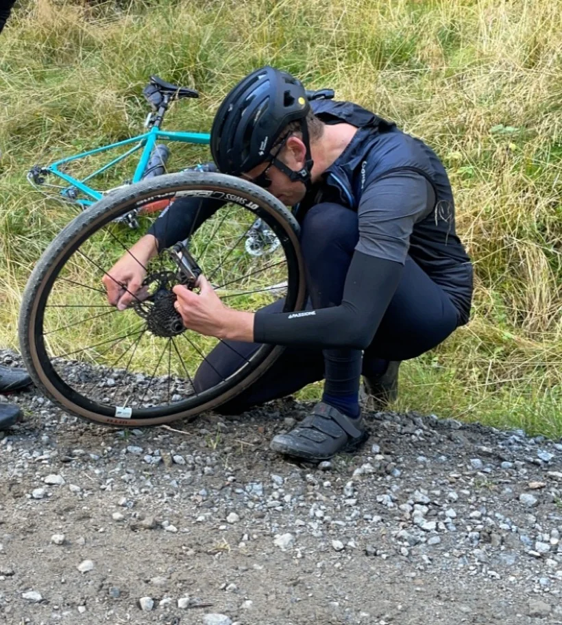
- ⚠Carry tools, a spare tube and a pump — the Hadeland forests and Nordmarka are remote, with no shops for long stretches
- ⚠Kikutstua has seasonal hours (best May–October) — check its current opening times before you count on it, especially off-season or midweek
- ⚠The high points on Totenåsen and in Nordmarka can be far colder than the valleys or the city — pack a layer
Café & Water
- km 68Lokstallen RøykenvikWed–Sun 12:00–20:00, closed Mon/Tue
A well-regarded café in the Røykenvik/Hadeland area, a couple of kilometres off the route. The last quality food stop before the long forest section.
- km 126KikutstuaWed–Sun, closed Mon/Tue (seasonal, best May–Oct)
The classic Nordmarka serving lodge, just over a kilometre off the route. Waffles and buns; seasonal hours.
Frequently asked questions
- How do the logistics work?
- The route runs one-way, Gjøvik→Oslo, and almost everyone rides it that way: take the Gjøvikbanen train from Oslo up to Gjøvik in the morning (about 2 hours, bikes allowed), then ride the 149 km home to Oslo. You finish where you started the day, so there's no shuttle or second car to arrange.
- What bike do I need?
- A gravel or mountain bike — or a road bike with clearance for wide gravel tyres. 80% of the route is unpaved, so narrow road tyres won't cope.
- When is the best time to ride it?
- Roughly May to October, once the forest roads are clear of snow and Kikutstua is open. Summer and early autumn are ideal.
- Can it be done in a day?
- Yes — long but very doable at 149 km. Take the early train up for the full day, and most riders finish with time for a swim at Sørenga.
- Where can I resupply?
- In Brandbu and Røykenvik around km 68 (Lokstallen is a couple of kilometres off the route), and at Kikutstua at km 126. Between those points lie 58 km of forest with no guaranteed service, so pack enough to get you through. Note that both cafés are closed Monday and Tuesday — on those days the SPAR supermarket in Brandbu, 150 metres off the route, is your safest backup.
- Should I ride Gjøvik→Oslo or the reverse?
- Gjøvik→Oslo is the classic direction — you take the train up, the net elevation runs downhill toward the city, and you finish at the fjord. The reverse ends with a long climb into the forest.
Know a better line?
Submit your local route and get featured with your own author profile, Strava, Instagram and Buy Me a Coffee link.
Share a Route → →Similar routes
Oslo Cycling — Nordmarka Royal Loop
Same Nordmarka forest covered as a shorter on-road loop
Rondane National Park Cycling Loop — Grimsdalen & Venabygdsfjellet
Step further north into proper Norwegian high-country gravel
Lom - Sognefjellshytta
Different mountain region — paved high-altitude alternative
Route Details
- Country
- Norway
- Region
- Oslo & Oslofjord
For experienced cyclists. Significant elevation and demanding distances.