
Lom - Sognefjellshytta
About this Route
← Western Fjords Cycling GuideA 99.1 km out-and-back from Lom with 1,477 m of climbing up the Sognefjellsvegen (RV55), Northern Europe's highest mountain pass road. Green valley floor to two-metre snow walls at the summit, then a long, cold descent back through Bøverdalen.
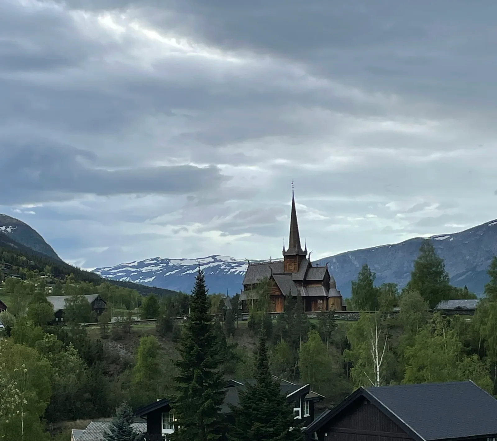
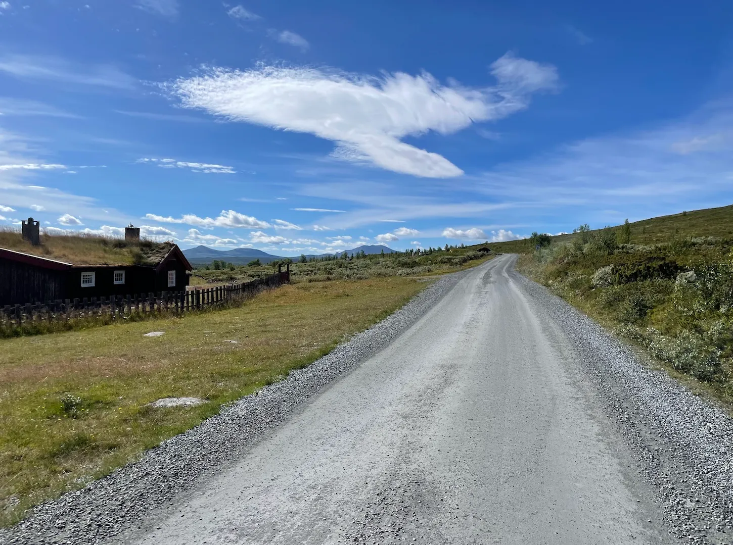
I rolled out of Lom on a cool morning with gels and energy bars stuffed into my jersey pockets, knowing full well there would be nothing between me and Sognefjellshytta except tarmac, wind and mountains. The Lom stavkyrkje watched me go — that dark, tar-scented silhouette is one of those sights that makes you pause for a photo even when you're itching to get the legs turning. From the church the RV55 tips gently upward alongside the Bøvra river, following the Bøverdalen valley deeper into the range. The first hour is deceptive: the gradient is modest, the tarmac smooth, and you can spin along at a comfortable pace while the valley walls slowly close in around you.
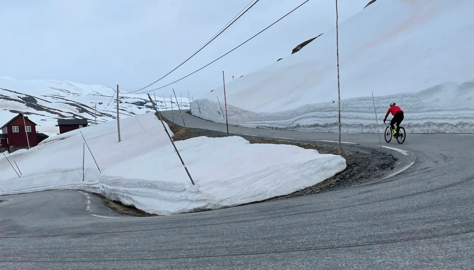
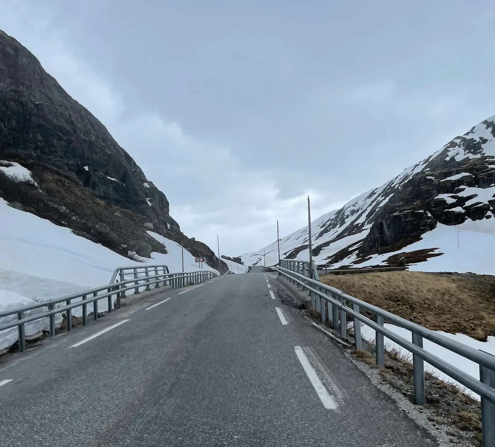
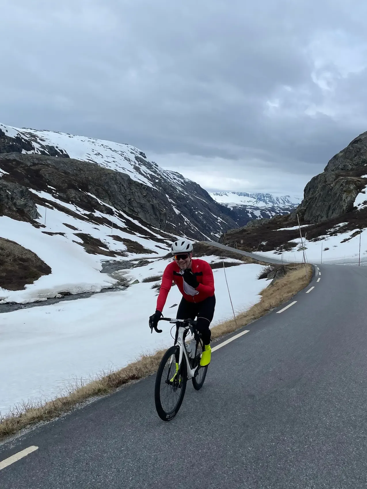
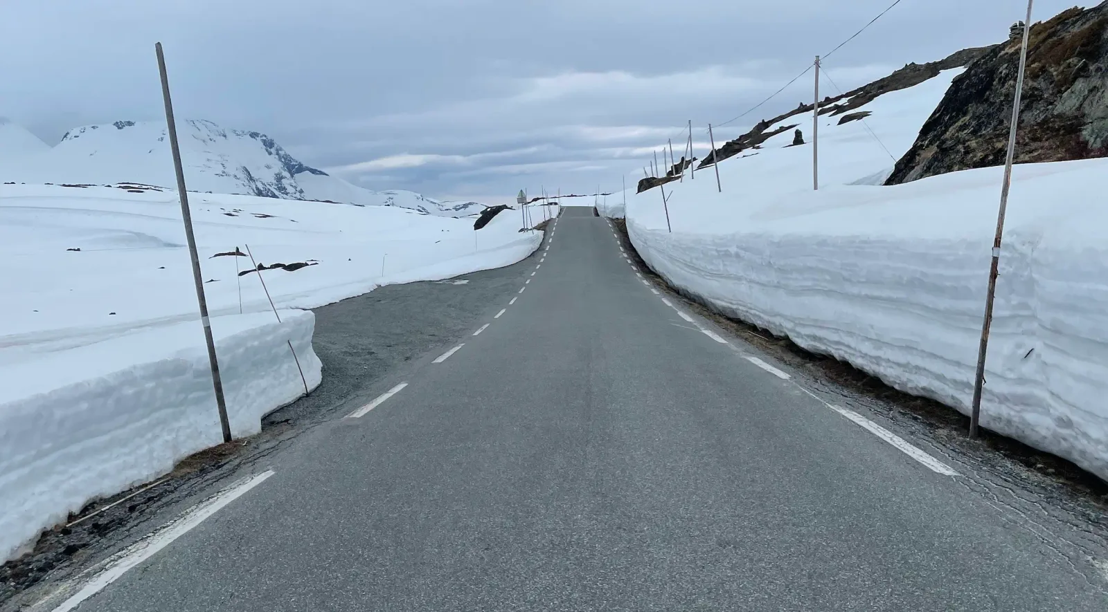
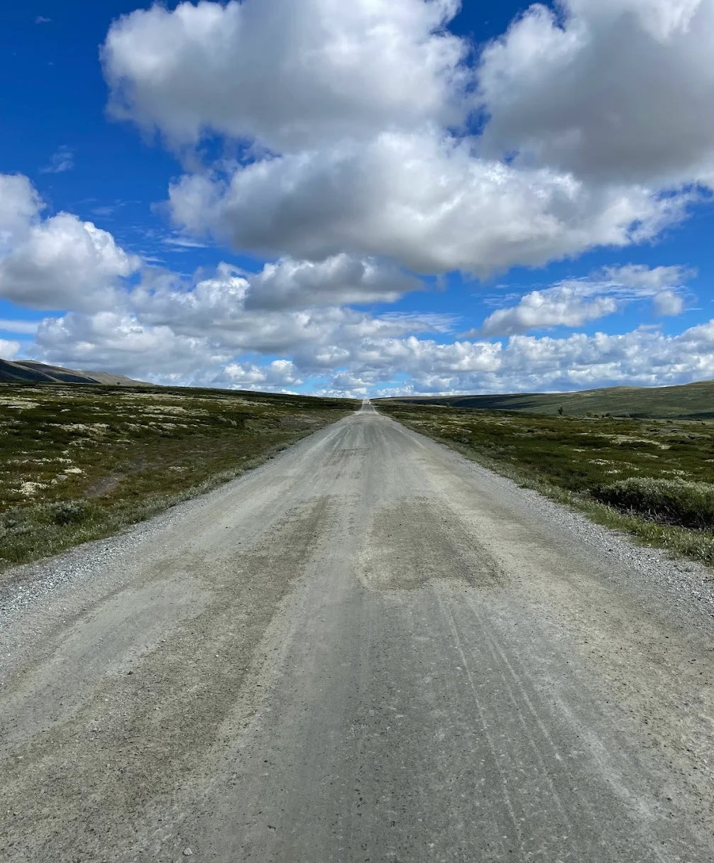
Then the Sognefjellsvegen begins in earnest. The road ramps up through a series of switchbacks, and the trees thin out until suddenly you're above the treeline and into proper high-mountain country. This is one of the highest mountain passes in Northern Europe and it feels it — glacial meltwater pouring off the rocks, the Smørstabbtindan and the broader Jotunheimen peaks rearing up on either side, and in early season, towering walls of snow carved out by the ploughs lining the road. I passed a Norwegian cross-country ski team out training on rollerskis, which tells you everything about how serious this climb is. The wind up top has a real bite, and the sense of scale is hard to overstate — it's bleak and beautiful and relentlessly photogenic.
I reached Sognefjellshytta genuinely cold despite the effort, and ducked inside for the traditional treatment: a bowl of hot soup, a waffle with brown cheese and jam, and a strong coffee. Twenty minutes by the fire and I felt human again. Before dropping back down I pulled on every layer I had — a windproof jacket, full-finger gloves and a buff over the ears. The descent is long, fast and exposed, and the wind-chill at 70 km/h on a body that's just finished climbing for two hours is not to be underestimated. I've been colder on that descent than on many winter rides.
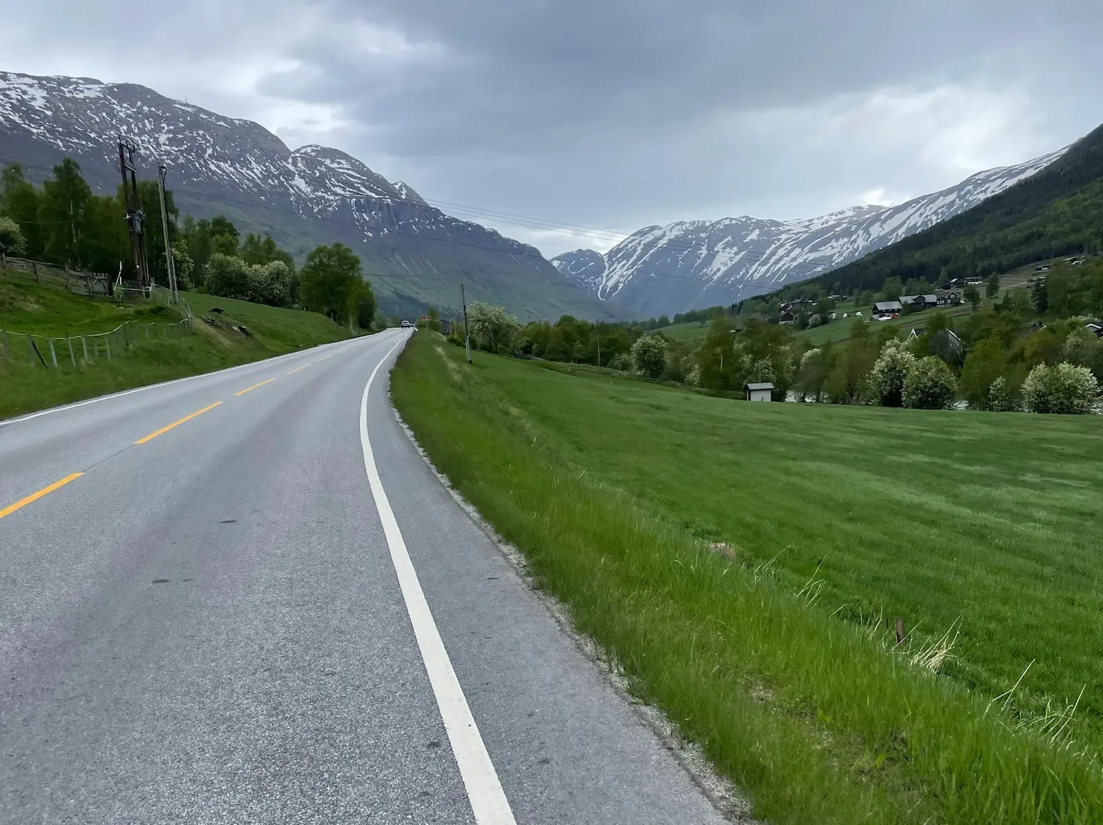
The run back down Bøverdalen to Lom is pure reward — sweeping bends, the Bøvra tumbling alongside, and the valley gradually softening back into farmland and birch forest. I rolled into Lom with tired legs and a huge grin, racked the bike outside Bakeriet i Lom, and finally cashed in the cheque I'd been writing myself all day. A skolebrød, a cinnamon knot and a proper coffee in the sun, looking back up towards the mountains I'd just climbed and descended. That, for me, is what this ride is about: earn the bakery, don't pre-empt it.
Kilometre by Kilometre
Leave Lom past the stave church and follow the RV55 along the Bøvra river. Gentle, green, fast — a proper warm-up through farmland with peaks already visible ahead.
The gradient ticks up but stays forgiving, with flat recovery stretches between the steeper ramps. Red farmsteads, birch, glimpses of glaciated summits. Rhythm riding at its best.
Trees thin out, granite and meltwater take over. Marker poles line the road and the Jotunheimen skyline opens up. The air gets noticeably colder here.
The road threads between two- to three-metre snow walls across the plateau. Frozen lakes, ski teams training on the snowfields, and a warm lodge at the top for soup and coffee.
Long, exposed and genuinely chilly. Layer up before you leave Sognefjellshytta. Watch the wind on the upper ramps and enjoy the landscape reversing itself.
Birch forest returns, then green pasture and the Bøvra alongside you. Roll back into Lom and close the loop where you started — ideally with another stop at Bakeriet.
Gallery
Route map & elevation profile
Key Climbs
Highlights
- •Riding over the Sognefjellet, Northern Europe's highest mountain pass — one of Norway's most iconic climbs.
- •Snow walls standing well into summer, cut by the ploughs across the highest stretch.
- •Sognefjellshytta as the turning point — soup, waffles with brown cheese, and coffee before the long way down.
- •Views of the Jotunheimen and the Smørstabbtindan the whole way up through the alpine high country.
- •Lom stave church at the start and Bakeriet i Lom at the finish — history and skolebrød framing the day.
Must know
- ⚠Fill your bottles and carry enough food from Lom — don't count on a refill before Sognefjellshytta. Keep gels and energy bars within reach.
- ⚠Pack a windproof jacket and full-finger gloves, even on a sunny day. The descent from 1,434 m is cold, and the wind can pick up as the day goes on.
- ⚠Check that the Sognefjellet is open before you set off — the road typically opens in mid-May, depending on snowfall, and closes in November. After heavy winters, opening can slip into June.
- ⚠The climb is long and steady, not steep — hold a pace you can sustain for hours rather than burning your matches early.
- ⚠The descent is fast; I clocked 70 km/h. The cold stiffens your fingers, so test the brakes early and stay focused the whole way down.
- ⚠The best window is June to early September. Even at midsummer there can be snow along the road, and the weather in the high mountains changes quickly.
Café & Water
- km 49Sognefjellshytta
The turning point at the top, 1,434 m. Soup, waffles with brown cheese, and hot coffee before you commit to the long descent. The natural — and only — stop on the route.
- km 99Bakeriet i Lom
The reward, not the fuel stop. A fresh skolebrød and coffee by the river when the whole climb is in your legs. One of Norway's best-known bakeries.
Frequently asked questions
- How high do I get?
- Sognefjellshytta sits at 1,434 m, near the pass's highest point at Fantesteinen. You turn around at or just before the top — this is an out-and-back, not a loop.
- How steep is the climb?
- It's long and steady rather than steep — around 4–5% average over the main ascent, with occasional ramps up to 10%. The challenge is the distance and the altitude, not the gradient.
- When is the road open?
- The Sognefjellet typically opens from mid-May to early November, depending on snowfall. In winter it's closed. Check the road status with Statens vegvesen before you set off.
- Do I need special gear?
- Nothing exotic, but a windproof jacket and full-finger gloves are non-negotiable for the descent. Carry enough food and water from Lom — there's no resupply before Sognefjellshytta.
- How cold is the descent?
- Cold enough that stiff fingers are a real concern. From 1,434 m the temperature drops fast, and the speed of the descent sharpens the chill. I hit 70 km/h coming down — dress for it.
Know a better line?
Submit your local route and get featured with your own author profile, Strava, Instagram and Buy Me a Coffee link.
Share a Route → →Similar routes
Sognefjellet & Tindevegen
Extends this out-and-back into a full loop with Tindevegen
Jotunheimen Cycling — Jotunheimvegen & Valdresflye Loop
Same Lom base — different high-mountain pass over Valdresflye
Rondane National Park Cycling Loop — Grimsdalen & Venabygdsfjellet
Adjacent Gudbrandsdalen — Rondane high country instead of Jotunheimen
Route Details
- Country
- Norway
- Region
- Western Fjords
For experienced cyclists. Significant elevation and demanding distances.