The Albuñol and Lújar climbs
About this Route
← Costa Tropical Cycling GuideTwo long climbs off the Costa Tropical, linked by a short stretch of coast. The Albuñol climb runs up into the Sierra de la Contraviesa on smooth tarmac, the hairpin descent faces the sea all the way down, and Lújar finishes the day. 97.1 km and 2,271 m from Gualchos.
The loop starts in Gualchos, a small white village above Castell de Ferro, about 90 minutes from Málaga airport. You begin by dropping straight down to the sea, so the legs are cold before any real work starts. Once you reach the coast you head east on the old coast road. It rolls past coves, rocky headlands and the old torres vigía, with greenhouses covering every bit of flat ground between the road and the hills. It's about 25 kilometres of warm-up with the Mediterranean on your right. La Rábita, at the mouth of the Rambla de Albuñol, is where I'd say it's a good idea to stop for a drink before turning inland.
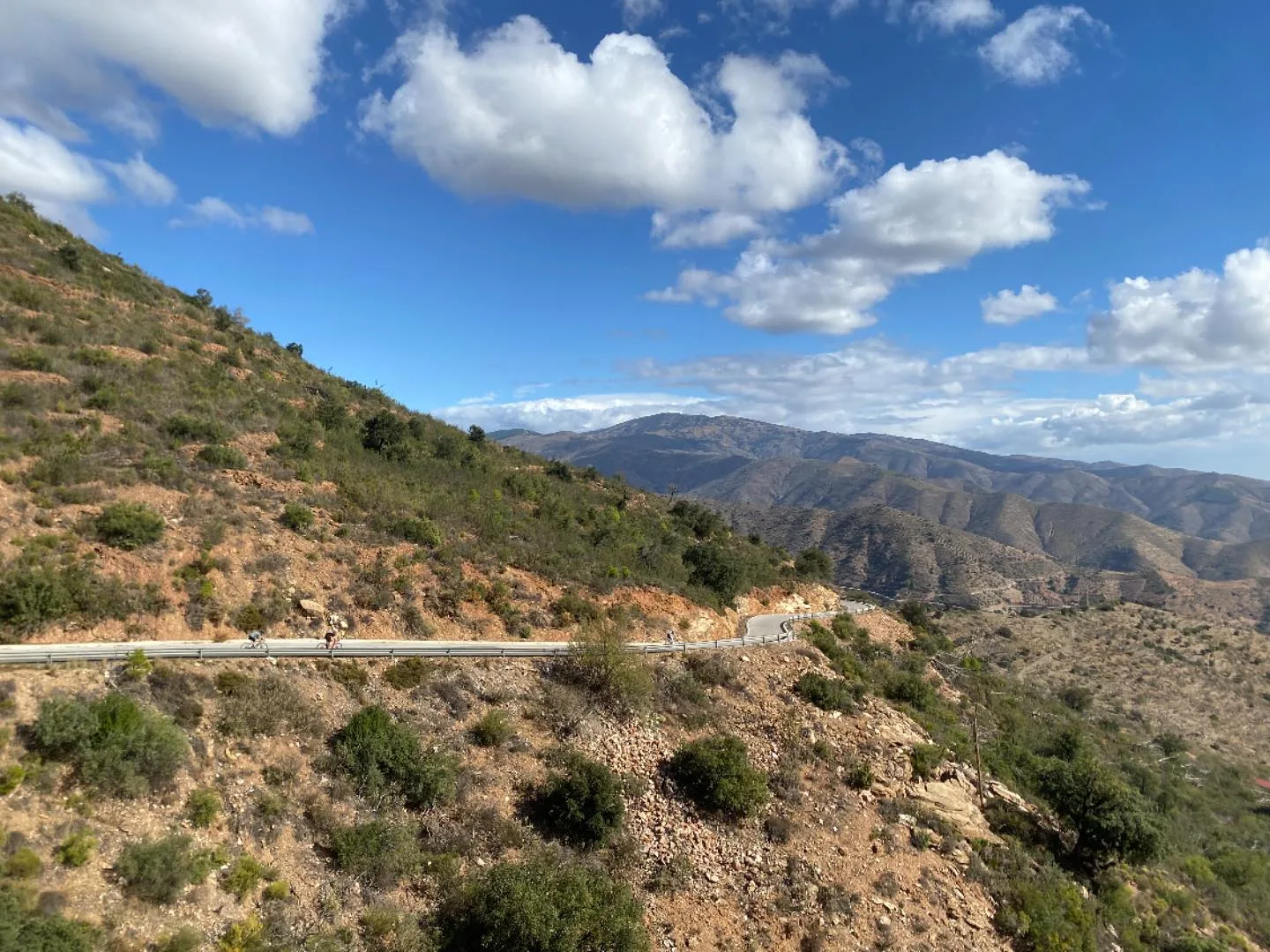
Leaving La Rábita you follow the dry riverbed up towards Albuñol, and this is the one thing to get right on the whole route: take the road on the left side of the river. The road on the right also gets you to the climb, but it often has heavy traffic. The valley floor is greenhouses, almond and olive terraces, and then the gradient starts properly at Albuñol. From there it's a small road with smooth tarmac all the way, steady between 4 % and 8 %. There are no nasty ramps, so you can settle into a tempo and hold it. The landscape opens into the Contraviesa: bare ochre ridges, scrub, broom flowering yellow in spring, almond trees and the odd vineyard. When you look back over your shoulder the sea is still there. The full climb runs on to the top at Haza del Lino, but this route turns off before the summit and starts going down.
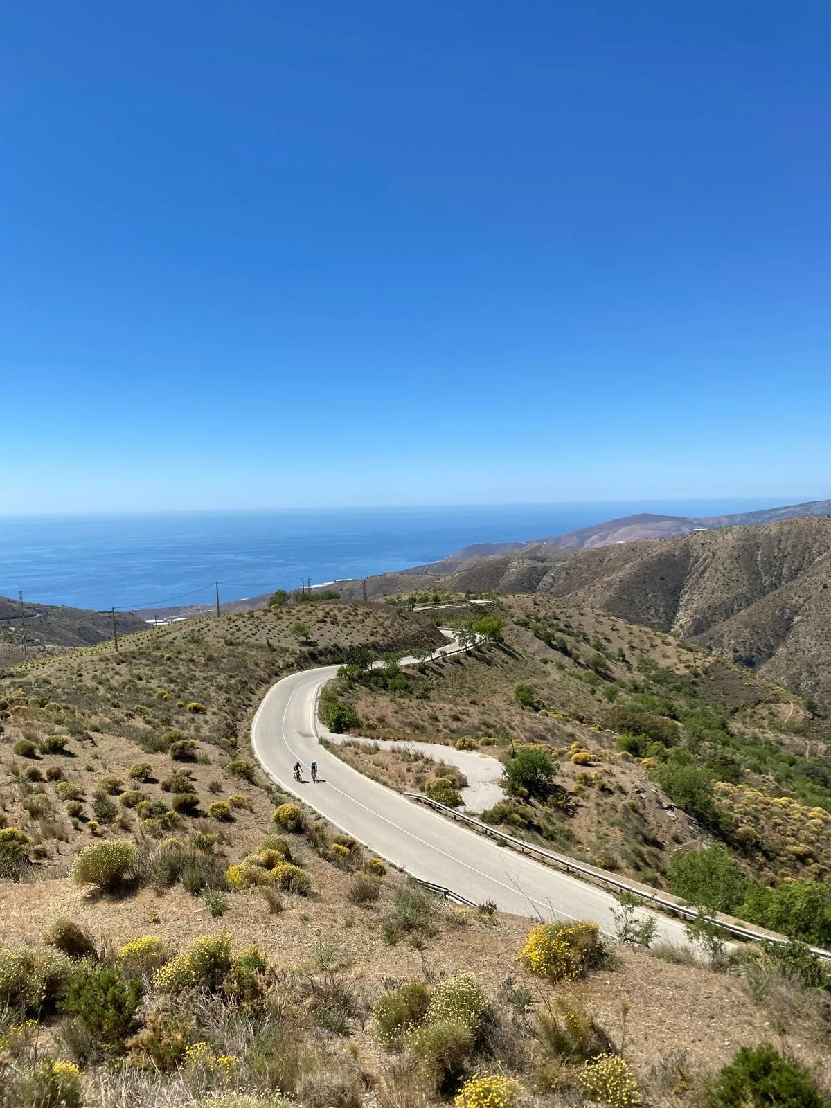
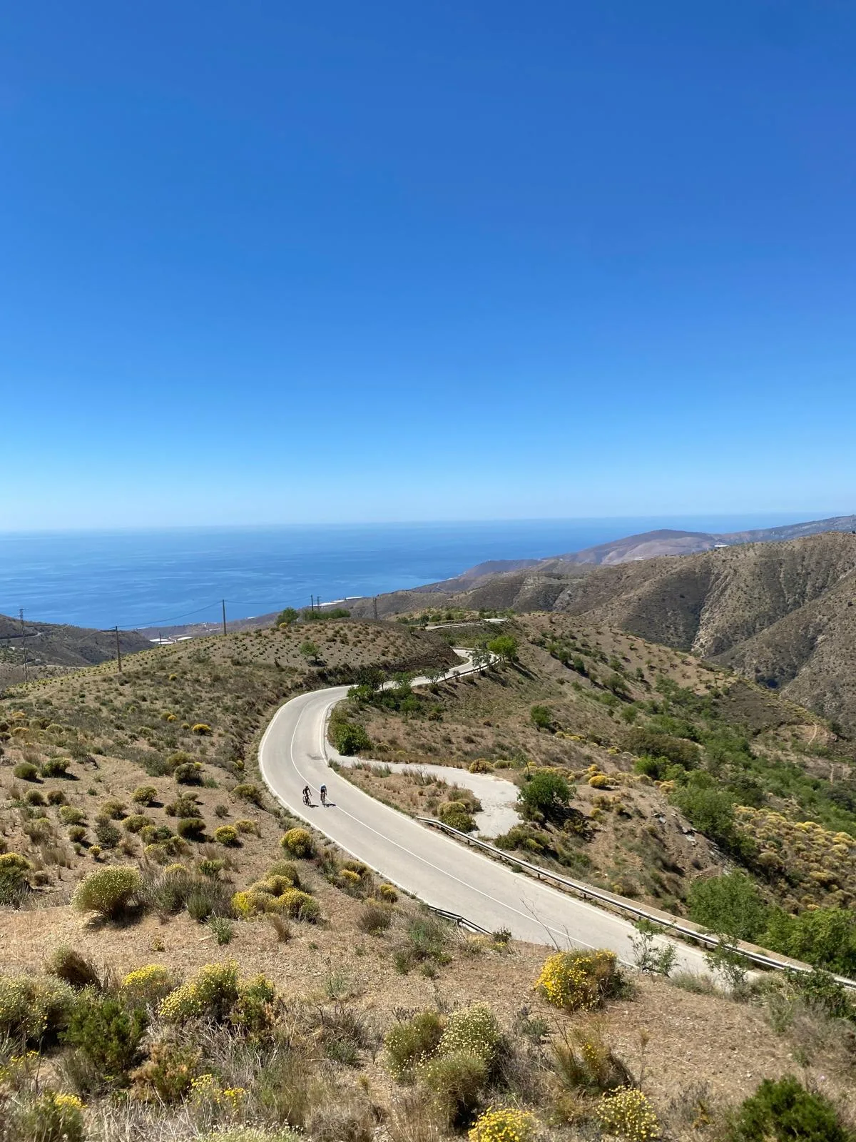
The descent towards Polopos is the part of the day I'd ride again tomorrow. It's about 14 kilometres long, a bit steeper than the way up, with a lot of hairpins and tarmac that's even smoother than the Albuñol side. You can see the switchbacks stacked below you and the Mediterranean fills the view the whole way down. It's an awesome descent. Keep something in reserve for braking, because the bends come quickly and after winter rain there can be grit on the inside of the hairpins. At the bottom you're on the coast at Restaurante Lancemar, a small restaurant at the foot of the Polopos climb, right next to the sea. Remember that in the province of Granada you get a free tapa every time you buy a beer or a soda. After two cokes and two tapas you're ready for another climb.
After lunch the route takes you back west along the coast and then inland for the second climb of the day, Lújar. It's a long one and it climbs into the valley where the village of Lújar sits, roughly halfway up. The village has two small bars and a natural spring where you can fill your bottles. On a warm day that matters, because there's very little shade on either climb. Above the village the last part of the climb is super smooth and nice. It rises through scrub and pine on the flanks of the Sierra de Lújar, and you can see brown ridges layered one behind the other in every direction.
From the top there's only a 7 kilometre descent left, on brand new tarmac, with the coast spread out below. It brings you back to Gualchos with 97 kilometres and almost 2,300 metres of climbing in the legs. Now you deserve a cold beer.
Kilometre by Kilometre
The day opens with a descent from Gualchos, a small white village above Castell de Ferro, down to sea level. Take it easy on cold legs, because the coast road is waiting at the bottom.
The old coast road heads east and rolls rather than climbs, passing coves, headlands, watchtowers and greenhouses, with the sea on your right. Expect some agricultural traffic serving the greenhouses. La Rábita is the place for a drink before you turn inland.
Leave La Rábita on the left side of the river to avoid the busier right-hand road, then follow the rambla up to Albuñol. From there the climb is a small road with smooth tarmac and a steady 4 % to 8 %. It runs up into the ochre ridges and almond terraces of the Sierra de la Contraviesa, and the sea stays behind you. The route turns off before the summit at Haza del Lino.
This descent is steeper than the climb, has a lot of hairpins and is surfaced with even smoother tarmac. The Mediterranean is in view the whole way down. It ends on the coast at the foot of the Polopos climb, next to Restaurante Lancemar.
A short rolling stretch west along the coast lets lunch settle. It's flat enough to spin the legs before the second climb starts.
This is a long, steady climb into the valley of Lújar. The village sits around the middle and has two small bars and a natural spring for your bottles. The upper part is the smoothest tarmac on the climb, rising through scrub and pine on the Sierra de Lújar with layered ridges all around.
The final descent is short and laid with brand new tarmac, and you can see the coast below as you drop back into Gualchos. After that it's time for a cold beer.
Gallery
Route map & elevation profile
Key Climbs
Highlights
- •**Steady climbing:** The Albuñol climb holds 4 % to 8 % on a small road with smooth tarmac, so you can find a rhythm and stay on it.
- •**Sea-view descent:** The hairpins down towards Polopos are steeper than the climb, smoother still, and face the Mediterranean all the way down.
- •**Lunch by the water:** Restaurante Lancemar sits at the foot of the Polopos climb next to the sea, and every drink comes with a free tapa.
- •**Lújar spring:** The village halfway up the second climb has two small bars and a natural spring for your bottles.
- •**Coast-road warm-up:** The rolling road east from Gualchos to La Rábita passes coves, headlands and old watchtowers.
Must know
- ⚠**Left side of the river:** Leaving La Rábita, stay on the road to the left of the river. The right-hand road also reaches the climb but often has heavy traffic.
- ⚠**Close to Málaga:** The start in Gualchos is about 90 minutes from Málaga airport.
- ⚠**Stop in La Rábita:** It's the natural place for a refreshment before the turn inland to Albuñol.
- ⚠**Free tapas:** In the province of Granada you get a free tapa with every beer or soda, so two cokes means two tapas at lunch.
- ⚠**Water at Lújar:** There's a natural spring and two small bars in Lújar, roughly halfway up the second climb.
- ⚠**No summit at Haza del Lino:** The route turns off and descends before the top of the Albuñol climb.
Café & Water
- km 66.6Restaurante Lancemar
Order a coke or a beer and the tapa comes free, so two rounds is lunch sorted before Lújar.
Frequently asked questions
- Which road should I take out of La Rábita to the Albuñol climb?
- Take the road on the left side of the river (the Rambla de Albuñol) as you leave La Rábita. The road on the right also reaches the Albuñol climb, but it often has heavy traffic. The left-hand road is the quieter way up the valley to Albuñol.
- Where can I eat and refill water on the Albuñol and Lújar loop?
- La Rábita has beachfront bars for a drink before the first climb. Restaurante Lancemar, at the foot of the Polopos climb by the sea, is the lunch stop after the big descent. In Lújar, halfway up the second climb, there are two small bars and a natural spring for filling bottles.
- How hard is the Albuñol climb?
- It's long but steady, with the gradient between 4 % and 8 % on a small road with smooth tarmac. There are no brutal ramps, so a good tempo rider will find a rhythm and hold it. On this loop you turn off before the summit at Haza del Lino.
- When is the best time to ride this Costa Tropical route?
- October to May. Winter is mild on the coast but noticeably cooler at the high points, and spring brings broom and almond blossom. Summer is hot and both climbs are exposed with little shade. If you ride in summer, start early and use the spring at Lújar.
- How demanding is the descent to Polopos?
- It runs for 14 km, a little steeper than the Albuñol climb, and the hairpins come one after another. The tarmac is very good, but winter rain washes grit into the corners. You want to be comfortable braking late and leaning the bike through tight bends before you commit to it.
- How far is Gualchos from Málaga?
- About ninety minutes by car from Málaga airport, up above Castell de Ferro on the Costa Tropical. The loop starts and finishes in the village, so you can leave the car there and be back at it after 97.1 km.
Know a better line?
Submit your local route and get featured with your own author profile, Strava, Instagram and Buy Me a Coffee link.
Share a Route → →